Overton is a village in Dawson County, Nebraska, United States. It is part of the Lexington, Nebraska Micropolitan Statistical Area. The population was 594 at the 2010 census.
| Name: | Overton village |
|---|---|
| LSAD Code: | 47 |
| LSAD Description: | village (suffix) |
| State: | Nebraska |
| County: | Dawson County |
| Elevation: | 2,320 ft (707 m) |
| Total Area: | 0.54 sq mi (1.40 km²) |
| Land Area: | 0.54 sq mi (1.40 km²) |
| Water Area: | 0.00 sq mi (0.00 km²) |
| Total Population: | 607 |
| Population Density: | 1,124.07/sq mi (433.76/km²) |
| ZIP code: | 68834, 68863 |
| Area code: | 308 |
| FIPS code: | 3137770 |
| GNISfeature ID: | 0831932 |
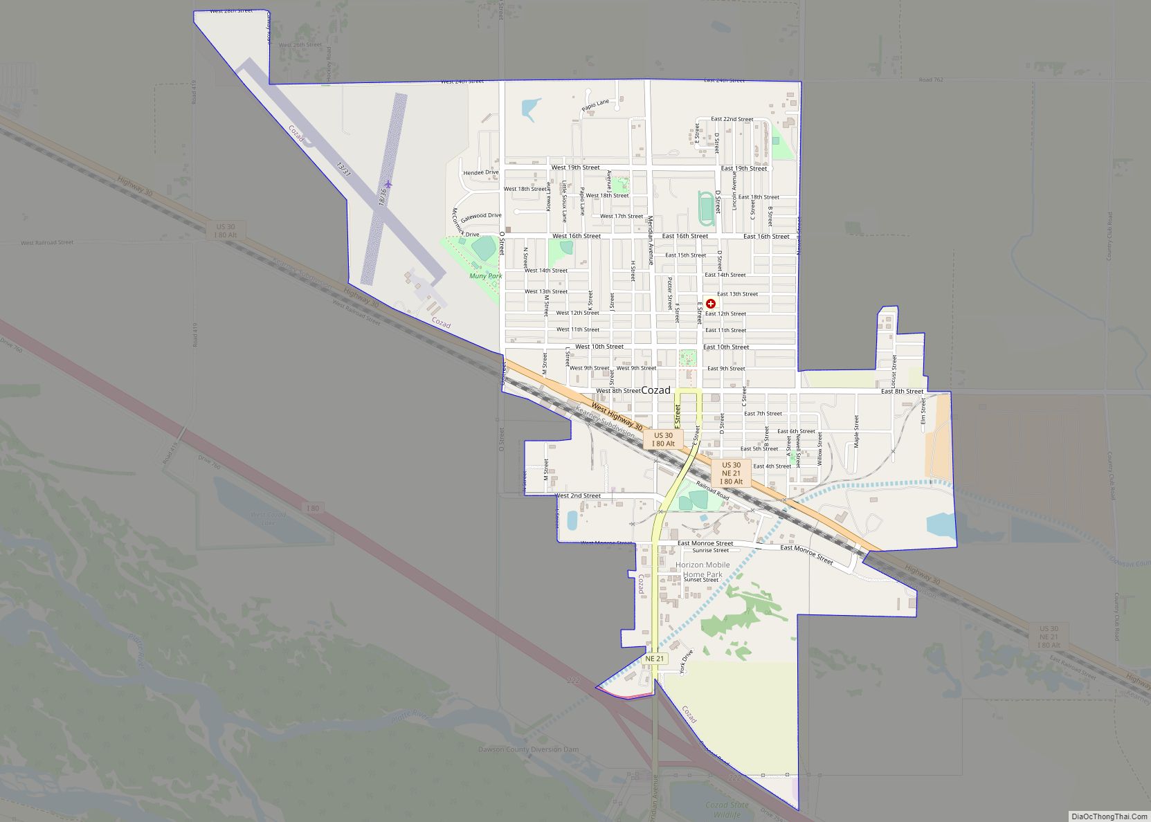
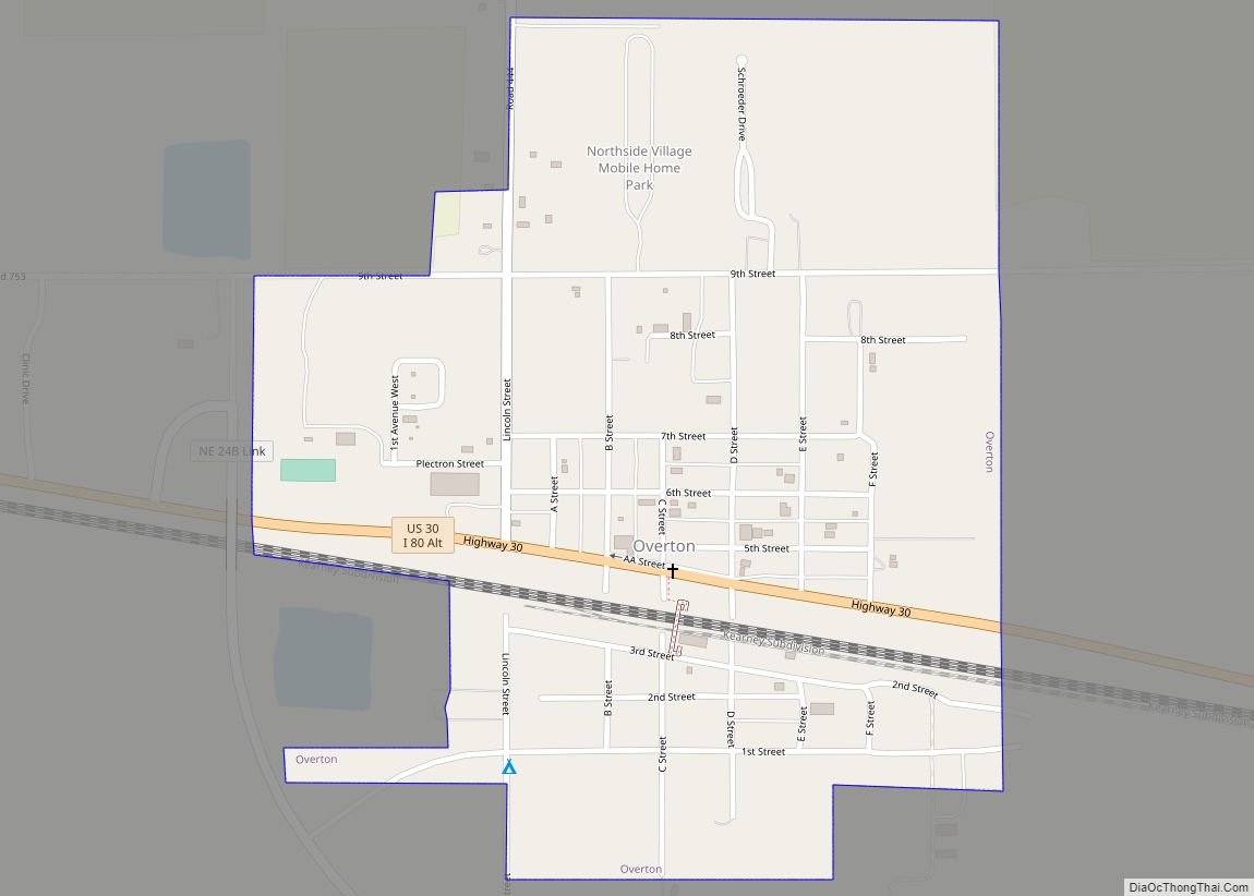
Online Interactive Map
Click on ![]() to view map in "full screen" mode.
to view map in "full screen" mode.
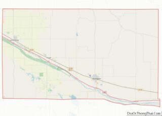
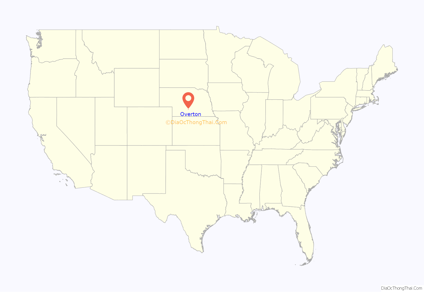
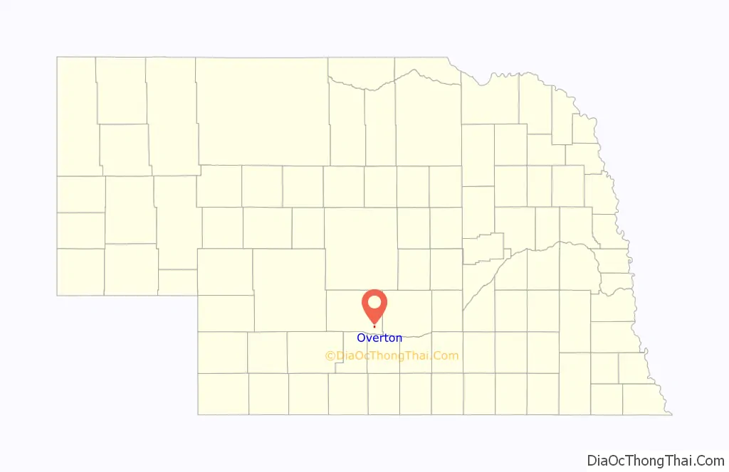
Overton location map. Where is Overton village?
History
Overton got its start following construction of the Union Pacific Railroad through the territory. The town was first settled in 1873.
A group of African Canadian families from Elgin, Ontario began moving near Overton in 1879. Over the course of five years, members of the Robinson, Guilds, Green, Emanuel, Riley, Hatter, Small, and Walker families relocated to Nebraska, filing homestead petitions and starting farms. Many of these families left Dawson County by 1907 to move to DeWitty in Cherry County.
The Plectron company, which manufactured alert radio receivers used by fire departments, was started in Overton in 1955; it transferred operations to Lexington in the 1980s
Overton Road Map
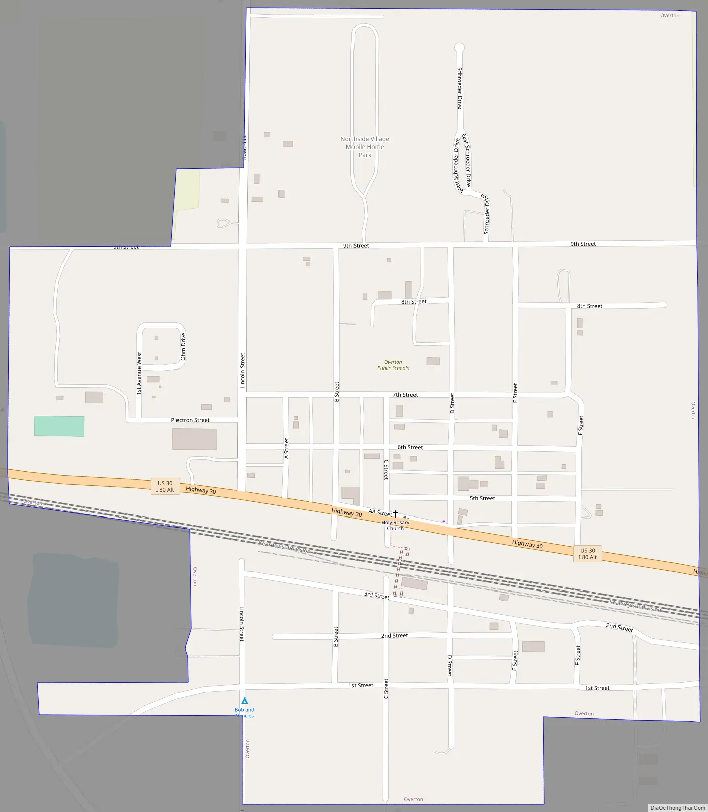
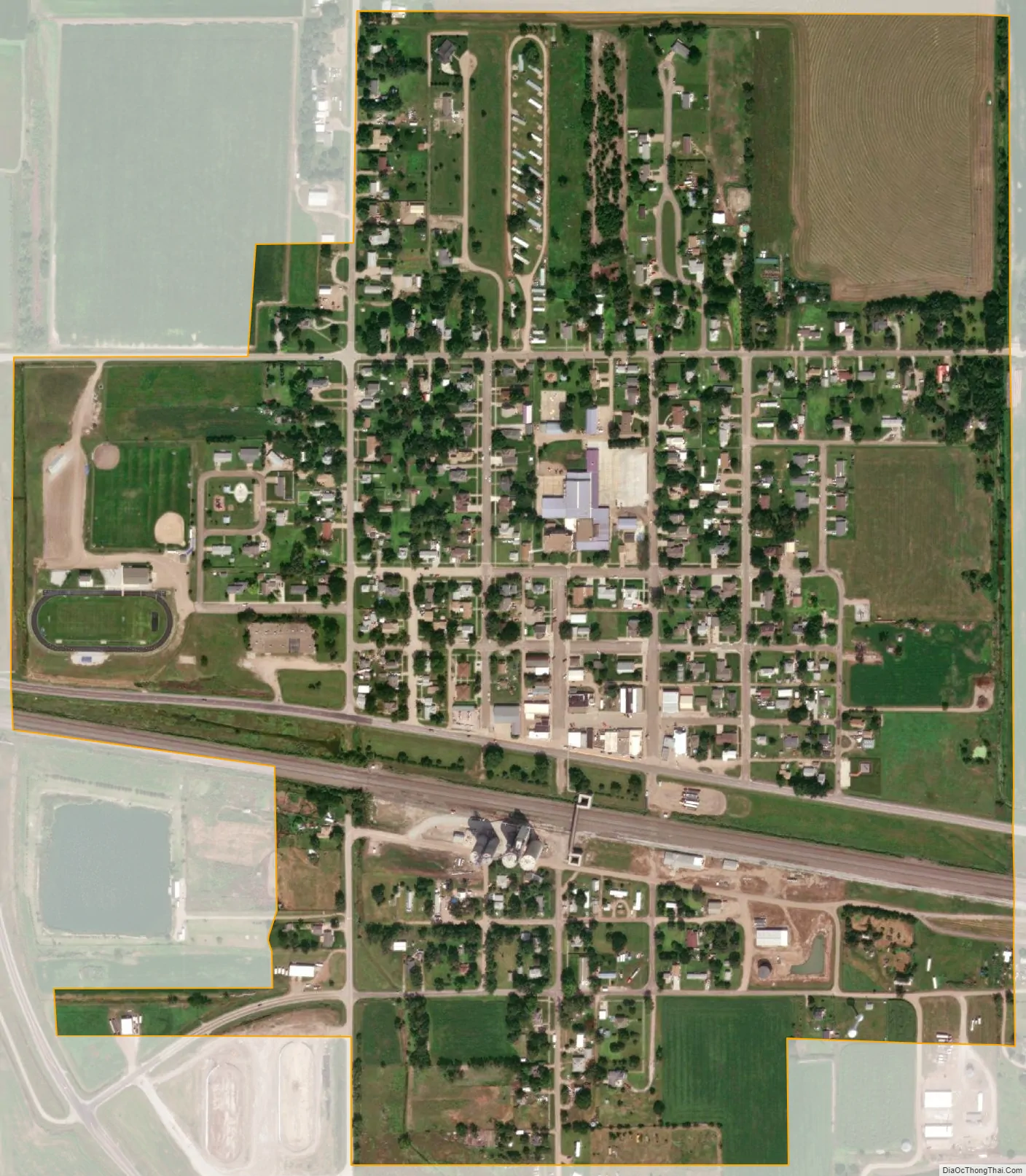
Overton city Satellite Map
Geography
Overton is located at 40°44′22″N 99°32′14″W / 40.73944°N 99.53722°W / 40.73944; -99.53722 (40.739556, -99.537358).
According to the United States Census Bureau, the village has a total area of 0.54 square miles (1.40 km), all land.
Overton is exactly halfway between New York and Los Angeles.
See also
Map of Nebraska State and its subdivision:- Adams
- Antelope
- Arthur
- Banner
- Blaine
- Boone
- Box Butte
- Boyd
- Brown
- Buffalo
- Burt
- Butler
- Cass
- Cedar
- Chase
- Cherry
- Cheyenne
- Clay
- Colfax
- Cuming
- Custer
- Dakota
- Dawes
- Dawson
- Deuel
- Dixon
- Dodge
- Douglas
- Dundy
- Fillmore
- Franklin
- Frontier
- Furnas
- Gage
- Garden
- Garfield
- Gosper
- Grant
- Greeley
- Hall
- Hamilton
- Harlan
- Hayes
- Hitchcock
- Holt
- Hooker
- Howard
- Jefferson
- Johnson
- Kearney
- Keith
- Keya Paha
- Kimball
- Knox
- Lancaster
- Lincoln
- Logan
- Loup
- Madison
- McPherson
- Merrick
- Morrill
- Nance
- Nemaha
- Nuckolls
- Otoe
- Pawnee
- Perkins
- Phelps
- Pierce
- Platte
- Polk
- Red Willow
- Richardson
- Rock
- Saline
- Sarpy
- Saunders
- Scotts Bluff
- Seward
- Sheridan
- Sherman
- Sioux
- Stanton
- Thayer
- Thomas
- Thurston
- Valley
- Washington
- Wayne
- Webster
- Wheeler
- York
- Alabama
- Alaska
- Arizona
- Arkansas
- California
- Colorado
- Connecticut
- Delaware
- District of Columbia
- Florida
- Georgia
- Hawaii
- Idaho
- Illinois
- Indiana
- Iowa
- Kansas
- Kentucky
- Louisiana
- Maine
- Maryland
- Massachusetts
- Michigan
- Minnesota
- Mississippi
- Missouri
- Montana
- Nebraska
- Nevada
- New Hampshire
- New Jersey
- New Mexico
- New York
- North Carolina
- North Dakota
- Ohio
- Oklahoma
- Oregon
- Pennsylvania
- Rhode Island
- South Carolina
- South Dakota
- Tennessee
- Texas
- Utah
- Vermont
- Virginia
- Washington
- West Virginia
- Wisconsin
- Wyoming