Scribner is a city in Dodge County, Nebraska, United States. The population was 857 at the 2010 census.
| Name: | Scribner city |
|---|---|
| LSAD Code: | 25 |
| LSAD Description: | city (suffix) |
| State: | Nebraska |
| County: | Dodge County |
| Elevation: | 1,253 ft (382 m) |
| Total Area: | 0.67 sq mi (1.72 km²) |
| Land Area: | 0.65 sq mi (1.69 km²) |
| Water Area: | 0.01 sq mi (0.04 km²) |
| Total Population: | 843 |
| Population Density: | 1,294.93/sq mi (499.85/km²) |
| ZIP code: | 68057 |
| Area code: | 402 |
| FIPS code: | 3144280 |
| GNISfeature ID: | 0833325 |
| Website: | https://www.scribner-ne.gov |
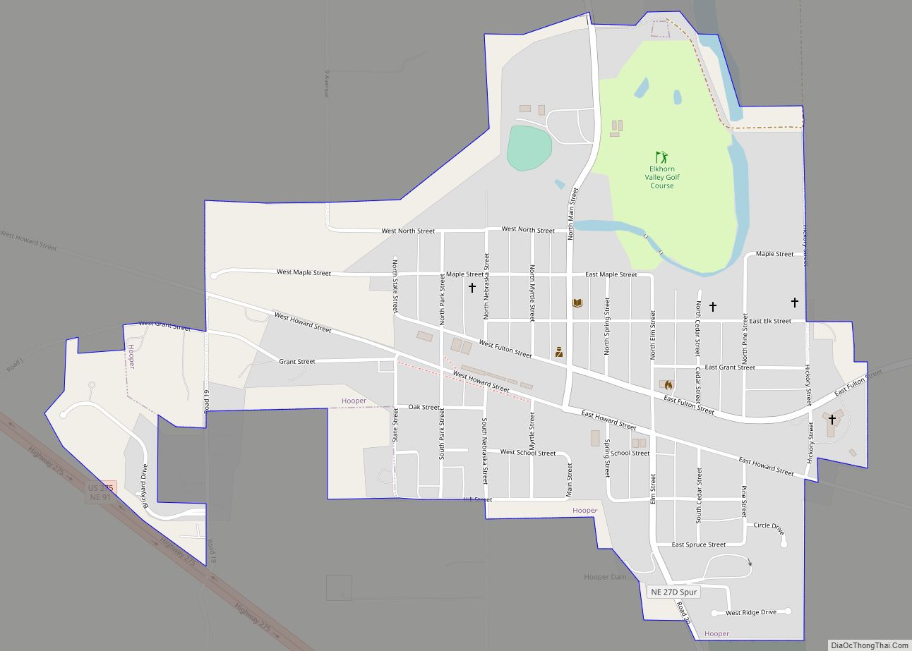
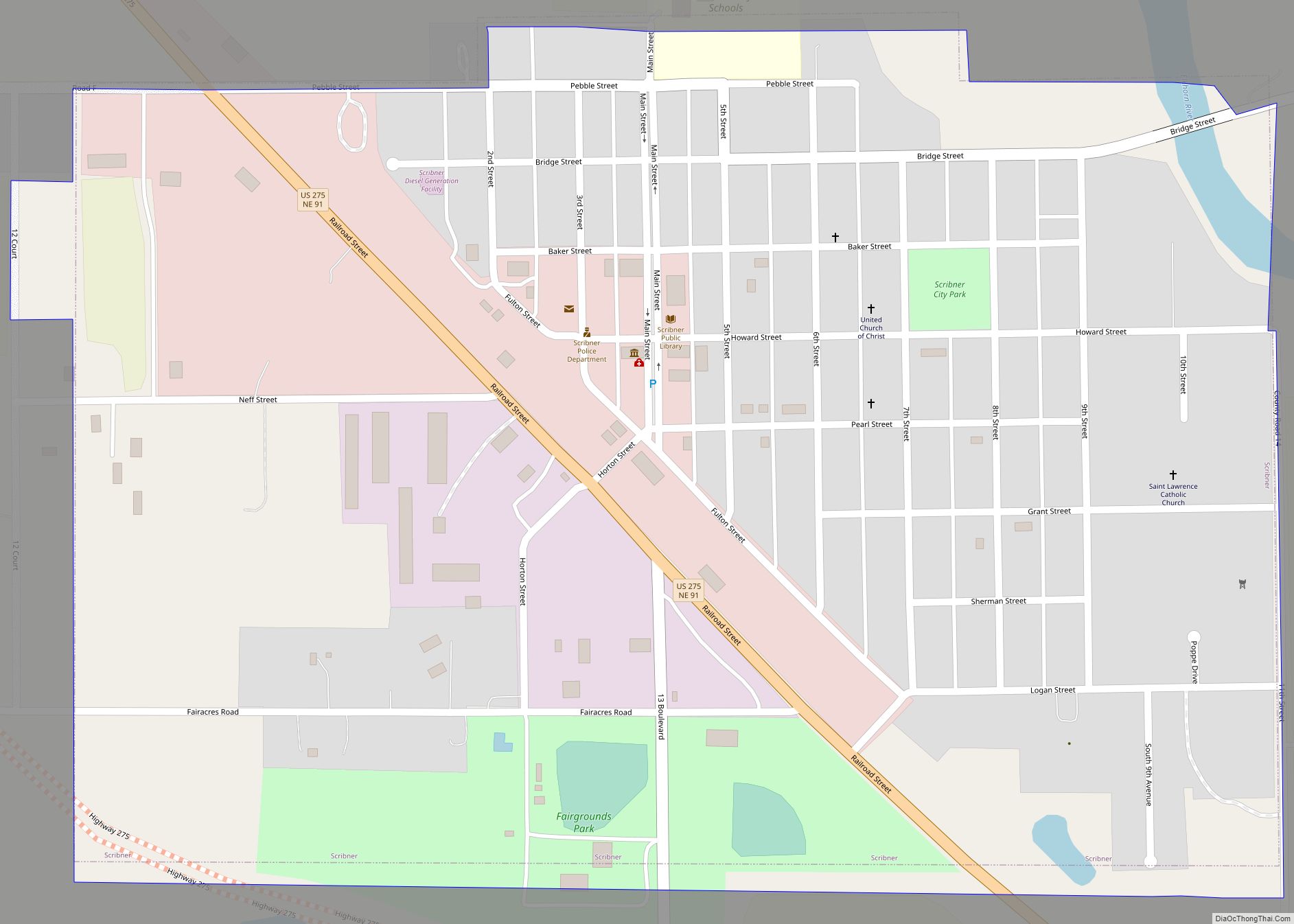
Online Interactive Map
Click on ![]() to view map in "full screen" mode.
to view map in "full screen" mode.
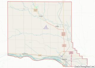
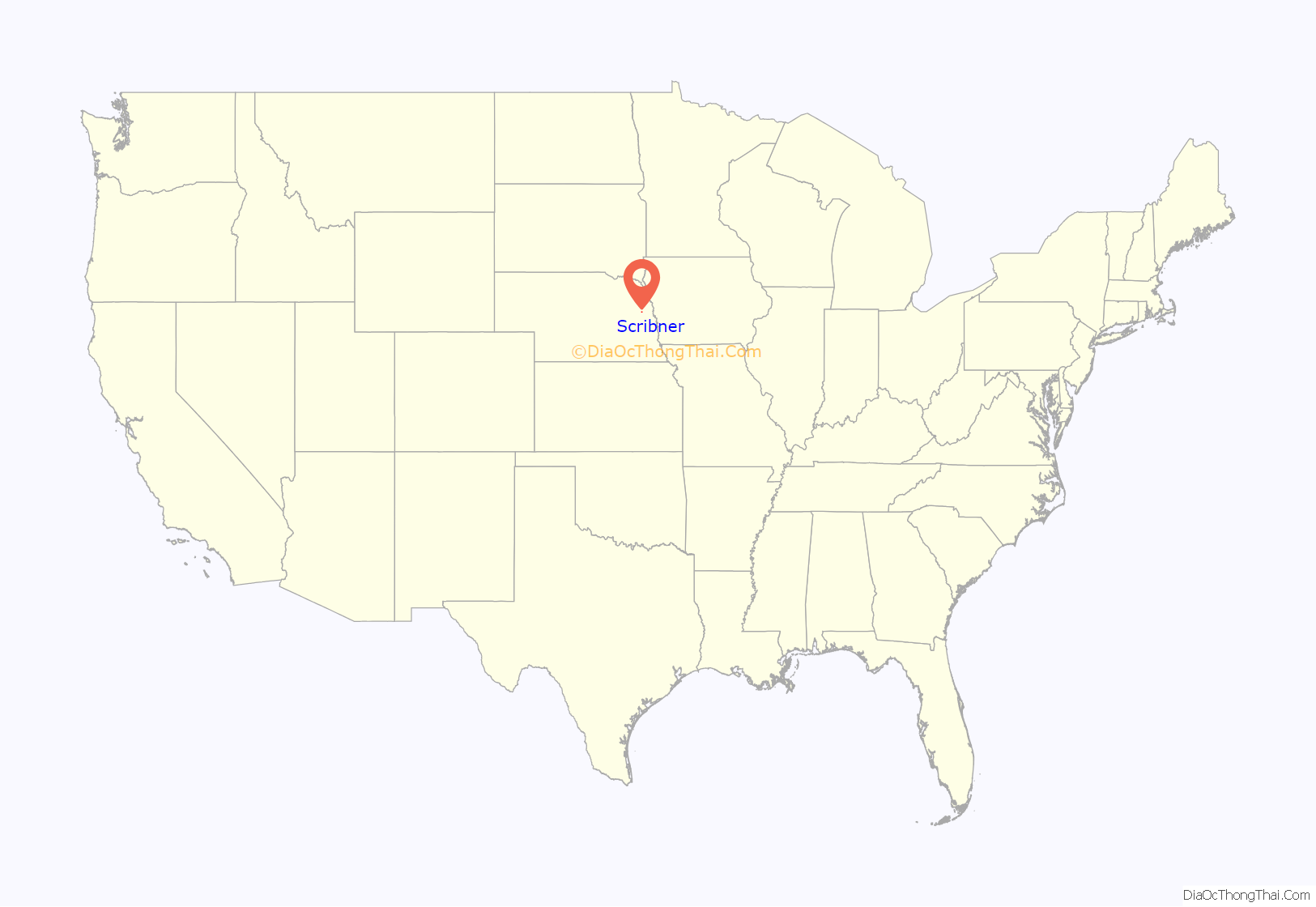
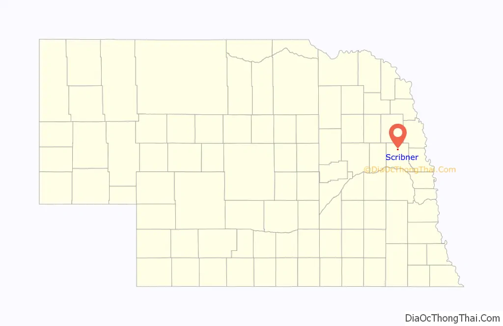
Scribner location map. Where is Scribner city?
History
Scribner was platted in 1870 by Lucius D. Richards when the railroad was extended to that point. It was named for publishing magnate Charles Scribner I. Today, Scribner remains a town of trade, even though the railroad no longer serves the town.
By the mid-1970s, the future of railroad service came into question. The Chicago & North Western tracks had been experiencing mildly declining freight traffic volumes. Revenue railroad service ultimately ended in spring of 1982, when flooding from the Elkhorn River & nearby Pebble Creek damaged sections of the track. With freight traffic mildly declining & flooding damage, the C&NW promptly filed a request with the Interstate Commerce Commission to abandon the line. Permission was granted a short time later, leaving the tracks with a dismal future. Plans were made to revive railroad service from the newly formed Fremont & Elkhorn Valley Railroad, who purchased the abandoned C&NW track. However, the costs were too high to revive railroad service, and the tracks were removed in 1988.
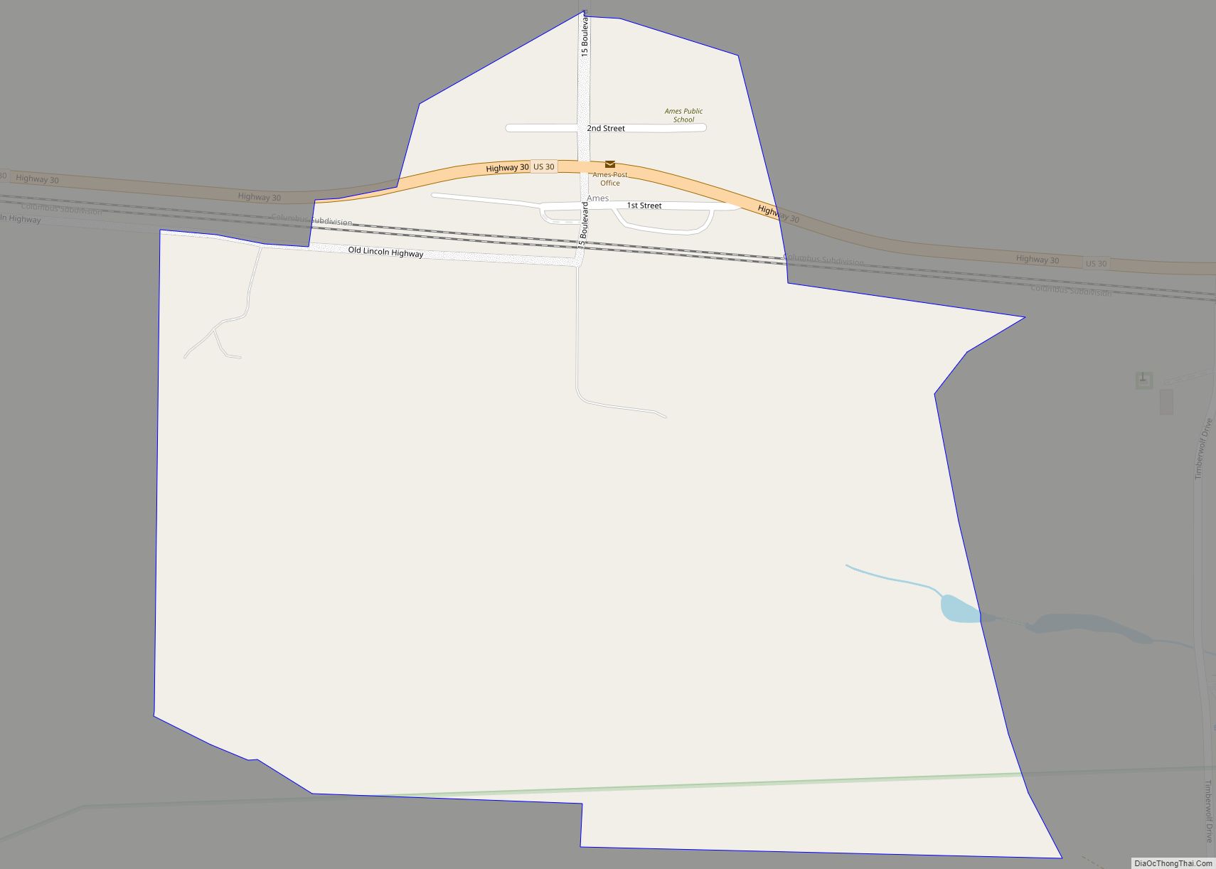
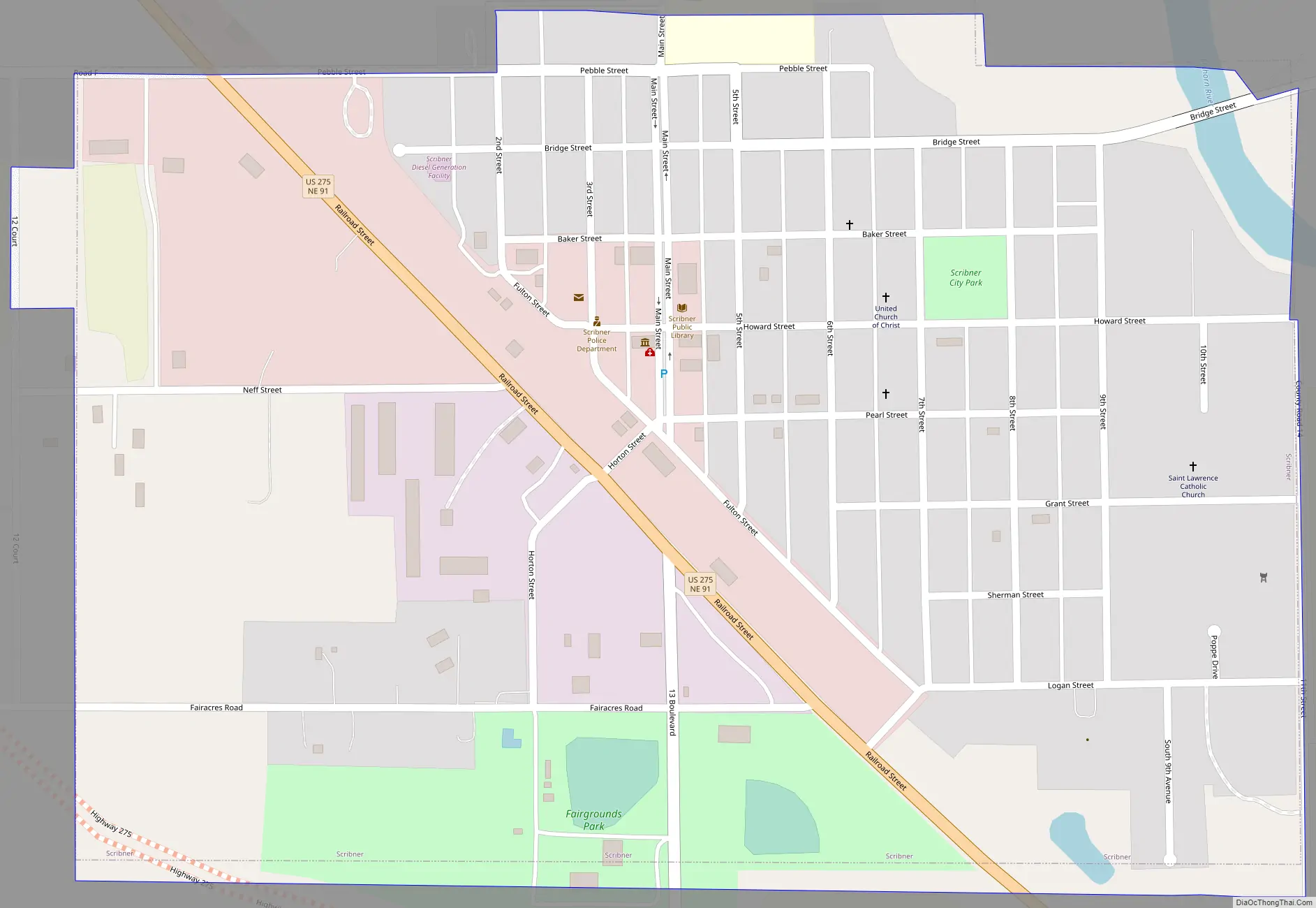
Scribner Road Map
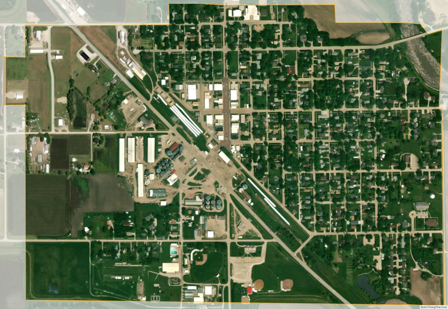
Scribner city Satellite Map
Geography
Scribner is located at 41°39′58″N 96°39′45″W / 41.66611°N 96.66250°W / 41.66611; -96.66250 (41.666040, -96.662541).
According to the United States Census Bureau, the city has a total area of 0.66 square miles (1.71 km), of which 0.64 square miles (1.66 km) is land and 0.02 square miles (0.05 km) is water.
Climate
This climatic region is typified by large seasonal temperature differences, with warm to hot (and often humid) summers and cold (sometimes severely cold) winters. According to the Köppen Climate Classification system, Scribner has a humid continental climate, abbreviated “Dfa” on climate maps.
See also
Map of Nebraska State and its subdivision:- Adams
- Antelope
- Arthur
- Banner
- Blaine
- Boone
- Box Butte
- Boyd
- Brown
- Buffalo
- Burt
- Butler
- Cass
- Cedar
- Chase
- Cherry
- Cheyenne
- Clay
- Colfax
- Cuming
- Custer
- Dakota
- Dawes
- Dawson
- Deuel
- Dixon
- Dodge
- Douglas
- Dundy
- Fillmore
- Franklin
- Frontier
- Furnas
- Gage
- Garden
- Garfield
- Gosper
- Grant
- Greeley
- Hall
- Hamilton
- Harlan
- Hayes
- Hitchcock
- Holt
- Hooker
- Howard
- Jefferson
- Johnson
- Kearney
- Keith
- Keya Paha
- Kimball
- Knox
- Lancaster
- Lincoln
- Logan
- Loup
- Madison
- McPherson
- Merrick
- Morrill
- Nance
- Nemaha
- Nuckolls
- Otoe
- Pawnee
- Perkins
- Phelps
- Pierce
- Platte
- Polk
- Red Willow
- Richardson
- Rock
- Saline
- Sarpy
- Saunders
- Scotts Bluff
- Seward
- Sheridan
- Sherman
- Sioux
- Stanton
- Thayer
- Thomas
- Thurston
- Valley
- Washington
- Wayne
- Webster
- Wheeler
- York
- Alabama
- Alaska
- Arizona
- Arkansas
- California
- Colorado
- Connecticut
- Delaware
- District of Columbia
- Florida
- Georgia
- Hawaii
- Idaho
- Illinois
- Indiana
- Iowa
- Kansas
- Kentucky
- Louisiana
- Maine
- Maryland
- Massachusetts
- Michigan
- Minnesota
- Mississippi
- Missouri
- Montana
- Nebraska
- Nevada
- New Hampshire
- New Jersey
- New Mexico
- New York
- North Carolina
- North Dakota
- Ohio
- Oklahoma
- Oregon
- Pennsylvania
- Rhode Island
- South Carolina
- South Dakota
- Tennessee
- Texas
- Utah
- Vermont
- Virginia
- Washington
- West Virginia
- Wisconsin
- Wyoming