Tecumseh is a city in and the county seat of Johnson County, Nebraska, United States. The population was 1,677 at the 2010 census.
| Name: | Tecumseh city |
|---|---|
| LSAD Code: | 25 |
| LSAD Description: | city (suffix) |
| State: | Nebraska |
| County: | Johnson County |
| Elevation: | 1,129 ft (344 m) |
| Total Area: | 1.51 sq mi (3.91 km²) |
| Land Area: | 1.51 sq mi (3.91 km²) |
| Water Area: | 0.00 sq mi (0.00 km²) |
| Total Population: | 1,694 |
| Population Density: | 1,121.11/sq mi (432.87/km²) |
| ZIP code: | 68450 |
| Area code: | 402 |
| FIPS code: | 3148480 |
| GNISfeature ID: | 2396036 |
| Website: | tecumsehne.com |
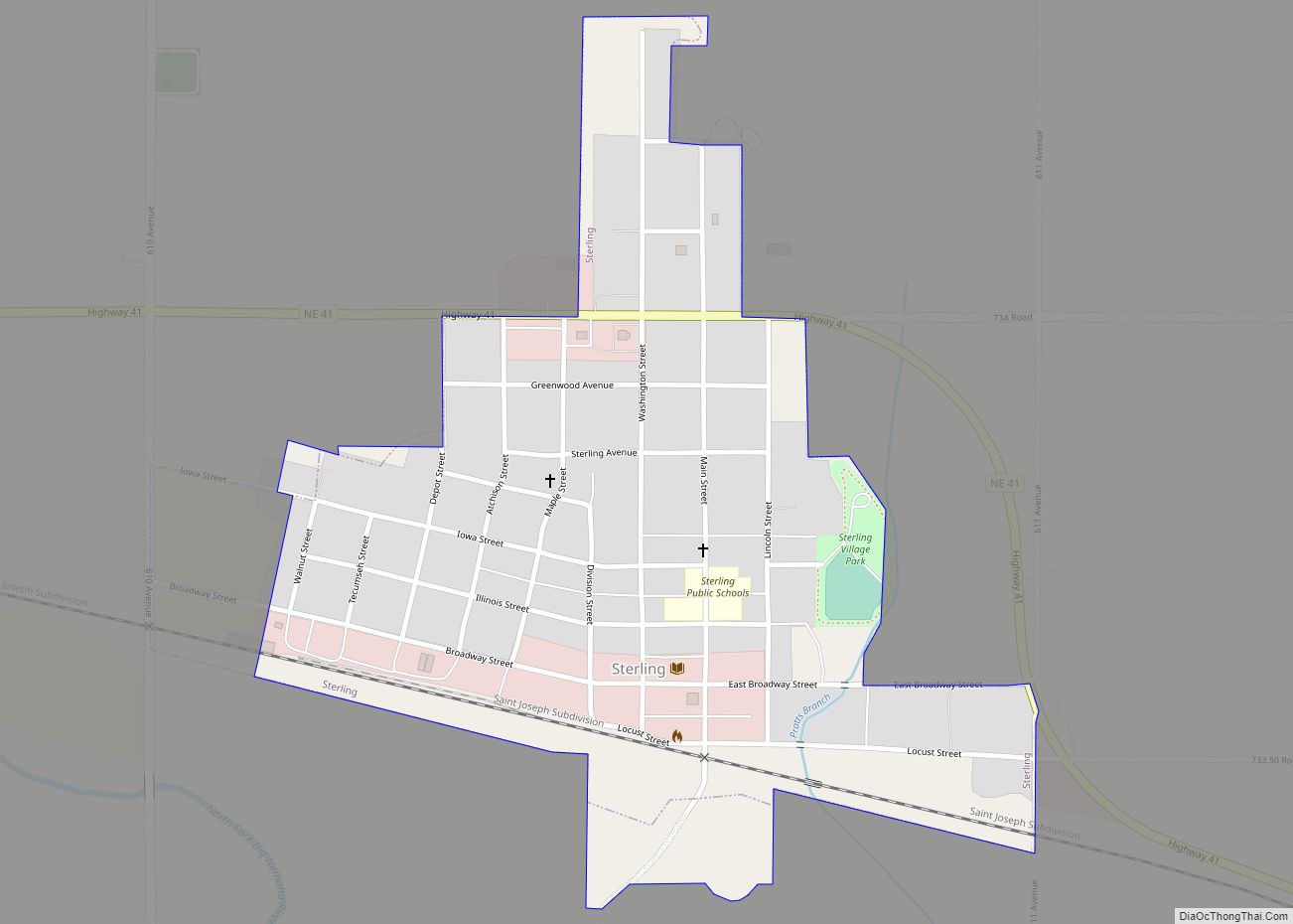
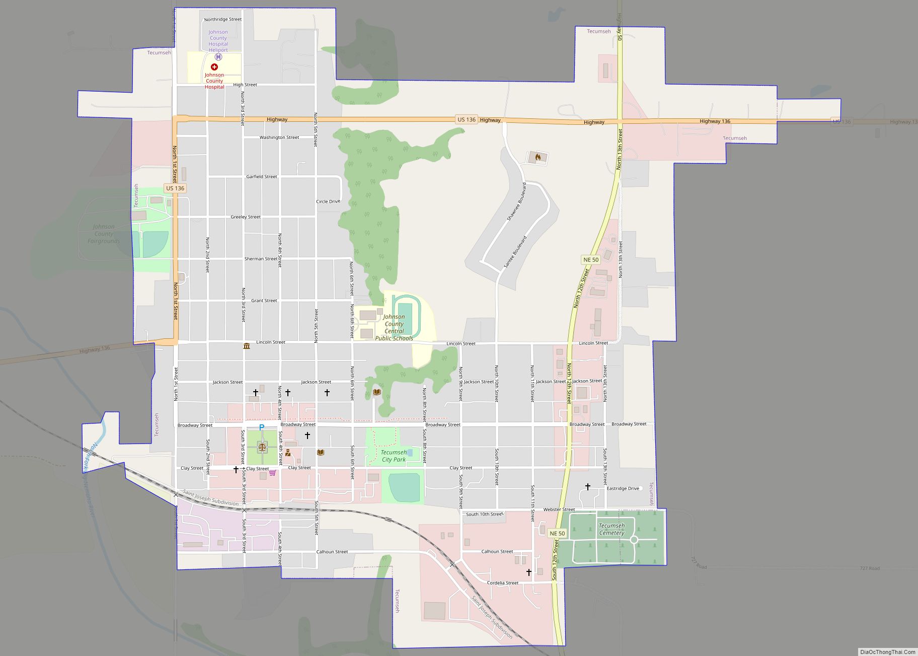
Online Interactive Map
Click on ![]() to view map in "full screen" mode.
to view map in "full screen" mode.
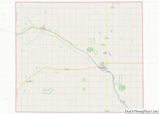
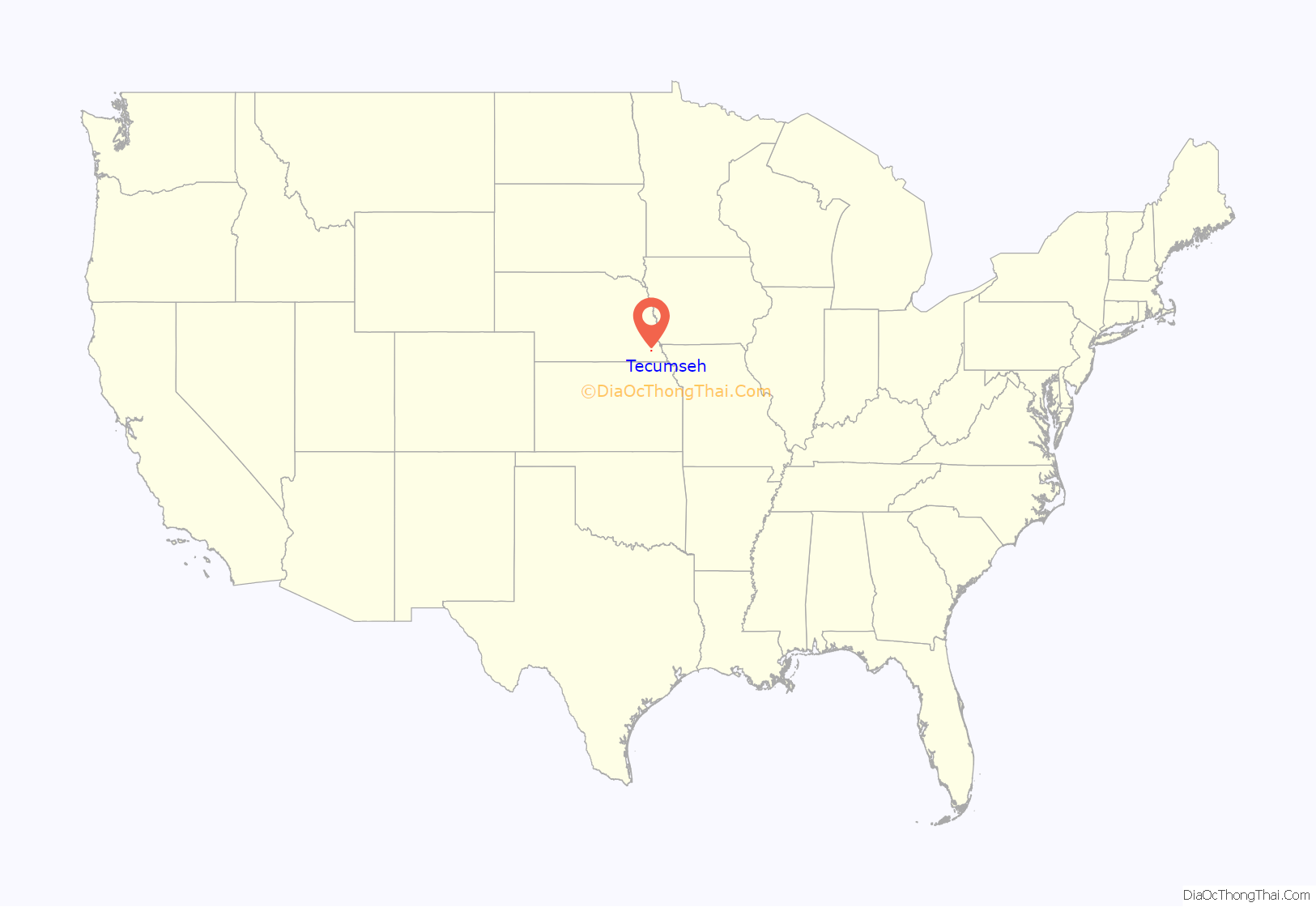
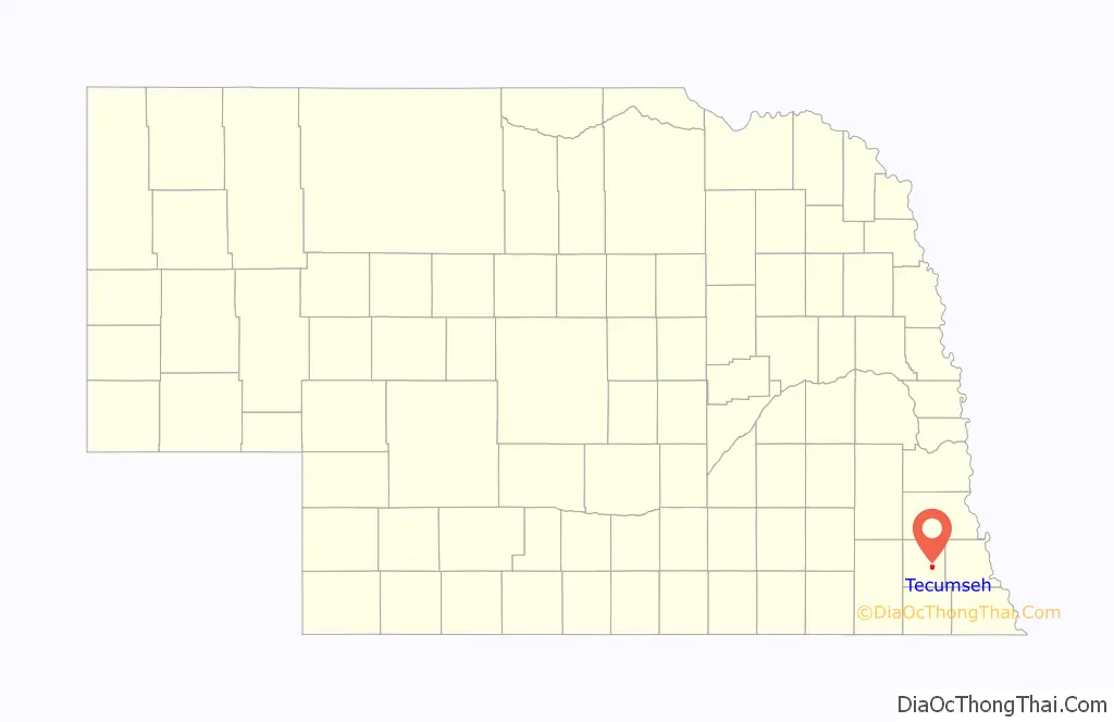
Tecumseh location map. Where is Tecumseh city?
History
Tecumseh was originally called Frances, and under the latter name was established in 1856. The label of Frances has long been falsely attributed as the name of the wife of Col. Richard M Johnson, the namesake of Johnson County. Johnson’s only marriage was to Julia Chinn, a common-law spouse. Julia Chinn, was an octoroon slave (one-eighth African, seven-eighths European in ancestry), born into slavery around 1790. Some historians have accepted the possibility that the legislature intended to name the county seat after Francis Burt, the first Governor of the Nebraska Territory. Shortly after being founded, the name was changed to Tecumseh after the Native American Chief said to have been killed by Johnson during the Battle of the Thames. The Nebraska Territorial Legislature established Tecumseh as the county seat in February 1857.
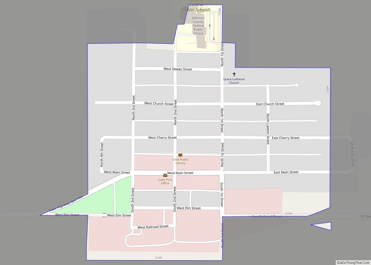
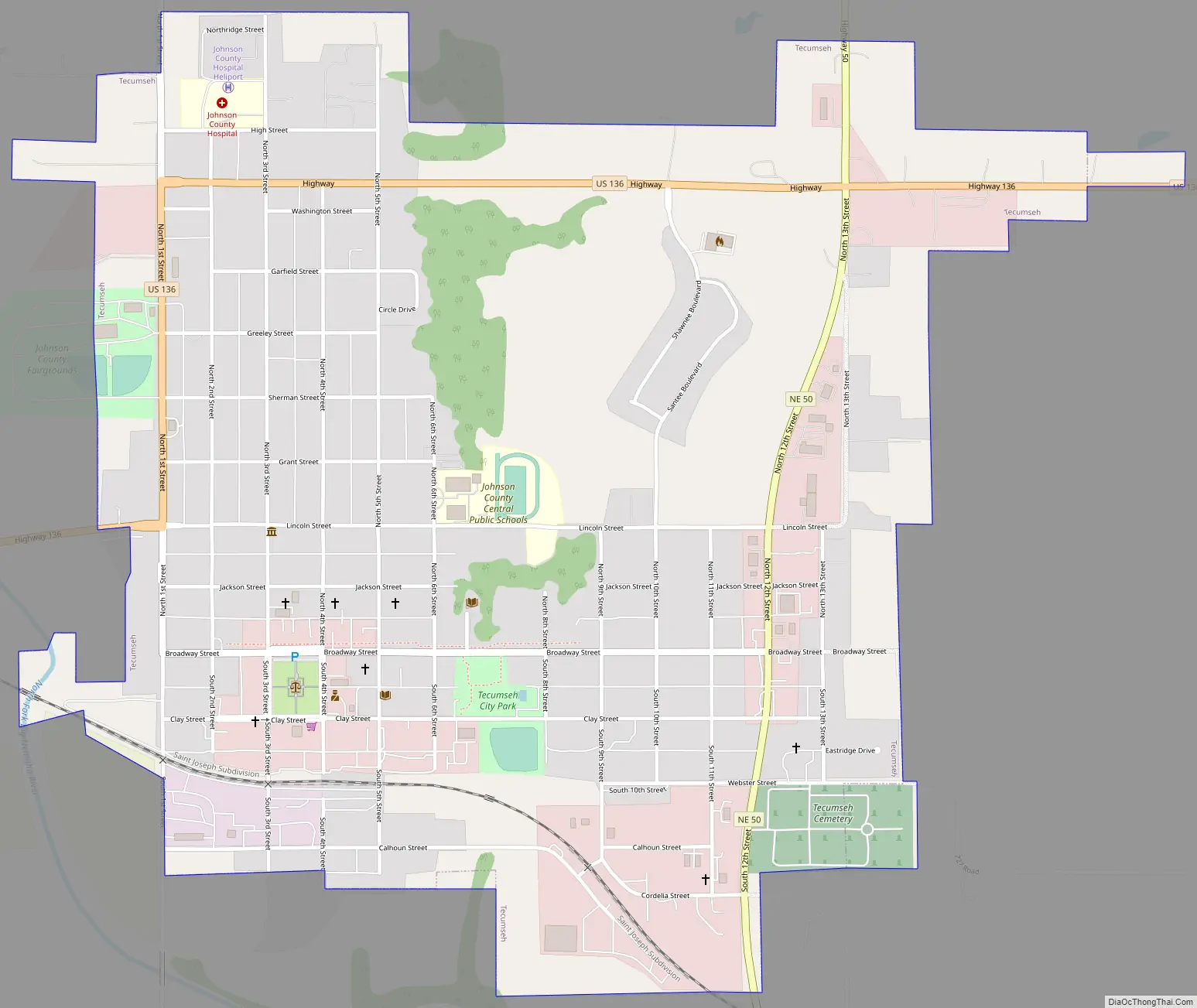
Tecumseh Road Map
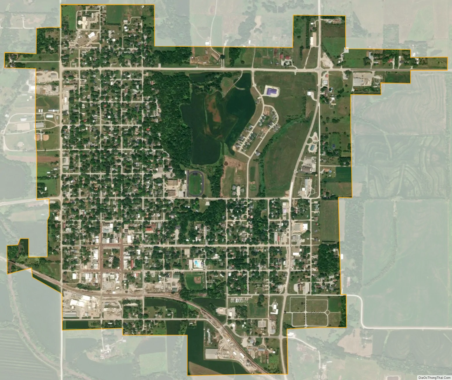
Tecumseh city Satellite Map
Geography
According to the United States Census Bureau, the city has a total area of 1.50 square miles (3.88 km), all land.
Climate
See also
Map of Nebraska State and its subdivision:- Adams
- Antelope
- Arthur
- Banner
- Blaine
- Boone
- Box Butte
- Boyd
- Brown
- Buffalo
- Burt
- Butler
- Cass
- Cedar
- Chase
- Cherry
- Cheyenne
- Clay
- Colfax
- Cuming
- Custer
- Dakota
- Dawes
- Dawson
- Deuel
- Dixon
- Dodge
- Douglas
- Dundy
- Fillmore
- Franklin
- Frontier
- Furnas
- Gage
- Garden
- Garfield
- Gosper
- Grant
- Greeley
- Hall
- Hamilton
- Harlan
- Hayes
- Hitchcock
- Holt
- Hooker
- Howard
- Jefferson
- Johnson
- Kearney
- Keith
- Keya Paha
- Kimball
- Knox
- Lancaster
- Lincoln
- Logan
- Loup
- Madison
- McPherson
- Merrick
- Morrill
- Nance
- Nemaha
- Nuckolls
- Otoe
- Pawnee
- Perkins
- Phelps
- Pierce
- Platte
- Polk
- Red Willow
- Richardson
- Rock
- Saline
- Sarpy
- Saunders
- Scotts Bluff
- Seward
- Sheridan
- Sherman
- Sioux
- Stanton
- Thayer
- Thomas
- Thurston
- Valley
- Washington
- Wayne
- Webster
- Wheeler
- York
- Alabama
- Alaska
- Arizona
- Arkansas
- California
- Colorado
- Connecticut
- Delaware
- District of Columbia
- Florida
- Georgia
- Hawaii
- Idaho
- Illinois
- Indiana
- Iowa
- Kansas
- Kentucky
- Louisiana
- Maine
- Maryland
- Massachusetts
- Michigan
- Minnesota
- Mississippi
- Missouri
- Montana
- Nebraska
- Nevada
- New Hampshire
- New Jersey
- New Mexico
- New York
- North Carolina
- North Dakota
- Ohio
- Oklahoma
- Oregon
- Pennsylvania
- Rhode Island
- South Carolina
- South Dakota
- Tennessee
- Texas
- Utah
- Vermont
- Virginia
- Washington
- West Virginia
- Wisconsin
- Wyoming