Verdigre is a village in Knox County, Nebraska, United States. The population was 575 at the 2010 census.
| Name: | Verdigre village |
|---|---|
| LSAD Code: | 47 |
| LSAD Description: | village (suffix) |
| State: | Nebraska |
| County: | Knox County |
| Elevation: | 1,355 ft (413 m) |
| Total Area: | 0.56 sq mi (1.46 km²) |
| Land Area: | 0.55 sq mi (1.42 km²) |
| Water Area: | 0.01 sq mi (0.04 km²) |
| Total Population: | 554 |
| Population Density: | 1,010.95/sq mi (390.65/km²) |
| ZIP code: | 68783 |
| Area code: | 402 |
| FIPS code: | 3150370 |
| GNISfeature ID: | 0834365 |
| Website: | www.verdigre.org |
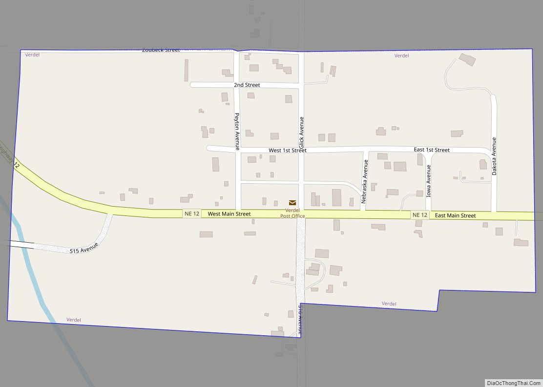
Online Interactive Map
Click on ![]() to view map in "full screen" mode.
to view map in "full screen" mode.
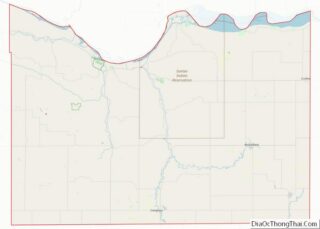
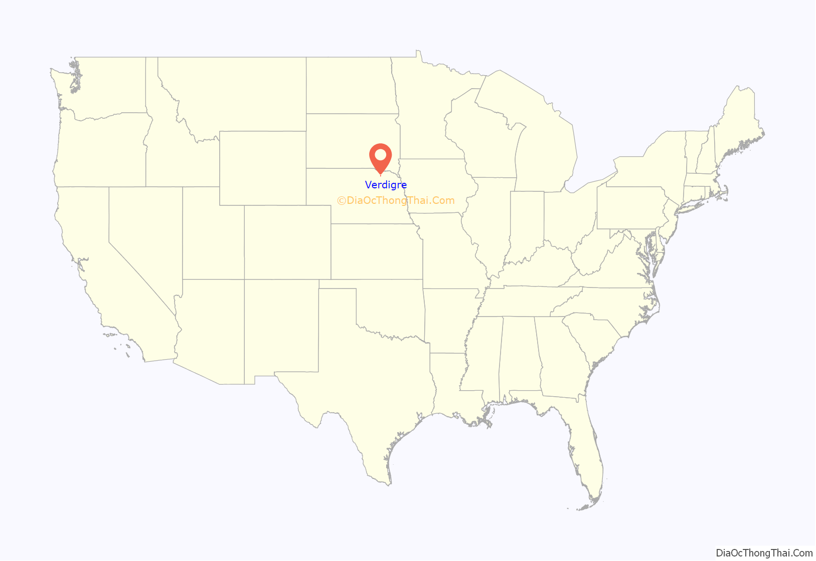
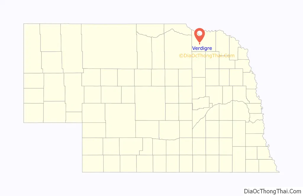
Verdigre location map. Where is Verdigre village?
History
Verdigre was platted in 1887 shortly before the Fremont, Elkhorn and Missouri Valley Railroad was extended to that point. It took its name from nearby Verdigre Creek.
Verdigre was the site of a fatal injury during a professional wrestling tag team match on June 13, 1971, when Alberto Torres was hurt while competing against Ox Baker. Torres died of a ruptured appendix four days after being hurt.
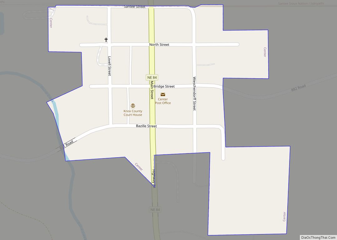
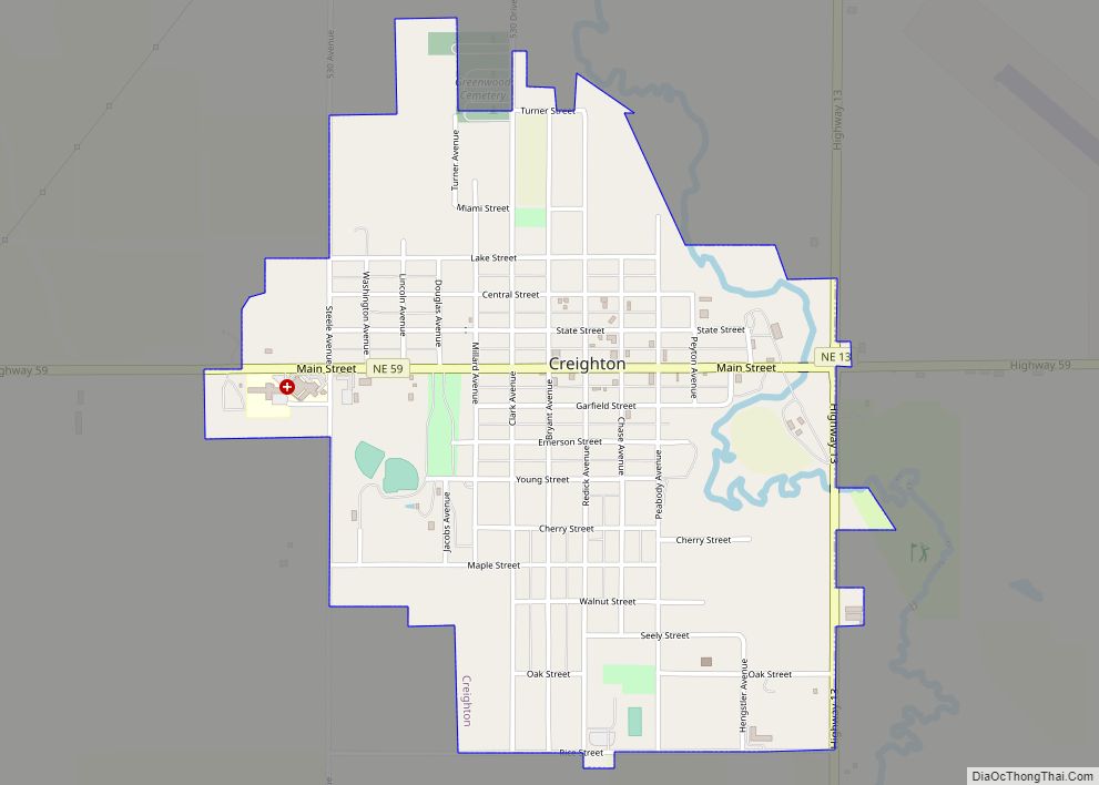
Verdigre Road Map
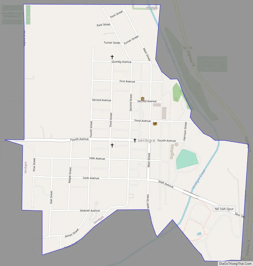
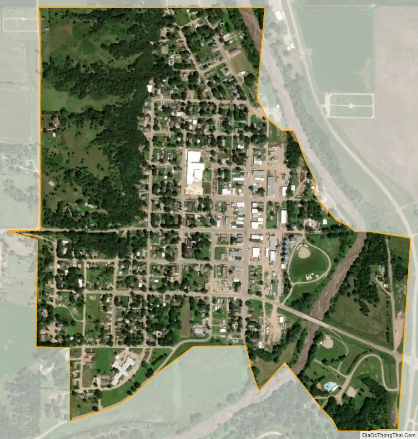
Verdigre city Satellite Map
Geography
Verdigre is located at 42°35′47″N 98°2′3″W / 42.59639°N 98.03417°W / 42.59639; -98.03417 (42.596437, -98.034118).
According to the United States Census Bureau, the village has a total area of 0.57 square miles (1.48 km), of which 0.55 square miles (1.42 km) is land and 0.02 square miles (0.05 km) is water.
See also
Map of Nebraska State and its subdivision:- Adams
- Antelope
- Arthur
- Banner
- Blaine
- Boone
- Box Butte
- Boyd
- Brown
- Buffalo
- Burt
- Butler
- Cass
- Cedar
- Chase
- Cherry
- Cheyenne
- Clay
- Colfax
- Cuming
- Custer
- Dakota
- Dawes
- Dawson
- Deuel
- Dixon
- Dodge
- Douglas
- Dundy
- Fillmore
- Franklin
- Frontier
- Furnas
- Gage
- Garden
- Garfield
- Gosper
- Grant
- Greeley
- Hall
- Hamilton
- Harlan
- Hayes
- Hitchcock
- Holt
- Hooker
- Howard
- Jefferson
- Johnson
- Kearney
- Keith
- Keya Paha
- Kimball
- Knox
- Lancaster
- Lincoln
- Logan
- Loup
- Madison
- McPherson
- Merrick
- Morrill
- Nance
- Nemaha
- Nuckolls
- Otoe
- Pawnee
- Perkins
- Phelps
- Pierce
- Platte
- Polk
- Red Willow
- Richardson
- Rock
- Saline
- Sarpy
- Saunders
- Scotts Bluff
- Seward
- Sheridan
- Sherman
- Sioux
- Stanton
- Thayer
- Thomas
- Thurston
- Valley
- Washington
- Wayne
- Webster
- Wheeler
- York
- Alabama
- Alaska
- Arizona
- Arkansas
- California
- Colorado
- Connecticut
- Delaware
- District of Columbia
- Florida
- Georgia
- Hawaii
- Idaho
- Illinois
- Indiana
- Iowa
- Kansas
- Kentucky
- Louisiana
- Maine
- Maryland
- Massachusetts
- Michigan
- Minnesota
- Mississippi
- Missouri
- Montana
- Nebraska
- Nevada
- New Hampshire
- New Jersey
- New Mexico
- New York
- North Carolina
- North Dakota
- Ohio
- Oklahoma
- Oregon
- Pennsylvania
- Rhode Island
- South Carolina
- South Dakota
- Tennessee
- Texas
- Utah
- Vermont
- Virginia
- Washington
- West Virginia
- Wisconsin
- Wyoming