Wahoo (/ˈwɑːˌhu/; from Dakota wǧhu; “arrow wood”) is a city and county seat of Saunders County, Nebraska, United States. The population was 4,818 at the 2020 census.
| Name: | Wahoo city |
|---|---|
| LSAD Code: | 25 |
| LSAD Description: | city (suffix) |
| State: | Nebraska |
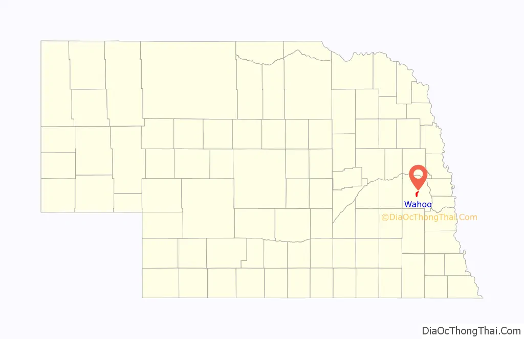
| County: | Saunders County |
| Elevation: | 1,230 ft (370 m) |
| Total Area: | 2.99 sq mi (7.75 km²) |
| Land Area: | 2.99 sq mi (7.75 km²) |
| Water Area: | 0.00 sq mi (0.00 km²) |
| Total Population: | 4,818 |
| Population Density: | 1,610.83/sq mi (621.98/km²) |
| ZIP code: | 68066 |
| Area code: | 402 |
| FIPS code: | 3150965 |
| GNISfeature ID: | 0838310 |
| Website: | wahoo.ne.us |
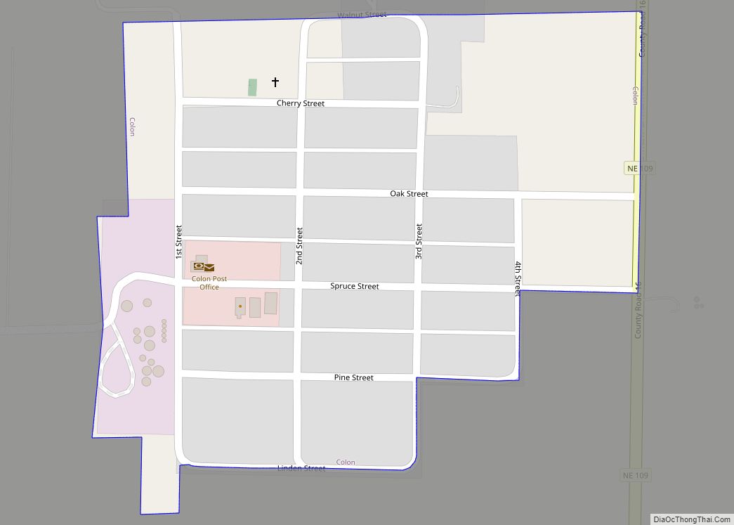
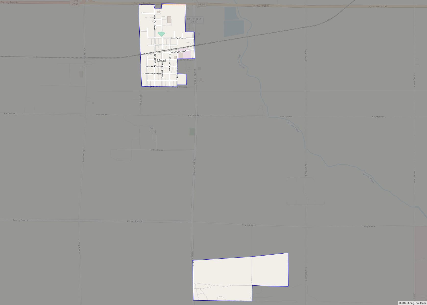
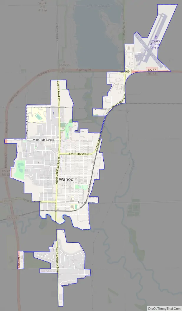
Online Interactive Map
Click on ![]() to view map in "full screen" mode.
to view map in "full screen" mode.
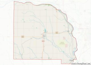
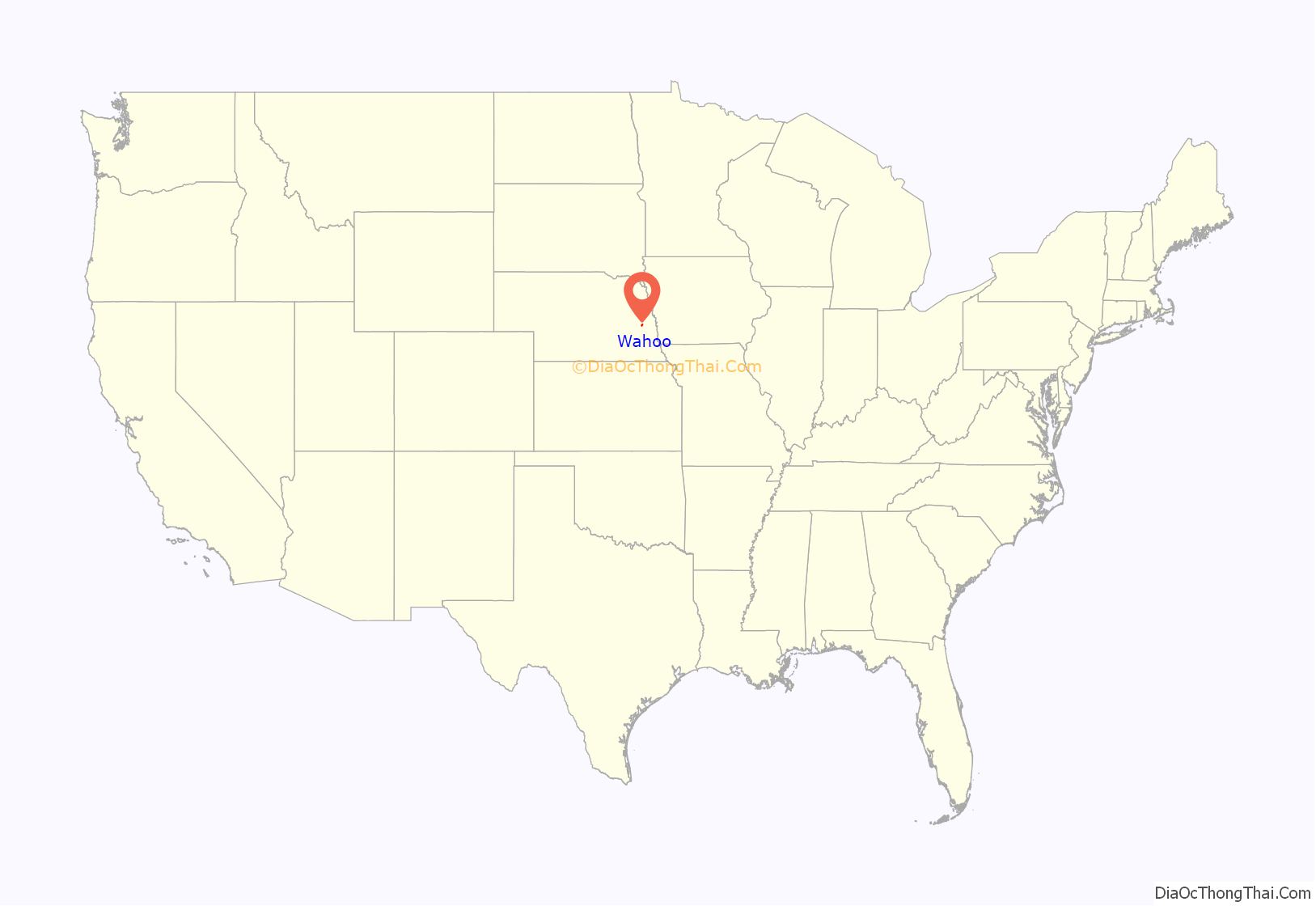
Wahoo location map. Where is Wahoo city?
History
Wahoo was founded in 1870. The town’s name comes from the eastern wahoo (Euonymus atropurpureus), a shrub found on the banks of Wahoo Creek. The town was originally built up chiefly by predominantly Czech, German, and Scandinavian settlers.
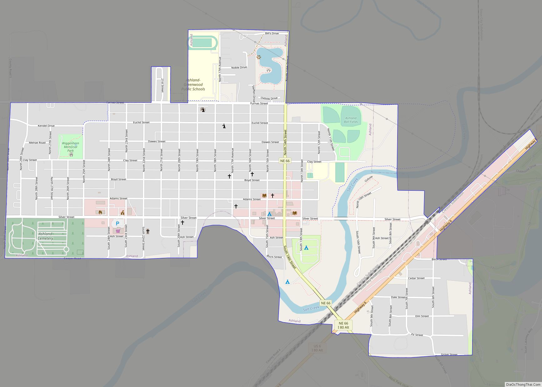
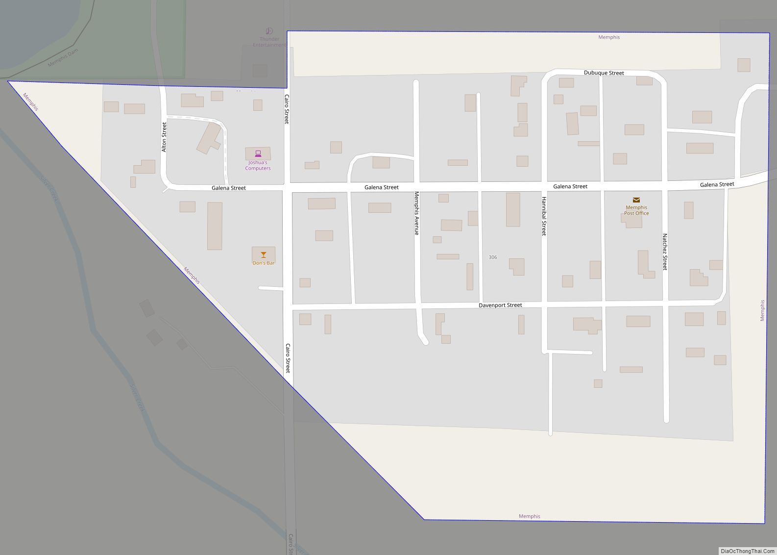
Wahoo Road Map
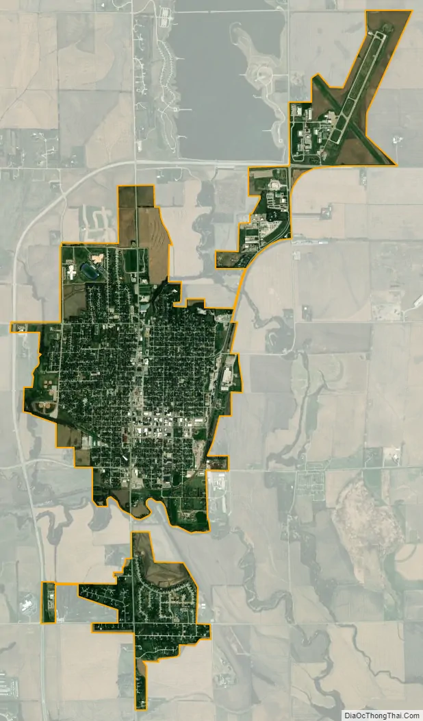
Wahoo city Satellite Map
Geography
According to the United States Census Bureau, the city has a total area of 2.65 square miles (6.86 km), all land.
See also
Map of Nebraska State and its subdivision:- Adams
- Antelope
- Arthur
- Banner
- Blaine
- Boone
- Box Butte
- Boyd
- Brown
- Buffalo
- Burt
- Butler
- Cass
- Cedar
- Chase
- Cherry
- Cheyenne
- Clay
- Colfax
- Cuming
- Custer
- Dakota
- Dawes
- Dawson
- Deuel
- Dixon
- Dodge
- Douglas
- Dundy
- Fillmore
- Franklin
- Frontier
- Furnas
- Gage
- Garden
- Garfield
- Gosper
- Grant
- Greeley
- Hall
- Hamilton
- Harlan
- Hayes
- Hitchcock
- Holt
- Hooker
- Howard
- Jefferson
- Johnson
- Kearney
- Keith
- Keya Paha
- Kimball
- Knox
- Lancaster
- Lincoln
- Logan
- Loup
- Madison
- McPherson
- Merrick
- Morrill
- Nance
- Nemaha
- Nuckolls
- Otoe
- Pawnee
- Perkins
- Phelps
- Pierce
- Platte
- Polk
- Red Willow
- Richardson
- Rock
- Saline
- Sarpy
- Saunders
- Scotts Bluff
- Seward
- Sheridan
- Sherman
- Sioux
- Stanton
- Thayer
- Thomas
- Thurston
- Valley
- Washington
- Wayne
- Webster
- Wheeler
- York
- Alabama
- Alaska
- Arizona
- Arkansas
- California
- Colorado
- Connecticut
- Delaware
- District of Columbia
- Florida
- Georgia
- Hawaii
- Idaho
- Illinois
- Indiana
- Iowa
- Kansas
- Kentucky
- Louisiana
- Maine
- Maryland
- Massachusetts
- Michigan
- Minnesota
- Mississippi
- Missouri
- Montana
- Nebraska
- Nevada
- New Hampshire
- New Jersey
- New Mexico
- New York
- North Carolina
- North Dakota
- Ohio
- Oklahoma
- Oregon
- Pennsylvania
- Rhode Island
- South Carolina
- South Dakota
- Tennessee
- Texas
- Utah
- Vermont
- Virginia
- Washington
- West Virginia
- Wisconsin
- Wyoming