DuBois (/ˈduːbɔɪz/ DOO-boyss) is a city and the most populous community in Clearfield County, Pennsylvania, United States. DuBois is located approximately 100 miles (160 km) northeast of Pittsburgh. The population was 7,510 as of the 2020 census. It is the principal city in the DuBois, PA Micropolitan Statistical Area. DuBois is also one of two principal cities, the other being State College, that make up the larger State College-DuBois, PA Combined Statistical Area.
| Name: | DuBois city |
|---|---|
| LSAD Code: | 25 |
| LSAD Description: | city (suffix) |
| State: | Pennsylvania |
| County: | Clearfield County |
| Elevation: | 1,410 ft (430 m) |
| Total Area: | 3.26 sq mi (8.44 km²) |
| Land Area: | 3.22 sq mi (8.34 km²) |
| Water Area: | 0.04 sq mi (0.10 km²) |
| Total Population: | 7,510 |
| Population Density: | 2,333.02/sq mi (900.88/km²) |
| ZIP code: | 15801 |
| Area code: | 814 |
| FIPS code: | 4220136 |
| Website: | www.duboispa.gov |
Online Interactive Map
Click on ![]() to view map in "full screen" mode.
to view map in "full screen" mode.
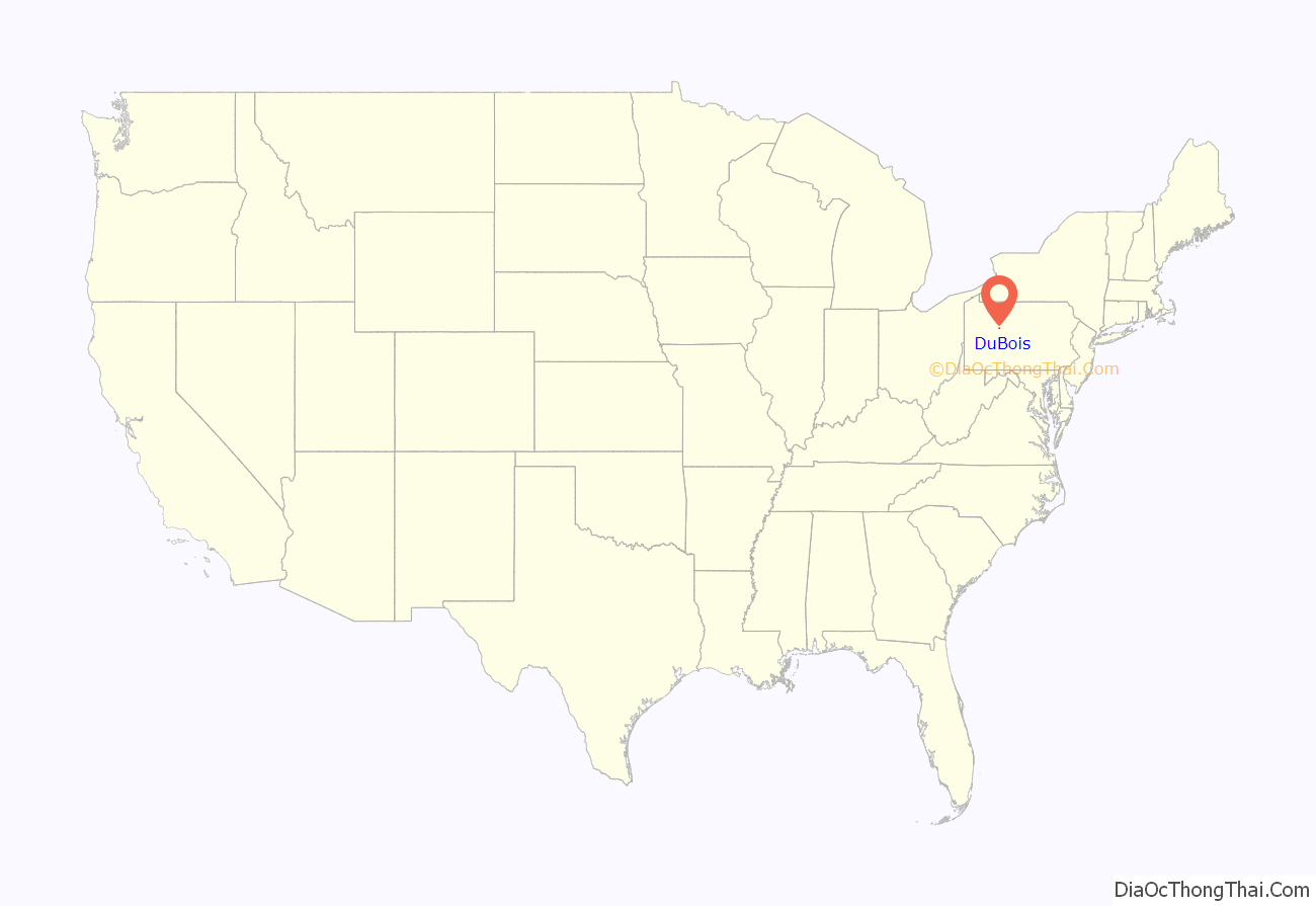
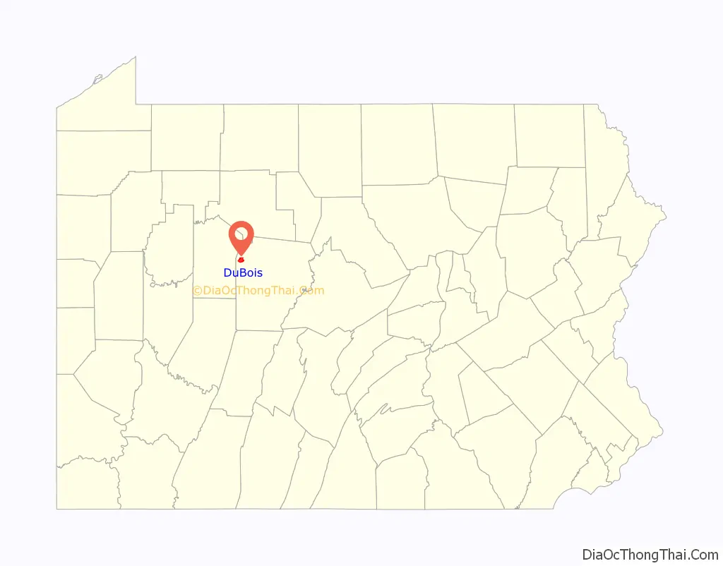
DuBois location map. Where is DuBois city?
History
Settled in 1812 and platted in 1872, DuBois was incorporated as a borough in 1881 and as a city in 1914.
The town was founded by John Rumbarger, for whom the town was originally named. The Rumbarger Cemetery is all that survives of John Rumbarger’s “original settlement” in the city of DuBois. The town was later renamed for local lumber magnate John DuBois, who came from a longstanding American family of French Huguenot descent. Many of the town’s original buildings and homes were funded and or donated by Mr. DuBois’s lumber mill. In 1938, his nephew, John E. DuBois, donated the family mansion and estate as a permanent home for the DuBois Campus of Penn State University. While DuBois was founded as a lumber town, the mining of bituminous coal quickly became the chief industry in DuBois.
Over the years there have been numerous unsuccessful attempts in 1989, 1995, and 2002 to combine the city with the surrounding Sandy Township, but in 2021 voters in both municipalities successfully voted to consolidate into a new third class city, anticipated to take effect between 2024 and 2026. Combined, the population of DuBois and Sandy Township is approximately 18,000 people.
The Commercial Hotel, since demolished, was listed on the National Register of Historic Places in 1985, and the DuBois Historic District was listed in 1997.
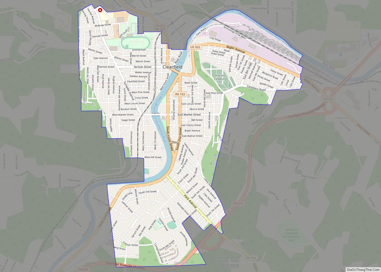
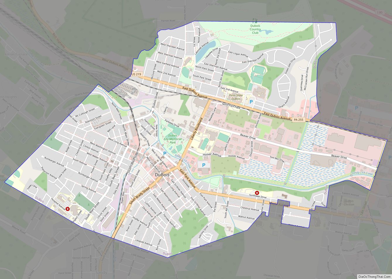
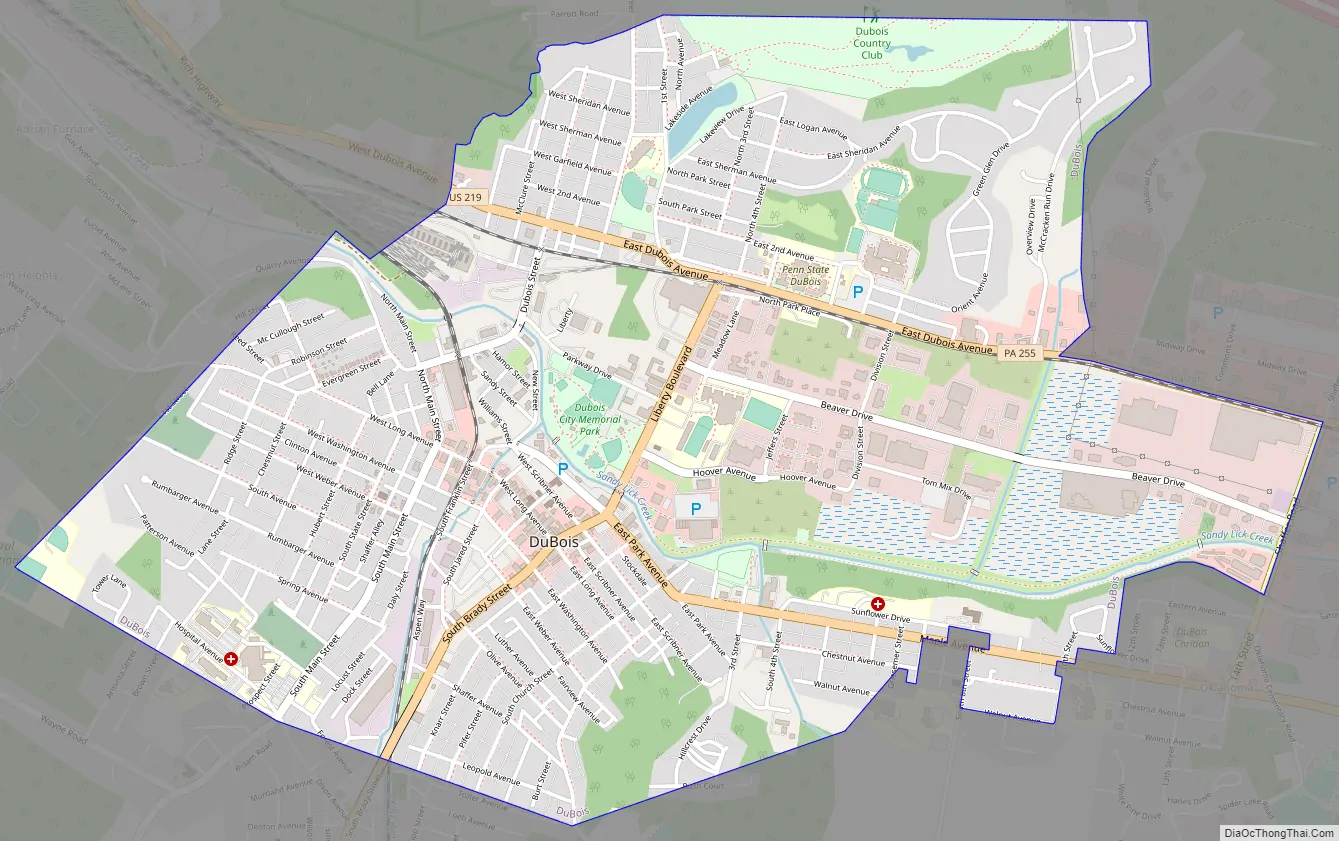
DuBois Road Map
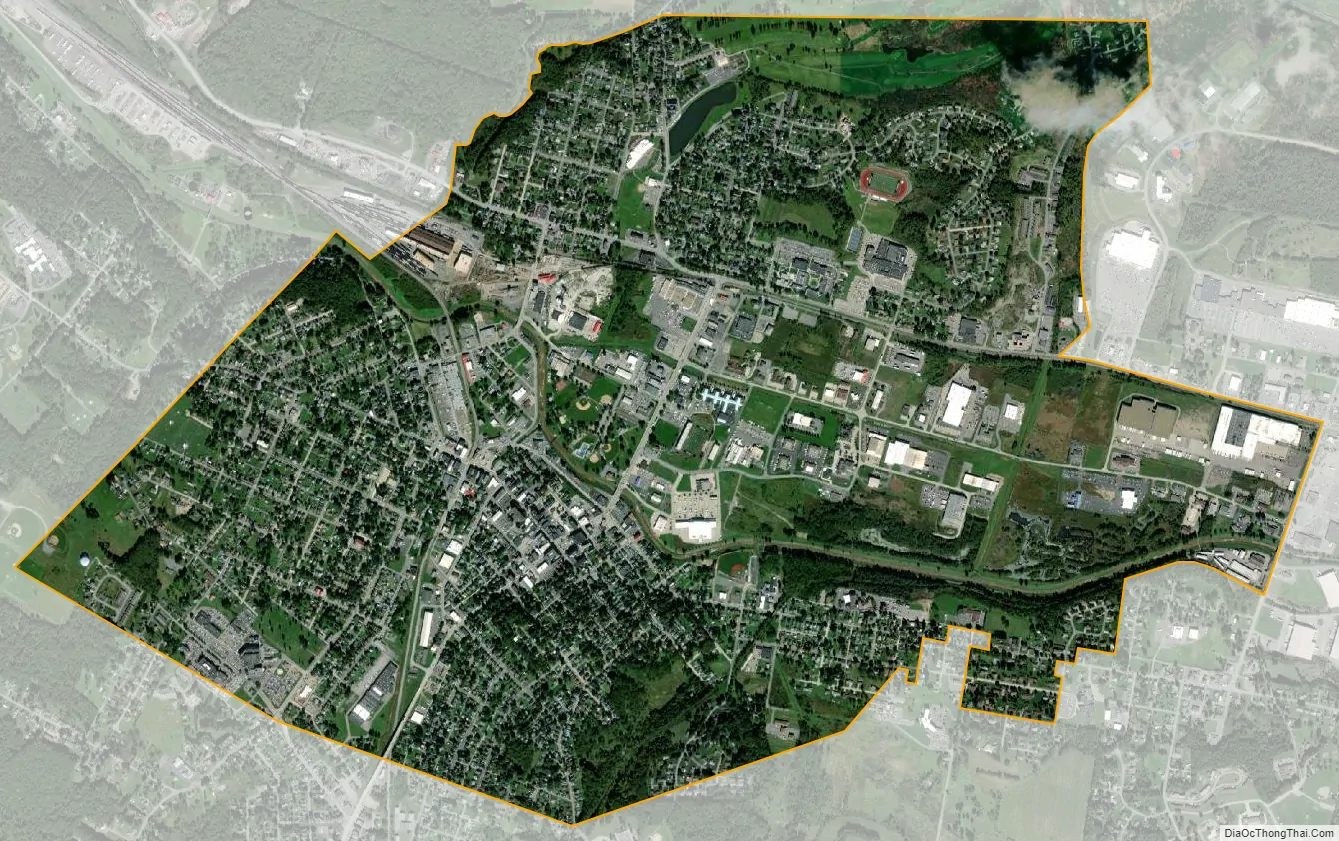
DuBois city Satellite Map
Geography
DuBois is located in northwestern Clearfield County at 41°7′13″N 78°45′43″W / 41.12028°N 78.76194°W / 41.12028; -78.76194 (41.120304, -78.761962). It is surrounded by Sandy Township. It is bordered to the southwest by the community of Sandy and to the southeast by the community of Oklahoma.
According to the U.S. Census Bureau, the city has an area of 3.2 square miles (8.3 km), of which 3.2 square miles (8.2 km) is land and 0.04 square miles (0.1 km), or 1.24%, is water. Sandy Lick Creek flows through the city from east to west. It is a tributary of Redbank Creek, part of the Allegheny River/Ohio River basin.
See also
Map of Pennsylvania State and its subdivision:- Adams
- Allegheny
- Armstrong
- Beaver
- Bedford
- Berks
- Blair
- Bradford
- Bucks
- Butler
- Cambria
- Cameron
- Carbon
- Centre
- Chester
- Clarion
- Clearfield
- Clinton
- Columbia
- Crawford
- Cumberland
- Dauphin
- Delaware
- Elk
- Erie
- Fayette
- Forest
- Franklin
- Fulton
- Greene
- Huntingdon
- Indiana
- Jefferson
- Juniata
- Lackawanna
- Lancaster
- Lawrence
- Lebanon
- Lehigh
- Luzerne
- Lycoming
- Mc Kean
- Mercer
- Mifflin
- Monroe
- Montgomery
- Montour
- Northampton
- Northumberland
- Perry
- Philadelphia
- Pike
- Potter
- Schuylkill
- Snyder
- Somerset
- Sullivan
- Susquehanna
- Tioga
- Union
- Venango
- Warren
- Washington
- Wayne
- Westmoreland
- Wyoming
- York
- Alabama
- Alaska
- Arizona
- Arkansas
- California
- Colorado
- Connecticut
- Delaware
- District of Columbia
- Florida
- Georgia
- Hawaii
- Idaho
- Illinois
- Indiana
- Iowa
- Kansas
- Kentucky
- Louisiana
- Maine
- Maryland
- Massachusetts
- Michigan
- Minnesota
- Mississippi
- Missouri
- Montana
- Nebraska
- Nevada
- New Hampshire
- New Jersey
- New Mexico
- New York
- North Carolina
- North Dakota
- Ohio
- Oklahoma
- Oregon
- Pennsylvania
- Rhode Island
- South Carolina
- South Dakota
- Tennessee
- Texas
- Utah
- Vermont
- Virginia
- Washington
- West Virginia
- Wisconsin
- Wyoming