State College is a home rule municipality in Centre County, Pennsylvania, United States. It is a college town, dominated economically, culturally, and demographically by the presence of the University Park campus of Penn State University.
State College is the largest designated borough in Pennsylvania. It is the principal borough of the six municipalities that make up the State College area, the largest settlement in Centre County and one of the principal cities of the greater State College-DuBois Combined Statistical Area with a combined population of 236,577 as of the 2010 U.S. census. In the 2010 census, the borough population was 42,034 with approximately 105,000 living in the borough and the surrounding townships, often referred to locally as the Centre Region. Many of these Centre Region communities also carry a “State College, PA” address although they are not part of the borough. Happy Valley and Lion Country are also used to identify the State College area, including both the borough and townships of College, Harris, Patton, and Ferguson.
| Name: | State College borough |
|---|---|
| LSAD Code: | 21 |
| LSAD Description: | borough (suffix) |
| State: | Pennsylvania |
| County: | Centre County |
| Incorporated: | August 29, 1896 |
| Elevation: | 1,154 ft (352 m) |
| Land Area: | 4.58 sq mi (11.86 km²) |
| Water Area: | 0.00 sq mi (0.00 km²) |
| Population Density: | 8,846.88/sq mi (3,415.50/km²) |
| Area code: | 814 and 582 |
| FIPS code: | 4273808 |
| Website: | www.statecollegepa.us |
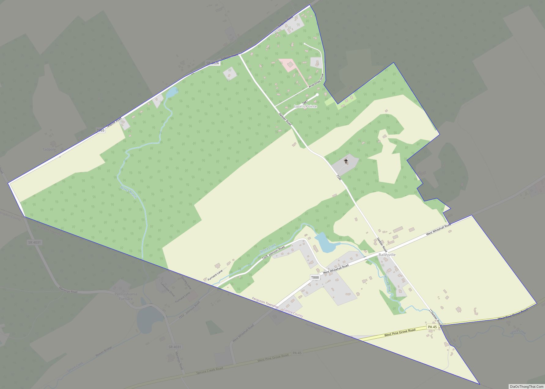
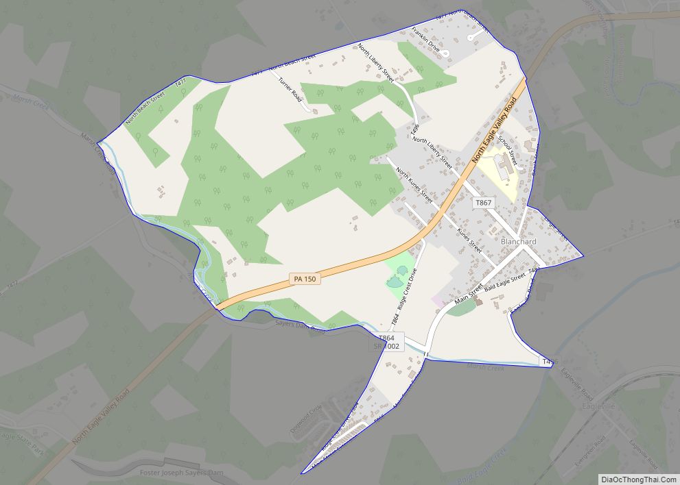
Online Interactive Map
Click on ![]() to view map in "full screen" mode.
to view map in "full screen" mode.
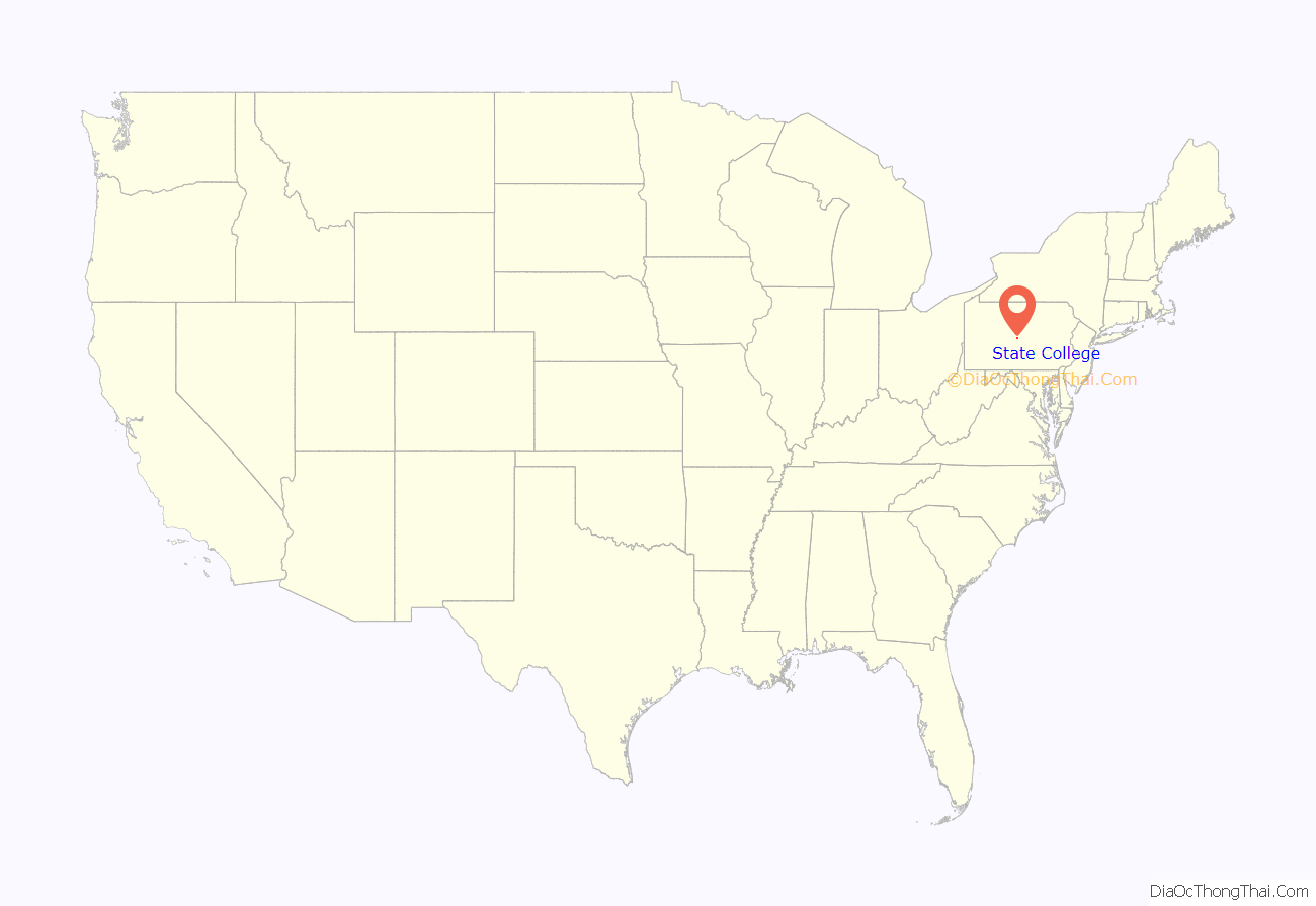
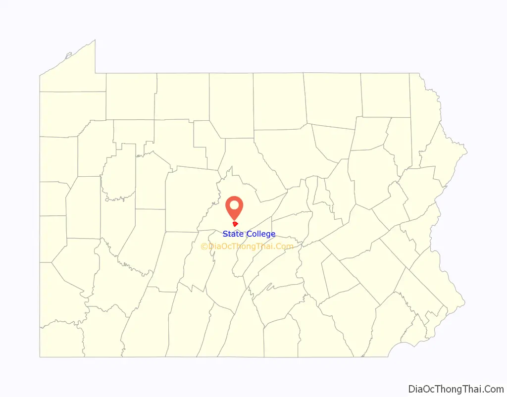
State College location map. Where is State College borough?
History
State College evolved from a village to a town to serve the needs of Pennsylvania State College, which was founded in 1855 as Farmers’ High School of Pennsylvania. State College was incorporated as a borough on August 29, 1896, and it has grown with the college, which was renamed The Pennsylvania State University in 1953.
In 1973, State College adopted a home rule charter which took effect in 1976; since then, it has not been governed by the state’s Borough Code, although it retains “Borough of State College” as its official name.
The university has a post office address in University Park, Pennsylvania. When it changed its name from Penn State College to Penn State University in 1953, its president, Milton S. Eisenhower, sought to persuade the town to change its name as well. A referendum failed to yield a majority for any of the choices proposed as a new name, so the town remains State College. After this, Penn State requested a new name for its on-campus post office in the HUB-Robeson Center from the U.S. Postal Service. The post office, which has since moved across an alley to the McAllister Building, is the official home of ZIP Code 16802 for University Park.
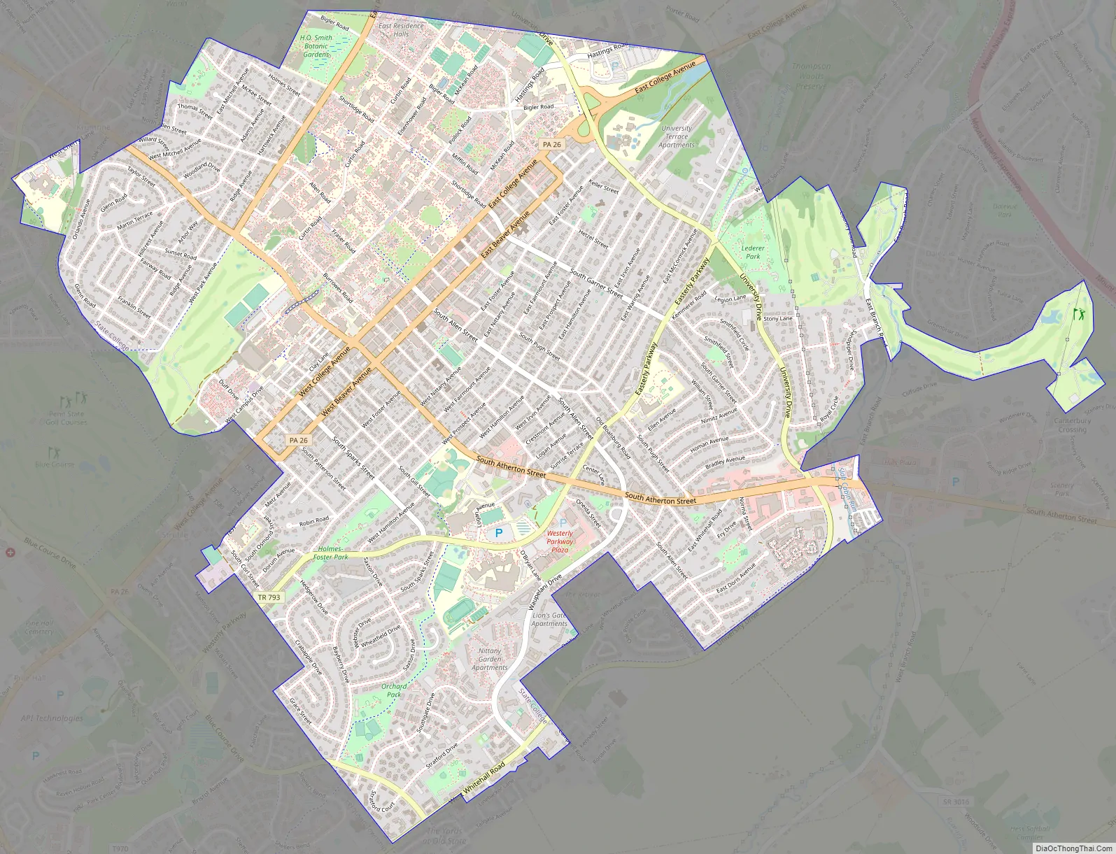
State College Road Map
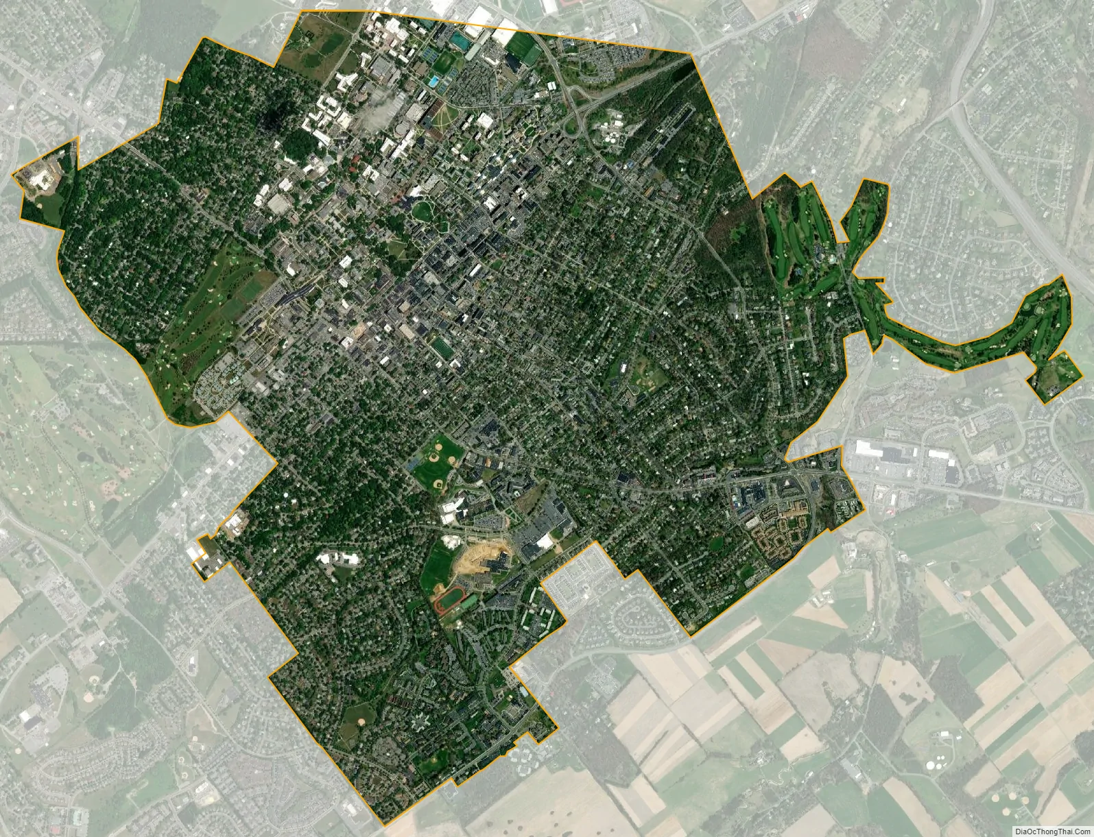
State College city Satellite Map
Geography
Location
State College is located at an elevation of approximately 1,200 feet (370 m) above sea level. According to the U.S. Census Bureau, the borough has a total area of 4.5 square miles (12 km), all land. It is surrounded by large tracts of farmland, and an expanse of Appalachian Mountain ranges and forests. Its location within a valley makes it prone to frequent rain and snowfall. Nittany Mountain is part of Pennsylvania’s geologic ridge-and-valley province of the Appalachian Mountains. It is located at the approximate geographic center of Pennsylvania.
Neighborhoods
Two major sections in State College include the Downtown Improvement District and University Park. Some significant neighborhoods include Highlands, Orchard Park, West End, College Heights, Holmes Foster, South State College, Tusseyview, Greentree, Nittany Hills and Penfield, and Vallamont. Four of these neighborhoods, Orchard Park, Greentree, Tusseyview, and South State College, are included as one area called “Suburban State College” under the National Citizen’s Survey.
Downtown State College, also known as the Downtown Improvement District, is State College’s commercial and cultural center. The area receives approximately 1.5 to 2 million annual visitors and boasts major festivals such as the Central Pennsylvania Festival for the Arts. Downtown State College has a population of 4,417 people.
Urban composition
State College is one of the densest cities in the U.S., primarily aided by the presence of numerous high-rises downtown along Beaver and College Avenues. The 2010s saw a construction boom downtown, with several mixed-use towers developed, including Rise, Metropolitan, Fraser Centre, and Here State College (a 15-floor tower on Garner Street), and others. Unlike older towers, many of the newer buildings are mixed-use, with retail on the ground floor, offices on the next couple floors up, and apartments on the top floors.
This high rise building boom has drawn debate in the local area. Some residents see it as a boon to increase foot traffic downtown and reduce congestion on the arterial roads leading into the town. Others, however, are skeptical of the developments since they replace historical buildings in the area at the expense, in their view, of the borough’s character.
In 2022, the State College Borough Council repealed the zoning regulations in State College to deter dense housing developments. Critics of the change said that it would lead to urban sprawl and make housing less affordable, whereas proponents of the zoning change said that high-rise student housing was inconsistent with the character of the college town.
University Park is the largest Penn State campus and the postal address for the university. Notable sites include Old Main, a landmark of the Farmers’ High School Historic District, Rec Hall, the Nittany Lion Shrine, the Palmer Museum of Art, Penn State Creamery, Beaver Stadium, and the Bryce Jordan Center; both Beaver Stadium and the Bryce Jordan Center are located in the university township half of University Park.
From 1909 to 1932, the Highlands in State College were annexed. The area was acclaimed for its plots of land in proximity to the post office. Twenty mansions were built between 1925 and 1933 to attract fraternities, while smaller houses were also constructed. The neighborhood terminated around Irvin Avenue, but after World War II expansion was necessary to accommodate for returning soldiers. Today, the Highlands is the borough’s most populous neighborhood with a population of 9,726 people, 77% of whom are in the age range of 18–24 years old. The neighborhood also includes a section of the Holmes–Foster–Highlands Historic District.
Orchard Park is a multi-family residential area mostly populated by college-aged residents and young professionals. Expansion for the area began in the late 20th century with the population then about 4,000 people. The neighborhood is home to two parks and is adjacent to Westerly Parkway Plaza, which houses many businesses. Orchard Park houses the South Hills Business School, a YMCA, and the Cedar Heights Church, which is used as a location for voters in State College.
The West End, also referred to as Urban Village, is an extension of the Downtown and Holmes–Foster areas. Located adjacent to west campus, the West End has a high population of renters, representing approximately 96.3% of the population. The neighborhood had a population of 2,324 people as of the 2010 U.S. census. The West End also makes up a third of the Holmes–Foster–Highlands Historic District.
College Heights is a neighborhood and historic district north of campus. The College Heights Historic District was added to the National Register of Historic Places in 1995 and makes up the majority of the area. College Heights is dominated by families of professionals, other Penn State faculty, and Penn State students due to the area’s proximity to the campus. From 1852 to 1920, the neighborhood included 15 homes just north of Penn State. Over the next decade, however, the number more than quadrupled to 69. Development continued throughout the 2010s with College Heights’s population growing to 1,839 people. The neighborhood has a park that partly spills into Ferguson Township.
Holmes–Foster makes up half of the Holmes–Foster–Highlands Historic District, which was added to the National Register of Historic Places in 1995. Holmes–Foster had a population of 1,597 during the 2010 census.
South State College, also referred to as the South Neighborhood, is shaped by Easterly Parkway, University Drive, and Atherton Street, which form a triangular shape. The area began expanding around World War II and has a population of 1,313.
Tusseyview is located south of South State College and has a population of 995. The neighborhood has three parks: Tussey View Park, South Hills Park, and Nittany Village Park. The area is home to State College Friends School, a Quaker school that serves the local school districts.
Greentree is a neighborhood between Holmes–Foster to the north, Orchard Park to the south, and Ferguson Township to the west. The population was 923 people.
Nittany Hills and Penfield are two sections of the same neighborhood. Nittany Hills includes the eastern half and Penfield makes up the western half. The neighborhood is sandwiched between State College South and College Township. The population was 353 people as of the 2010 census.
Vallamont is a small neighborhood east of the Highlands, west of College Township, and north of Nittany Hills. The population was 124 people as of the 2010 census. The number of residents is attributed to an apartment building located within the census borders.
See also
Map of Pennsylvania State and its subdivision:- Adams
- Allegheny
- Armstrong
- Beaver
- Bedford
- Berks
- Blair
- Bradford
- Bucks
- Butler
- Cambria
- Cameron
- Carbon
- Centre
- Chester
- Clarion
- Clearfield
- Clinton
- Columbia
- Crawford
- Cumberland
- Dauphin
- Delaware
- Elk
- Erie
- Fayette
- Forest
- Franklin
- Fulton
- Greene
- Huntingdon
- Indiana
- Jefferson
- Juniata
- Lackawanna
- Lancaster
- Lawrence
- Lebanon
- Lehigh
- Luzerne
- Lycoming
- Mc Kean
- Mercer
- Mifflin
- Monroe
- Montgomery
- Montour
- Northampton
- Northumberland
- Perry
- Philadelphia
- Pike
- Potter
- Schuylkill
- Snyder
- Somerset
- Sullivan
- Susquehanna
- Tioga
- Union
- Venango
- Warren
- Washington
- Wayne
- Westmoreland
- Wyoming
- York
- Alabama
- Alaska
- Arizona
- Arkansas
- California
- Colorado
- Connecticut
- Delaware
- District of Columbia
- Florida
- Georgia
- Hawaii
- Idaho
- Illinois
- Indiana
- Iowa
- Kansas
- Kentucky
- Louisiana
- Maine
- Maryland
- Massachusetts
- Michigan
- Minnesota
- Mississippi
- Missouri
- Montana
- Nebraska
- Nevada
- New Hampshire
- New Jersey
- New Mexico
- New York
- North Carolina
- North Dakota
- Ohio
- Oklahoma
- Oregon
- Pennsylvania
- Rhode Island
- South Carolina
- South Dakota
- Tennessee
- Texas
- Utah
- Vermont
- Virginia
- Washington
- West Virginia
- Wisconsin
- Wyoming