Wattsville is an unincorporated community in Laurens County, South Carolina, United States. The town name is derived from Watts Mill, a textile mill in the center of town. The area is listed as the Wattsville census-designated place (CDP) for statistical purposes. The population of the CDP was 1,635 at the 2010 census. It is part of the Greenville–Mauldin–Easley Metropolitan Statistical Area.
| Name: | Watts Mills CDP |
|---|---|
| LSAD Code: | 57 |
| LSAD Description: | CDP (suffix) |
| State: | South Carolina |
| County: | Laurens County |
| Elevation: | 650 ft (200 m) |
| Total Area: | 2.29 sq mi (5.92 km²) |
| Land Area: | 2.29 sq mi (5.92 km²) |
| Water Area: | 0.00 sq mi (0.00 km²) |
| Total Population: | 1,654 |
| Population Density: | 722.90/sq mi (279.17/km²) |
| ZIP code: | 29360 |
| Area code: | 864 |
| FIPS code: | 4575220 |
| GNISfeature ID: | 2402988 |
Online Interactive Map
Click on ![]() to view map in "full screen" mode.
to view map in "full screen" mode.
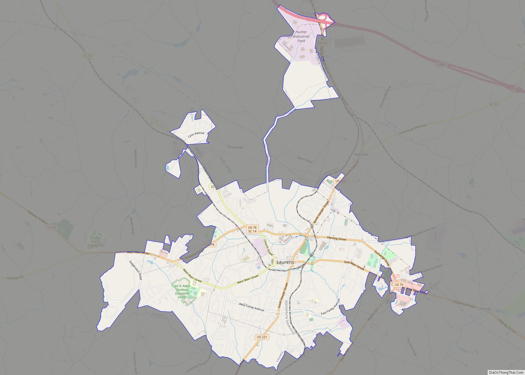
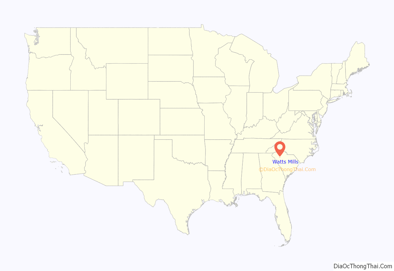
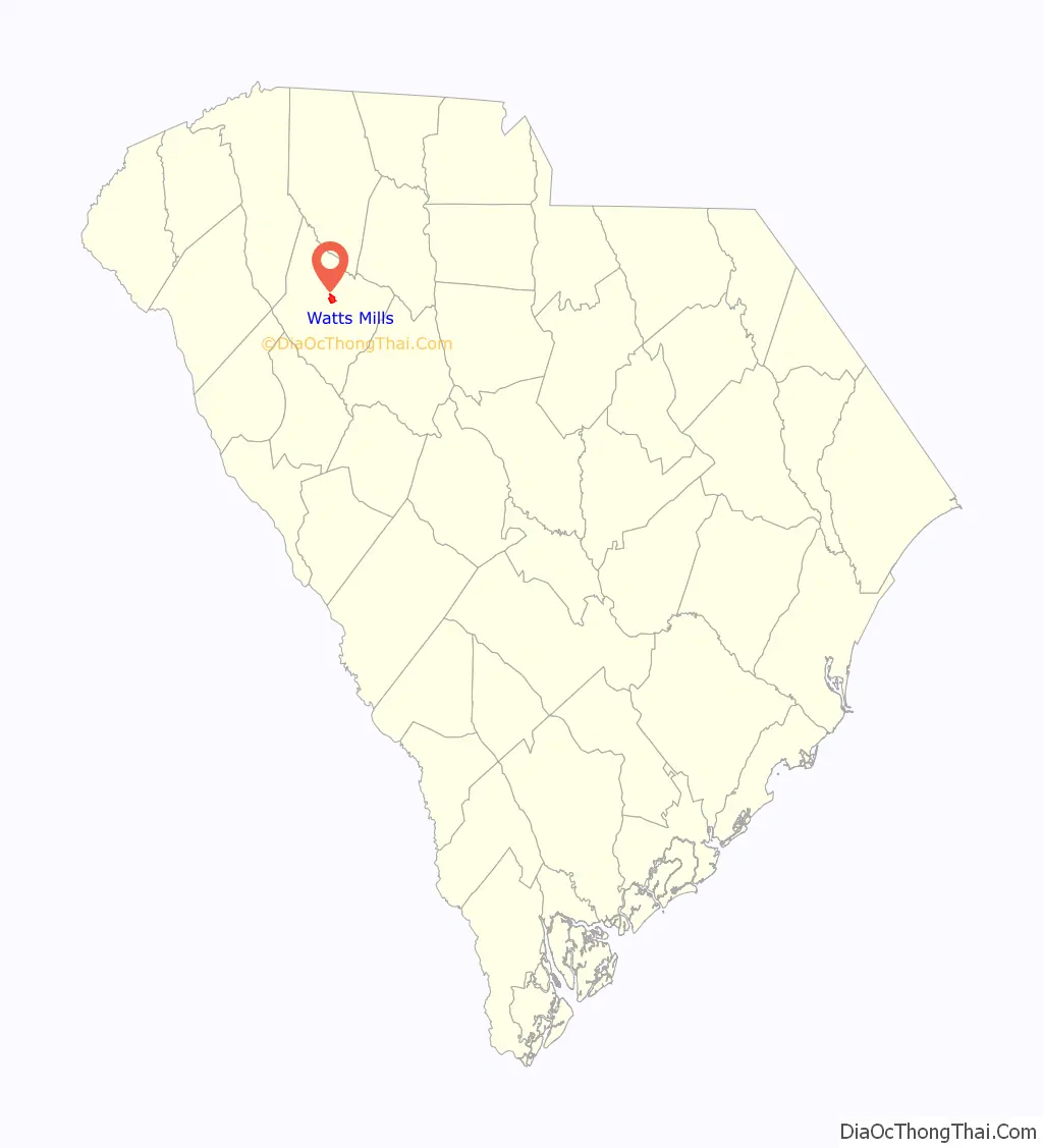
Watts Mills location map. Where is Watts Mills CDP?
Watts Mills Road Map
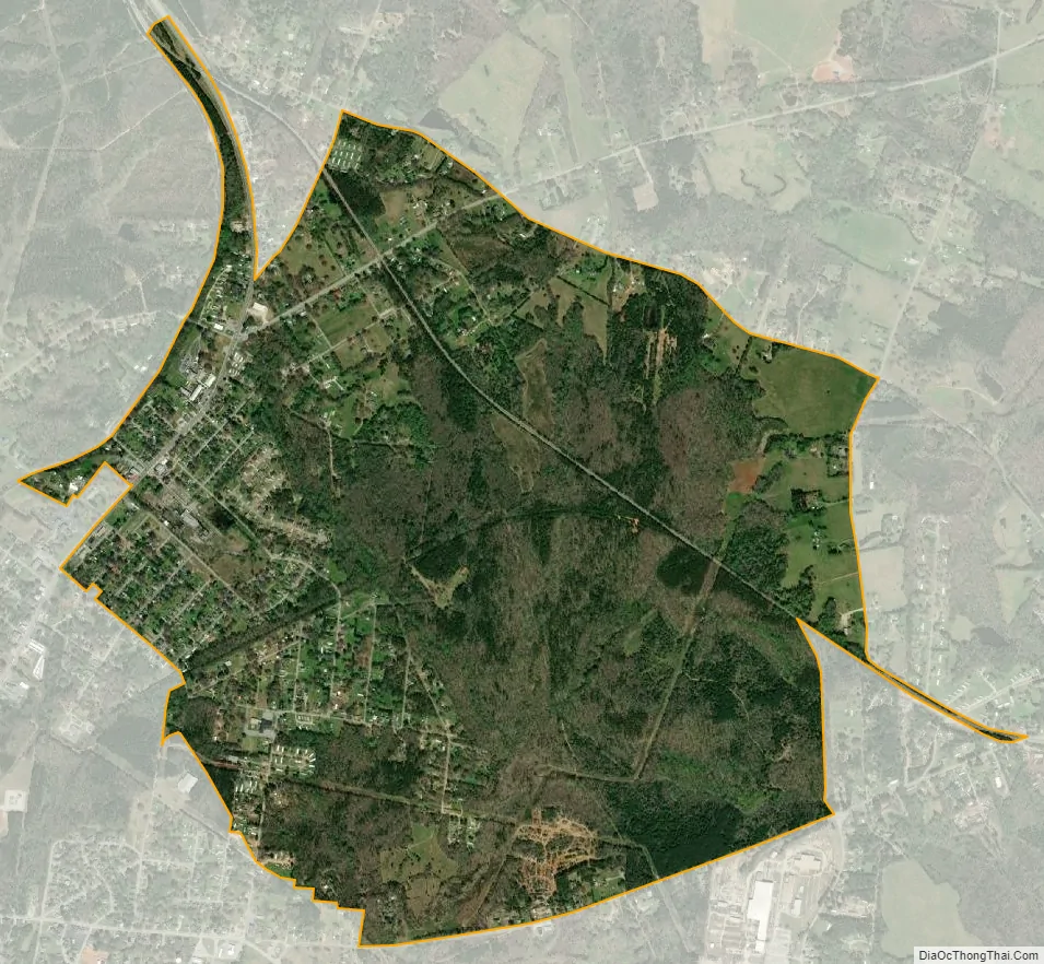
Watts Mills city Satellite Map
Geography
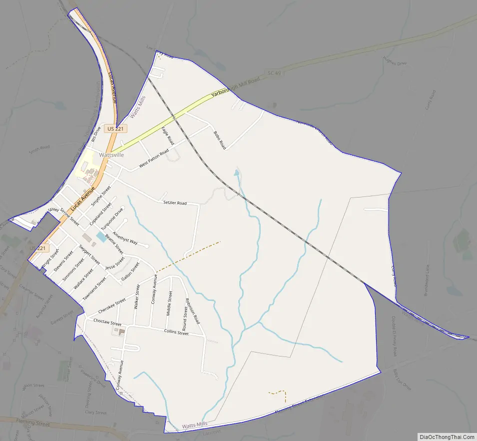
Wattsville is located in central Laurens County at 34°30′55″N 81°59′39″W / 34.515305°N 81.994227°W / 34.515305; -81.994227 and is bordered to the southwest by the city of Laurens, the county seat. U.S. Route 221 passes through the center of Wattsville, leading north 34 miles (55 km) to Spartanburg and south through Laurens 27 miles (43 km) to Greenwood. South Carolina Highway 49 leaves US 221 in Wattsville, leading northeast 29 miles (47 km) to Union. Interstate 385 passes 2 miles (3 km) north of Wattsville, with access from both US-221 and SC-49.
According to the United States Census Bureau, the CDP has a total area of 2.3 square miles (5.9 km), all land. The center of the community occupies a ridge between south-flowing streams that lead to the Little River, a southeast-flowing tributary of the Saluda River.
See also
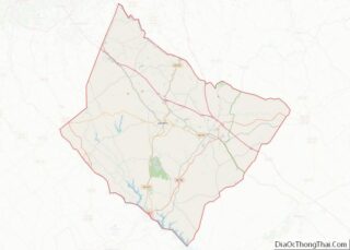
Map of South Carolina State and its subdivision:- Abbeville
- Aiken
- Allendale
- Anderson
- Bamberg
- Barnwell
- Beaufort
- Berkeley
- Calhoun
- Charleston
- Cherokee
- Chester
- Chesterfield
- Clarendon
- Colleton
- Darlington
- Dillon
- Dorchester
- Edgefield
- Fairfield
- Florence
- Georgetown
- Greenville
- Greenwood
- Hampton
- Horry
- Jasper
- Kershaw
- Lancaster
- Laurens
- Lee
- Lexington
- Marion
- Marlboro
- McCormick
- Newberry
- Oconee
- Orangeburg
- Pickens
- Richland
- Saluda
- Spartanburg
- Sumter
- Union
- Williamsburg
- York
- Alabama
- Alaska
- Arizona
- Arkansas
- California
- Colorado
- Connecticut
- Delaware
- District of Columbia
- Florida
- Georgia
- Hawaii
- Idaho
- Illinois
- Indiana
- Iowa
- Kansas
- Kentucky
- Louisiana
- Maine
- Maryland
- Massachusetts
- Michigan
- Minnesota
- Mississippi
- Missouri
- Montana
- Nebraska
- Nevada
- New Hampshire
- New Jersey
- New Mexico
- New York
- North Carolina
- North Dakota
- Ohio
- Oklahoma
- Oregon
- Pennsylvania
- Rhode Island
- South Carolina
- South Dakota
- Tennessee
- Texas
- Utah
- Vermont
- Virginia
- Washington
- West Virginia
- Wisconsin
- Wyoming