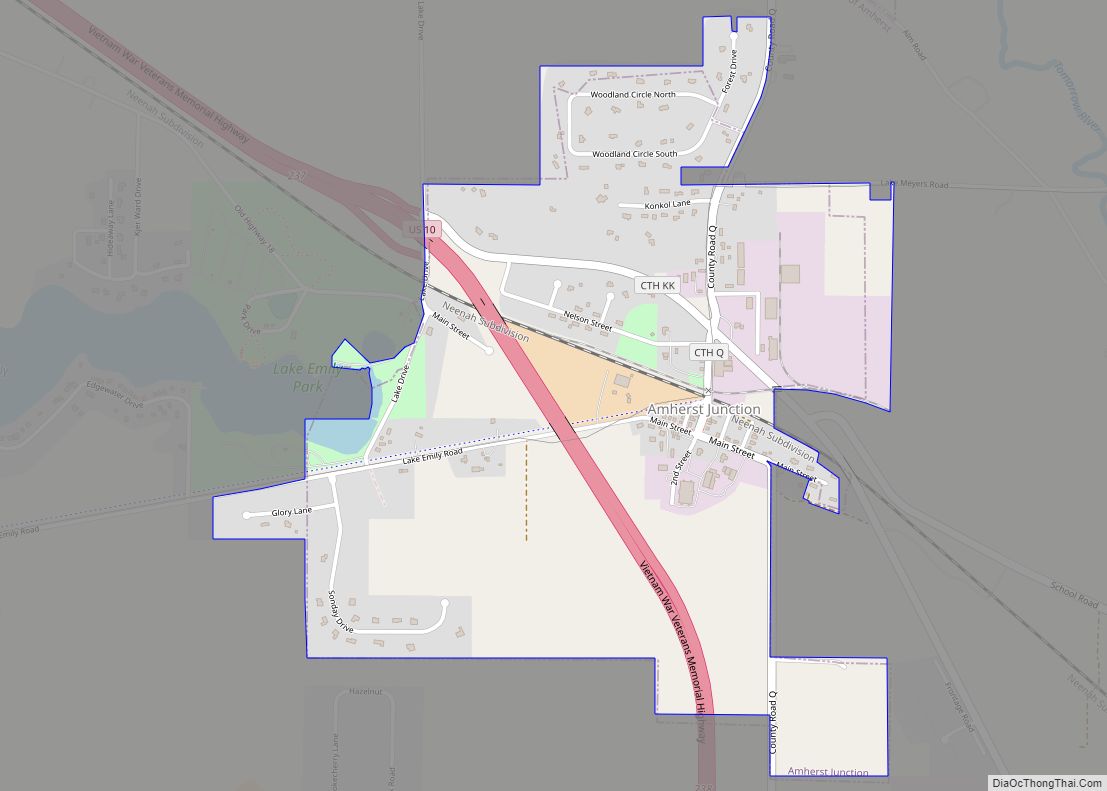
Amherst Junction is a village in Portage County, Wisconsin, United States. The population was 377 at the 2010 census.
| Name: | Amherst Junction village |
|---|---|
| LSAD Code: | 47 |
| LSAD Description: | village (suffix) |
| State: | Wisconsin |
| County: | Portage County |
| Elevation: | 1,109 ft (338 m) |
| Total Area: | 1.24 sq mi (3.22 km²) |
| Land Area: | 1.24 sq mi (3.20 km²) |
| Water Area: | 0.01 sq mi (0.02 km²) |
| Total Population: | 377 |
| Population Density: | 309.87/sq mi (119.63/km²) |
| FIPS code: | 5501800 |
| GNISfeature ID: | 1560833 |
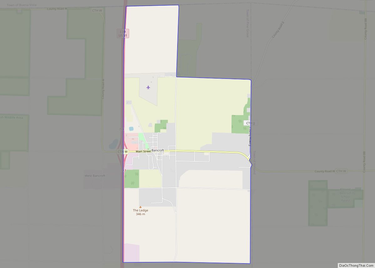
Online Interactive Map
Click on ![]() to view map in "full screen" mode.
to view map in "full screen" mode.
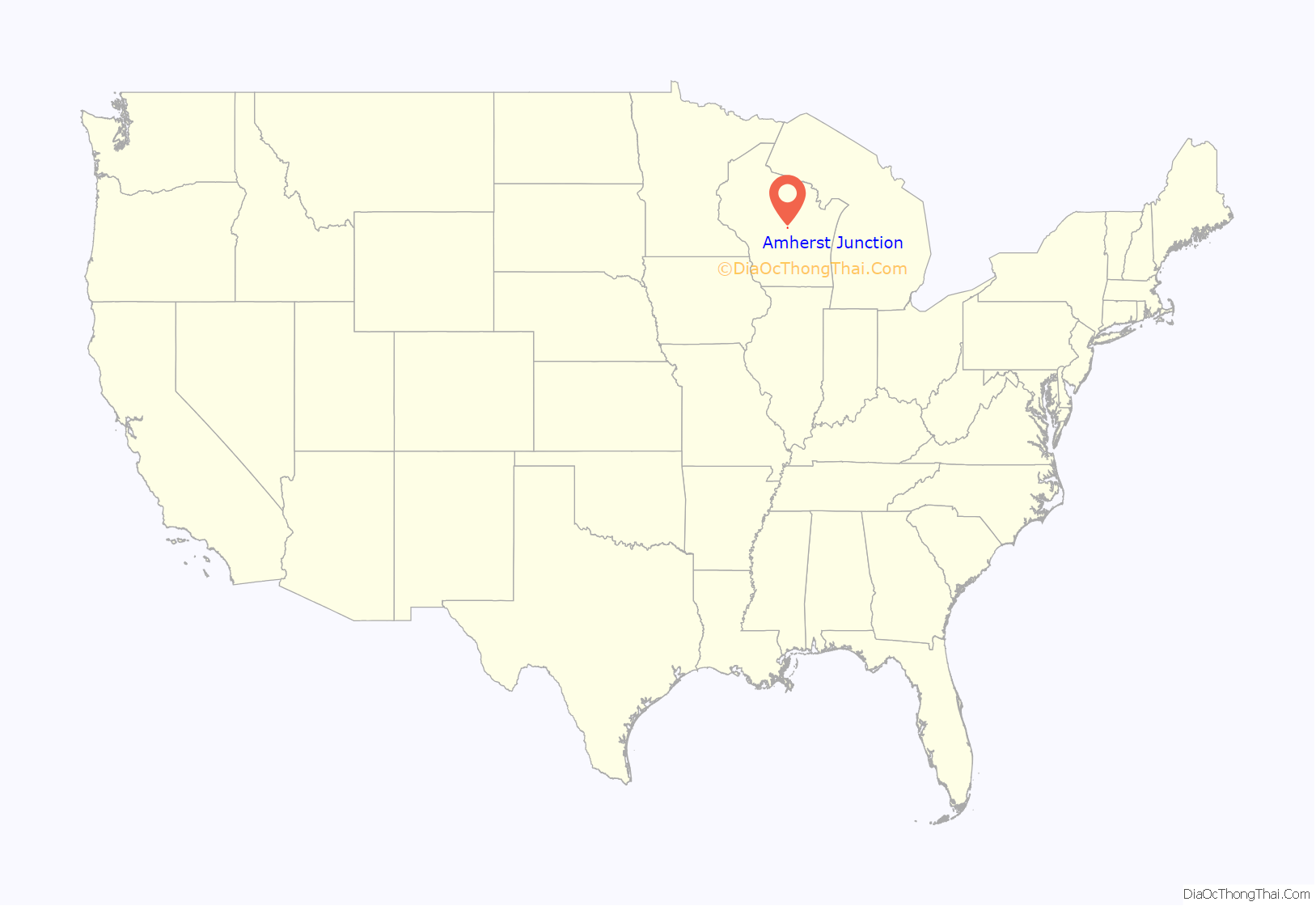
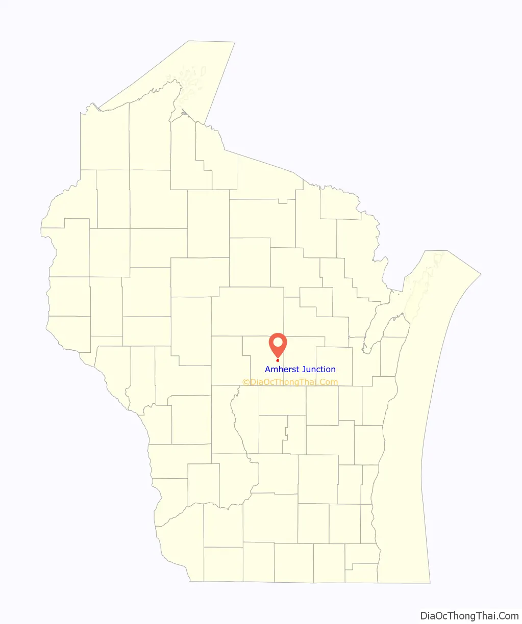
Amherst Junction location map. Where is Amherst Junction village?
History
Amherst Junction was created when the railroad first came through the county. It was a junction between two railroads: the Wisconsin Central and the Green Bay and Lake Pepin railroads.
Until 1875, the community was referred to as Groversburg, presumably after the Grover family that held considerable property in the area. But when a post office was established in March 1875, it was called Amherst Junction.
It was not until 1911 that the village was incorporated. By 1914, the village had become an important buying and shipping center for potatoes. Many people traveling to the eastern and northeastern parts of the county would detrain in Amherst Junction and hire a rig from a livery in the village to take them to their destination.
The village at one time had 36 businesses which included: five taverns, two hotels, two grocery stores, dancehalls, depots, feed stores, four potato warehouses, a blacksmith, a livery stable, a meat market, bank, hardware store, car dealership, a post office, a school, and a turkey processing plant.
The Summit House, a fairly large hotel, was built in the village around 1872 or 1873 by H. N. Livermore. Since the hotel was a popular place to stay, eat and dance, Amherst Junction must have been a gathering center for many of the surrounding communities. The Summit House remained in business until 1939, when it was dismantled and its lumber was used to build a new home for the owner. At one time, the hotel was operated by Zilphia Moyers Een, the county’s first woman hotel keeper.
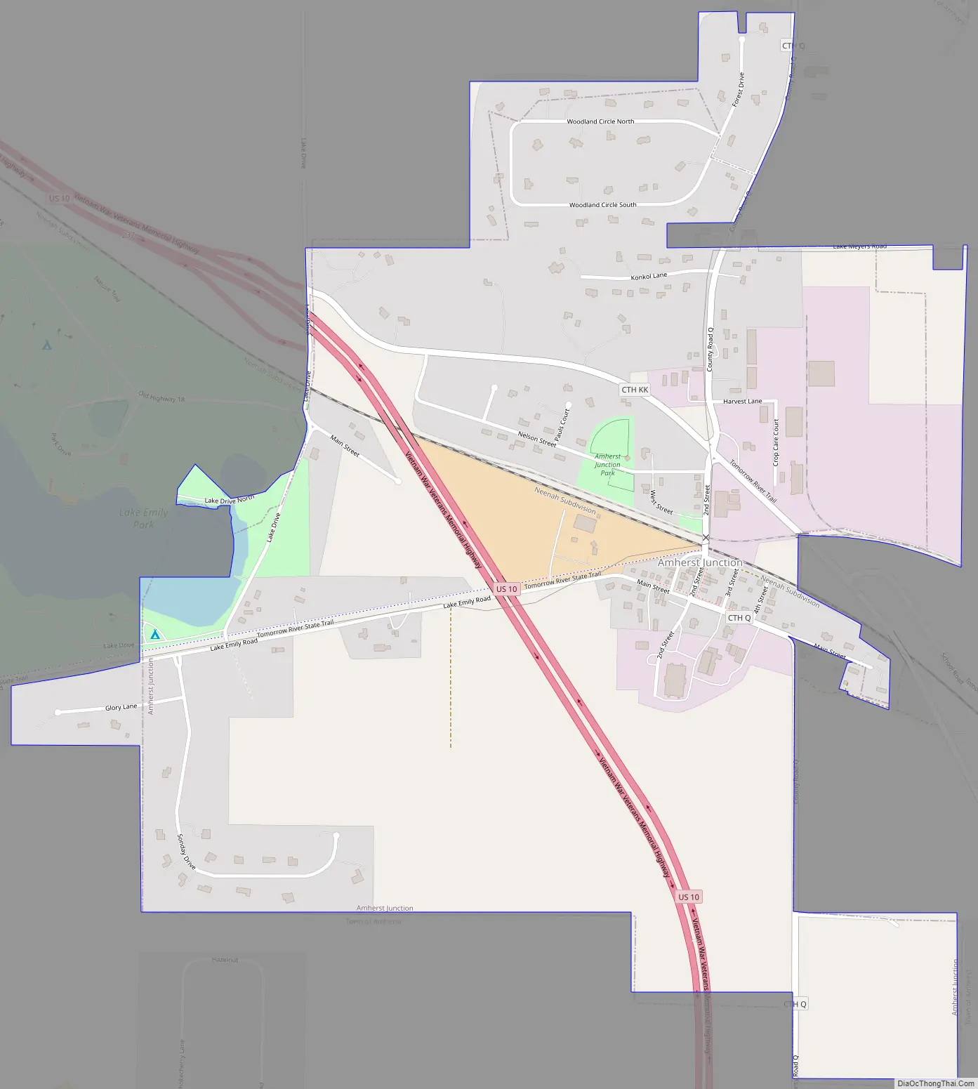
Amherst Junction Road Map
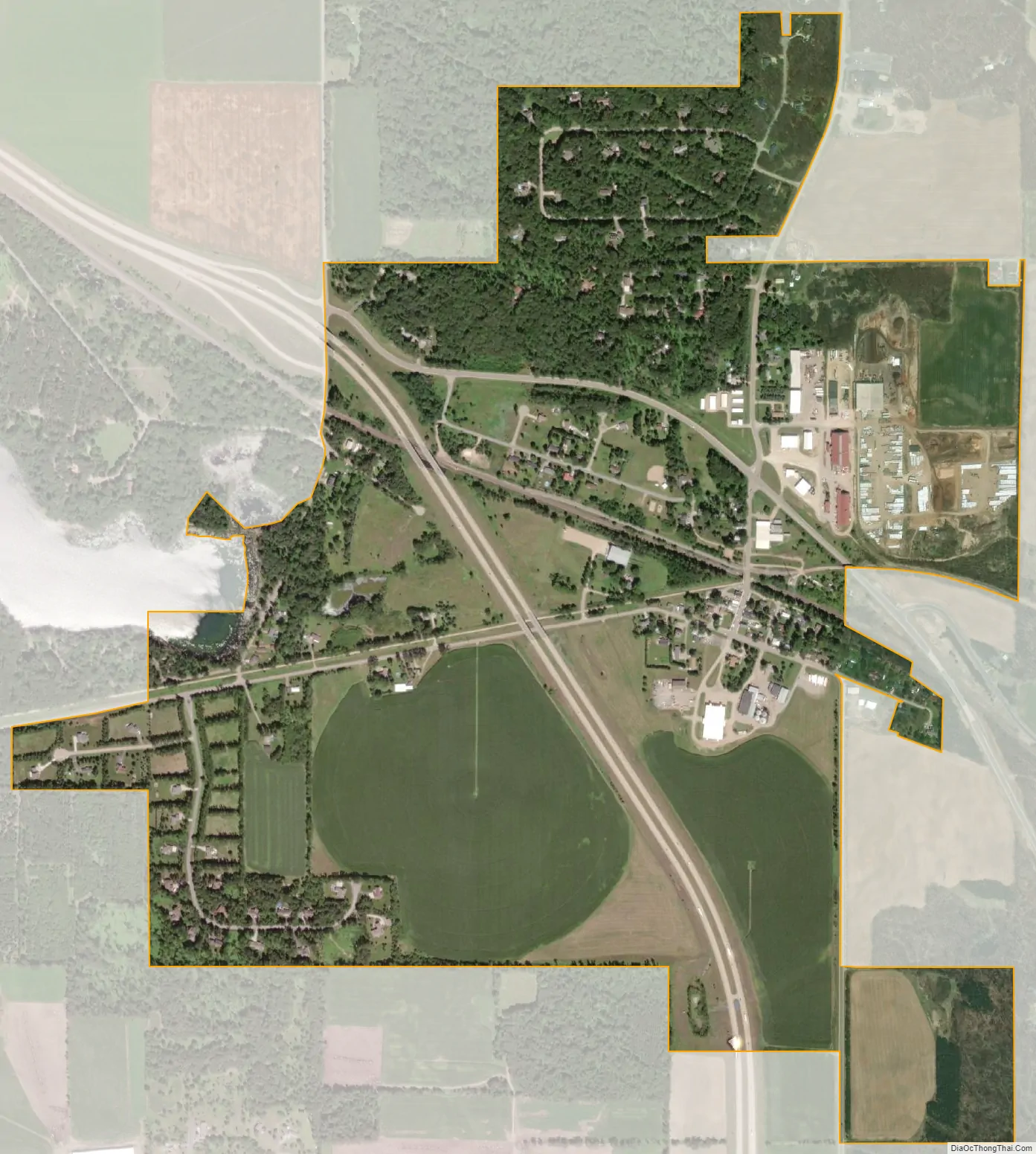
Amherst Junction city Satellite Map
Geography
Amherst Junction is located at 44°28′10″N 89°19′1″W / 44.46944°N 89.31694°W / 44.46944; -89.31694 (44.469523, -89.316827).
According to the United States Census Bureau, the village has a total area of 1.22 square miles (3.16 km), of which, 1.21 square miles (3.13 km) of it is land and 0.01 square miles (0.03 km) is water.
See also
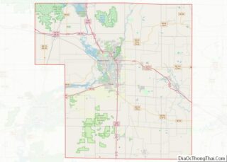
Map of Wisconsin State and its subdivision:- Adams
- Ashland
- Barron
- Bayfield
- Brown
- Buffalo
- Burnett
- Calumet
- Chippewa
- Clark
- Columbia
- Crawford
- Dane
- Dodge
- Door
- Douglas
- Dunn
- Eau Claire
- Florence
- Fond du Lac
- Forest
- Grant
- Green
- Green Lake
- Iowa
- Iron
- Jackson
- Jefferson
- Juneau
- Kenosha
- Kewaunee
- La Crosse
- Lafayette
- Lake Michigan
- Lake Superior
- Langlade
- Lincoln
- Manitowoc
- Marathon
- Marinette
- Marquette
- Menominee
- Milwaukee
- Monroe
- Oconto
- Oneida
- Outagamie
- Ozaukee
- Pepin
- Pierce
- Polk
- Portage
- Price
- Racine
- Richland
- Rock
- Rusk
- Saint Croix
- Sauk
- Sawyer
- Shawano
- Sheboygan
- Taylor
- Trempealeau
- Vernon
- Vilas
- Walworth
- Washburn
- Washington
- Waukesha
- Waupaca
- Waushara
- Winnebago
- Wood
- Alabama
- Alaska
- Arizona
- Arkansas
- California
- Colorado
- Connecticut
- Delaware
- District of Columbia
- Florida
- Georgia
- Hawaii
- Idaho
- Illinois
- Indiana
- Iowa
- Kansas
- Kentucky
- Louisiana
- Maine
- Maryland
- Massachusetts
- Michigan
- Minnesota
- Mississippi
- Missouri
- Montana
- Nebraska
- Nevada
- New Hampshire
- New Jersey
- New Mexico
- New York
- North Carolina
- North Dakota
- Ohio
- Oklahoma
- Oregon
- Pennsylvania
- Rhode Island
- South Carolina
- South Dakota
- Tennessee
- Texas
- Utah
- Vermont
- Virginia
- Washington
- West Virginia
- Wisconsin
- Wyoming