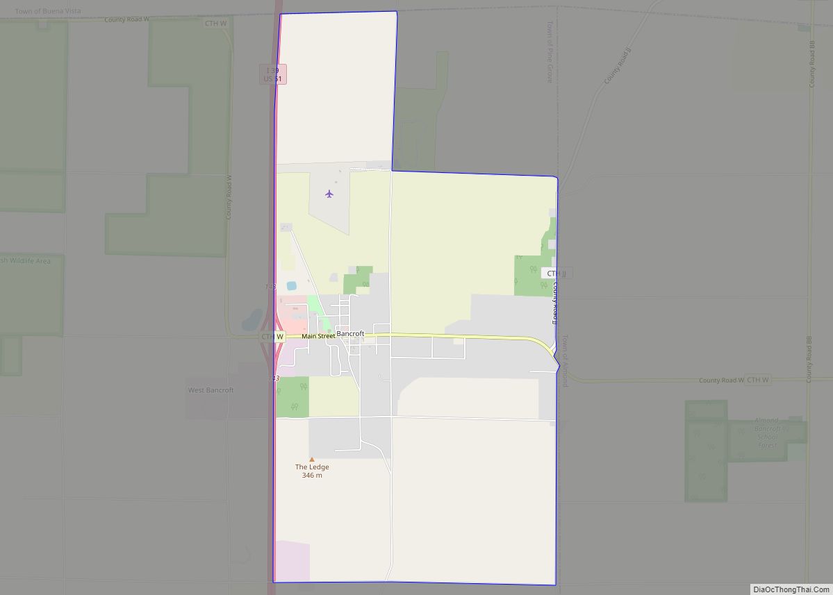
Bancroft is an unincorporated census-designated place in Portage County, Wisconsin, United States. As of the 2010 census, its population is 535. It is included in the Stevens Point, Wisconsin Micropolitan Statistical Area.
| Name: | Bancroft CDP |
|---|---|
| LSAD Code: | 57 |
| LSAD Description: | CDP (suffix) |
| State: | Wisconsin |
| County: | Portage County |
| Elevation: | 1,093 ft (333 m) |
| Total Area: | 5.040 sq mi (13.05 km²) |
| Land Area: | 5.030 sq mi (13.03 km²) |
| Water Area: | 0.010 sq mi (0.03 km²) |
| Total Population: | 535 |
| Population Density: | 110/sq mi (41/km²) |
| FIPS code: | 5504525 |
| GNISfeature ID: | 1561145 |
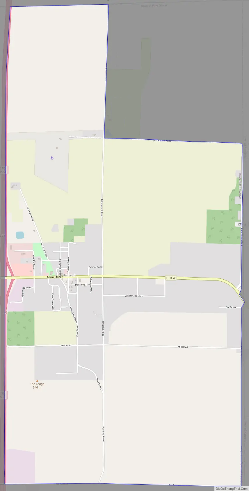
Online Interactive Map
Click on ![]() to view map in "full screen" mode.
to view map in "full screen" mode.
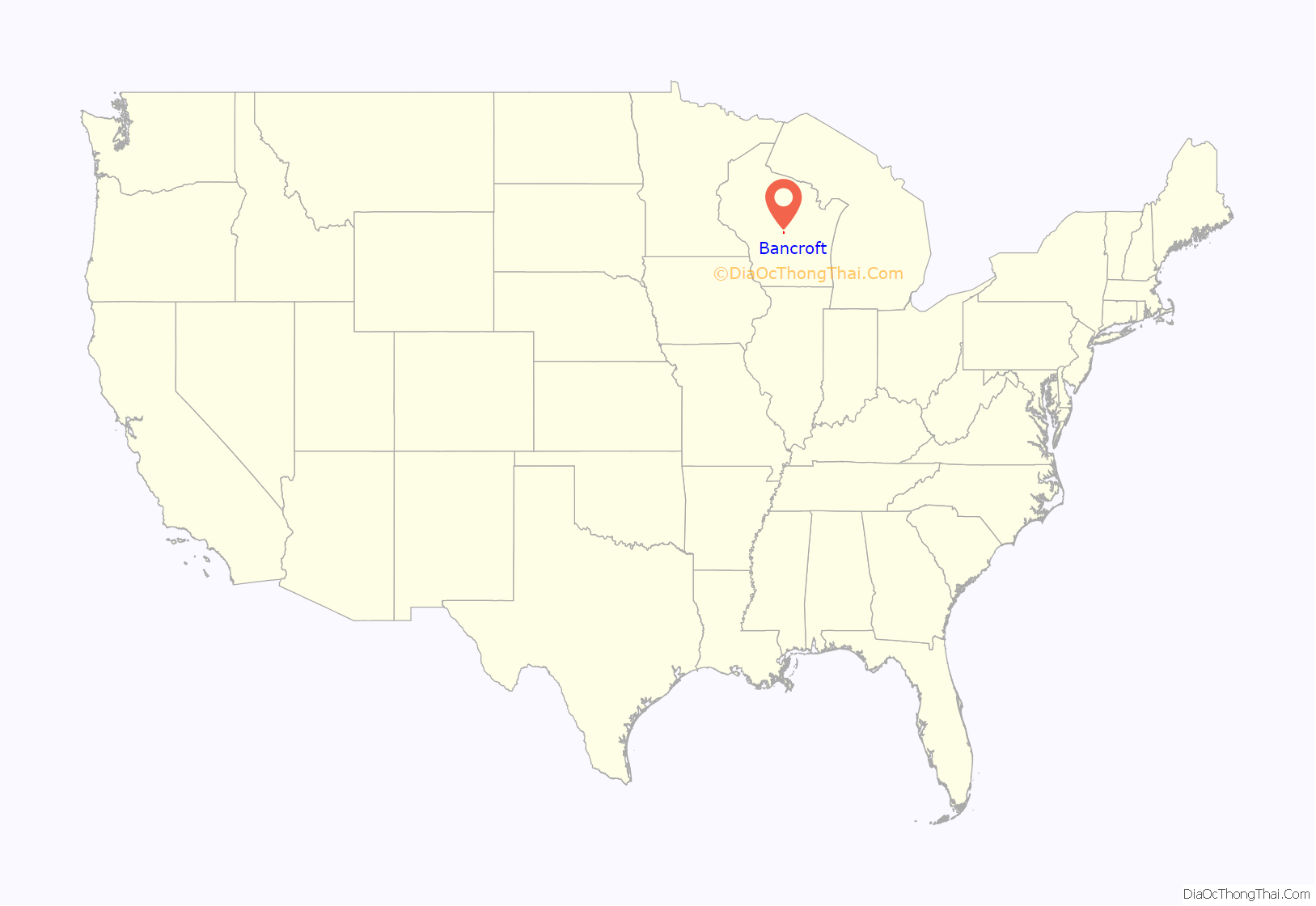
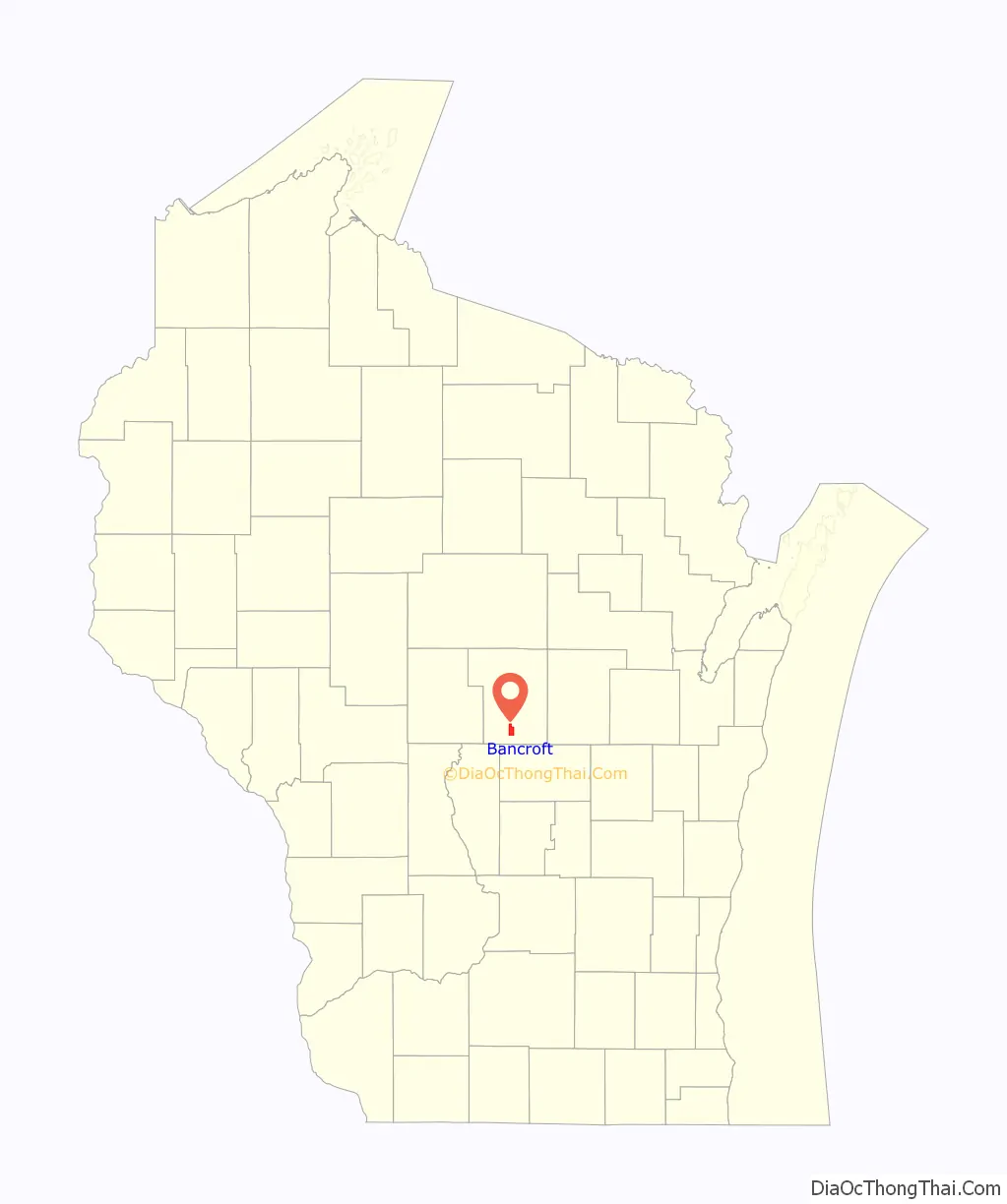
Bancroft location map. Where is Bancroft CDP?
History
Bancroft was named for Warren Gamaliel Bancroft, who served in the 42nd Wisconsin Regiment during the American Civil War and later served as pastor of the Oshkosh Methodist Church. Bancroft was the name sake of Warren Gamaliel Bancroft Winnipeg Harding, who is better known as Warren G. Harding—the 29th president of the United States. A post office in the community was opened on May 17, 1876.
Bancroft Road Map
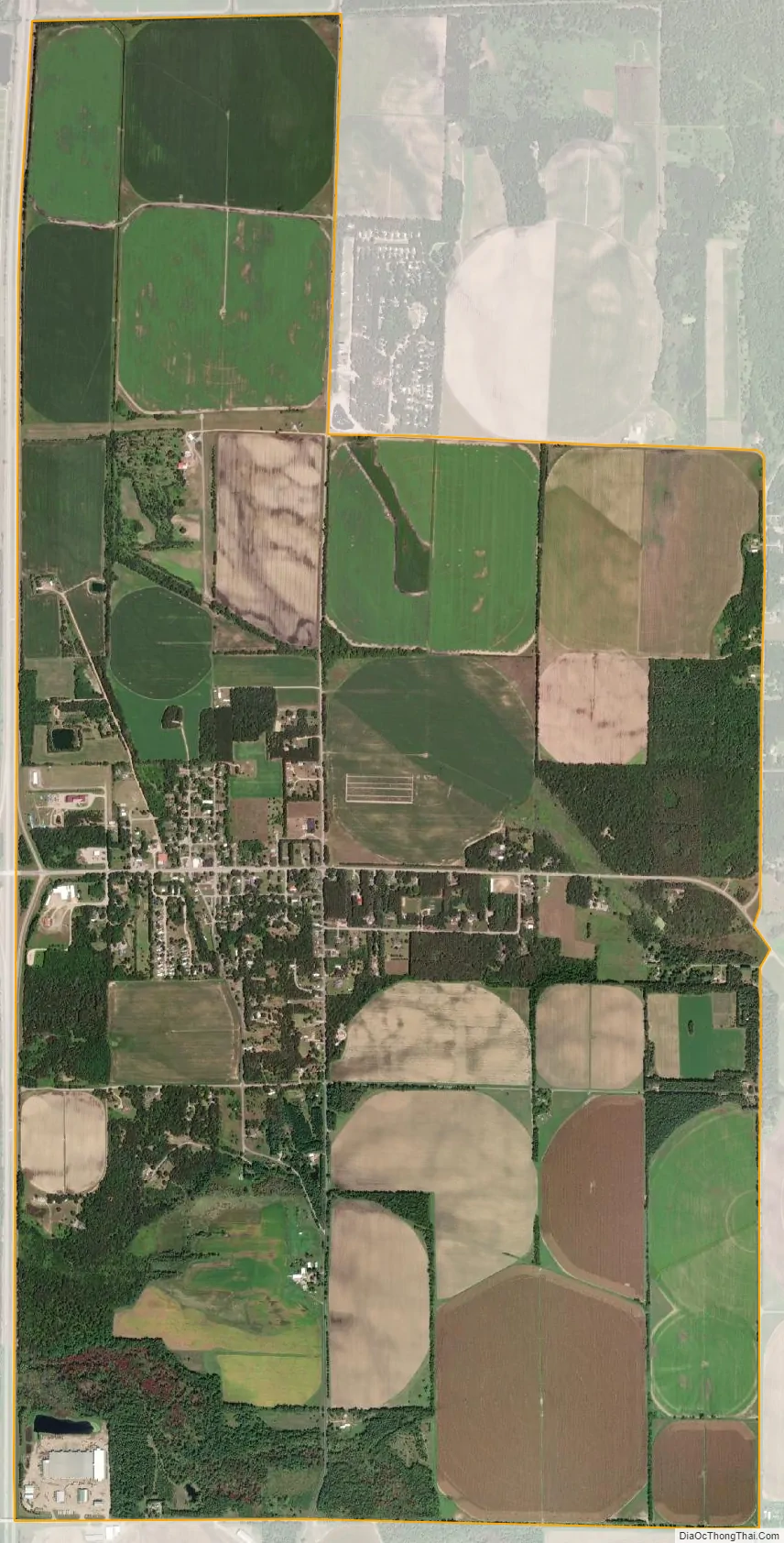
Bancroft city Satellite Map
Geography
Bancroft is located in central Wisconsin approximately 10 miles south of Plover and approximately five miles north of Plainfield. Bancroft rests on Portage County Road W just to the east of Interstate 39 / U.S. Highway 51, at exit 143. (Lat: 44° 18′ 35.0″, Lon: -89° 30′ 49.7″). Bancroft is the seat for the Town of Pine Grove. Bancroft has an area of 5.040 square miles (13.05 km); 5.030 square miles (13.03 km) of this is land, and 0.010 square miles (0.026 km) is water.
The geography of Bancroft is mostly flat. There are, however, two interesting bluffs that rise prominently above the otherwise level plains. One was a large bluff, commonly referred to as Mosquito Bluff, that runs in an East-West direction. Mosquito Bluff is now separated into two large hills by Harding Road.
The other prominent feature is known as The Ledge, which runs towards the North-East and is visible from I-39. This Bluff has gone by many names (Lover’s Leap, Hellfire Hill, High Rock, Gulliver’s Stool) but is most commonly known as The Ledge. At the top of The Ledge is an ichnite rock that has preserved traces of the passage of Climactichnites.
See also
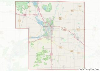
Map of Wisconsin State and its subdivision:- Adams
- Ashland
- Barron
- Bayfield
- Brown
- Buffalo
- Burnett
- Calumet
- Chippewa
- Clark
- Columbia
- Crawford
- Dane
- Dodge
- Door
- Douglas
- Dunn
- Eau Claire
- Florence
- Fond du Lac
- Forest
- Grant
- Green
- Green Lake
- Iowa
- Iron
- Jackson
- Jefferson
- Juneau
- Kenosha
- Kewaunee
- La Crosse
- Lafayette
- Lake Michigan
- Lake Superior
- Langlade
- Lincoln
- Manitowoc
- Marathon
- Marinette
- Marquette
- Menominee
- Milwaukee
- Monroe
- Oconto
- Oneida
- Outagamie
- Ozaukee
- Pepin
- Pierce
- Polk
- Portage
- Price
- Racine
- Richland
- Rock
- Rusk
- Saint Croix
- Sauk
- Sawyer
- Shawano
- Sheboygan
- Taylor
- Trempealeau
- Vernon
- Vilas
- Walworth
- Washburn
- Washington
- Waukesha
- Waupaca
- Waushara
- Winnebago
- Wood
- Alabama
- Alaska
- Arizona
- Arkansas
- California
- Colorado
- Connecticut
- Delaware
- District of Columbia
- Florida
- Georgia
- Hawaii
- Idaho
- Illinois
- Indiana
- Iowa
- Kansas
- Kentucky
- Louisiana
- Maine
- Maryland
- Massachusetts
- Michigan
- Minnesota
- Mississippi
- Missouri
- Montana
- Nebraska
- Nevada
- New Hampshire
- New Jersey
- New Mexico
- New York
- North Carolina
- North Dakota
- Ohio
- Oklahoma
- Oregon
- Pennsylvania
- Rhode Island
- South Carolina
- South Dakota
- Tennessee
- Texas
- Utah
- Vermont
- Virginia
- Washington
- West Virginia
- Wisconsin
- Wyoming