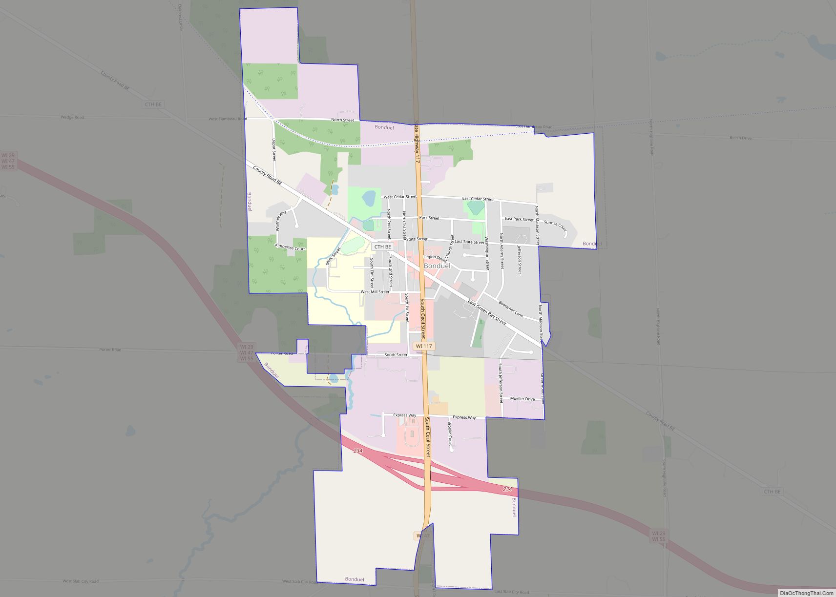
Bonduel is a village in Shawano County, Wisconsin, United States. The population was 1,478 at the 2010 census.
| Name: | Bonduel village |
|---|---|
| LSAD Code: | 47 |
| LSAD Description: | village (suffix) |
| State: | Wisconsin |
| County: | Shawano County |
| Elevation: | 889 ft (271 m) |
| Total Area: | 2.26 sq mi (5.85 km²) |
| Land Area: | 2.26 sq mi (5.84 km²) |
| Water Area: | 0.00 sq mi (0.01 km²) |
| Total Population: | 1,478 |
| Population Density: | 628.10/sq mi (242.54/km²) |
| FIPS code: | 5508725 |
| GNISfeature ID: | 1562052 |
| Website: | http://www.villageofbonduel.com |
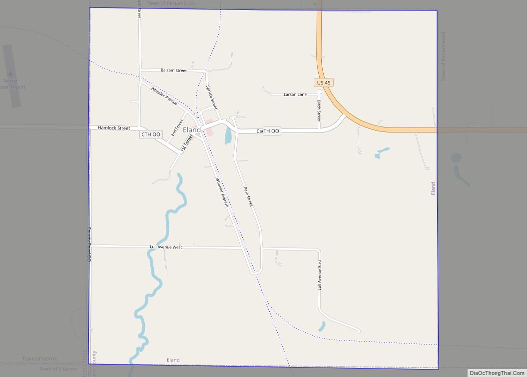
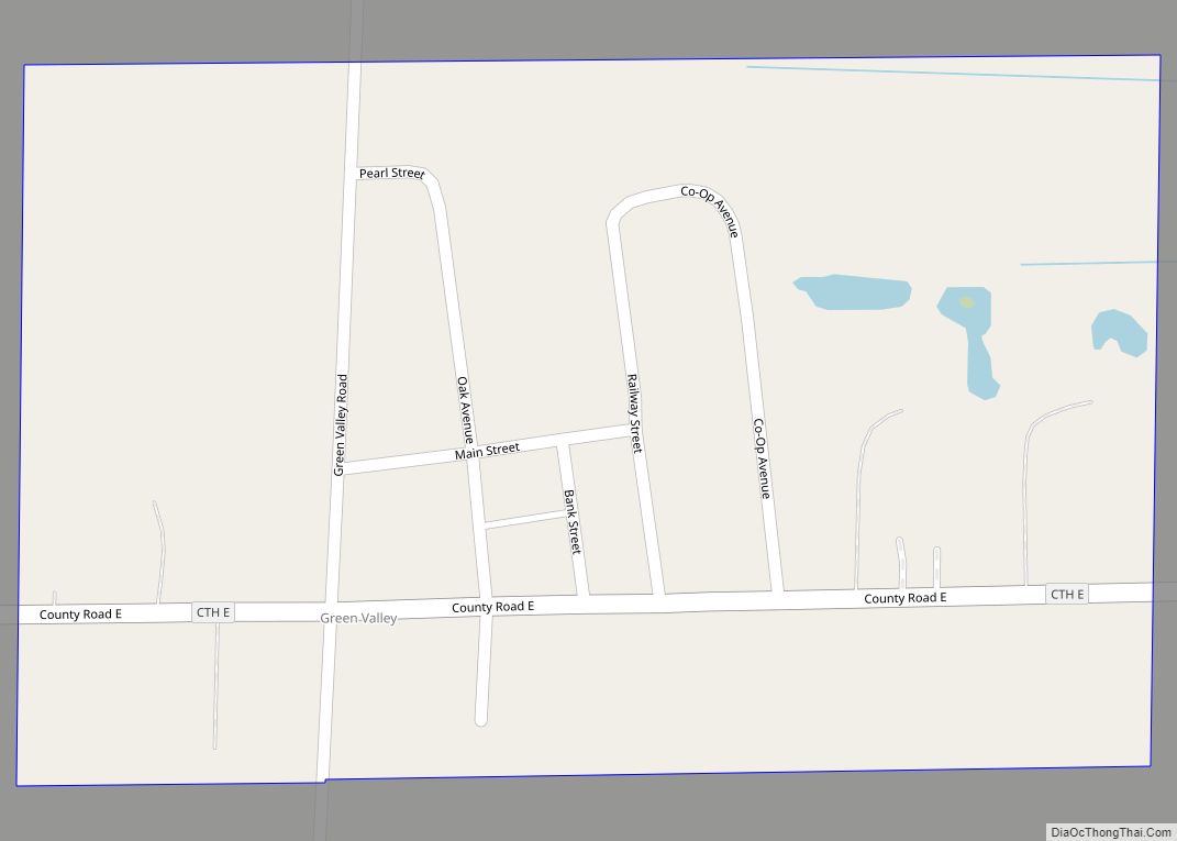
Online Interactive Map
Click on ![]() to view map in "full screen" mode.
to view map in "full screen" mode.
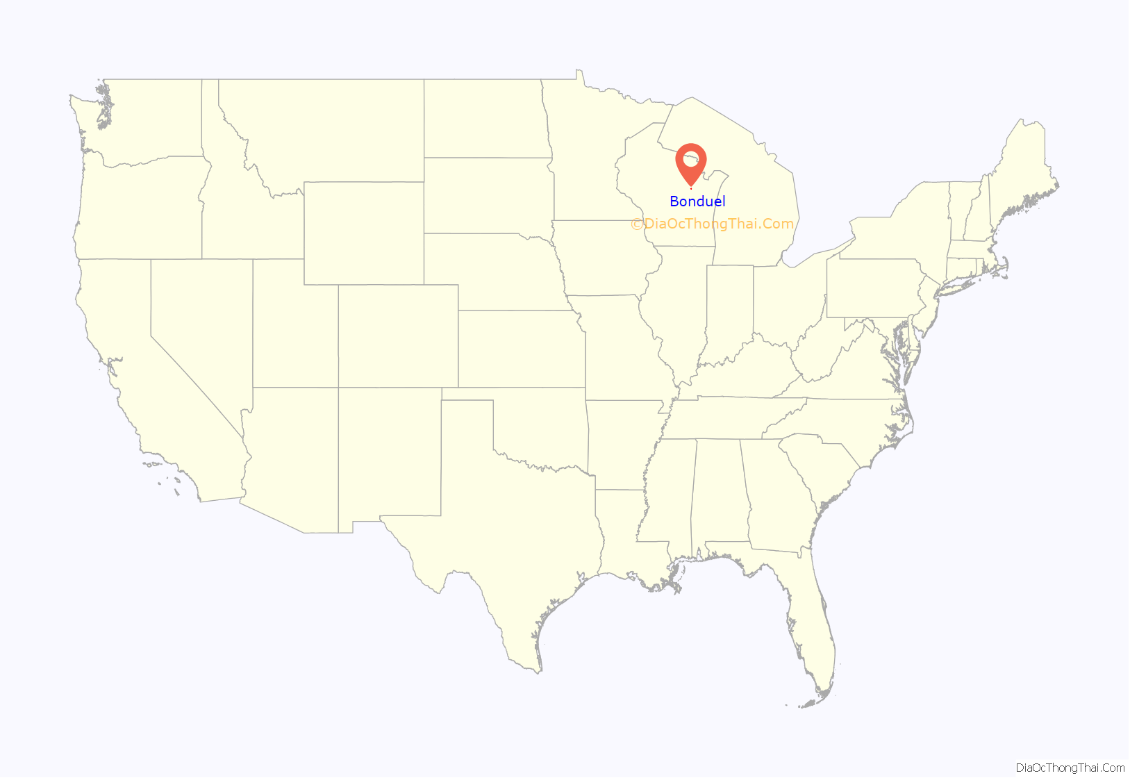
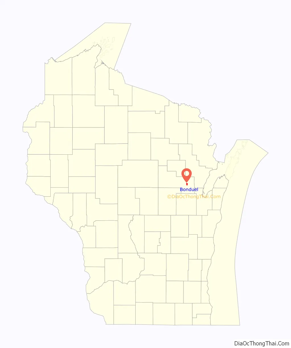
Bonduel location map. Where is Bonduel village?
History
As founded, the community did not have an officially agreed upon name. Some early news reports called it Hartland Corners, presumably in reference to the surrounding town, named Hartland. The name Bonduel was not established for the community until an application for a post office was made in 1864, at which point “Hartland” was rejected as already being in use as a village name in Wisconsin. Therefore, the village was named Bonduel when the post office was created. The village is named after a Jesuit missionary, the Rev. Florimond Bonduel, who served Wisconsin parishes and who worked with the Menominee Indians, helping them settle on their newly created reservation in 1853.
Bonduel incorporated as a village in 1916. Prior to this time, administrative affairs for the community were managed by the surrounding town of Hartland.
In 1964 attempts by the National Farmers Organization to get farmers to withhold their produce, milk and livestock from the market in order to boost prices resulted in the deaths of two NFO members who were run over by a cattle truck in Bonduel.
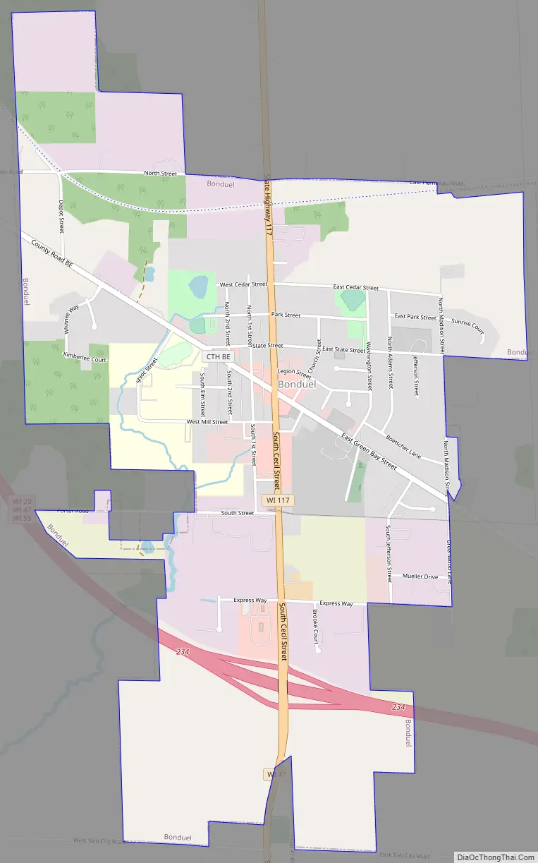
Bonduel Road Map
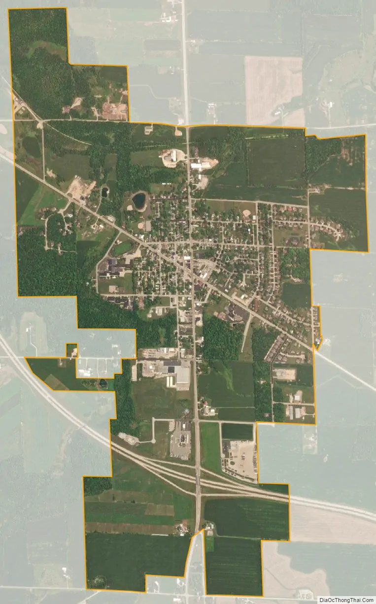
Bonduel city Satellite Map
Geography
Bonduel is located at 44°44′25″N 88°26′43″W / 44.74028°N 88.44528°W / 44.74028; -88.44528 (44.740388, -88.445291).
According to the United States Census Bureau, the village has a total area of 2.33 square miles (6.03 km), all of it land.
See also
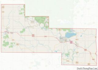
Map of Wisconsin State and its subdivision:- Adams
- Ashland
- Barron
- Bayfield
- Brown
- Buffalo
- Burnett
- Calumet
- Chippewa
- Clark
- Columbia
- Crawford
- Dane
- Dodge
- Door
- Douglas
- Dunn
- Eau Claire
- Florence
- Fond du Lac
- Forest
- Grant
- Green
- Green Lake
- Iowa
- Iron
- Jackson
- Jefferson
- Juneau
- Kenosha
- Kewaunee
- La Crosse
- Lafayette
- Lake Michigan
- Lake Superior
- Langlade
- Lincoln
- Manitowoc
- Marathon
- Marinette
- Marquette
- Menominee
- Milwaukee
- Monroe
- Oconto
- Oneida
- Outagamie
- Ozaukee
- Pepin
- Pierce
- Polk
- Portage
- Price
- Racine
- Richland
- Rock
- Rusk
- Saint Croix
- Sauk
- Sawyer
- Shawano
- Sheboygan
- Taylor
- Trempealeau
- Vernon
- Vilas
- Walworth
- Washburn
- Washington
- Waukesha
- Waupaca
- Waushara
- Winnebago
- Wood
- Alabama
- Alaska
- Arizona
- Arkansas
- California
- Colorado
- Connecticut
- Delaware
- District of Columbia
- Florida
- Georgia
- Hawaii
- Idaho
- Illinois
- Indiana
- Iowa
- Kansas
- Kentucky
- Louisiana
- Maine
- Maryland
- Massachusetts
- Michigan
- Minnesota
- Mississippi
- Missouri
- Montana
- Nebraska
- Nevada
- New Hampshire
- New Jersey
- New Mexico
- New York
- North Carolina
- North Dakota
- Ohio
- Oklahoma
- Oregon
- Pennsylvania
- Rhode Island
- South Carolina
- South Dakota
- Tennessee
- Texas
- Utah
- Vermont
- Virginia
- Washington
- West Virginia
- Wisconsin
- Wyoming