Clintonville is a city in Waupaca County, Wisconsin, United States. The population was 4,591 at the 2020 census. The area that became Clintonville was first settled in March, 1855.
| Name: | Clintonville city |
|---|---|
| LSAD Code: | 25 |
| LSAD Description: | city (suffix) |
| State: | Wisconsin |
| County: | Waupaca County |
| Elevation: | 814 ft (248 m) |
| Total Area: | 4.54 sq mi (11.76 km²) |
| Land Area: | 4.45 sq mi (11.51 km²) |
| Water Area: | 0.09 sq mi (0.24 km²) |
| Total Population: | 4,591 |
| Population Density: | 1,000/sq mi (390/km²) |
| Area code: | 715 & 534 |
| FIPS code: | 5515725 |
| GNISfeature ID: | 1563198 |
| Website: | clintonvillewi.org |
Online Interactive Map
Click on ![]() to view map in "full screen" mode.
to view map in "full screen" mode.
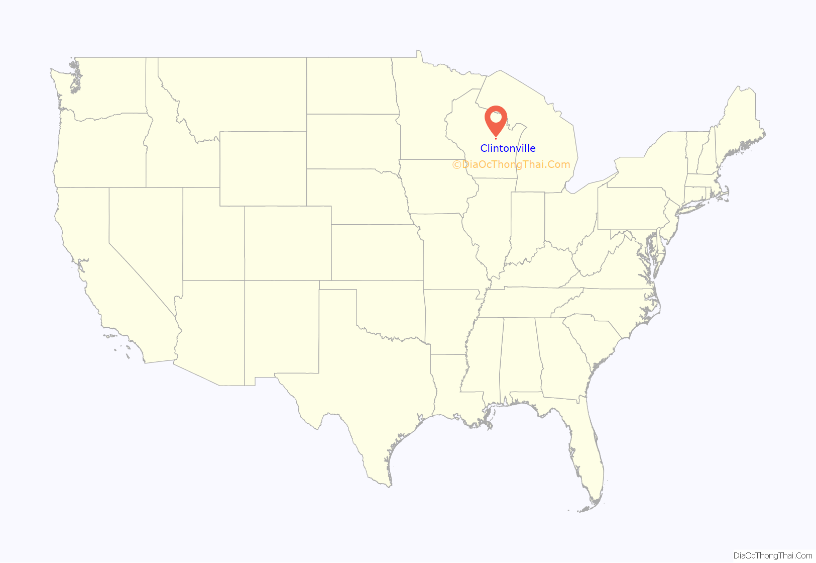
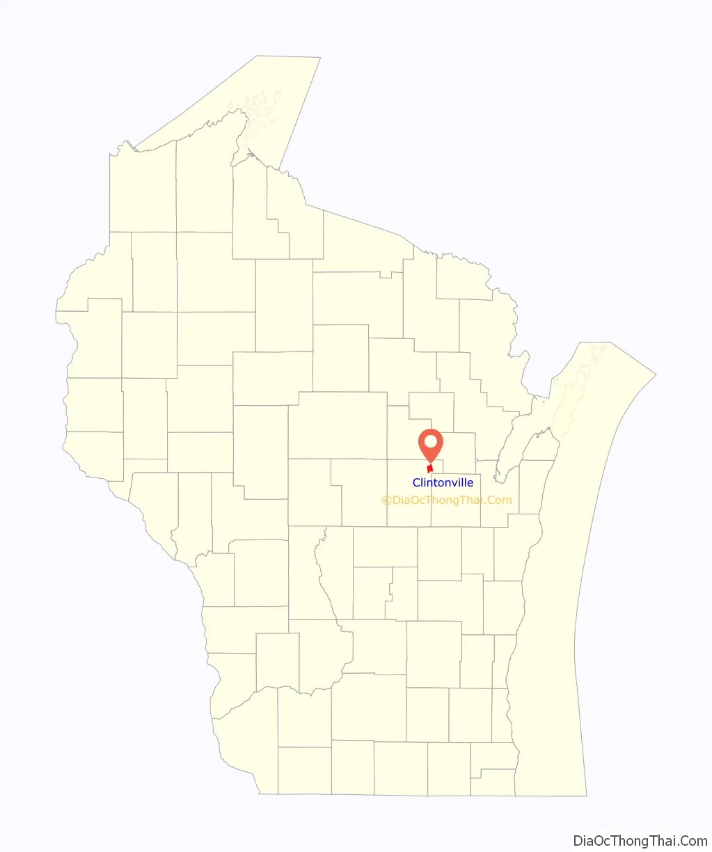
Clintonville location map. Where is Clintonville city?
History
Clintonville lies within ancestral Menominee territory. In the Menominee language, it is known as Omīniahkan, “place where pigeons are hunted”. It was ceded to the United States by the Menominee in 1836 through the Treaty of the Cedars, an agreement to sell over four million acres to the United States as part of the negotiations about how to accommodate the Oneida, Stockbridge-Munsee, and Brothertown peoples who were being removed from New York to Wisconsin. After this, the area around Clintonville became available for purchase by white American settlers.
In March, 1855 Norman Clinton and his family U. P. Clinton, Boardman Luman, and Mandy settled along the bank of the Pigeon River. They built the first establishment that grew into the city of Clintonville. The home they built was constructed of poles covered with hemlock boughs. It was used until a more suitable home built of logs could be constructed. They had drinking water from two large springs located on the bank of the river “Whose delicious water had flowed unmolested since the creation of the Universe.”
In March 2012, mysterious booms were heard by some in the city. The U.S. Geological Survey detected a 1.5 magnitude microearthquake nearby on March 21 that geophysicists said might have produced the sounds.
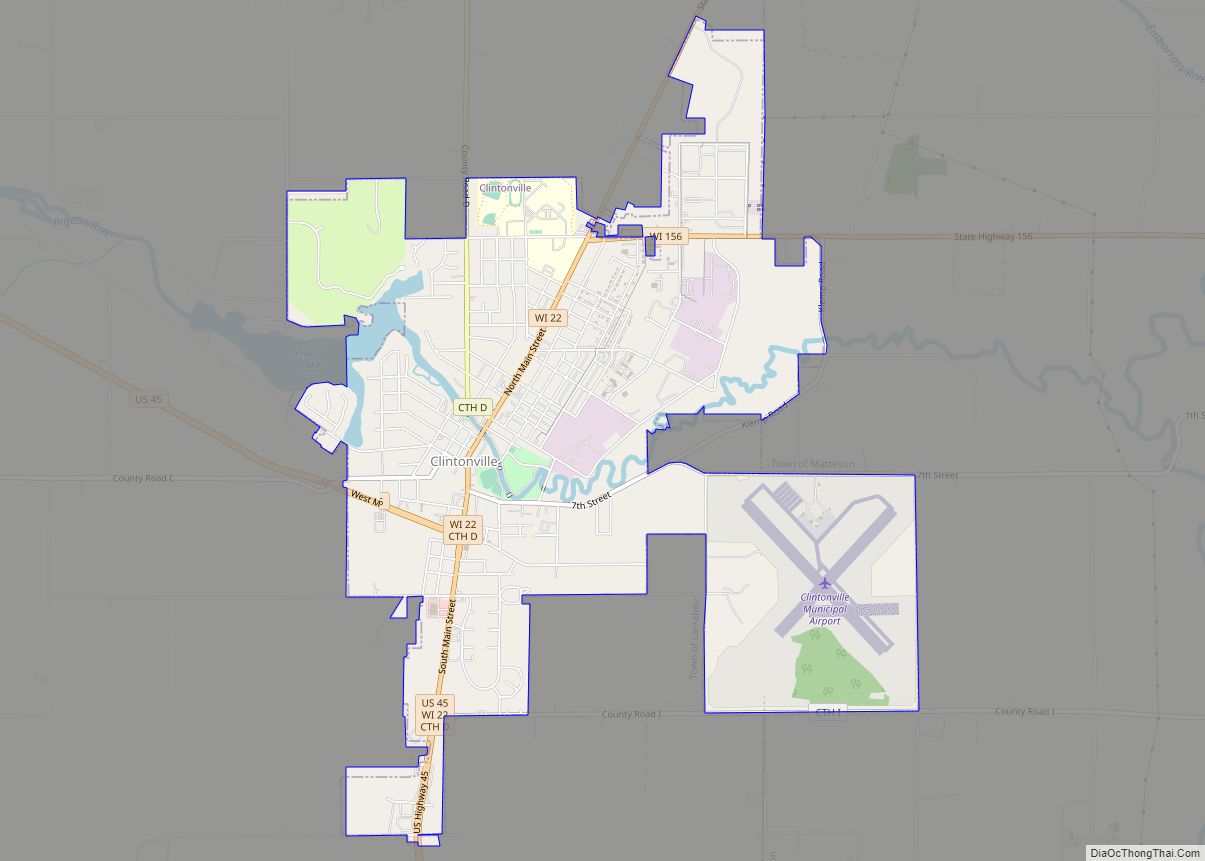
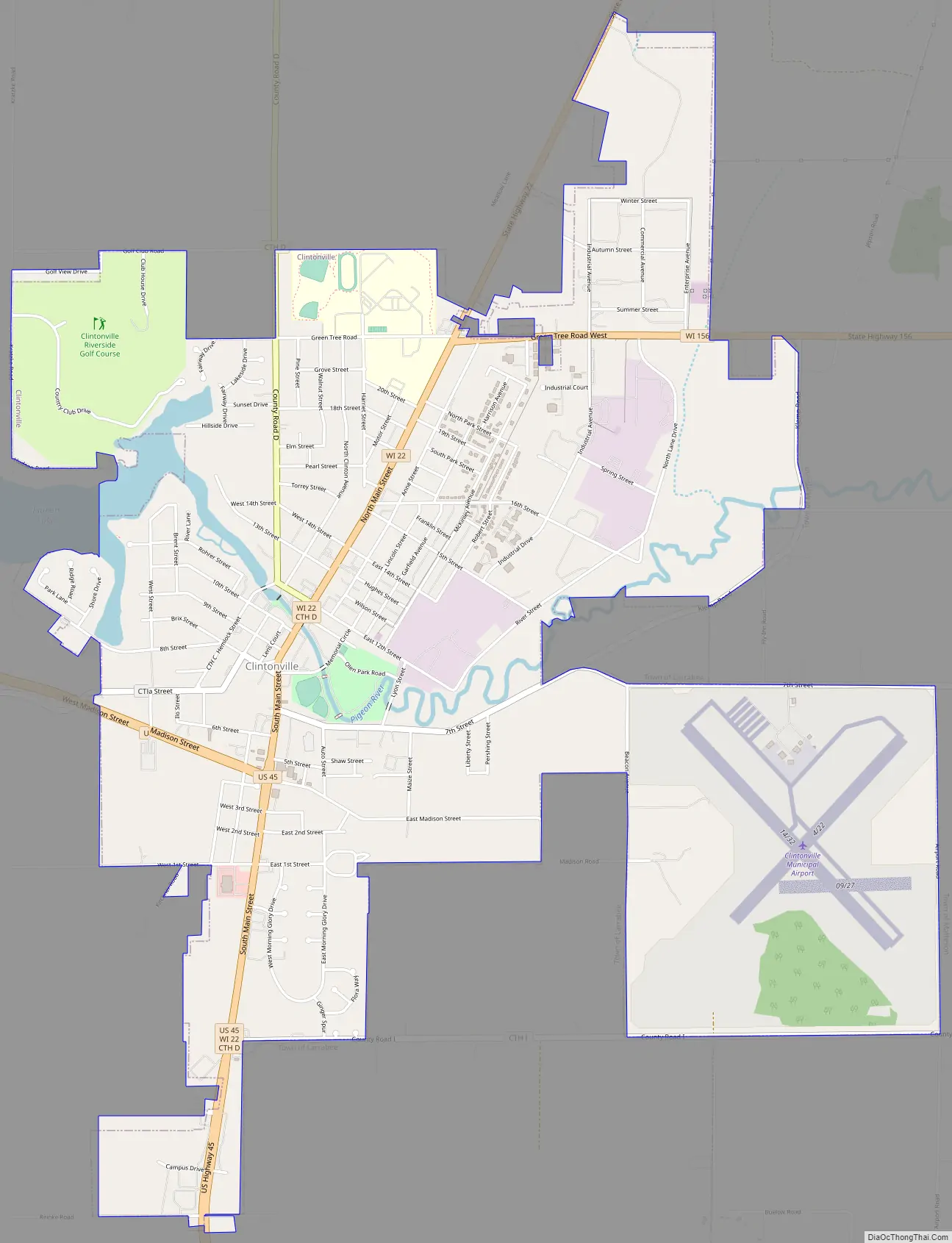
Clintonville Road Map
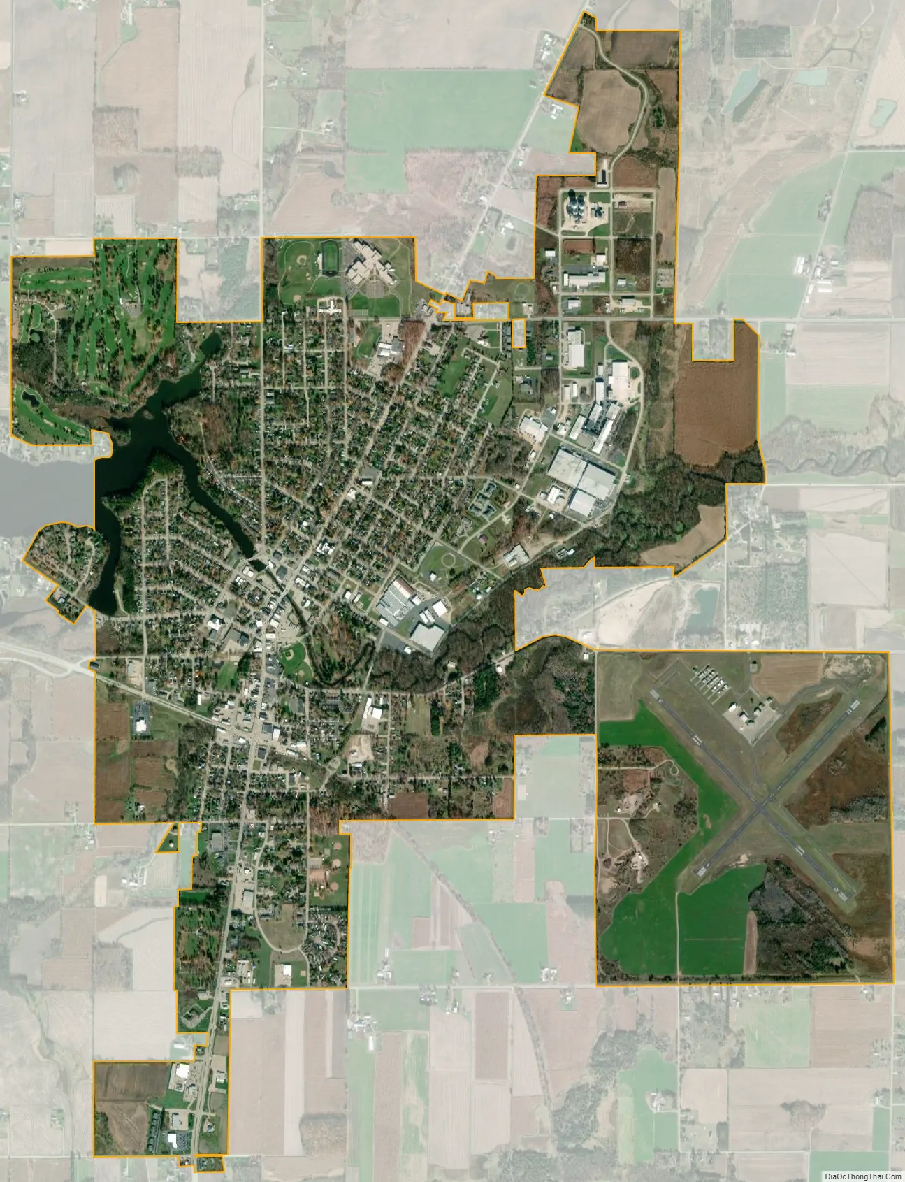
Clintonville city Satellite Map
Geography
According to the United States Census Bureau, the city has a total area of 4.46 square miles (11.55 km), of which, 4.40 square miles (11.40 km) is land and 0.06 square miles (0.16 km) is water.
See also
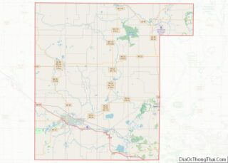
Map of Wisconsin State and its subdivision:- Adams
- Ashland
- Barron
- Bayfield
- Brown
- Buffalo
- Burnett
- Calumet
- Chippewa
- Clark
- Columbia
- Crawford
- Dane
- Dodge
- Door
- Douglas
- Dunn
- Eau Claire
- Florence
- Fond du Lac
- Forest
- Grant
- Green
- Green Lake
- Iowa
- Iron
- Jackson
- Jefferson
- Juneau
- Kenosha
- Kewaunee
- La Crosse
- Lafayette
- Lake Michigan
- Lake Superior
- Langlade
- Lincoln
- Manitowoc
- Marathon
- Marinette
- Marquette
- Menominee
- Milwaukee
- Monroe
- Oconto
- Oneida
- Outagamie
- Ozaukee
- Pepin
- Pierce
- Polk
- Portage
- Price
- Racine
- Richland
- Rock
- Rusk
- Saint Croix
- Sauk
- Sawyer
- Shawano
- Sheboygan
- Taylor
- Trempealeau
- Vernon
- Vilas
- Walworth
- Washburn
- Washington
- Waukesha
- Waupaca
- Waushara
- Winnebago
- Wood
- Alabama
- Alaska
- Arizona
- Arkansas
- California
- Colorado
- Connecticut
- Delaware
- District of Columbia
- Florida
- Georgia
- Hawaii
- Idaho
- Illinois
- Indiana
- Iowa
- Kansas
- Kentucky
- Louisiana
- Maine
- Maryland
- Massachusetts
- Michigan
- Minnesota
- Mississippi
- Missouri
- Montana
- Nebraska
- Nevada
- New Hampshire
- New Jersey
- New Mexico
- New York
- North Carolina
- North Dakota
- Ohio
- Oklahoma
- Oregon
- Pennsylvania
- Rhode Island
- South Carolina
- South Dakota
- Tennessee
- Texas
- Utah
- Vermont
- Virginia
- Washington
- West Virginia
- Wisconsin
- Wyoming