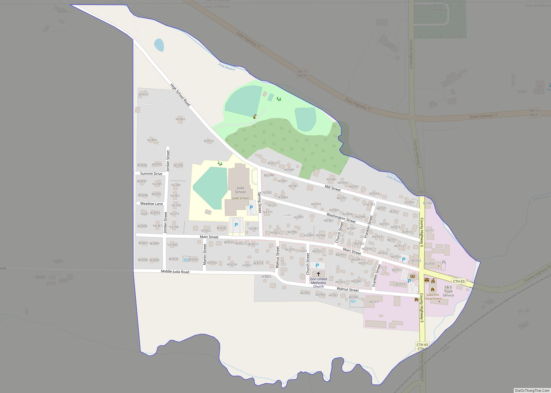
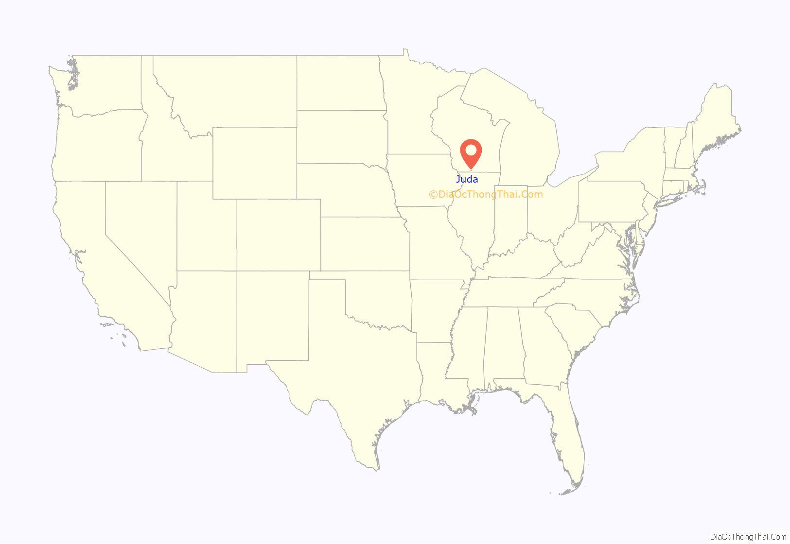
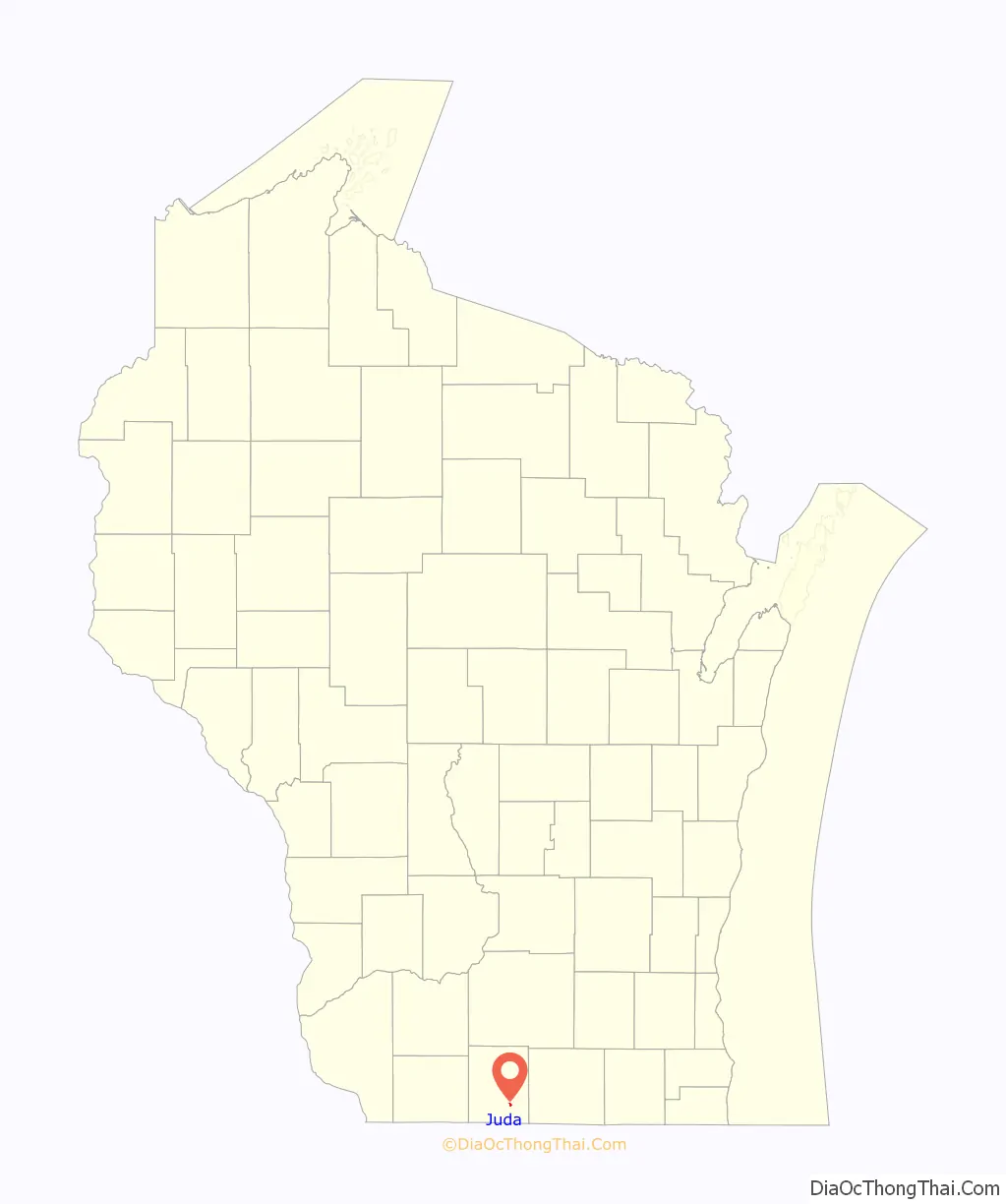
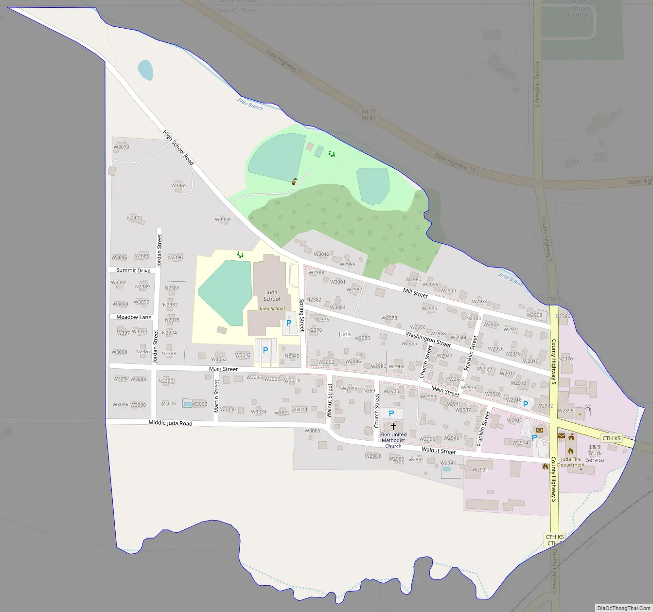
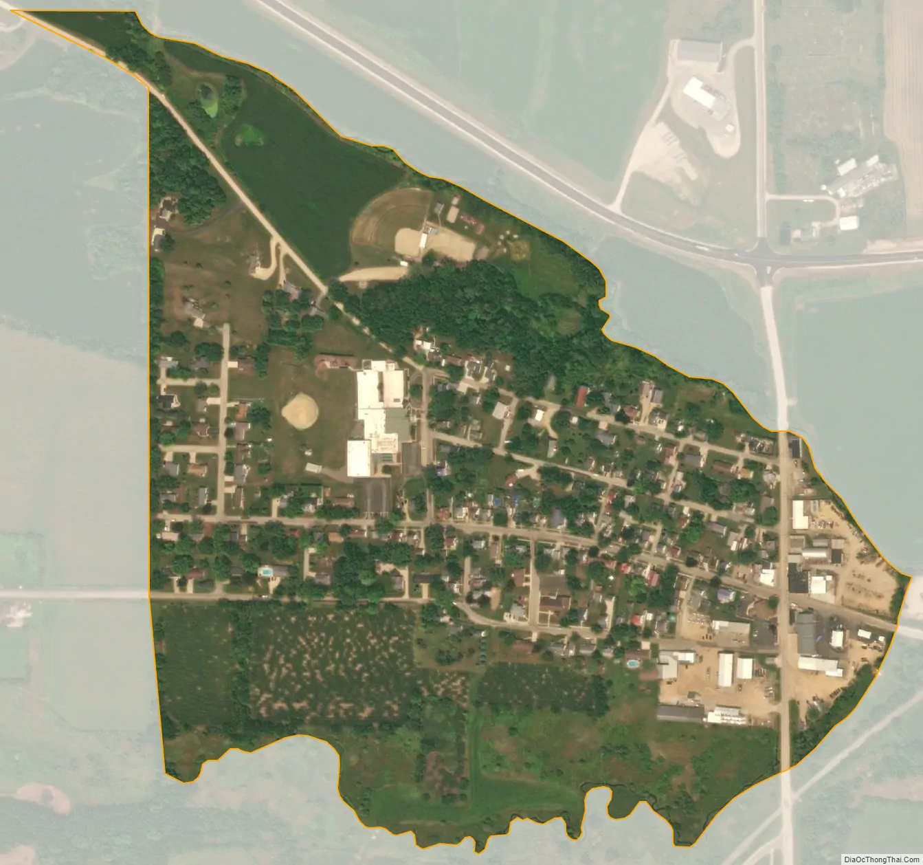
Juda is an unincorporated census-designated place located in the town of Jefferson, in Green County, Wisconsin, United States. Juda is 5 miles east of Monroe along Wisconsin State Highway 11, and 81. As of the 2010 census, its population was 357. Juda is a part of the Madison Metropolitan Statistical Area.
On March 30, 1967, nine students from Juda’s Union High School, all girls, were killed when a Delta Air Lines DC-8 jet crashed into the motel where they had been staying during a senior class trip to New Orleans, Louisiana.
| Name: | Juda CDP |
|---|---|
| LSAD Code: | 57 |
| LSAD Description: | CDP (suffix) |
| State: | Wisconsin |
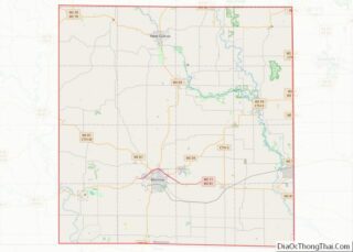
| County: | Green County |
| Elevation: | 846 ft (258 m) |
| Total Area: | 0.267 sq mi (0.69 km²) |
| Land Area: | 0.267 sq mi (0.69 km²) |
| Water Area: | 0 sq mi (0 km²) |
| Total Population: | 357 |
| Population Density: | 1,300/sq mi (520/km²) |
| Area code: | 608 |
| FIPS code: | 5538600 |
| GNISfeature ID: | 1577668 |
Online Interactive Map
Click on ![]() to view map in "full screen" mode.
to view map in "full screen" mode.
Juda location map. Where is Juda CDP?
Juda Road Map
Juda city Satellite Map
See also
Map of Wisconsin State and its subdivision:- Adams
- Ashland
- Barron
- Bayfield
- Brown
- Buffalo
- Burnett
- Calumet
- Chippewa
- Clark
- Columbia
- Crawford
- Dane
- Dodge
- Door
- Douglas
- Dunn
- Eau Claire
- Florence
- Fond du Lac
- Forest
- Grant
- Green
- Green Lake
- Iowa
- Iron
- Jackson
- Jefferson
- Juneau
- Kenosha
- Kewaunee
- La Crosse
- Lafayette
- Lake Michigan
- Lake Superior
- Langlade
- Lincoln
- Manitowoc
- Marathon
- Marinette
- Marquette
- Menominee
- Milwaukee
- Monroe
- Oconto
- Oneida
- Outagamie
- Ozaukee
- Pepin
- Pierce
- Polk
- Portage
- Price
- Racine
- Richland
- Rock
- Rusk
- Saint Croix
- Sauk
- Sawyer
- Shawano
- Sheboygan
- Taylor
- Trempealeau
- Vernon
- Vilas
- Walworth
- Washburn
- Washington
- Waukesha
- Waupaca
- Waushara
- Winnebago
- Wood
- Alabama
- Alaska
- Arizona
- Arkansas
- California
- Colorado
- Connecticut
- Delaware
- District of Columbia
- Florida
- Georgia
- Hawaii
- Idaho
- Illinois
- Indiana
- Iowa
- Kansas
- Kentucky
- Louisiana
- Maine
- Maryland
- Massachusetts
- Michigan
- Minnesota
- Mississippi
- Missouri
- Montana
- Nebraska
- Nevada
- New Hampshire
- New Jersey
- New Mexico
- New York
- North Carolina
- North Dakota
- Ohio
- Oklahoma
- Oregon
- Pennsylvania
- Rhode Island
- South Carolina
- South Dakota
- Tennessee
- Texas
- Utah
- Vermont
- Virginia
- Washington
- West Virginia
- Wisconsin
- Wyoming