Solon Springs is a village in Douglas County, Wisconsin, United States. The population was 600 at the 2010 census. The village is located within the Town of Solon Springs.
| Name: | Solon Springs village |
|---|---|
| LSAD Code: | 47 |
| LSAD Description: | village (suffix) |
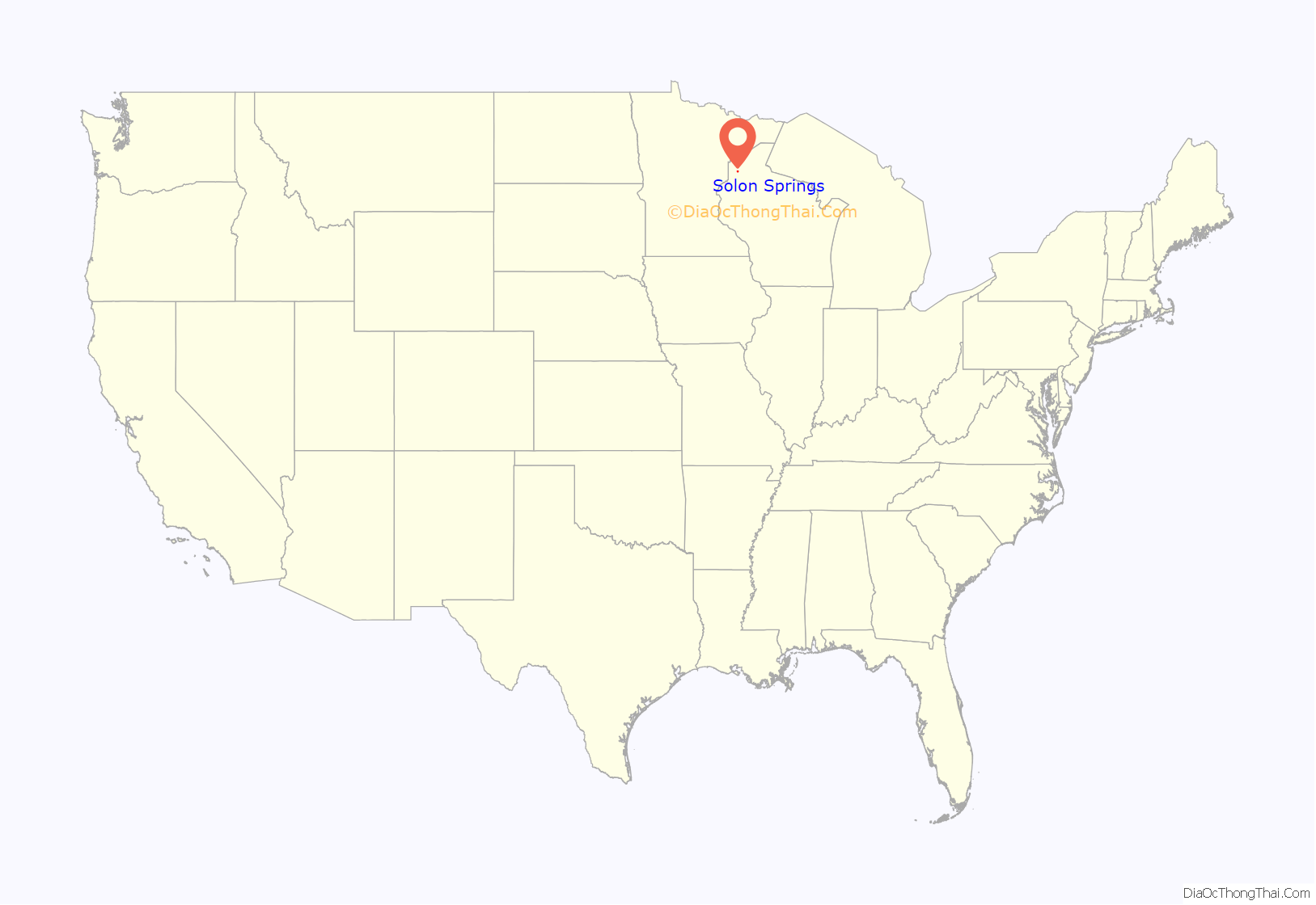
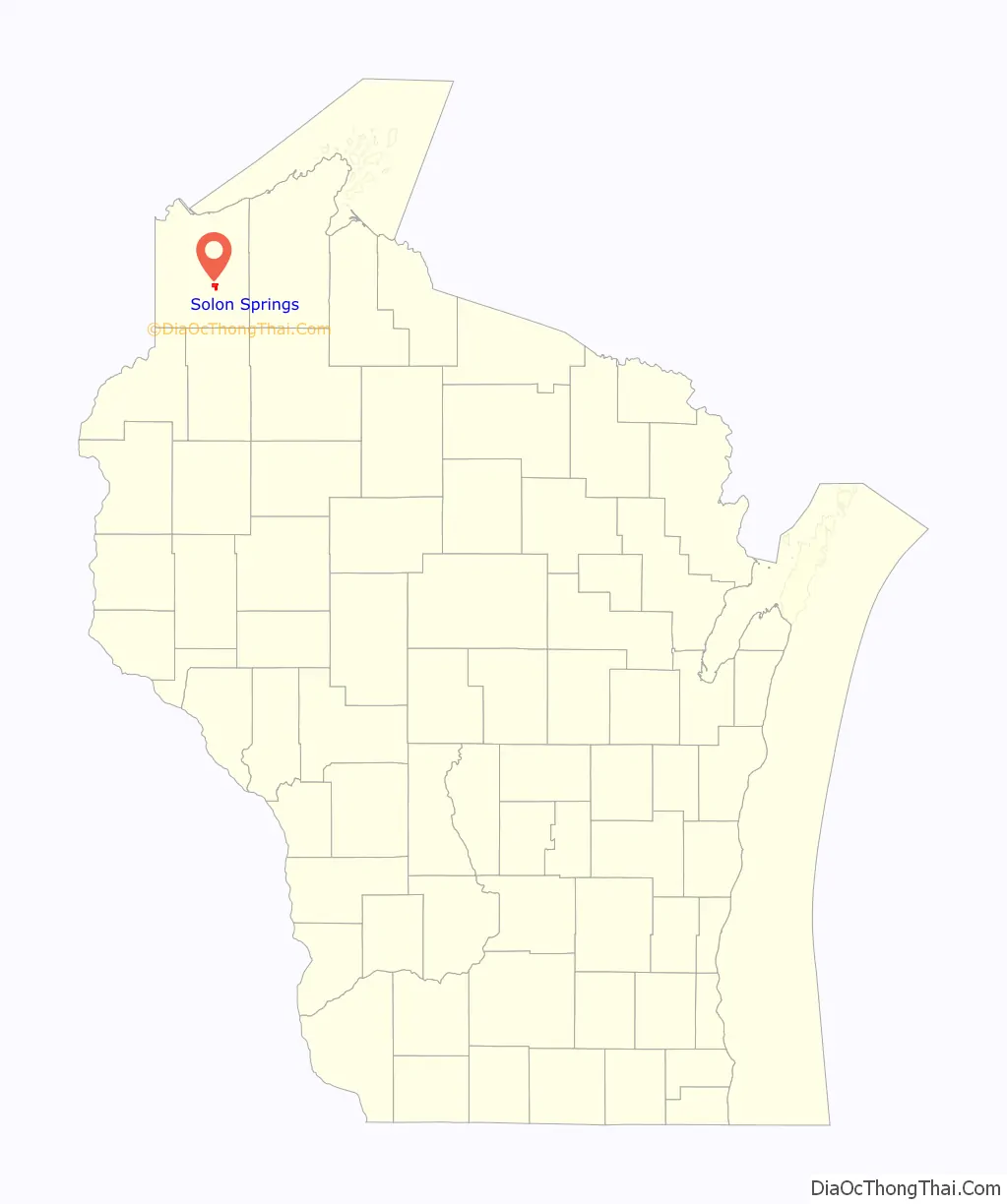
| State: | Wisconsin |
| County: | Douglas County |
| Elevation: | 1,122 ft (342 m) |
| Total Area: | 2.30 sq mi (5.95 km²) |
| Land Area: | 1.57 sq mi (4.06 km²) |
| Water Area: | 0.73 sq mi (1.90 km²) |
| Total Population: | 600 |
| Population Density: | 378.03/sq mi (145.97/km²) |
| Area code: | 715 and 534 |
| FIPS code: | 5574575 |
| GNISfeature ID: | 1574366 |
| Website: | www.villageofsolonsprings.com |
Online Interactive Map
Click on ![]() to view map in "full screen" mode.
to view map in "full screen" mode.
Solon Springs location map. Where is Solon Springs village?
History
Solon Springs was first called White Birch, from a grove of white birch trees near the original town site. The present name of Solon Springs honors Thomas F. Solon, who discovered mineral springs here. A post office was established as White Birch in 1885, and the name of the post office was changed to Solon Springs in 1896.
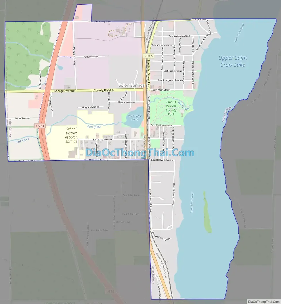
Solon Springs Road Map
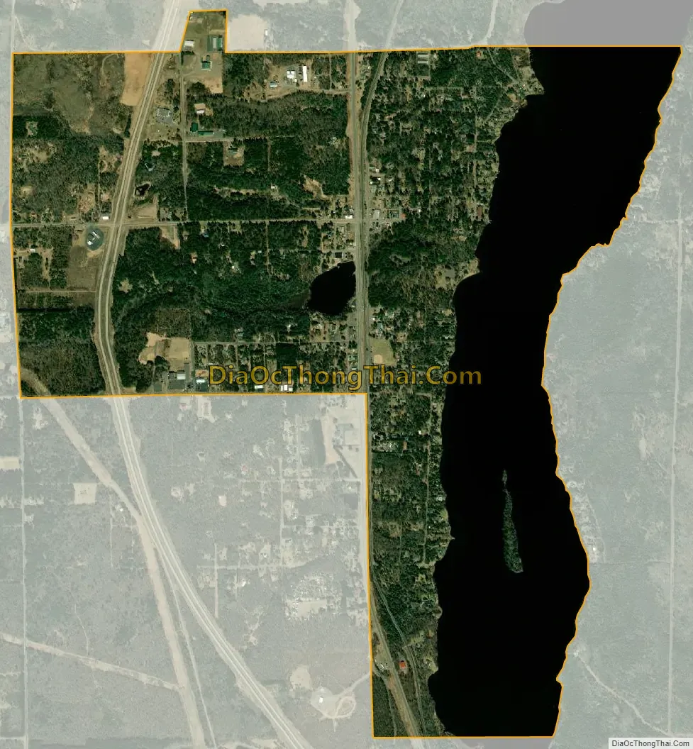
Solon Springs city Satellite Map
Geography
Solon Springs is located at 46°21′3″N 91°49′5″W / 46.35083°N 91.81806°W / 46.35083; -91.81806 (46.351049, -91.818139).
According to the United States Census Bureau, the village has a total area of 2.30 square miles (5.96 km), of which, 1.57 square miles (4.07 km) of it is land and 0.73 square miles (1.89 km) is water.
Solon Springs is located 32 miles southeast of the city of Superior.
See also
Map of Wisconsin State and its subdivision:- Adams
- Ashland
- Barron
- Bayfield
- Brown
- Buffalo
- Burnett
- Calumet
- Chippewa
- Clark
- Columbia
- Crawford
- Dane
- Dodge
- Door
- Douglas
- Dunn
- Eau Claire
- Florence
- Fond du Lac
- Forest
- Grant
- Green
- Green Lake
- Iowa
- Iron
- Jackson
- Jefferson
- Juneau
- Kenosha
- Kewaunee
- La Crosse
- Lafayette
- Lake Michigan
- Lake Superior
- Langlade
- Lincoln
- Manitowoc
- Marathon
- Marinette
- Marquette
- Menominee
- Milwaukee
- Monroe
- Oconto
- Oneida
- Outagamie
- Ozaukee
- Pepin
- Pierce
- Polk
- Portage
- Price
- Racine
- Richland
- Rock
- Rusk
- Saint Croix
- Sauk
- Sawyer
- Shawano
- Sheboygan
- Taylor
- Trempealeau
- Vernon
- Vilas
- Walworth
- Washburn
- Washington
- Waukesha
- Waupaca
- Waushara
- Winnebago
- Wood
- Alabama
- Alaska
- Arizona
- Arkansas
- California
- Colorado
- Connecticut
- Delaware
- District of Columbia
- Florida
- Georgia
- Hawaii
- Idaho
- Illinois
- Indiana
- Iowa
- Kansas
- Kentucky
- Louisiana
- Maine
- Maryland
- Massachusetts
- Michigan
- Minnesota
- Mississippi
- Missouri
- Montana
- Nebraska
- Nevada
- New Hampshire
- New Jersey
- New Mexico
- New York
- North Carolina
- North Dakota
- Ohio
- Oklahoma
- Oregon
- Pennsylvania
- Rhode Island
- South Carolina
- South Dakota
- Tennessee
- Texas
- Utah
- Vermont
- Virginia
- Washington
- West Virginia
- Wisconsin
- Wyoming


