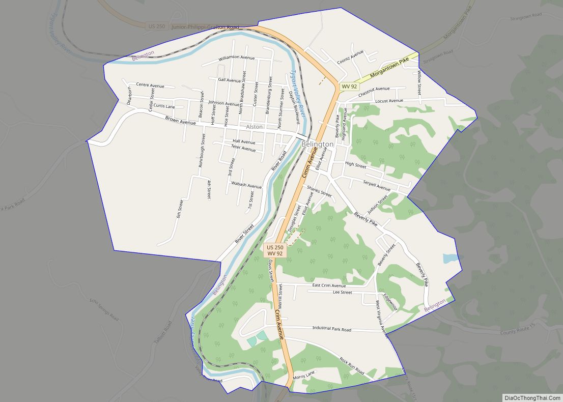
Belington is a town in Barbour County, West Virginia, United States, situated along the Tygart Valley River. The population was 1,804 as of the 2020 census.
| Name: | Belington town |
|---|---|
| LSAD Code: | 43 |
| LSAD Description: | town (suffix) |
| State: | West Virginia |
| County: | Barbour County |
| Incorporated: | 1894-08-22 |
| Elevation: | 1,703 ft (519 m) |
| Total Area: | 2.13 sq mi (5.52 km²) |
| Land Area: | 2.06 sq mi (5.34 km²) |
| Water Area: | 0.07 sq mi (0.18 km²) |
| Total Population: | 1,804 |
| Population Density: | 922.85/sq mi (356.24/km²) |
| ZIP code: | 26250 |
| Area code: | 304 |
| FIPS code: | 5405788 |
| GNISfeature ID: | 1535594 |
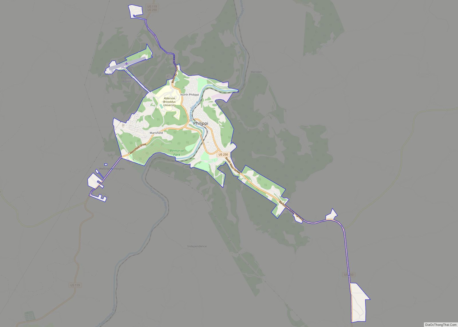
Online Interactive Map
Click on ![]() to view map in "full screen" mode.
to view map in "full screen" mode.
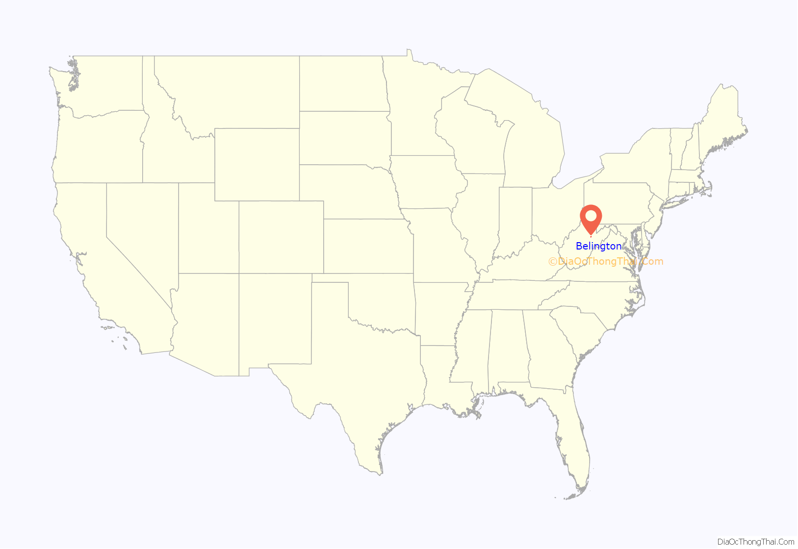
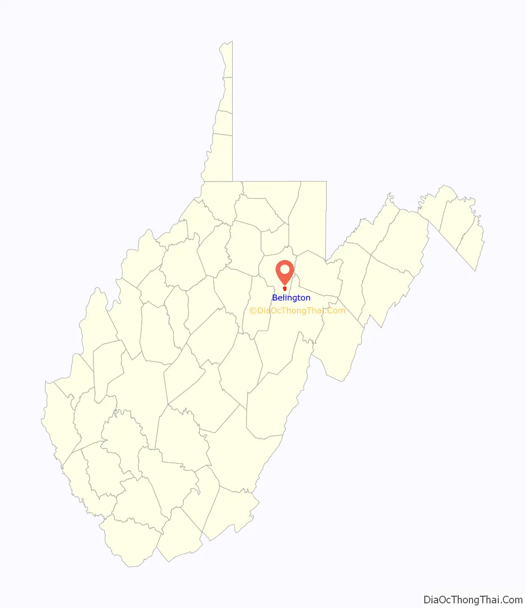
Belington location map. Where is Belington town?
History
Belington was founded in 1766–70. Originally it was known as the Barker Settlement, after Elias Barker, who had settled there with his brother William Barker. About 1785, it was called Yeagers, taking its name from a settler, George Yeager, and his sons. In 1855, it took its current name, Belington, from John Bealin, who had opened up a store there, and who would later move to Kansas.
After the June 3, 1861 Battle of Philippi, site of the first land battle of the Civil War, the Confederate forces, having been routed by the Union Army in Philippi, retreated south. The Confederates made camp near the Laurel Mountain Road, today, a winding single lane dirt road that crosses the mountain and connects Belington with Elkins.
In 1891, the West Virginia Central and Pittsburg Railway (later the Western Maryland Railway) was built into Belington. In 1894 the land on the east side of the river was incorporated as Belington, while the west side was incorporated as Alston in 1897. The two towns merged in 1906 to form the present Belington.
The Bernard E. Wilmoth House in Belington is a historic house listed on the National Register of Historic Places.
Belington Road Map
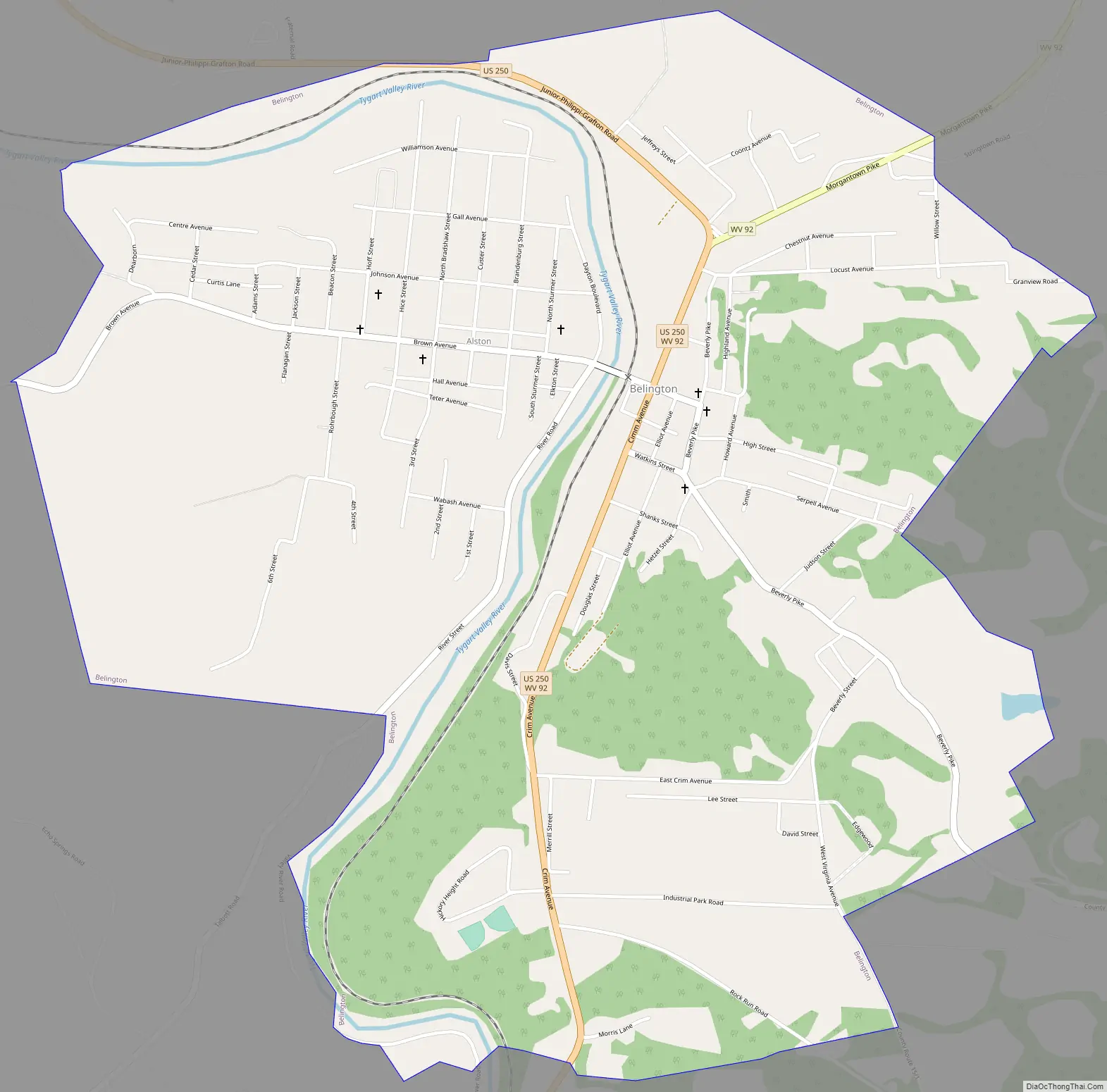
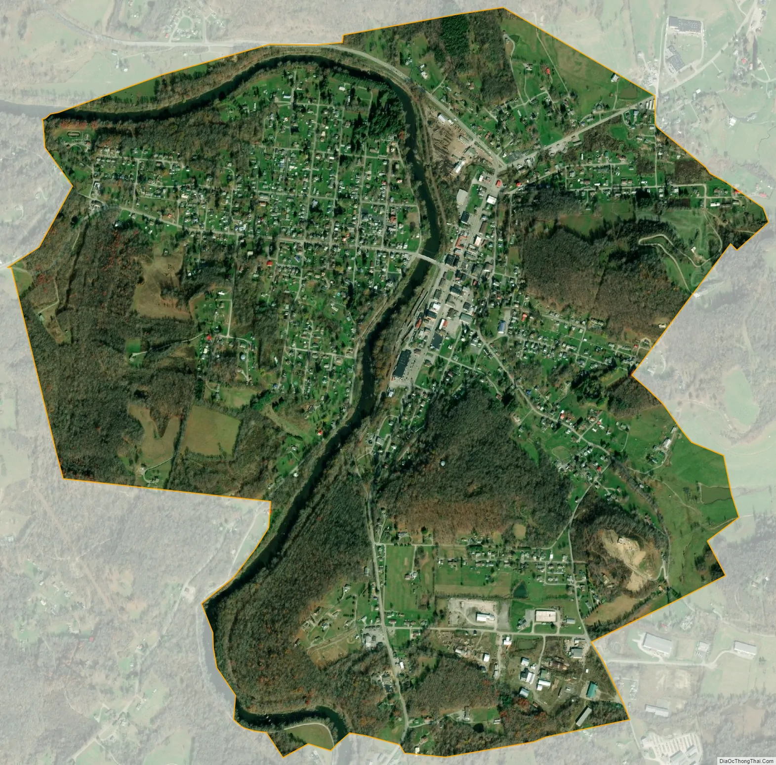
Belington city Satellite Map
Geography
Belington is located at 39°1′33″N 79°56′17″W / 39.02583°N 79.93806°W / 39.02583; -79.93806 (39.025706, -79.938166).
The town has a total area of 2.13 square miles (5.52 km), of which 2.06 square miles (5.34 km) is land and 0.07 square miles (0.18 km) is water.
See also
Map of West Virginia State and its subdivision:- Barbour
- Berkeley
- Boone
- Braxton
- Brooke
- Cabell
- Calhoun
- Clay
- Doddridge
- Fayette
- Gilmer
- Grant
- Greenbrier
- Hampshire
- Hancock
- Hardy
- Harrison
- Jackson
- Jefferson
- Kanawha
- Lewis
- Lincoln
- Logan
- Marion
- Marshall
- Mason
- McDowell
- Mercer
- Mineral
- Mingo
- Monongalia
- Monroe
- Morgan
- Nicholas
- Ohio
- Pendleton
- Pleasants
- Pocahontas
- Preston
- Putnam
- Raleigh
- Randolph
- Ritchie
- Roane
- Summers
- Taylor
- Tucker
- Tyler
- Upshur
- Wayne
- Webster
- Wetzel
- Wirt
- Wood
- Wyoming
- Alabama
- Alaska
- Arizona
- Arkansas
- California
- Colorado
- Connecticut
- Delaware
- District of Columbia
- Florida
- Georgia
- Hawaii
- Idaho
- Illinois
- Indiana
- Iowa
- Kansas
- Kentucky
- Louisiana
- Maine
- Maryland
- Massachusetts
- Michigan
- Minnesota
- Mississippi
- Missouri
- Montana
- Nebraska
- Nevada
- New Hampshire
- New Jersey
- New Mexico
- New York
- North Carolina
- North Dakota
- Ohio
- Oklahoma
- Oregon
- Pennsylvania
- Rhode Island
- South Carolina
- South Dakota
- Tennessee
- Texas
- Utah
- Vermont
- Virginia
- Washington
- West Virginia
- Wisconsin
- Wyoming