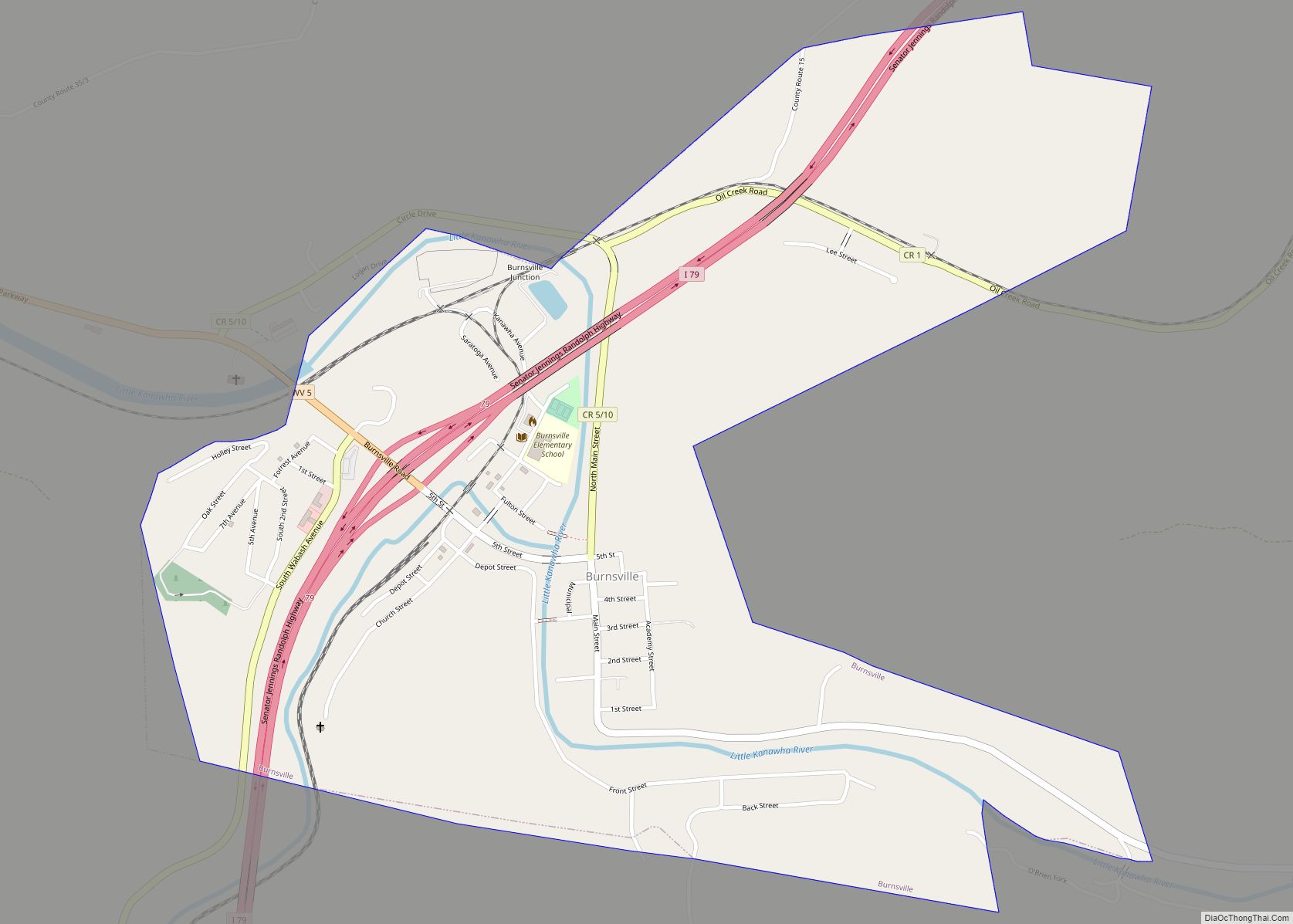
Burnsville is a town in Braxton County, West Virginia, United States, at the confluence of the Little Kanawha River and Saltlick Creek. The population was 401 at the 2020 census. Burnsville was incorporated in 1902 by the Circuit Court and named for Captain John Burns who operated the first sawmill in that section of the state and who established the town shortly after the close of the American Civil War. It was named “All West Virginia City” in 1976.
| Name: | Burnsville town |
|---|---|
| LSAD Code: | 43 |
| LSAD Description: | town (suffix) |
| State: | West Virginia |
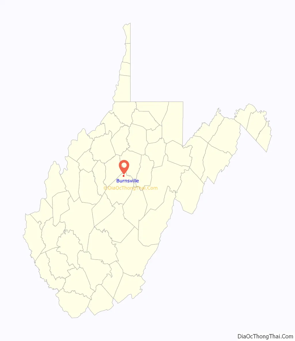
| County: | Braxton County |
| Elevation: | 810 ft (247 m) |
| Total Area: | 1.09 sq mi (2.82 km²) |
| Land Area: | 1.06 sq mi (2.74 km²) |
| Water Area: | 0.03 sq mi (0.09 km²) |
| Total Population: | 401 |
| Population Density: | 451.28/sq mi (174.23/km²) |
| ZIP code: | 26335 |
| Area code: | 304 |
| FIPS code: | 5411716 |
| GNISfeature ID: | 1554034 |
Online Interactive Map
Click on ![]() to view map in "full screen" mode.
to view map in "full screen" mode.
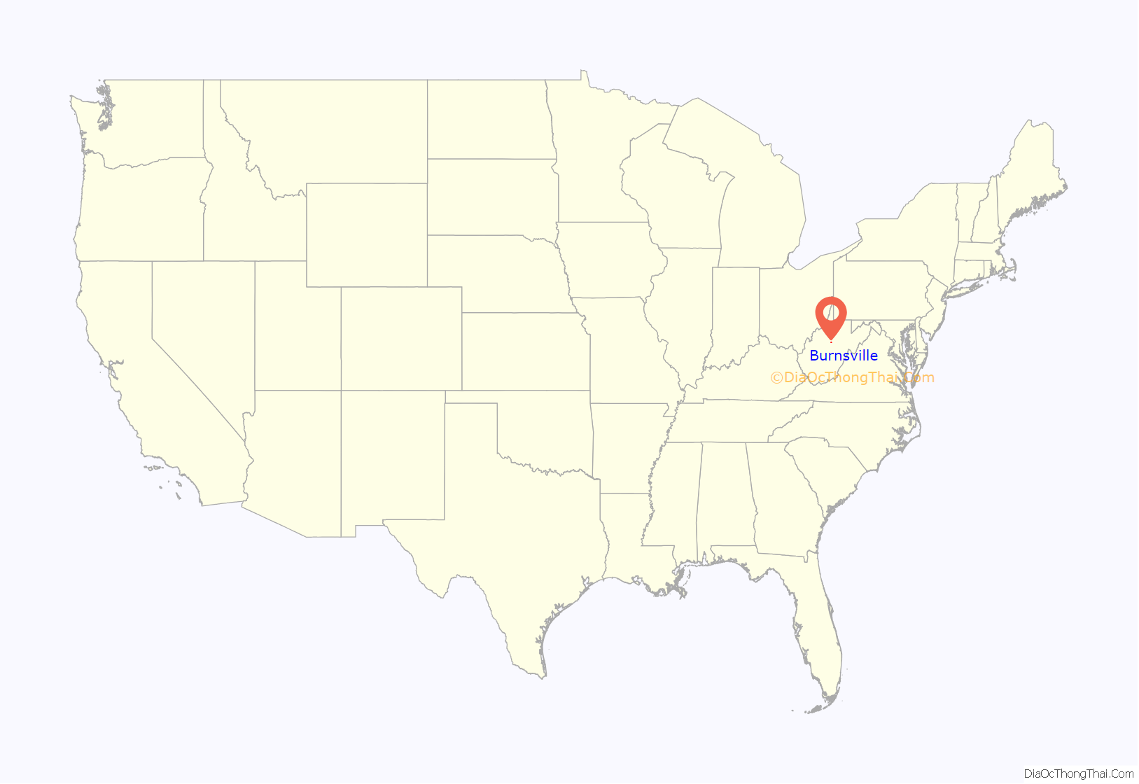
Burnsville location map. Where is Burnsville town?
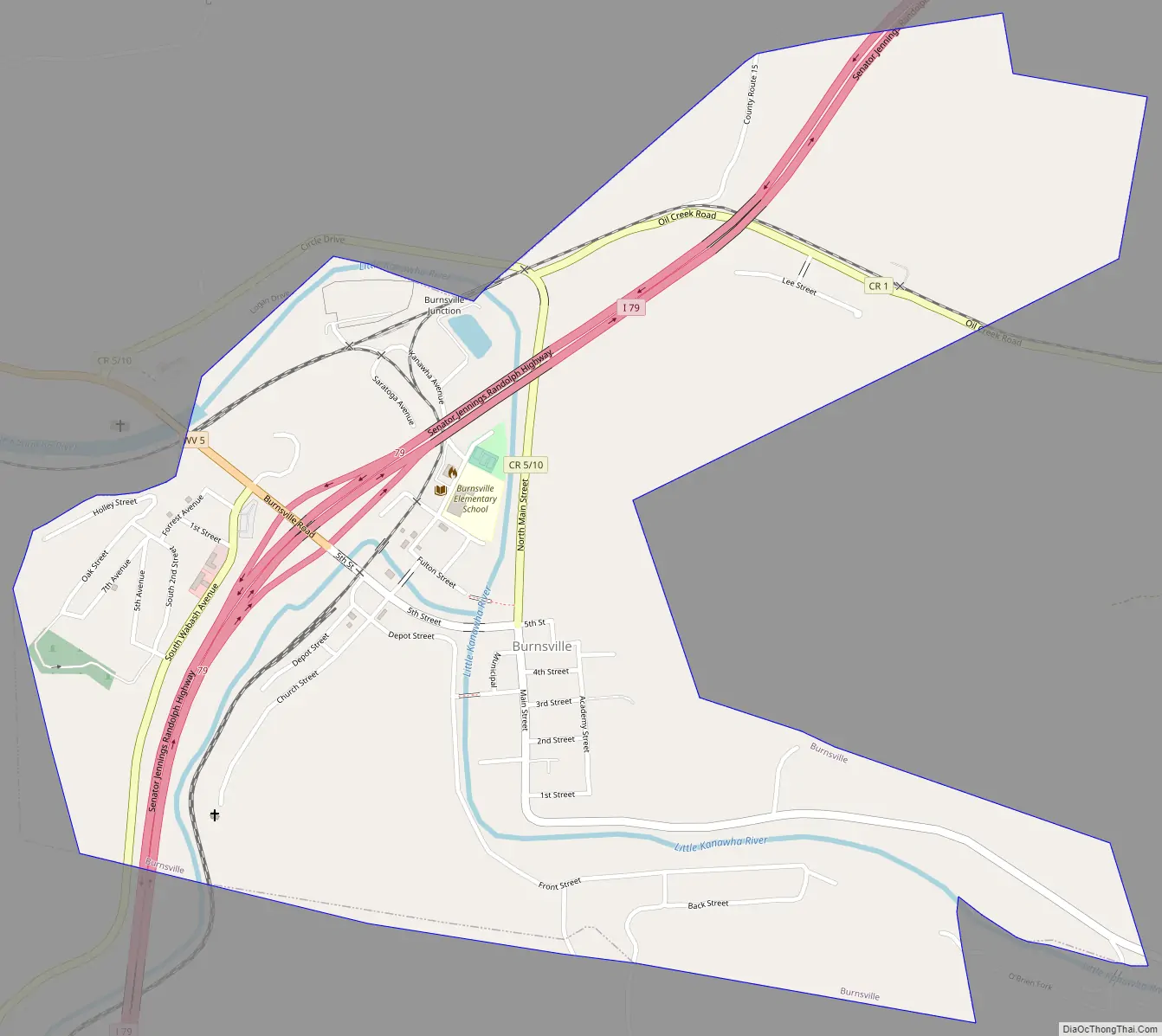
Burnsville Road Map
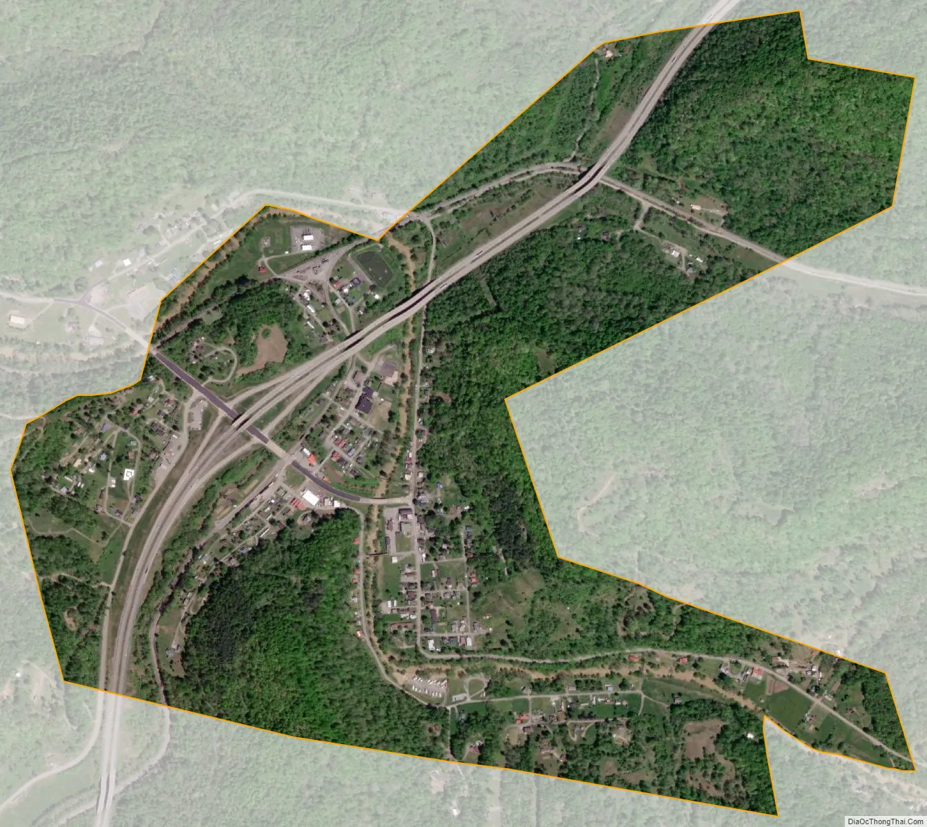
Burnsville city Satellite Map
Geography
Burnsville is located at 38°51′31″N 80°39′20″W / 38.858538°N 80.655439°W / 38.858538; -80.655439 (38.858538, -80.655439). According to the United States Census Bureau, the town has a total area of 1.09 square miles (2.82 km), of which 1.06 square miles (2.75 km) is land and 0.03 square miles (0.08 km) is water.
See also
Map of West Virginia State and its subdivision:- Barbour
- Berkeley
- Boone
- Braxton
- Brooke
- Cabell
- Calhoun
- Clay
- Doddridge
- Fayette
- Gilmer
- Grant
- Greenbrier
- Hampshire
- Hancock
- Hardy
- Harrison
- Jackson
- Jefferson
- Kanawha
- Lewis
- Lincoln
- Logan
- Marion
- Marshall
- Mason
- McDowell
- Mercer
- Mineral
- Mingo
- Monongalia
- Monroe
- Morgan
- Nicholas
- Ohio
- Pendleton
- Pleasants
- Pocahontas
- Preston
- Putnam
- Raleigh
- Randolph
- Ritchie
- Roane
- Summers
- Taylor
- Tucker
- Tyler
- Upshur
- Wayne
- Webster
- Wetzel
- Wirt
- Wood
- Wyoming
- Alabama
- Alaska
- Arizona
- Arkansas
- California
- Colorado
- Connecticut
- Delaware
- District of Columbia
- Florida
- Georgia
- Hawaii
- Idaho
- Illinois
- Indiana
- Iowa
- Kansas
- Kentucky
- Louisiana
- Maine
- Maryland
- Massachusetts
- Michigan
- Minnesota
- Mississippi
- Missouri
- Montana
- Nebraska
- Nevada
- New Hampshire
- New Jersey
- New Mexico
- New York
- North Carolina
- North Dakota
- Ohio
- Oklahoma
- Oregon
- Pennsylvania
- Rhode Island
- South Carolina
- South Dakota
- Tennessee
- Texas
- Utah
- Vermont
- Virginia
- Washington
- West Virginia
- Wisconsin
- Wyoming