Clay is a town in and the county seat of Clay County, West Virginia, United States. The population was 399 at the 2020 census. It is the only incorporated town in Clay County.
| Name: | Clay town |
|---|---|
| LSAD Code: | 43 |
| LSAD Description: | town (suffix) |
| State: | West Virginia |
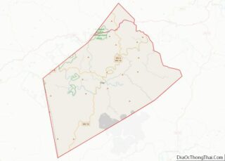
| County: | Clay County |
| Elevation: | 709 ft (216 m) |
| Total Area: | 0.62 sq mi (1.59 km²) |
| Land Area: | 0.56 sq mi (1.44 km²) |
| Water Area: | 0.06 sq mi (0.15 km²) |
| Total Population: | 399 |
| Population Density: | 790.32/sq mi (305.26/km²) |
| ZIP code: | 25043 |
| Area code: | 304 |
| FIPS code: | 5415676 |
| GNISfeature ID: | 1537360 |
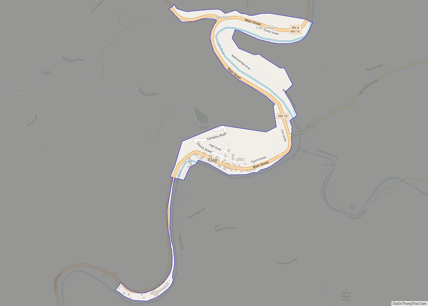
Online Interactive Map
Click on ![]() to view map in "full screen" mode.
to view map in "full screen" mode.
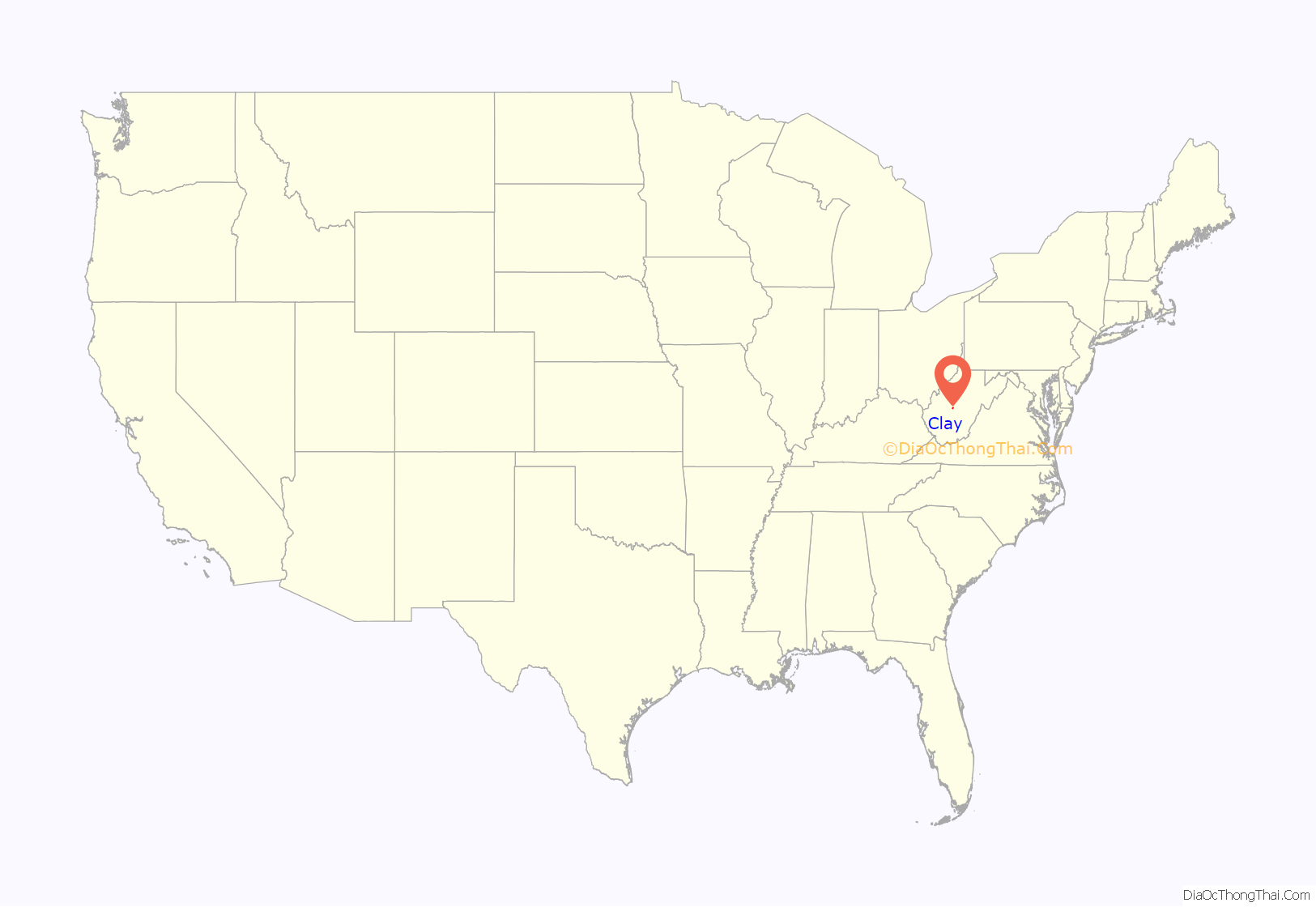
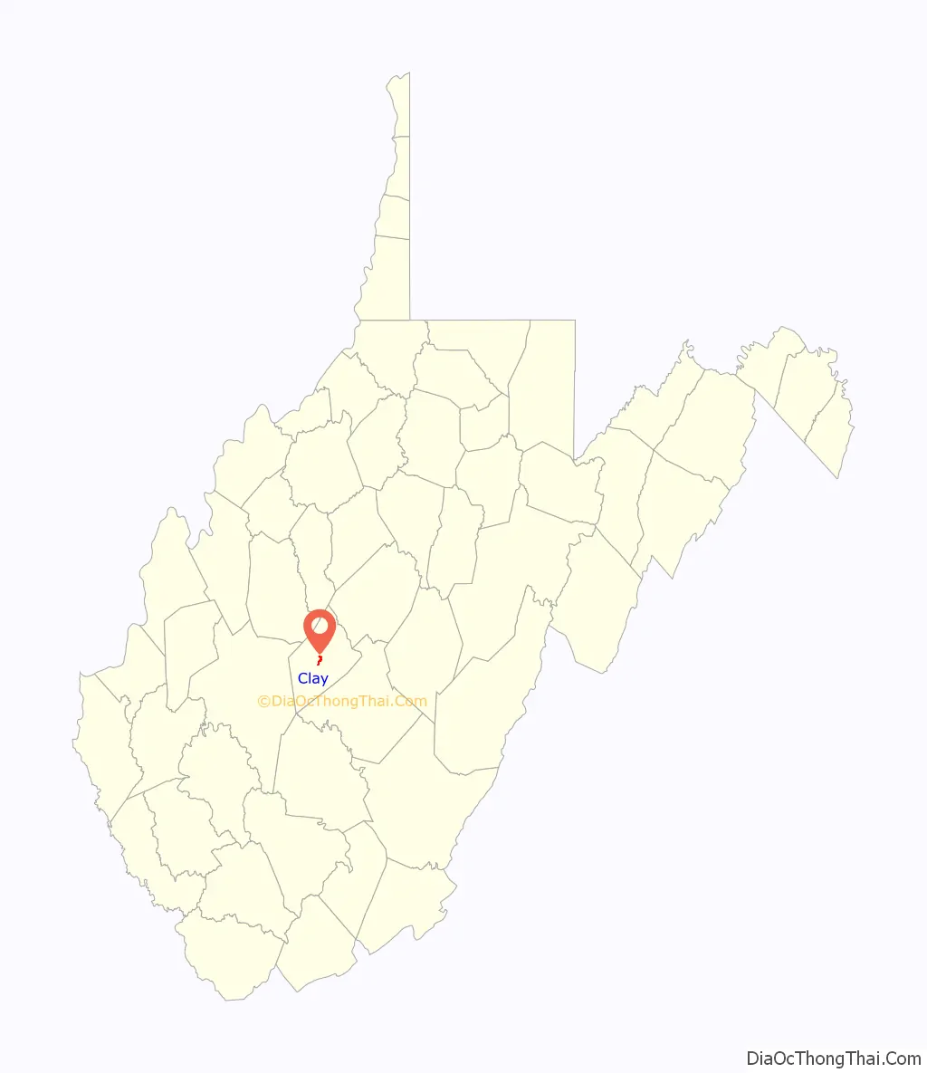
Clay location map. Where is Clay town?
History
Clay was established on the site of a farm that was the site of Clay County’s first court meeting following the county’s establishment in 1858. The community was initially known by the name of “Marshall,” then briefly as “Henry,” and then as “Clay Courthouse” and finally Clay. The town and county are both named for U.S. Senator and Secretary of State Henry Clay (1777–1852). The town was incorporated in 1895. Before 1880, Clay was inaccessible to traffic from horse-drawn vehicles, and the Elk River was its primary mode of transport. Expansion of the Coal and Coke Railway reached Clay in 1905.
In June 2016, the town was impacted by severe flooding from the Elk River.
In November 2016, Clay mayor Beverly Whaling approvingly responded to a social media post that referred to U.S. First Lady Michelle Obama as an “ape in heels”. Following international media coverage of the incident, Whaling resigned.
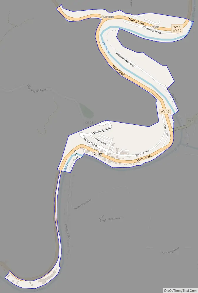
Clay Road Map
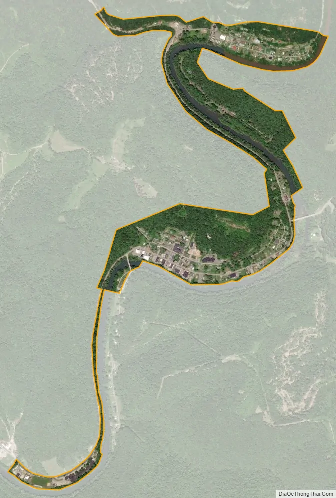
Clay city Satellite Map
Geography
The city of Charleston, the state capitol, is approximately 40 miles (64 km) from Clay to the southwest. Clay is centrally located within Clay County at 38°27′46″N 81°4′48″W / 38.46278°N 81.08000°W / 38.46278; -81.08000 (38.462855, -81.080024), along the Elk River and West Virginia Route 16 at an elevation of 708 feet (216 m). West Virginia Route 4 overlaps with Route 16 in the north of Clay. There is not much bottom land in Clay, as the river cuts a deep gorge through the city, limiting growth.
According to the United States Census Bureau, the town has a total area of 0.62 square miles (1.61 km), of which 0.56 square miles (1.45 km) is land and 0.06 square miles (0.16 km) is water.
Climate
The climate in this area is characterized by hot, humid summers and generally mild to cool winters. According to the Köppen Climate Classification system, Clay has a humid subtropical climate, abbreviated “Cfa” on climate maps.
See also
Map of West Virginia State and its subdivision:- Barbour
- Berkeley
- Boone
- Braxton
- Brooke
- Cabell
- Calhoun
- Clay
- Doddridge
- Fayette
- Gilmer
- Grant
- Greenbrier
- Hampshire
- Hancock
- Hardy
- Harrison
- Jackson
- Jefferson
- Kanawha
- Lewis
- Lincoln
- Logan
- Marion
- Marshall
- Mason
- McDowell
- Mercer
- Mineral
- Mingo
- Monongalia
- Monroe
- Morgan
- Nicholas
- Ohio
- Pendleton
- Pleasants
- Pocahontas
- Preston
- Putnam
- Raleigh
- Randolph
- Ritchie
- Roane
- Summers
- Taylor
- Tucker
- Tyler
- Upshur
- Wayne
- Webster
- Wetzel
- Wirt
- Wood
- Wyoming
- Alabama
- Alaska
- Arizona
- Arkansas
- California
- Colorado
- Connecticut
- Delaware
- District of Columbia
- Florida
- Georgia
- Hawaii
- Idaho
- Illinois
- Indiana
- Iowa
- Kansas
- Kentucky
- Louisiana
- Maine
- Maryland
- Massachusetts
- Michigan
- Minnesota
- Mississippi
- Missouri
- Montana
- Nebraska
- Nevada
- New Hampshire
- New Jersey
- New Mexico
- New York
- North Carolina
- North Dakota
- Ohio
- Oklahoma
- Oregon
- Pennsylvania
- Rhode Island
- South Carolina
- South Dakota
- Tennessee
- Texas
- Utah
- Vermont
- Virginia
- Washington
- West Virginia
- Wisconsin
- Wyoming