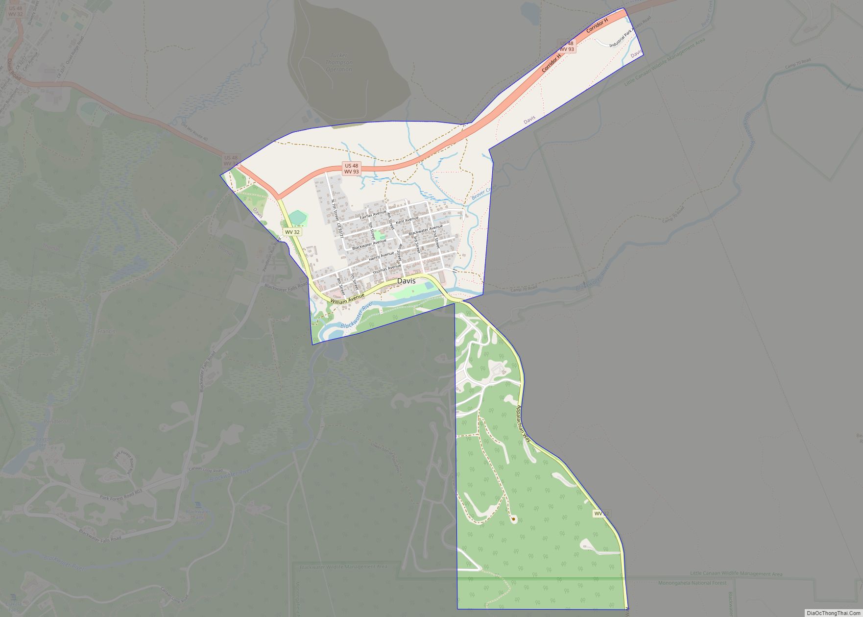
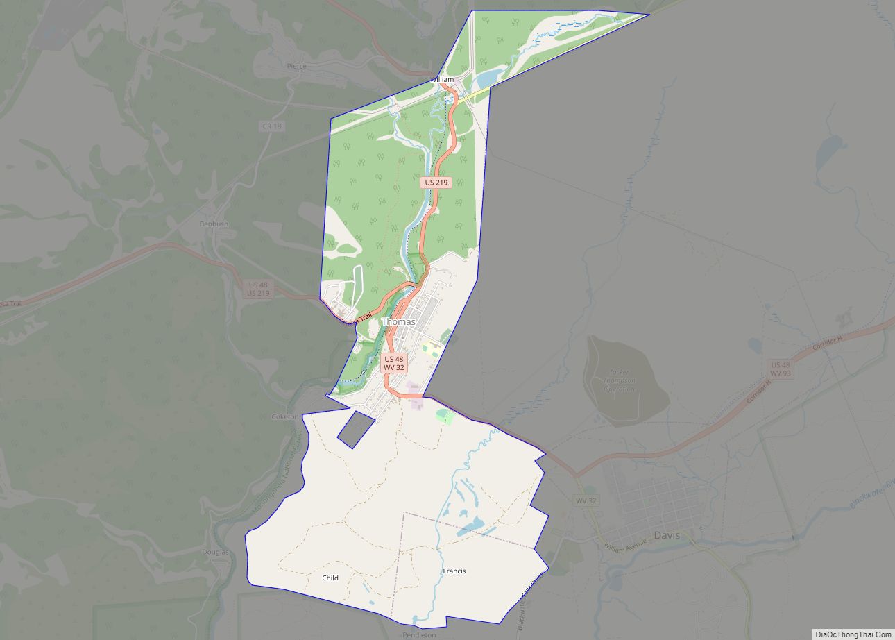
Davis is a town in Tucker County, West Virginia, United States, situated along the Blackwater River. The population was 595 at the 2020 census.
| Name: | Davis town |
|---|---|
| LSAD Code: | 43 |
| LSAD Description: | town (suffix) |
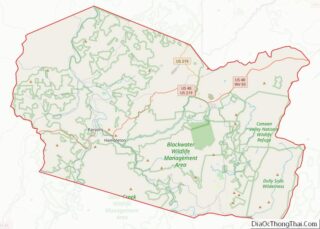
| State: | West Virginia |
| County: | Tucker County |
| Elevation: | 3,100 ft (945 m) |
| Total Area: | 1.83 sq mi (4.74 km²) |
| Land Area: | 1.83 sq mi (4.74 km²) |
| Water Area: | 0.00 sq mi (0.00 km²) |
| Total Population: | 595 |
| Population Density: | 344.62/sq mi (133.06/km²) |
| ZIP code: | 26260 |
| Area code: | 304 |
| FIPS code: | 5420428 |
| GNISfeature ID: | 1550876 |
Online Interactive Map
Click on ![]() to view map in "full screen" mode.
to view map in "full screen" mode.
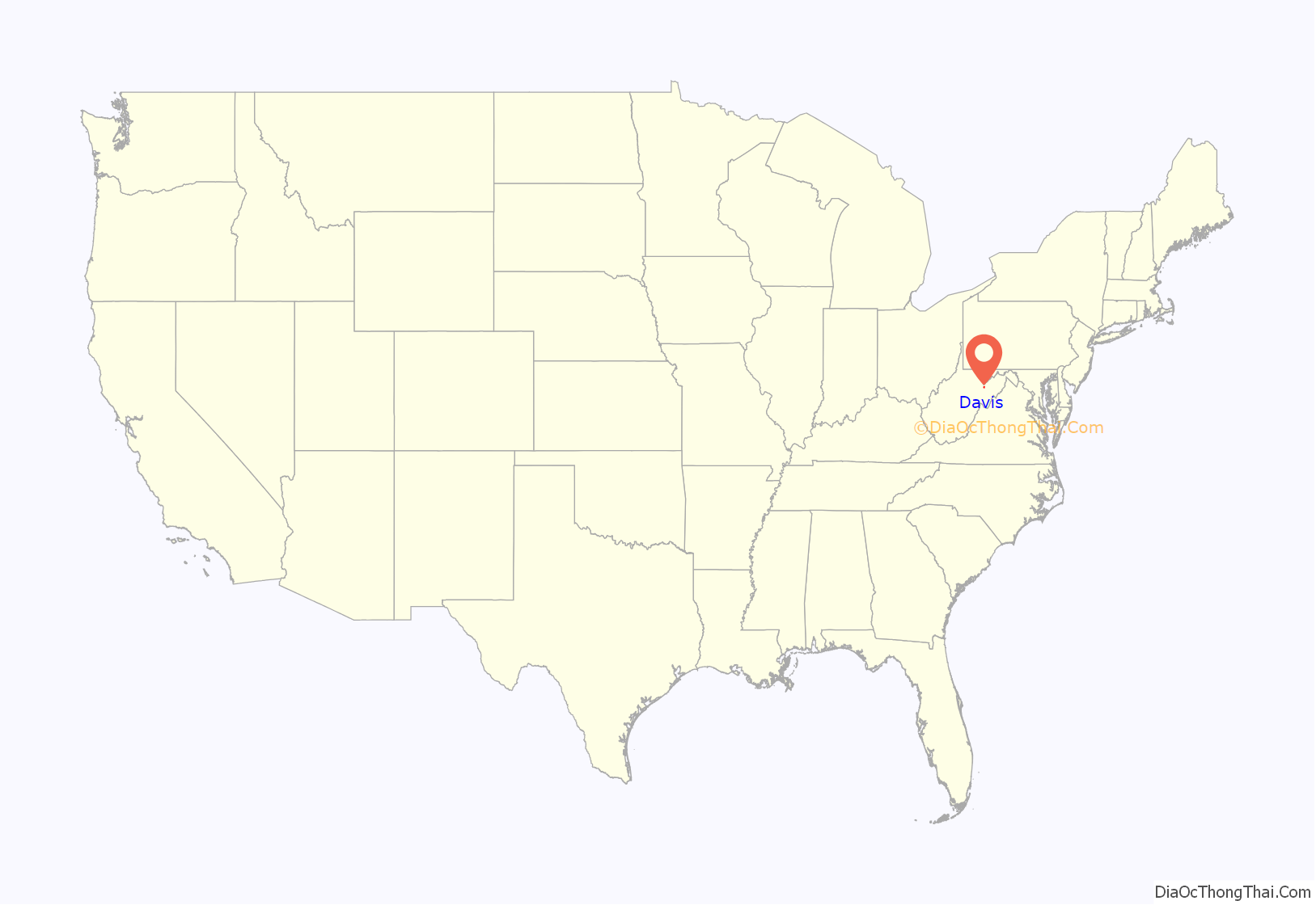
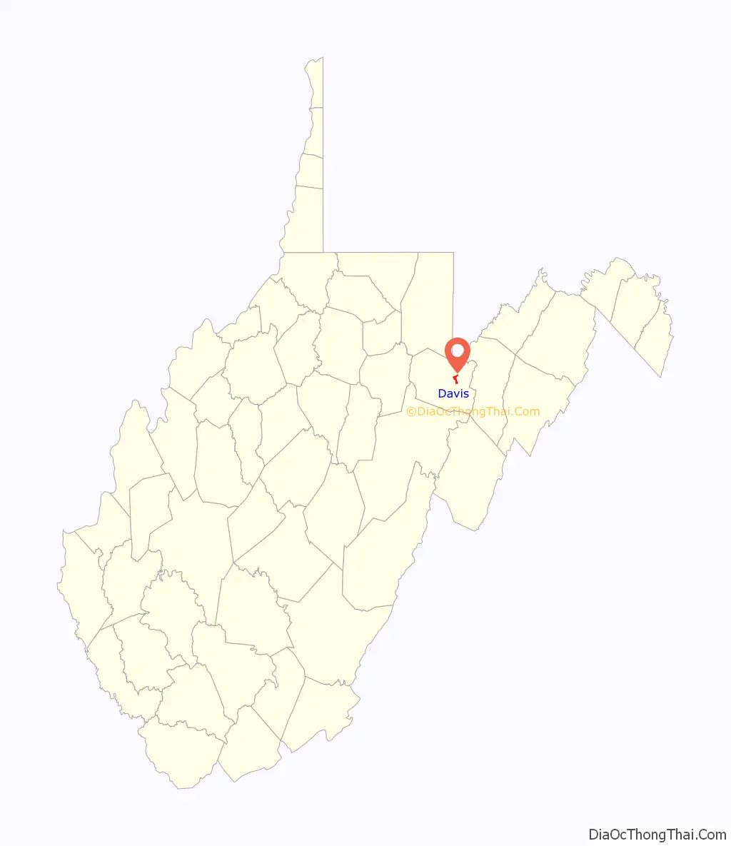
Davis location map. Where is Davis town?
History
Davis was named either for Senator Henry Gassaway Davis, or for his family generally.
The Herman August Meyer House was listed on the National Register of Historic Places in 2010.
Davis Road Map
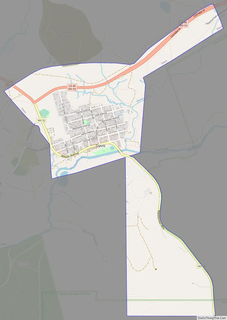
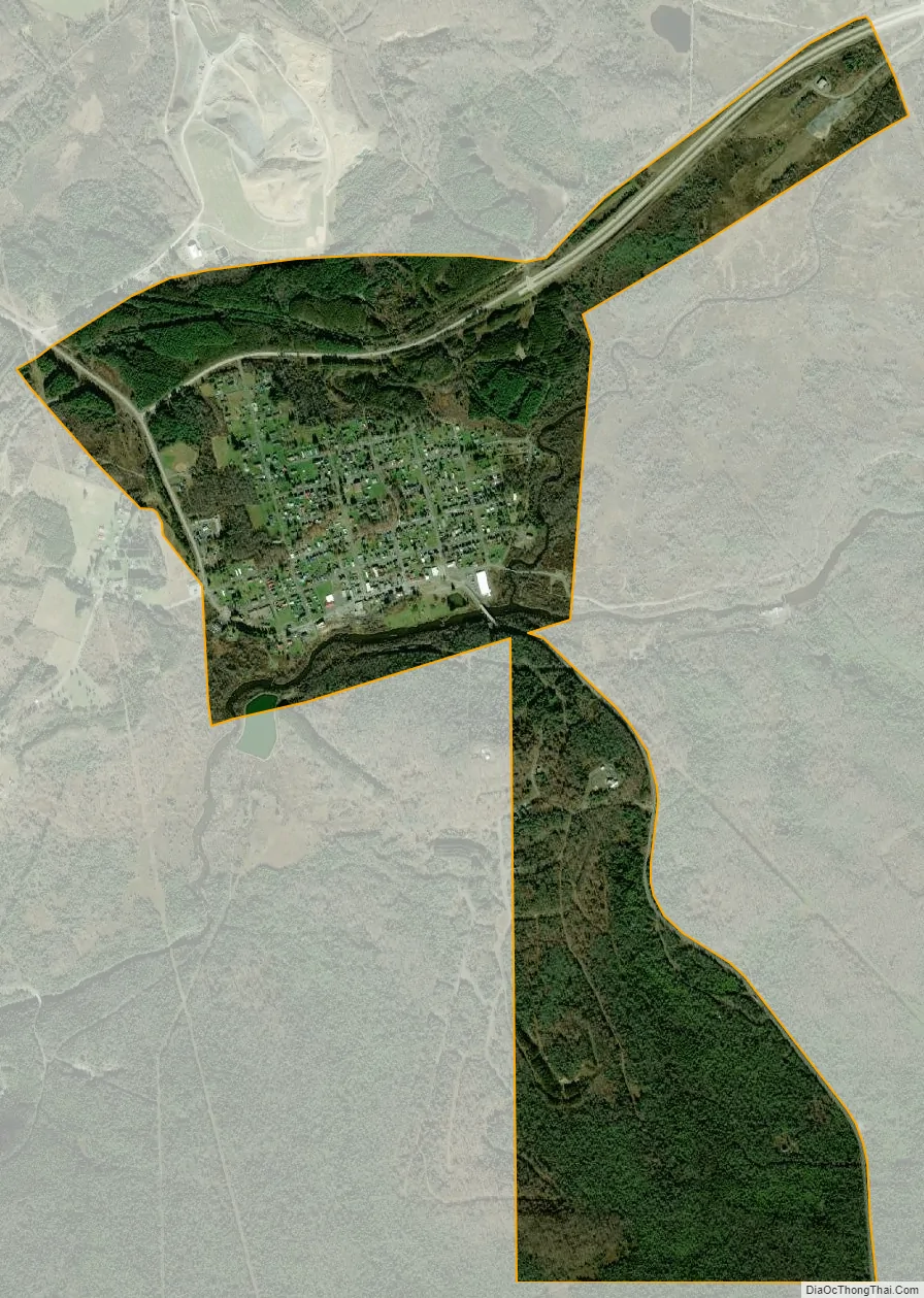
Davis city Satellite Map
Geography
Davis is located at 39°07′52″N 79°27′59″W / 39.131110°N 79.466318°W / 39.131110; -79.466318 (39.131110, -79.466318). It is located in the northern portion of Canaan Valley, West Virginia near the Canaan Valley State Resort Park, and is partially surrounded by the Monongahela National Forest, including scenic Blackwater Falls.
At an elevation of 3,520 feet, Davis has the highest elevation of any West Virginia town.
According to the United States Census Bureau, the town has a total area of 1.83 square miles (4.74 km), all land.
See also
Map of West Virginia State and its subdivision:- Barbour
- Berkeley
- Boone
- Braxton
- Brooke
- Cabell
- Calhoun
- Clay
- Doddridge
- Fayette
- Gilmer
- Grant
- Greenbrier
- Hampshire
- Hancock
- Hardy
- Harrison
- Jackson
- Jefferson
- Kanawha
- Lewis
- Lincoln
- Logan
- Marion
- Marshall
- Mason
- McDowell
- Mercer
- Mineral
- Mingo
- Monongalia
- Monroe
- Morgan
- Nicholas
- Ohio
- Pendleton
- Pleasants
- Pocahontas
- Preston
- Putnam
- Raleigh
- Randolph
- Ritchie
- Roane
- Summers
- Taylor
- Tucker
- Tyler
- Upshur
- Wayne
- Webster
- Wetzel
- Wirt
- Wood
- Wyoming
- Alabama
- Alaska
- Arizona
- Arkansas
- California
- Colorado
- Connecticut
- Delaware
- District of Columbia
- Florida
- Georgia
- Hawaii
- Idaho
- Illinois
- Indiana
- Iowa
- Kansas
- Kentucky
- Louisiana
- Maine
- Maryland
- Massachusetts
- Michigan
- Minnesota
- Mississippi
- Missouri
- Montana
- Nebraska
- Nevada
- New Hampshire
- New Jersey
- New Mexico
- New York
- North Carolina
- North Dakota
- Ohio
- Oklahoma
- Oregon
- Pennsylvania
- Rhode Island
- South Carolina
- South Dakota
- Tennessee
- Texas
- Utah
- Vermont
- Virginia
- Washington
- West Virginia
- Wisconsin
- Wyoming