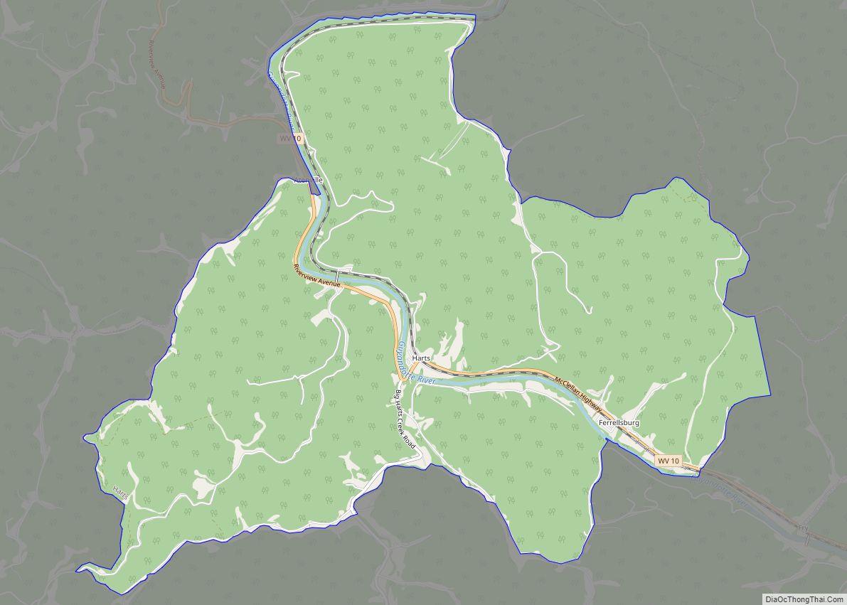
Harts is a census-designated place (CDP) at the mouth of Big Harts Creek in Lincoln County, West Virginia, United States, situated along the Guyandotte River. As of the 2010 census, its population was 656. Harts is a part of the Huntington-Ashland, WV-KY-OH, Metropolitan Statistical Area (MSA). The Harts CDP includes the unincorporated communities of Harts, Atenville, Ferrellsburg, and Sand Creek.
| Name: | Harts CDP |
|---|---|
| LSAD Code: | 57 |
| LSAD Description: | CDP (suffix) |
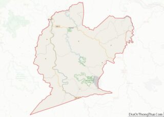
| State: | West Virginia |
| County: | Lincoln County |
| Elevation: | 630 ft (192 m) |
| Total Area: | 9.31 sq mi (24.12 km²) |
| Land Area: | 9.18 sq mi (23.77 km²) |
| Water Area: | 0.14 sq mi (0.35 km²) |
| Total Population: | 656 |
| Population Density: | 71/sq mi (27.6/km²) |
| ZIP code: | 25524 |
| Area code: | 304 |
| FIPS code: | 5435596 |
| GNISfeature ID: | 1540035 |
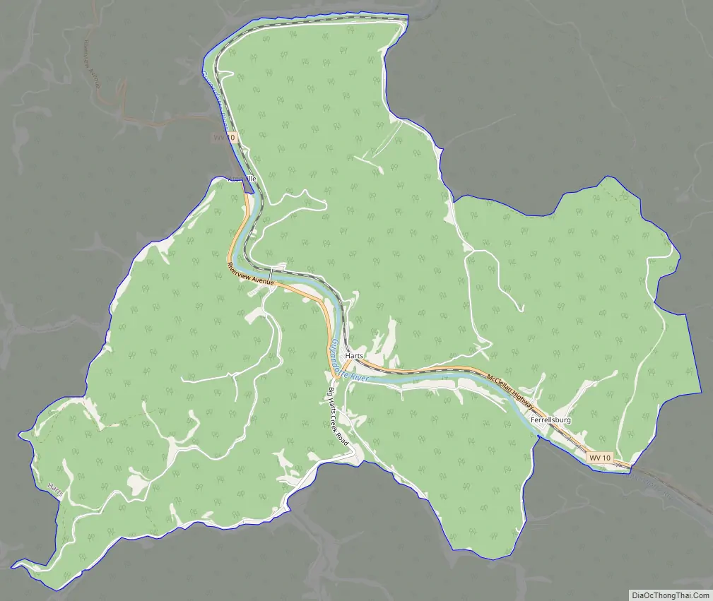
Online Interactive Map
Click on ![]() to view map in "full screen" mode.
to view map in "full screen" mode.
Harts location map. Where is Harts CDP?


History
Harts (town), situated at the mouth of Big Harts Creek, is named for Stephen Hart (Heart), an early settler who once lived in the area, or his father, the latter killed by Native Americans in the vicinity. Richard Elkins was the first permanent settler, arriving in 1807 or 1815. At the time of Elkins’ settlement, depending on which year is accurate, the present-day town was part of Kanawha County or Cabell County. Prominent early families who settled in the present-day town of Harts included the Elkins, Adkins, and Toney families. After 1824, the area became a part of Logan County. Prior to the Civil War, Isaac Adkins (who lived at the present-day site of the Harts Fire Department) operated a large farm at “Harts Bottom.” He was one of the area’s most prominent landowners; Isaac Adkins Shoals are named for him. In the 1840s, James Toney, a native of present-day Boone County, acquired land from the Elkins settlers at the mouth of Big Harts Creek, just across the Guyandotte from Harts Bottom. During the Civil War, nearly all local men served in the Confederate States Army.
In 1869, the area became part of Lincoln County. In November or December 1870, Henry S. Godby established Hearts Creek Post Office. The Hearts Creek PO was discontinued in 1872. In 1877, merchant William T. “Bill” Fowler established Hart’s Creek Post Office. This post office was discontinued in 1880. In 1881, Andrew D. Robinson established the Hart Post Office. During the 1880s, the Lincoln County Feud occurred in Harts and garnered headlines in newspapers across the United States. During the 1890s, Al and Hollena Brumfield were the most prominent residents. In 1904, the C&O Railroad passed through town. In 1910, Hart PO was discontinued. In 1916, Lewis Dempsey established Harts Post Office, which continues today. Prominent merchants during this time and in subsequent decades included F.E. Adkins, Herb Adkins, P.B. “Fed” Adkins, Hollena Brumfield, Fisher B. Adkins, Watson Adkins, and L.T. Jones.
The Harts Creek community includes the Harts Creek District of Lincoln County and a portion of Chapmanville District in Logan County. It includes the following communities, many of which once had post offices which are now closed: Atenville, Bulwark, Enzelo, Ferrellsburg, Fourteen, Fry, Gill, Green Shoal, Halcyon, Harts, Leet, Rector, Sand Creek, Shively, Spottswood, Toney, Warren, and Whirlwind. The larger community includes the following watersheds: Big Harts Creek (Lincoln and Logan counties), Big Ugly Creek, Fourteen Mile Creek, a portion of Kiahs Creek, Little Harts Creek, Little Ugly Creek, Sand Creek, Dry Branch, Browns Branch, Swift Shoals Branch, Walker Branch, Fowler Branch, Douglas Branch, Green Shoal Creek, and Abbotts Branch. These various locations were populated by numerous families prior to 1840: Brumfield, Elkins, Gore, Adkins, Fry, Brown, Lucas, Spurlock, Toney, Vance, Workman, Conley, Rowe, Adams, Browning, Collins, Dingess, Dolen, Heart, Johnson, Lambert, Lilly, Perry, Tomblin, Hensley, Butcher, White, Mullins, Dalton, Thompson, Dempsey, Abbott, Blankenship, Butcher, Estep, Farley, Ferrell, Nester, Richards, Spears, Dial, Carter, and Farmer. Most early settlers were of English origin.
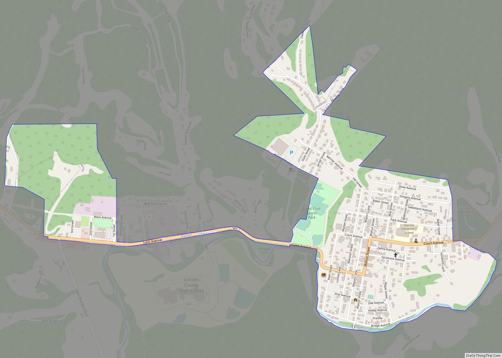
Harts Road Map
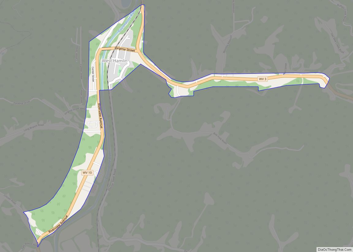
Harts city Satellite Map

Geography
Harts is located in southern Lincoln County at 38°1′50″N 82°7′41″W / 38.03056°N 82.12806°W / 38.03056; -82.12806 (38.030643, -82.128147). West Virginia Route 10 passes through the center of the community, following the Guyandotte River. The highway leads northwest (downstream) 44 miles (71 km) to Huntington and southeast (upstream) 10 miles (16 km) to Chapmanville.
According to the United States Census Bureau, the Harts CDP has a total area of 9.3 square miles (24.1 km), of which 9.2 square miles (23.8 km) are land and 0.1 square miles (0.3 km), or 1.44%, are water.
The census area includes both Big Harts Creek and Little Harts Creek. The West Fork of Big Harts Creek is often misidentified as “East Fork” on maps and in deeds. However, the West Fork was named for a man by the name of West, not the direction of the creek.
See also
Map of West Virginia State and its subdivision:- Barbour
- Berkeley
- Boone
- Braxton
- Brooke
- Cabell
- Calhoun
- Clay
- Doddridge
- Fayette
- Gilmer
- Grant
- Greenbrier
- Hampshire
- Hancock
- Hardy
- Harrison
- Jackson
- Jefferson
- Kanawha
- Lewis
- Lincoln
- Logan
- Marion
- Marshall
- Mason
- McDowell
- Mercer
- Mineral
- Mingo
- Monongalia
- Monroe
- Morgan
- Nicholas
- Ohio
- Pendleton
- Pleasants
- Pocahontas
- Preston
- Putnam
- Raleigh
- Randolph
- Ritchie
- Roane
- Summers
- Taylor
- Tucker
- Tyler
- Upshur
- Wayne
- Webster
- Wetzel
- Wirt
- Wood
- Wyoming
- Alabama
- Alaska
- Arizona
- Arkansas
- California
- Colorado
- Connecticut
- Delaware
- District of Columbia
- Florida
- Georgia
- Hawaii
- Idaho
- Illinois
- Indiana
- Iowa
- Kansas
- Kentucky
- Louisiana
- Maine
- Maryland
- Massachusetts
- Michigan
- Minnesota
- Mississippi
- Missouri
- Montana
- Nebraska
- Nevada
- New Hampshire
- New Jersey
- New Mexico
- New York
- North Carolina
- North Dakota
- Ohio
- Oklahoma
- Oregon
- Pennsylvania
- Rhode Island
- South Carolina
- South Dakota
- Tennessee
- Texas
- Utah
- Vermont
- Virginia
- Washington
- West Virginia
- Wisconsin
- Wyoming