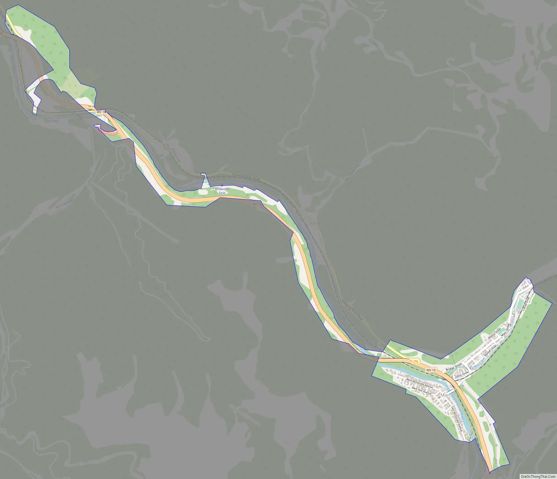
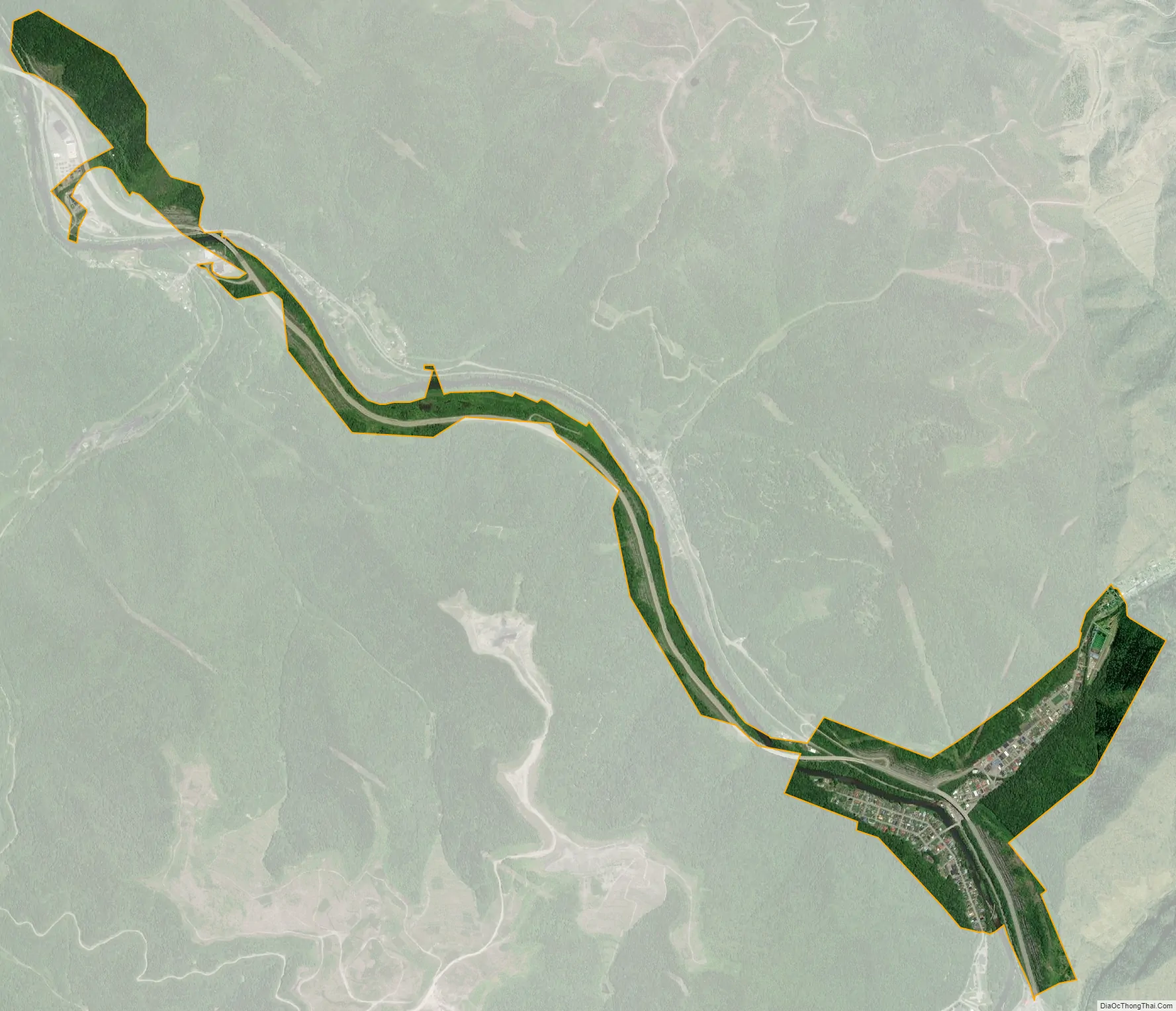
Man is a town in Logan County, West Virginia, United States. The population was 759 at the 2010 census. The town is located along the Guyandotte River at the mouth of Buffalo Creek, which was the site of the 1972 Buffalo Creek Flood following a dam collapse. The name of the town reportedly derives from the last syllable of the surname of Ulysses Hinchman, who was a member of the House of Delegates from Logan County between 1866 and 1869.
| Name: | Man town |
|---|---|
| LSAD Code: | 43 |
| LSAD Description: | town (suffix) |
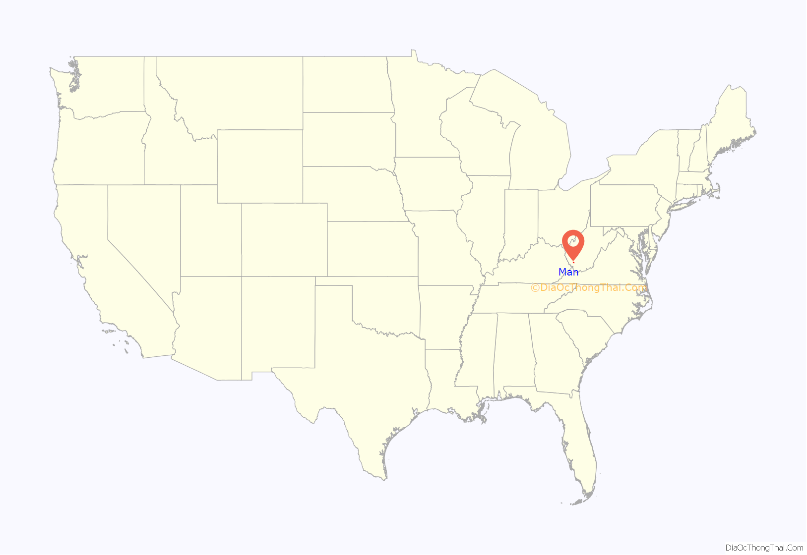
| State: | West Virginia |
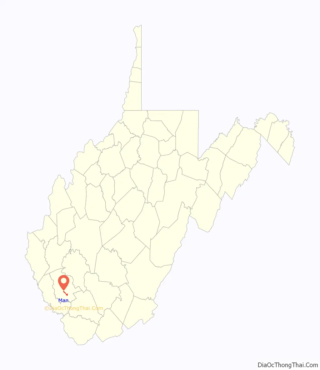
| County: | Logan County |
| Elevation: | 738 ft (225 m) |
| Total Area: | 1.15 sq mi (2.98 km²) |
| Land Area: | 1.10 sq mi (2.84 km²) |
| Water Area: | 0.06 sq mi (0.14 km²) |
| Total Population: | 779 |
| Population Density: | 574.82/sq mi (221.85/km²) |
| ZIP code: | 25635 |
| Area code: | 304 & 681 |
| FIPS code: | 5450932 |
| GNISfeature ID: | 1542706 |
Online Interactive Map
Click on ![]() to view map in "full screen" mode.
to view map in "full screen" mode.
Man location map. Where is Man town?
Man Road Map
Man city Satellite Map
Geography
According to the United States Census Bureau, the town has a total area of 1.16 square miles (3.00 km), of which 1.10 square miles (2.85 km) is land and 0.06 square miles (0.16 km) is water.
Climate
The climate in this area is characterized by hot, humid summers and generally mild to cool winters. According to the Köppen Climate Classification system, Man has a humid subtropical climate, abbreviated “Cfa” on climate maps.
See also
Map of West Virginia State and its subdivision:- Barbour
- Berkeley
- Boone
- Braxton
- Brooke
- Cabell
- Calhoun
- Clay
- Doddridge
- Fayette
- Gilmer
- Grant
- Greenbrier
- Hampshire
- Hancock
- Hardy
- Harrison
- Jackson
- Jefferson
- Kanawha
- Lewis
- Lincoln
- Logan
- Marion
- Marshall
- Mason
- McDowell
- Mercer
- Mineral
- Mingo
- Monongalia
- Monroe
- Morgan
- Nicholas
- Ohio
- Pendleton
- Pleasants
- Pocahontas
- Preston
- Putnam
- Raleigh
- Randolph
- Ritchie
- Roane
- Summers
- Taylor
- Tucker
- Tyler
- Upshur
- Wayne
- Webster
- Wetzel
- Wirt
- Wood
- Wyoming
- Alabama
- Alaska
- Arizona
- Arkansas
- California
- Colorado
- Connecticut
- Delaware
- District of Columbia
- Florida
- Georgia
- Hawaii
- Idaho
- Illinois
- Indiana
- Iowa
- Kansas
- Kentucky
- Louisiana
- Maine
- Maryland
- Massachusetts
- Michigan
- Minnesota
- Mississippi
- Missouri
- Montana
- Nebraska
- Nevada
- New Hampshire
- New Jersey
- New Mexico
- New York
- North Carolina
- North Dakota
- Ohio
- Oklahoma
- Oregon
- Pennsylvania
- Rhode Island
- South Carolina
- South Dakota
- Tennessee
- Texas
- Utah
- Vermont
- Virginia
- Washington
- West Virginia
- Wisconsin
- Wyoming


