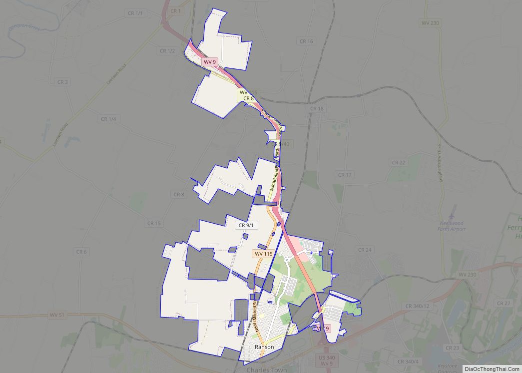
Ranson is a city in Jefferson County, West Virginia, United States. The population was 5,433 at the 2020 census. It is part of the northwestern fringes of the Washington metropolitan area.
| Name: | Ranson corporation |
|---|---|
| LSAD Code: | CN |
| LSAD Description: | corporation (suffix) |
| State: | West Virginia |
| County: | Jefferson County |
| Total Area: | 8.09 sq mi (20.96 km²) |
| Land Area: | 8.09 sq mi (20.95 km²) |
| Water Area: | 0.00 sq mi (0.00 km²) |
| Total Population: | 5,433 |
| Population Density: | 670/sq mi (260/km²) |
| ZIP code: | 25438 |
| Area code: | 304, 681 |
| FIPS code: | 5466988 |
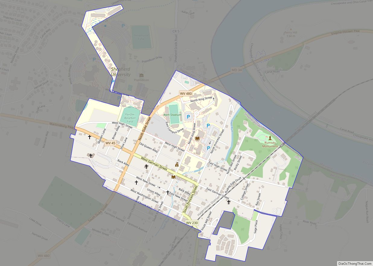
Online Interactive Map
Click on ![]() to view map in "full screen" mode.
to view map in "full screen" mode.
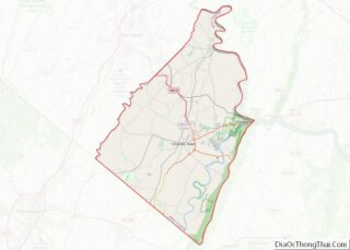
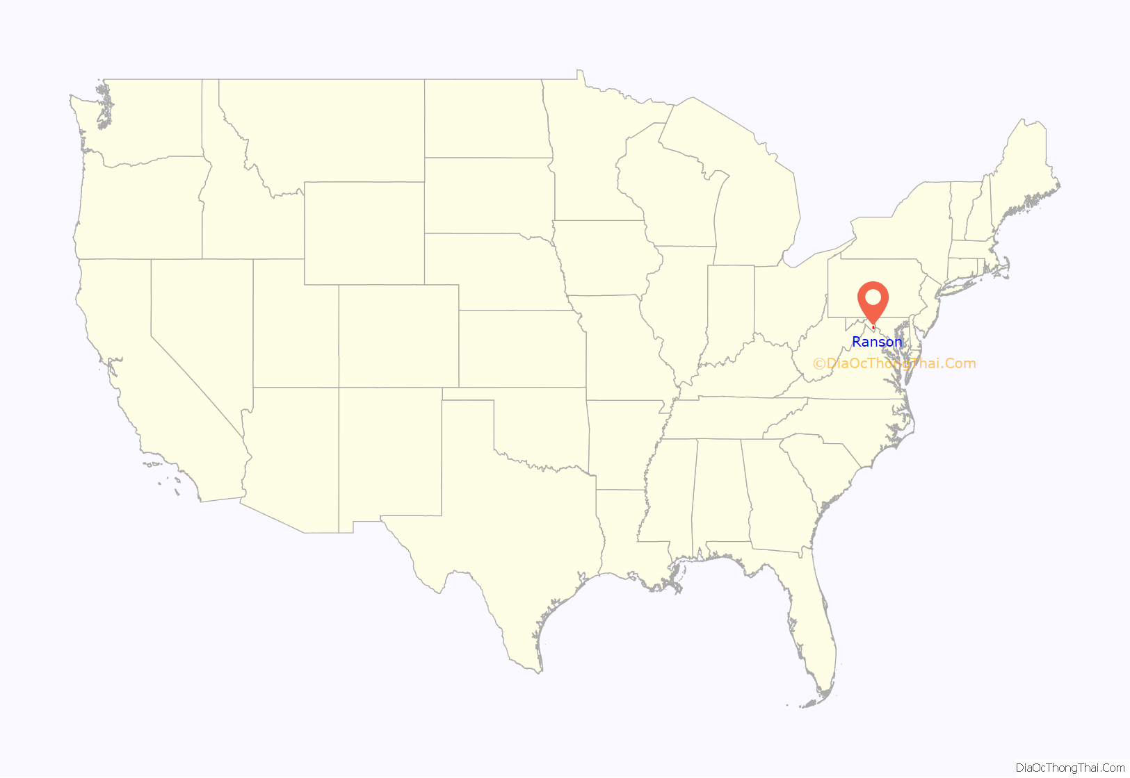
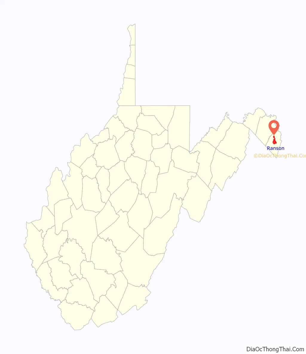
Ranson location map. Where is Ranson corporation?
History
The Charles Town Mining, Manufacturing, and Improvement Company played an instrumental role in creating this new town. In 1890, the company bought 850 acres (3.4 km) adjoining the western and northern corporate limits of Charles Town, and commissioned D.G. Howell, a civil engineer and architect, to lay out the town. The largest tract of land purchased was from the Ranson family. Ranson, in Jefferson County, West Virginia, was officially incorporated in 1910, when residents, by a vote of 67–2, decided to form their own town. It was named in honor of Dr. James Ranson, a dentist and farmer living in the area.
The early growth and development of Ranson reflects the late 19th century boom of the Shenandoah Valley and surrounding areas associated with the rise of the railroads, mining, and manufacturing. Early photographs of Ranson show the offices of the Charles Town Mining, Manufacturing & Improvement Company, and the Hotel Powhatan, along with a few residential structures nearby. The community grew north from Lancaster Circle. Some of the companies that located in Ranson early on included the Hotel Powhatan, the Goetz Saddlery, the Shenandoah Brass and Iron Works, the Elemer E. Beachley Saw and Planing Mill, the John Farrin Boiler and Machine Shop, and the Vulcan Road Machine Company.
One of the most significant structures to be constructed in Ranson was Hotel Powhatan. This four-story frame Queen Anne structure was located on 3.61 acres (14,600 m) on 3rd Avenue, between Mildred and Preston Streets. The building was designed by “Baldwin and Pennington, Architects”, and was built by local contractor Julius C. Holmes for $46,500. The hotel opened in October, 1891, but in 1900, it had become the Powhatan College for Young Women. In 1913, the college closed, and in 1915 it was re-opened by the Episcopal Diocese, under the direction of Maria Pendleton Duval, as St. Hilda’s Hall for Girls, a Christian school. In 1921, a dormitory was added on property across the street from the original building. This new structure was known as Peterkin Hall, and currently houses the offices of Amerigas. In 1931, with the stock market crash, the school closed, and was converted into apartments. The original hotel structure burned to the ground on December 11, 1937.
In 1936, the town of Ranson purchased the former Charles Town Mining, Manufacturing & Improvement Company office building from Mr. Getzendauner for $3,000 for the purposes of establishing a town hall. In 2003, the City began a multi-year renovation of the entire building, bringing it into the 21st century. By 1941, Ranson’s population was 1,171. Ranson continued to grow and by 1950, the population increased to 1,436. By 1970, the population had increased to 2,189. In 2000, Ranson had a population of 2,951. By 2010, the population was at 4,440, an increase of over 50% in just 10 years. In the 2000s, the City Council saw a need to grow its tax and employment base after the unfortunate closings of AB&C Corporation, Dixie Narco, and Badger Powhatan, and took advantage of the commercial development opportunities along the 4-lane stretch of State Route 9 north of Ranson. Thus, the Council annexed several thousand acres, which now host commercial, residential, and agricultural properties.
With the construction and opening of the new $425,000 Charles Town General Hospital on October 3, 1948, at the original location of the Hotel Powhatan on 3rd Avenue, Ranson began to develop a medical community, with many doctors opening offices in and around the hospital. On April 22, 1975, Jefferson Memorial Hospital (now Jefferson Medical Center) opened at its current facility on Preston Street and 4th Avenue, at a cost of $4.5 million. The current facility continues to serve the residents of Jefferson County. Just outside the limits of Ranson, but extremely important to the community’s economy, is Hollywood Casino at Charles Town Races. This facility provides employment to over 1200 individuals, and generates millions of dollars of taxes to Jefferson County and its municipalities for capital improvements. Thanks, in part, to these proceeds, which began flowing in 2004, the City has been able to purchase police cars and equipment, complete the Mildred Street streetscape project in 2007, which added sidewalks, curb, gutter and benches, renovate and construct parks, and renovate City Hall.
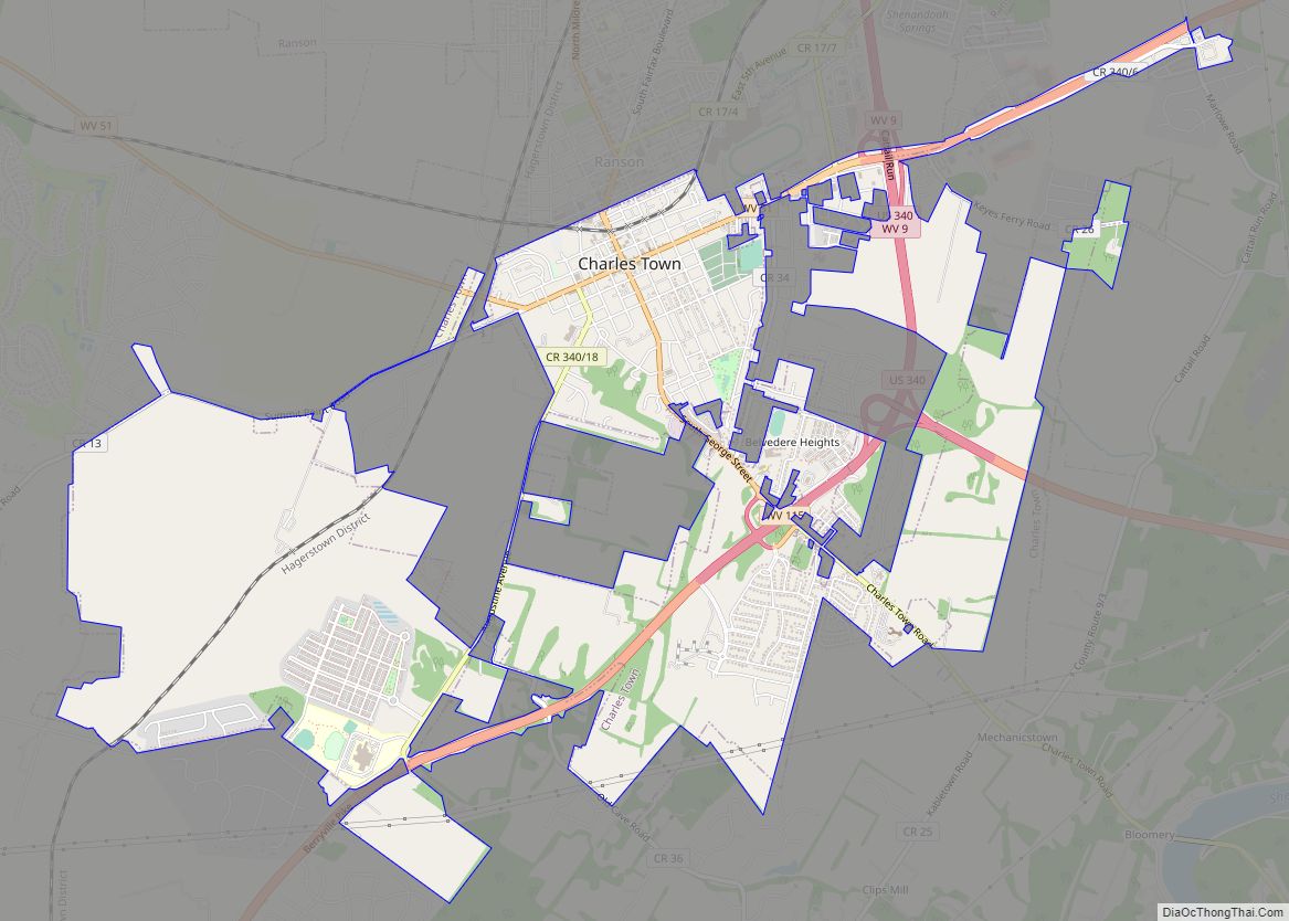
Ranson Road Map
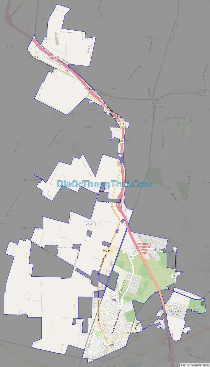
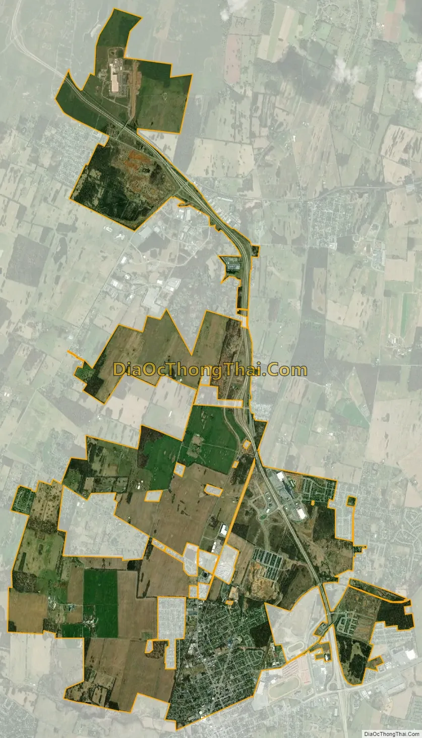
Ranson city Satellite Map
Geography
Ranson is located at 39°17′55″N 77°51′40″W / 39.29861°N 77.86111°W / 39.29861; -77.86111 (39.298578, -77.861169).
According to the United States Census Bureau, the corporation has a total area of 8.05 square miles (20.85 km), all land. Since 2004, however, the City of Ranson has annexed approximately 5,000 acres (20 km) of land into the corporate limits, expanding the total land area of the City to approximately 9 square miles (23 km).
See also
Map of West Virginia State and its subdivision:- Barbour
- Berkeley
- Boone
- Braxton
- Brooke
- Cabell
- Calhoun
- Clay
- Doddridge
- Fayette
- Gilmer
- Grant
- Greenbrier
- Hampshire
- Hancock
- Hardy
- Harrison
- Jackson
- Jefferson
- Kanawha
- Lewis
- Lincoln
- Logan
- Marion
- Marshall
- Mason
- McDowell
- Mercer
- Mineral
- Mingo
- Monongalia
- Monroe
- Morgan
- Nicholas
- Ohio
- Pendleton
- Pleasants
- Pocahontas
- Preston
- Putnam
- Raleigh
- Randolph
- Ritchie
- Roane
- Summers
- Taylor
- Tucker
- Tyler
- Upshur
- Wayne
- Webster
- Wetzel
- Wirt
- Wood
- Wyoming
- Alabama
- Alaska
- Arizona
- Arkansas
- California
- Colorado
- Connecticut
- Delaware
- District of Columbia
- Florida
- Georgia
- Hawaii
- Idaho
- Illinois
- Indiana
- Iowa
- Kansas
- Kentucky
- Louisiana
- Maine
- Maryland
- Massachusetts
- Michigan
- Minnesota
- Mississippi
- Missouri
- Montana
- Nebraska
- Nevada
- New Hampshire
- New Jersey
- New Mexico
- New York
- North Carolina
- North Dakota
- Ohio
- Oklahoma
- Oregon
- Pennsylvania
- Rhode Island
- South Carolina
- South Dakota
- Tennessee
- Texas
- Utah
- Vermont
- Virginia
- Washington
- West Virginia
- Wisconsin
- Wyoming