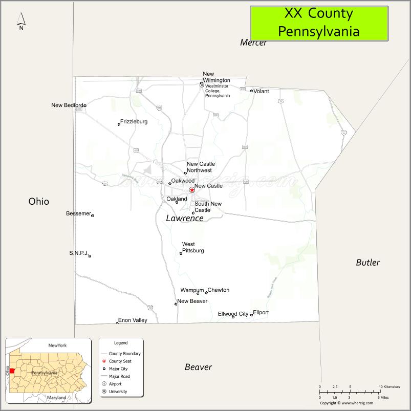
Lawrence County is a county in the Commonwealth of Pennsylvania. As of the 2020 census, the population was 86,070. The county seat is New Castle.
Lawrence County comprises the entire New Castle, PA Micropolitan Statistical Area, which is also included in the larger Pittsburgh-New Castle-Weirton, PA-WV-OH Combined Statistical Area.
| Name: | Lawrence County |
|---|---|
| FIPS code: | 42-073 |
| State: | Pennsylvania |
| Founded: | March 20, 1849 |
| Named for: | USS Lawrence |
| Seat: | New Castle |
| Largest city: | New Castle |
| Total Area: | 363 sq mi (940 km²) |
| Land Area: | 358 sq mi (930 km²) |
| Total Population: | 86,070 |
| Population Density: | 240/sq mi (90/km²) |
| Time zone: | UTC−5 (Eastern) |
| Summer Time Zone (DST): | UTC−4 (EDT) |
| Website: | www.co.lawrence.pa.us |
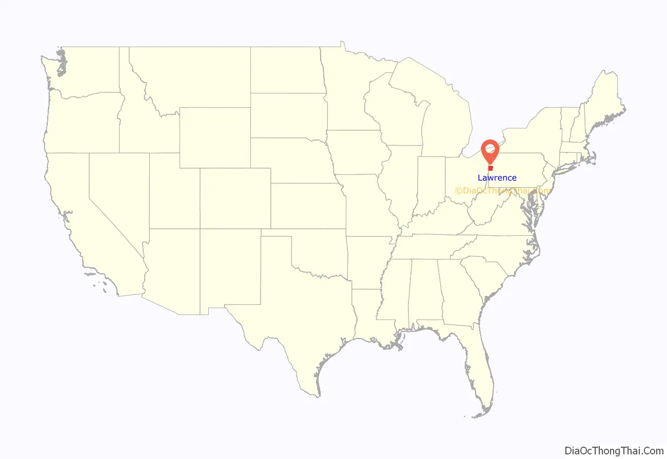
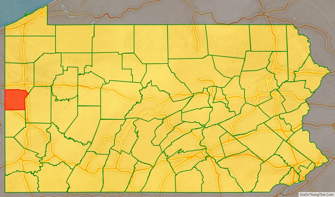
Lawrence County location map. Where is Lawrence County?
History
Lawrence County was created on March 20, 1849, from parts of Beaver and Mercer counties due to the rapid growth of New Castle, which was primarily in Mercer County but was rapidly expanding into Beaver County. The former borders between Beaver and Mercer Counties are still evident in Lawrence County today, as the northern borders of North Beaver Township, Shenango Township, and Slippery Rock Township with (respectively) the southern borders of Mahoning Township, Hickory Township, and Scott Township make up the former boundaries between Beaver and Mercer Counties. In addition, County Line Road in New Castle where the Lawrence County Courthouse is located also marks the former boundaries.
The county was named after the flagship of Commodore Oliver Hazard Perry, the USS Lawrence, which was disabled in the 10 September 1813 Battle of Lake Erie during the War of 1812. The ship’s complement included local raw recruits. That niagara-class brig (more correctly: snow) was itself a namesake, of Perry’s friend and naval officer James Lawrence, who died during the War of 1812.
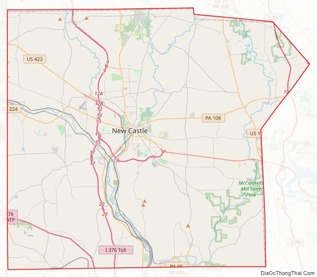
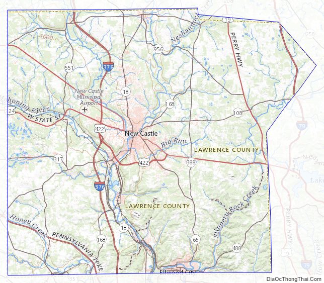
Lawrence County Road Map
Geography
According to the U.S. Census Bureau, the county has a total area of 363 square miles (940 km), of which 358 square miles (930 km) is land and 4.5 square miles (12 km) (1.3%) is water. Major waterways are the Shenango River, Neshannock Creek and the Mahoning River which form the Beaver River. Also, the Slippery Rock Creek and Connoquenessing Creak empty into the Beaver River. It has a humid continental climate (Dfa/Dfb) and average monthly temperatures in New Castle range from 27.7 °F in January to 72.2 °F in July. [1]
Adjacent counties
- Mercer County (north)
- Butler County (east)
- Beaver County (south)
- Columbiana County, Ohio (southwest)
- Mahoning County, Ohio (west)
Lawrence County Topographic Map
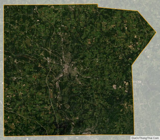
Lawrence County Satellite Map
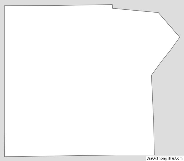
Lawrence County Outline Map
See also
Map of Pennsylvania State and its subdivision:- Adams
- Allegheny
- Armstrong
- Beaver
- Bedford
- Berks
- Blair
- Bradford
- Bucks
- Butler
- Cambria
- Cameron
- Carbon
- Centre
- Chester
- Clarion
- Clearfield
- Clinton
- Columbia
- Crawford
- Cumberland
- Dauphin
- Delaware
- Elk
- Erie
- Fayette
- Forest
- Franklin
- Fulton
- Greene
- Huntingdon
- Indiana
- Jefferson
- Juniata
- Lackawanna
- Lancaster
- Lawrence
- Lebanon
- Lehigh
- Luzerne
- Lycoming
- Mc Kean
- Mercer
- Mifflin
- Monroe
- Montgomery
- Montour
- Northampton
- Northumberland
- Perry
- Philadelphia
- Pike
- Potter
- Schuylkill
- Snyder
- Somerset
- Sullivan
- Susquehanna
- Tioga
- Union
- Venango
- Warren
- Washington
- Wayne
- Westmoreland
- Wyoming
- York
- Alabama
- Alaska
- Arizona
- Arkansas
- California
- Colorado
- Connecticut
- Delaware
- District of Columbia
- Florida
- Georgia
- Hawaii
- Idaho
- Illinois
- Indiana
- Iowa
- Kansas
- Kentucky
- Louisiana
- Maine
- Maryland
- Massachusetts
- Michigan
- Minnesota
- Mississippi
- Missouri
- Montana
- Nebraska
- Nevada
- New Hampshire
- New Jersey
- New Mexico
- New York
- North Carolina
- North Dakota
- Ohio
- Oklahoma
- Oregon
- Pennsylvania
- Rhode Island
- South Carolina
- South Dakota
- Tennessee
- Texas
- Utah
- Vermont
- Virginia
- Washington
- West Virginia
- Wisconsin
- Wyoming