Fountain Lake is a city in Garland County, Arkansas, United States. It is part of the Hot Springs Metropolitan Statistical Area. The population was 503 at the 2010 census.
| Name: | Fountain Lake town |
|---|---|
| LSAD Code: | 43 |
| LSAD Description: | town (suffix) |
| State: | Arkansas |
| County: | Garland County |
| Elevation: | 591 ft (180 m) |
| Total Area: | 4.25 sq mi (11.01 km²) |
| Land Area: | 4.25 sq mi (11.01 km²) |
| Water Area: | 0.00 sq mi (0.00 km²) |
| Total Population: | 475 |
| Population Density: | 111.79/sq mi (43.16/km²) |
| ZIP code: | 71901 |
| Area code: | 501 |
| FIPS code: | 0524700 |
| GNISfeature ID: | 0057768 |
Online Interactive Map
Click on ![]() to view map in "full screen" mode.
to view map in "full screen" mode.
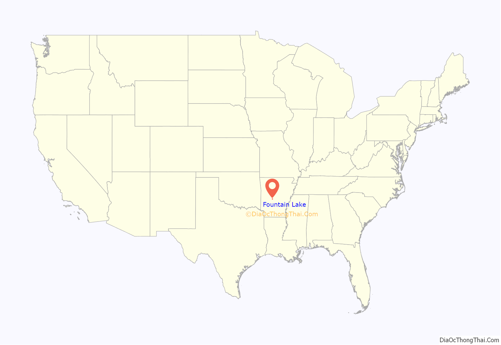
Fountain Lake location map. Where is Fountain Lake town?
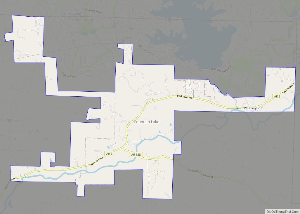
Fountain Lake Road Map
Fountain Lake city Satellite Map
Geography
Fountain Lake is located in eastern Garland County at 34°37′03″N 92°55′08″W / 34.617439°N 92.918914°W / 34.617439; -92.918914. According to the United States Census Bureau, the town has a total area of 3.9 square miles (10.1 km), all land. The town is 12 miles (19 km) northeast of downtown Hot Springs and is bordered to the north by unincorporated Hot Springs Village.
The community is named for a former estate on the southern edge of the area. The location is directly off Highway 7, across from Fountain Lake Center (a strip mall), and can be identified by a large stucco entrance gate and a long tree-lined drive. The property contains remnants of a large home, barn, and other out-buildings. A small lake with an ornamental fountain are intact. The property is privately owned.
The Fountain Lake Center, historical Fountain Lake estate, and Fountain Lake School are not actually in the town limits of Fountain Lake. The town limits include approximately 3 miles (5 km) (and community roads attached) along Highway 5 and 2 miles (3 km) along Highway 128. All other associated property outside these limits is part of Garland County, not the town of Fountain Lake.
See also
Map of Arkansas State and its subdivision:- Arkansas
- Ashley
- Baxter
- Benton
- Boone
- Bradley
- Calhoun
- Carroll
- Chicot
- Clark
- Clay
- Cleburne
- Cleveland
- Columbia
- Conway
- Craighead
- Crawford
- Crittenden
- Cross
- Dallas
- Desha
- Drew
- Faulkner
- Franklin
- Fulton
- Garland
- Grant
- Greene
- Hempstead
- Hot Spring
- Howard
- Independence
- Izard
- Jackson
- Jefferson
- Johnson
- Lafayette
- Lawrence
- Lee
- Lincoln
- Little River
- Logan
- Lonoke
- Madison
- Marion
- Miller
- Mississippi
- Monroe
- Montgomery
- Nevada
- Newton
- Ouachita
- Perry
- Phillips
- Pike
- Poinsett
- Polk
- Pope
- Prairie
- Pulaski
- Randolph
- Saint Francis
- Saline
- Scott
- Searcy
- Sebastian
- Sevier
- Sharp
- Stone
- Union
- Van Buren
- Washington
- White
- Woodruff
- Yell
- Alabama
- Alaska
- Arizona
- Arkansas
- California
- Colorado
- Connecticut
- Delaware
- District of Columbia
- Florida
- Georgia
- Hawaii
- Idaho
- Illinois
- Indiana
- Iowa
- Kansas
- Kentucky
- Louisiana
- Maine
- Maryland
- Massachusetts
- Michigan
- Minnesota
- Mississippi
- Missouri
- Montana
- Nebraska
- Nevada
- New Hampshire
- New Jersey
- New Mexico
- New York
- North Carolina
- North Dakota
- Ohio
- Oklahoma
- Oregon
- Pennsylvania
- Rhode Island
- South Carolina
- South Dakota
- Tennessee
- Texas
- Utah
- Vermont
- Virginia
- Washington
- West Virginia
- Wisconsin
- Wyoming
