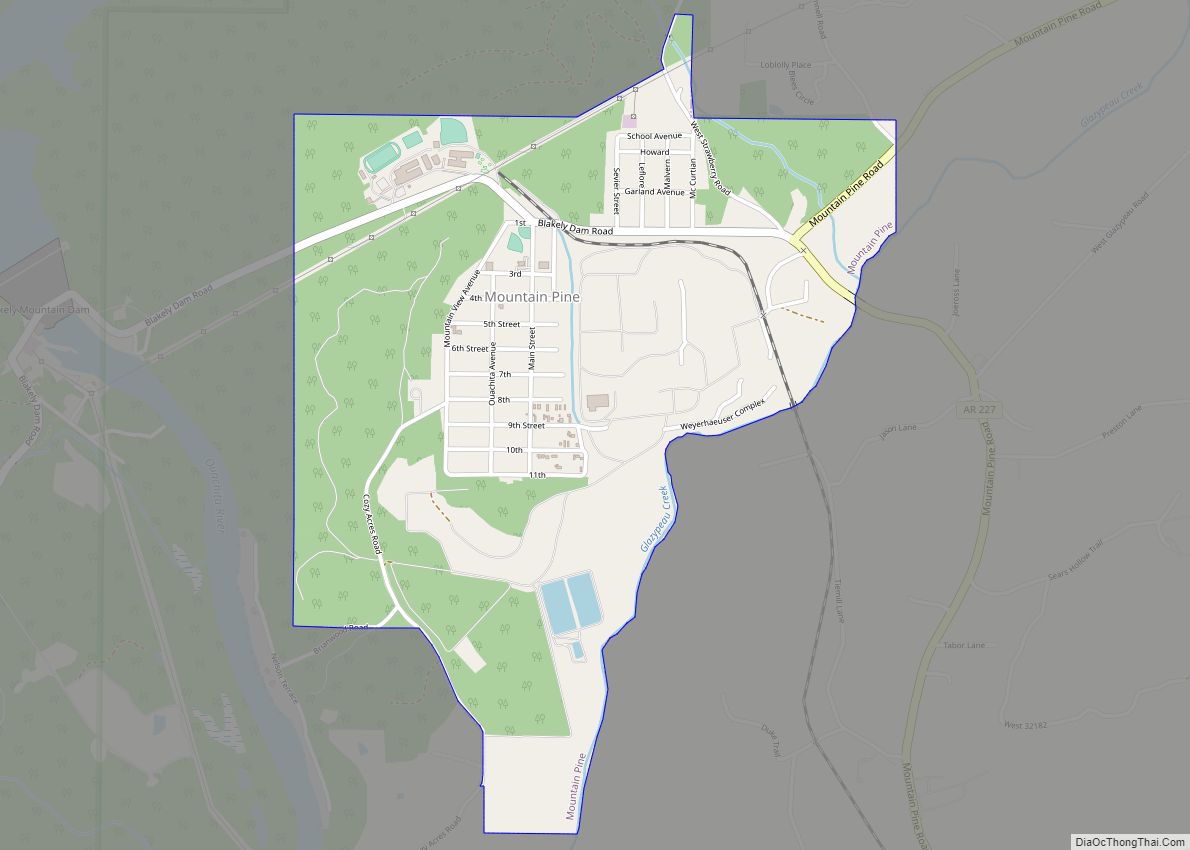
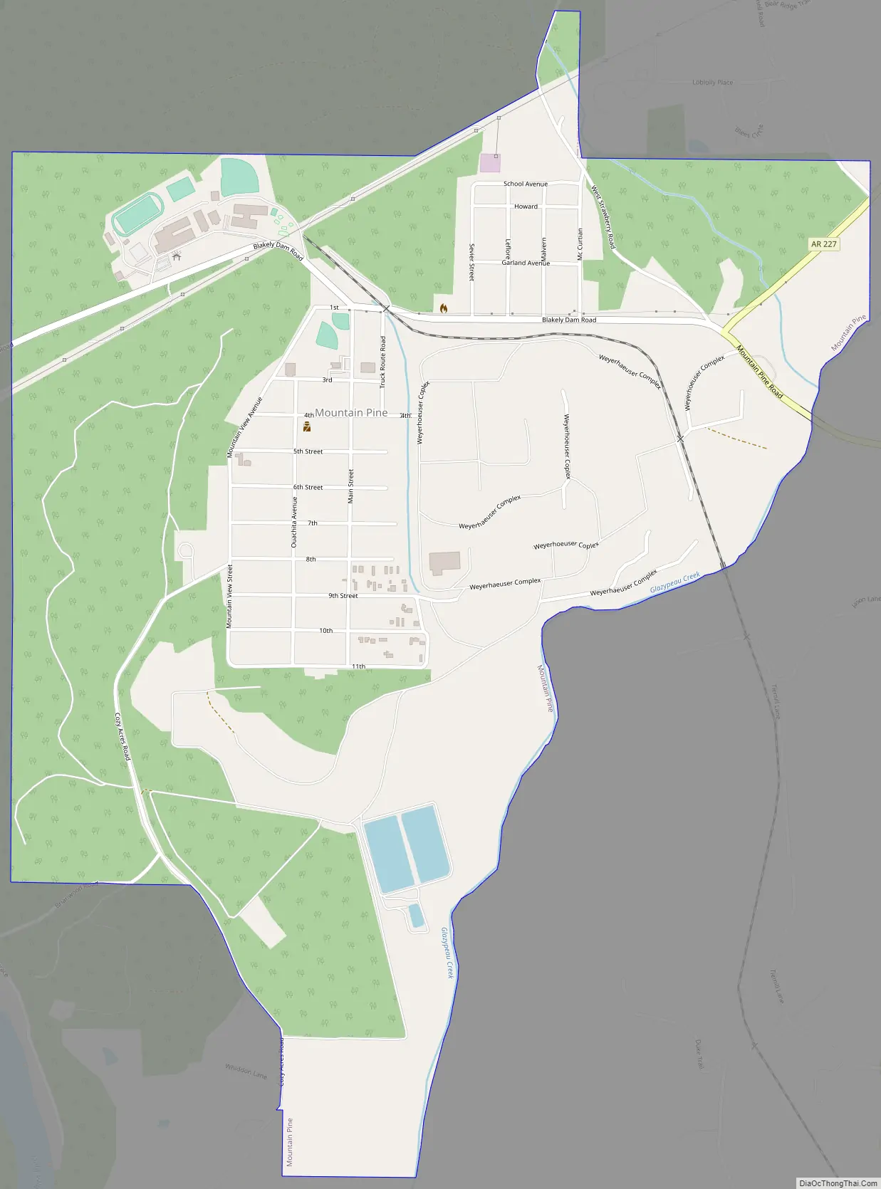
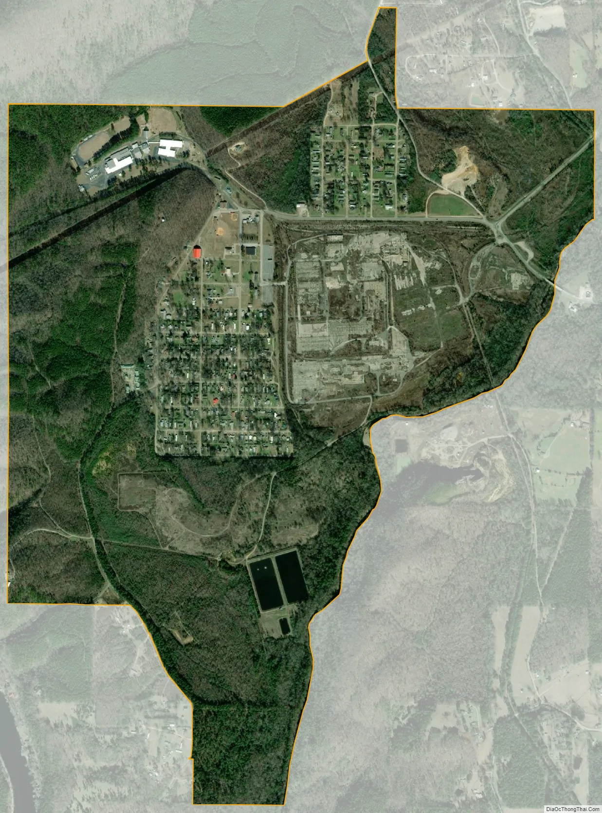
Mountain Pine is a city in Garland County, Arkansas, United States. It is part of the Hot Springs Metropolitan Statistical Area. The population was 770 at the 2010 United States Census. It is located immediately southeast of Lake Ouachita below the Blakely Mountain Dam. The city consists of five defined neighborhoods, Pinewood (north), South Mountain Pine, a business district (city hall, bank, post office, store), Cozy Acres (southwest) and Mountain View/Timberland area.
Mountain Pine was founded as a company town in the late 1920s by Dierks Lumber and Coal Company, which operated a vast lumber mill on the town’s east side. The mill was closed in 2006 by then-owners Weyerhaeuser, and later dismantled.
| Name: | Mountain Pine city |
|---|---|
| LSAD Code: | 25 |
| LSAD Description: | city (suffix) |
| State: | Arkansas |
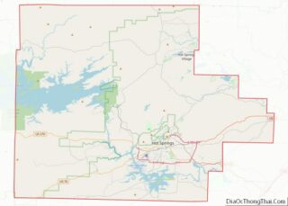
| County: | Garland County |
| Elevation: | 472 ft (144 m) |
| Total Area: | 1.67 sq mi (4.34 km²) |
| Land Area: | 1.66 sq mi (4.30 km²) |
| Water Area: | 0.01 sq mi (0.03 km²) |
| Total Population: | 585 |
| Population Density: | 352.20/sq mi (135.99/km²) |
| ZIP code: | 71956 |
| Area code: | 501 |
| FIPS code: | 0547450 |
| GNISfeature ID: | 0072790 |
Online Interactive Map
Click on ![]() to view map in "full screen" mode.
to view map in "full screen" mode.
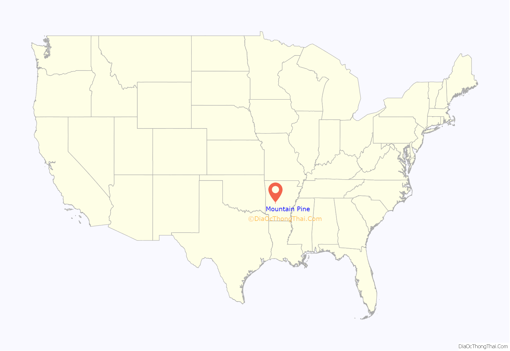
Mountain Pine location map. Where is Mountain Pine city?

Mountain Pine Road Map
Mountain Pine city Satellite Map
Geography
Mountain Pine is located near the center of Garland County at 34°34′21″N 93°10′22″W / 34.57250°N 93.17278°W / 34.57250; -93.17278 (34.572375, -93.172806). It is 11 miles (18 km) northwest of Hot Springs.
According to the United States Census Bureau, Mountain Pine has a total area of 1.8 square miles (4.6 km), of which 0.01 square miles (0.03 km), or 0.75%, is water.
See also
Map of Arkansas State and its subdivision:- Arkansas
- Ashley
- Baxter
- Benton
- Boone
- Bradley
- Calhoun
- Carroll
- Chicot
- Clark
- Clay
- Cleburne
- Cleveland
- Columbia
- Conway
- Craighead
- Crawford
- Crittenden
- Cross
- Dallas
- Desha
- Drew
- Faulkner
- Franklin
- Fulton
- Garland
- Grant
- Greene
- Hempstead
- Hot Spring
- Howard
- Independence
- Izard
- Jackson
- Jefferson
- Johnson
- Lafayette
- Lawrence
- Lee
- Lincoln
- Little River
- Logan
- Lonoke
- Madison
- Marion
- Miller
- Mississippi
- Monroe
- Montgomery
- Nevada
- Newton
- Ouachita
- Perry
- Phillips
- Pike
- Poinsett
- Polk
- Pope
- Prairie
- Pulaski
- Randolph
- Saint Francis
- Saline
- Scott
- Searcy
- Sebastian
- Sevier
- Sharp
- Stone
- Union
- Van Buren
- Washington
- White
- Woodruff
- Yell
- Alabama
- Alaska
- Arizona
- Arkansas
- California
- Colorado
- Connecticut
- Delaware
- District of Columbia
- Florida
- Georgia
- Hawaii
- Idaho
- Illinois
- Indiana
- Iowa
- Kansas
- Kentucky
- Louisiana
- Maine
- Maryland
- Massachusetts
- Michigan
- Minnesota
- Mississippi
- Missouri
- Montana
- Nebraska
- Nevada
- New Hampshire
- New Jersey
- New Mexico
- New York
- North Carolina
- North Dakota
- Ohio
- Oklahoma
- Oregon
- Pennsylvania
- Rhode Island
- South Carolina
- South Dakota
- Tennessee
- Texas
- Utah
- Vermont
- Virginia
- Washington
- West Virginia
- Wisconsin
- Wyoming