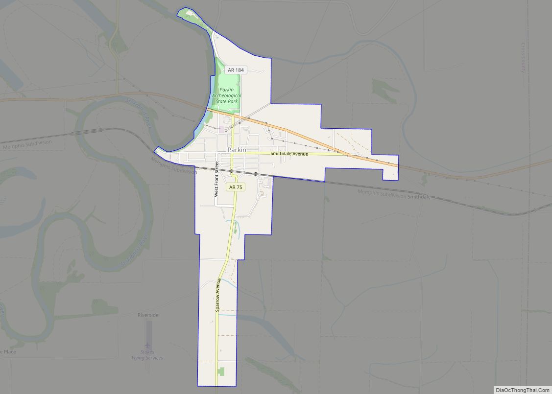
Parkin is a city in Cross County, Arkansas, United States, along the St. Francis River. The population was 1,105 at the 2010 census, down from 1,602 in 2000. Due to the recent population loss, a large segment of the downtown area has many abandoned and boarded-up buildings. The town has recently become known as a speed trap.
| Name: | Parkin city |
|---|---|
| LSAD Code: | 25 |
| LSAD Description: | city (suffix) |
| State: | Arkansas |
| County: | Cross County |
| Elevation: | 207 ft (63 m) |
| Total Area: | 2.59 sq mi (6.70 km²) |
| Land Area: | 2.56 sq mi (6.62 km²) |
| Water Area: | 0.03 sq mi (0.07 km²) |
| Total Population: | 794 |
| Population Density: | 310.40/sq mi (119.87/km²) |
| ZIP code: | 72373 |
| Area code: | 870 |
| FIPS code: | 0553600 |
| GNISfeature ID: | 0058329 |
Online Interactive Map
Click on ![]() to view map in "full screen" mode.
to view map in "full screen" mode.
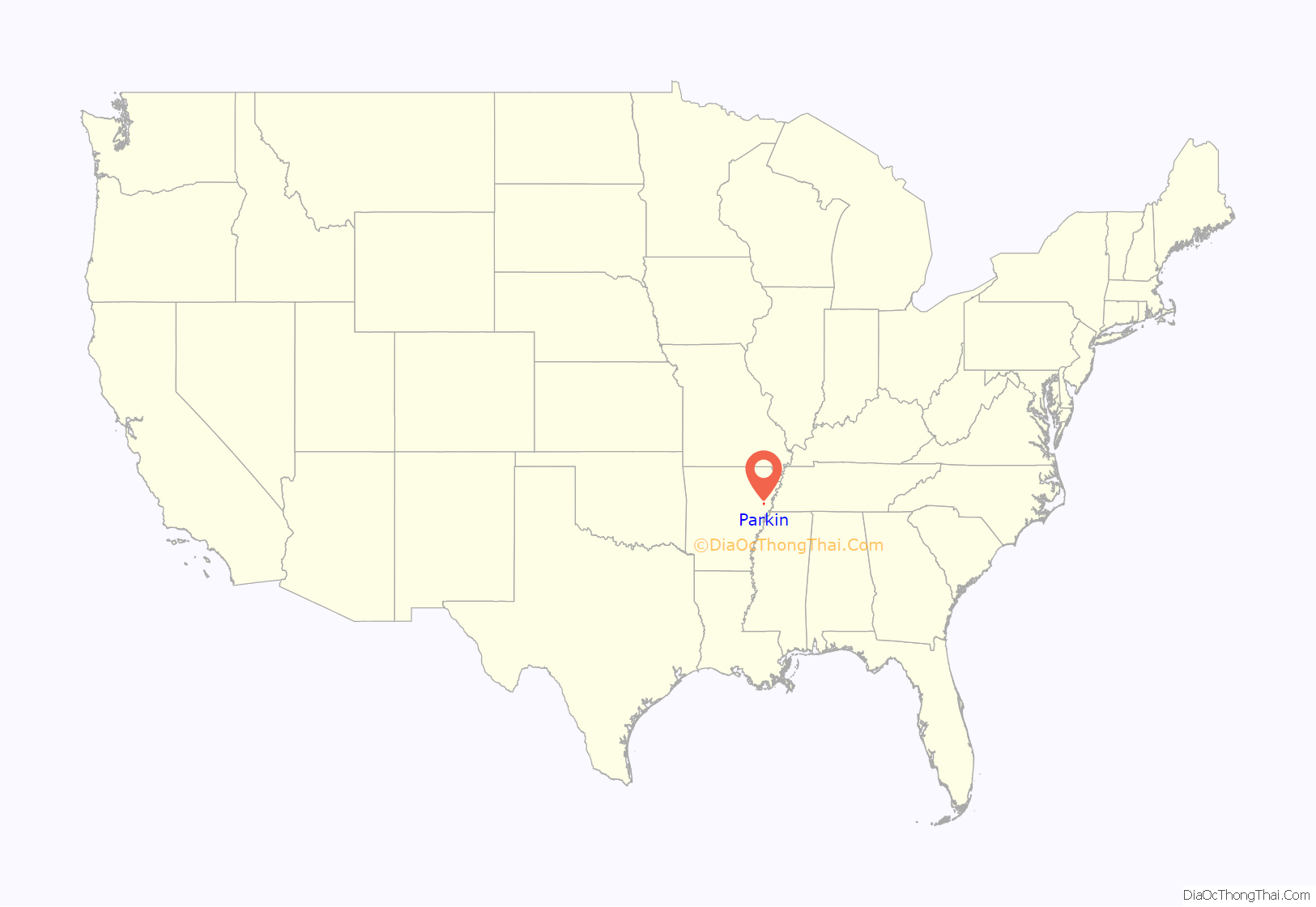
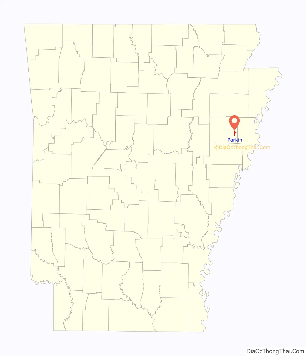
Parkin location map. Where is Parkin city?
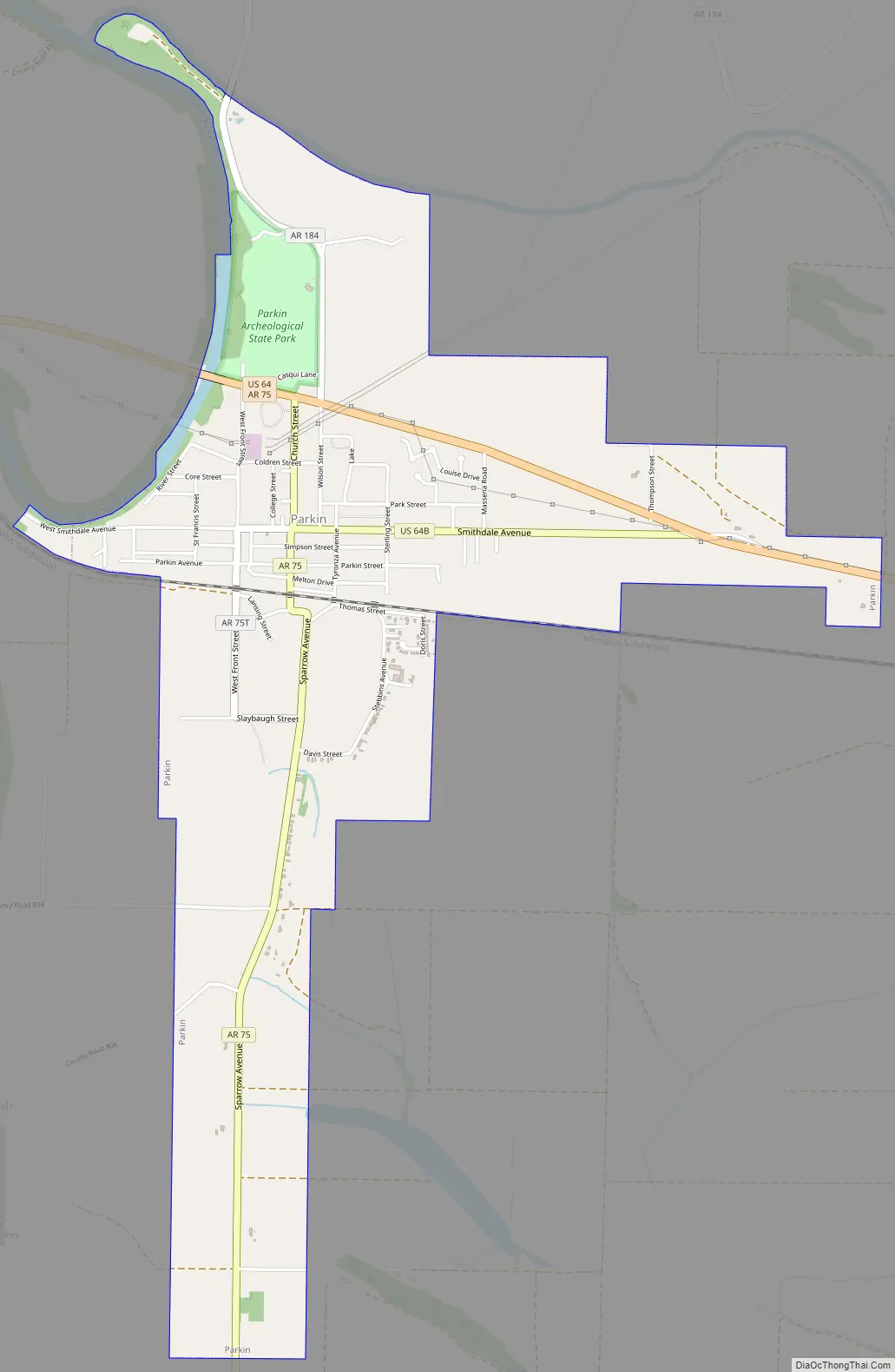
Parkin Road Map
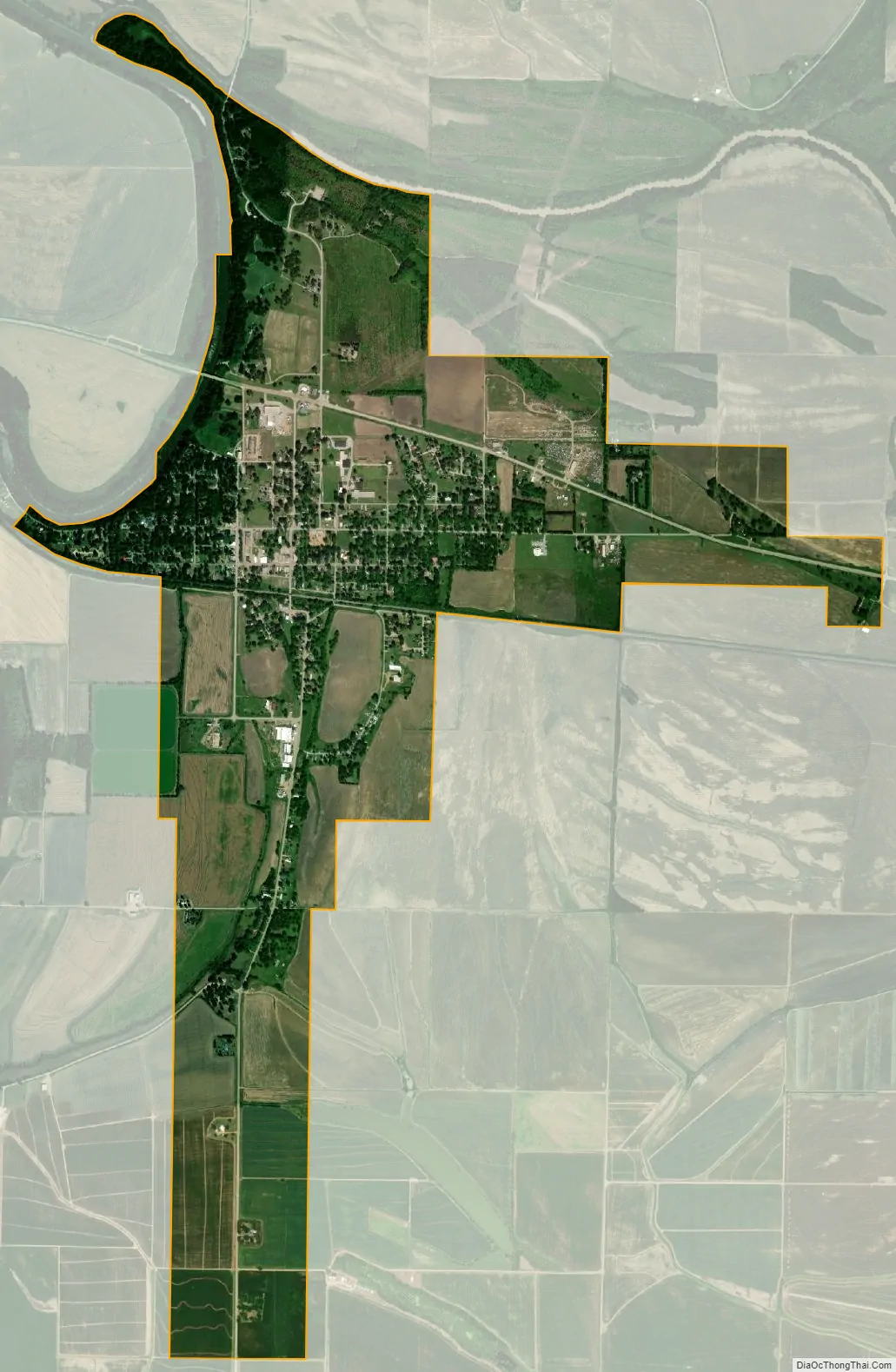
Parkin city Satellite Map
Geography
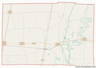
Parkin is located in eastern Cross County at 35°15′55″N 90°33′18″W / 35.26528°N 90.55500°W / 35.26528; -90.55500 (35.265392, -90.554880), on the east bank of the St. Francis River just south of the mouth of the Tyronza River. U.S. Route 64 passes through the community, leading east 5 miles (8 km) to Earle and west 14 miles (23 km) to Wynne, the Cross County seat.
According to the United States Census Bureau, the city has a total area of 2.5 square miles (6.6 km), all land.
See also
Map of Arkansas State and its subdivision:- Arkansas
- Ashley
- Baxter
- Benton
- Boone
- Bradley
- Calhoun
- Carroll
- Chicot
- Clark
- Clay
- Cleburne
- Cleveland
- Columbia
- Conway
- Craighead
- Crawford
- Crittenden
- Cross
- Dallas
- Desha
- Drew
- Faulkner
- Franklin
- Fulton
- Garland
- Grant
- Greene
- Hempstead
- Hot Spring
- Howard
- Independence
- Izard
- Jackson
- Jefferson
- Johnson
- Lafayette
- Lawrence
- Lee
- Lincoln
- Little River
- Logan
- Lonoke
- Madison
- Marion
- Miller
- Mississippi
- Monroe
- Montgomery
- Nevada
- Newton
- Ouachita
- Perry
- Phillips
- Pike
- Poinsett
- Polk
- Pope
- Prairie
- Pulaski
- Randolph
- Saint Francis
- Saline
- Scott
- Searcy
- Sebastian
- Sevier
- Sharp
- Stone
- Union
- Van Buren
- Washington
- White
- Woodruff
- Yell
- Alabama
- Alaska
- Arizona
- Arkansas
- California
- Colorado
- Connecticut
- Delaware
- District of Columbia
- Florida
- Georgia
- Hawaii
- Idaho
- Illinois
- Indiana
- Iowa
- Kansas
- Kentucky
- Louisiana
- Maine
- Maryland
- Massachusetts
- Michigan
- Minnesota
- Mississippi
- Missouri
- Montana
- Nebraska
- Nevada
- New Hampshire
- New Jersey
- New Mexico
- New York
- North Carolina
- North Dakota
- Ohio
- Oklahoma
- Oregon
- Pennsylvania
- Rhode Island
- South Carolina
- South Dakota
- Tennessee
- Texas
- Utah
- Vermont
- Virginia
- Washington
- West Virginia
- Wisconsin
- Wyoming