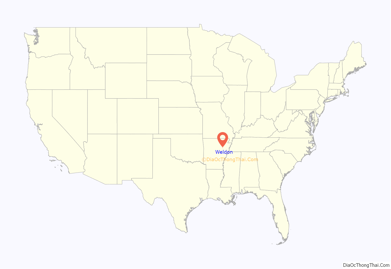
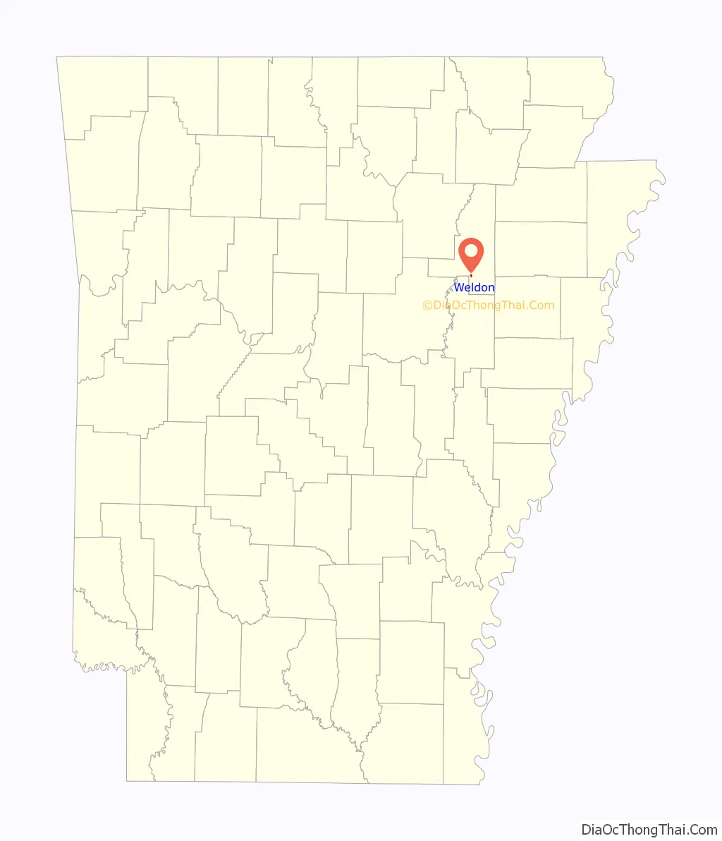
Weldon is a town in Jackson County, Arkansas, United States. The population was 75 at the 2010 census.
| Name: | Weldon town |
|---|---|
| LSAD Code: | 43 |
| LSAD Description: | town (suffix) |
| State: | Arkansas |
| County: | Jackson County |
| Elevation: | 223 ft (68 m) |
| Total Area: | 0.24 sq mi (0.63 km²) |
| Land Area: | 0.24 sq mi (0.63 km²) |
| Water Area: | 0.00 sq mi (0.00 km²) |
| Total Population: | 57 |
| Population Density: | 233.61/sq mi (90.12/km²) |
| ZIP code: | 72112 |
| Area code: | 870 |
| FIPS code: | 0574000 |
| GNISfeature ID: | 2406854 |
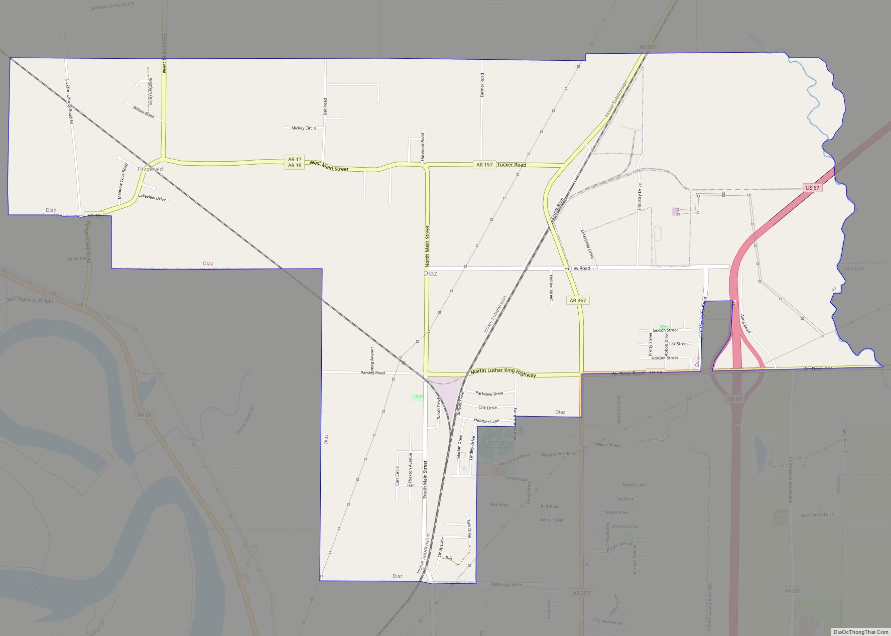
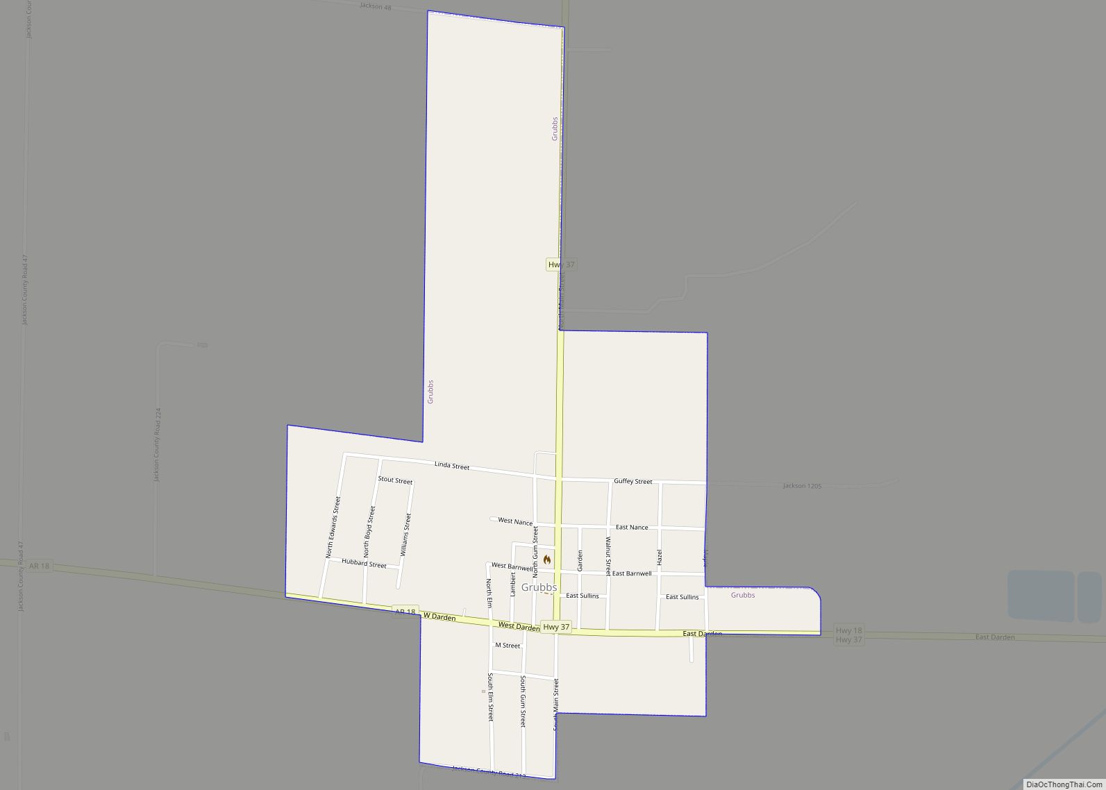
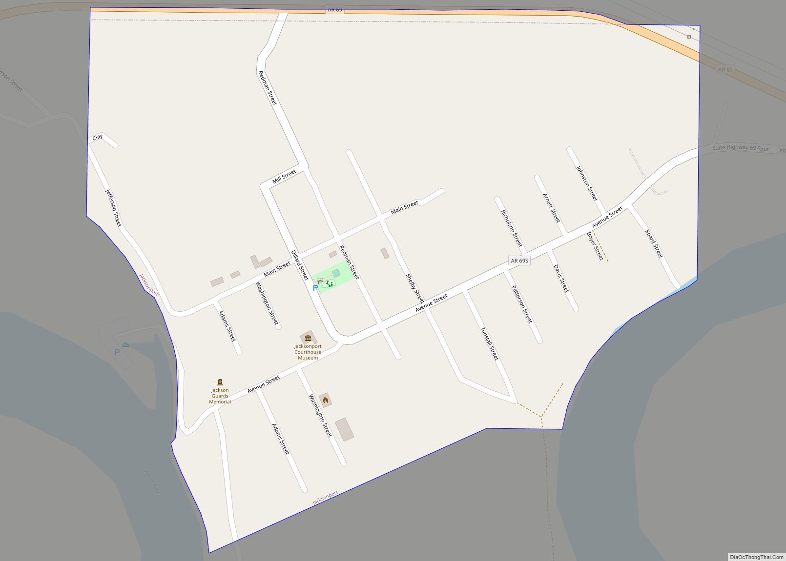
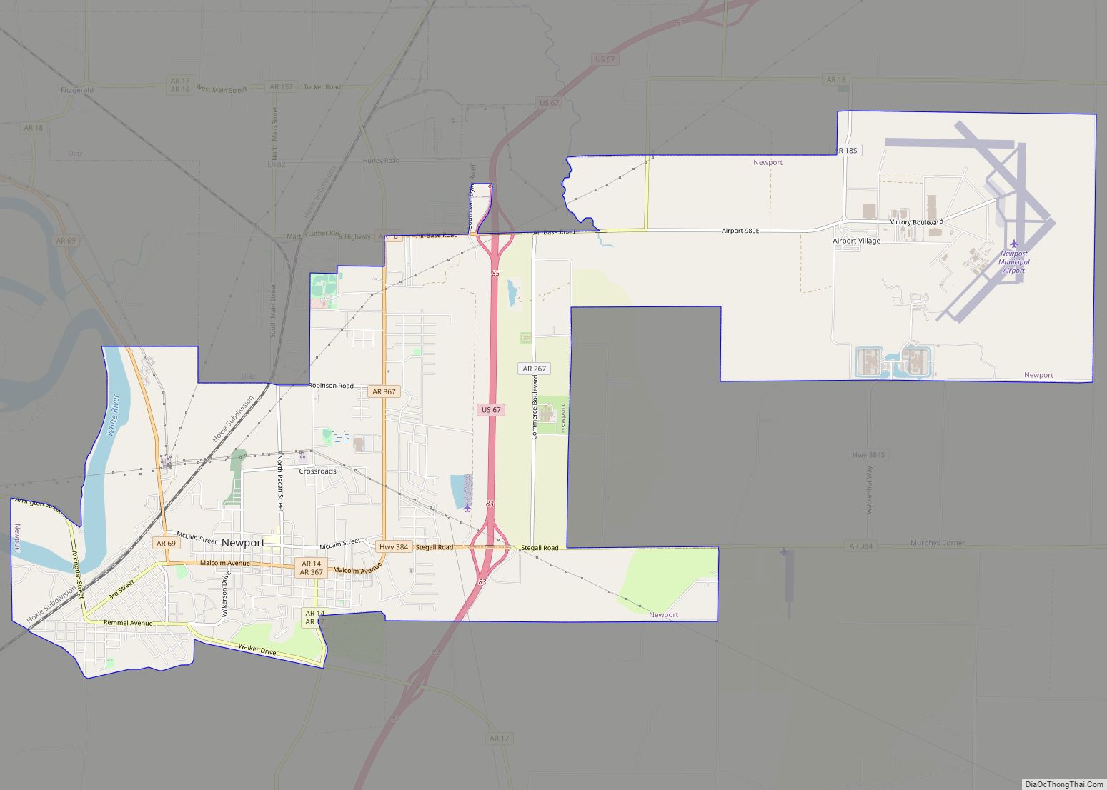
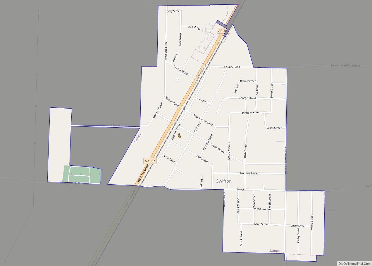
Online Interactive Map
Click on ![]() to view map in "full screen" mode.
to view map in "full screen" mode.
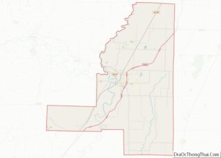
Weldon location map. Where is Weldon town?
History
Weldon was originally a station on the Batesville & Brinkley Railroad, a narrow-gauge line which operated between Brinkley and Newport, Arkansas. The railroad eventually became part of the Rock Island Railroad and was abandoned in 1940. The Weldon Rock Island depot survived another 50 years after the railroad’s demise, and on June 11, 1992 was added to the National Register of Historic Places. The depot eventually succumbed to old age and neglect and the property was delisted from the Register on September 25, 2012.
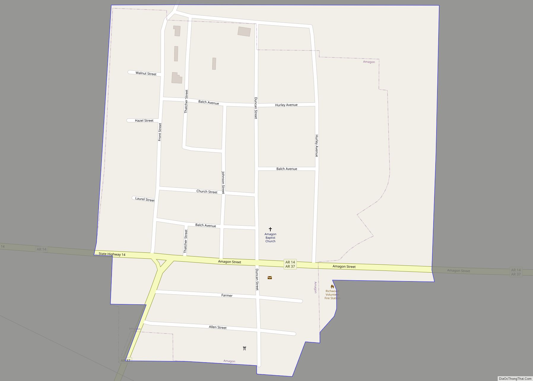
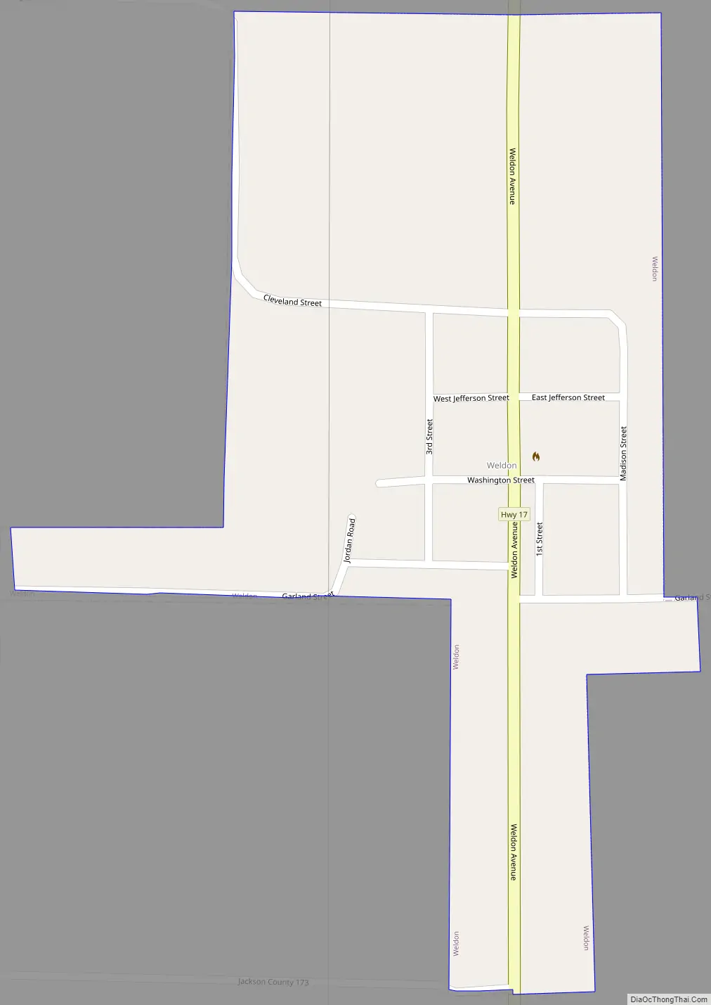
Weldon Road Map
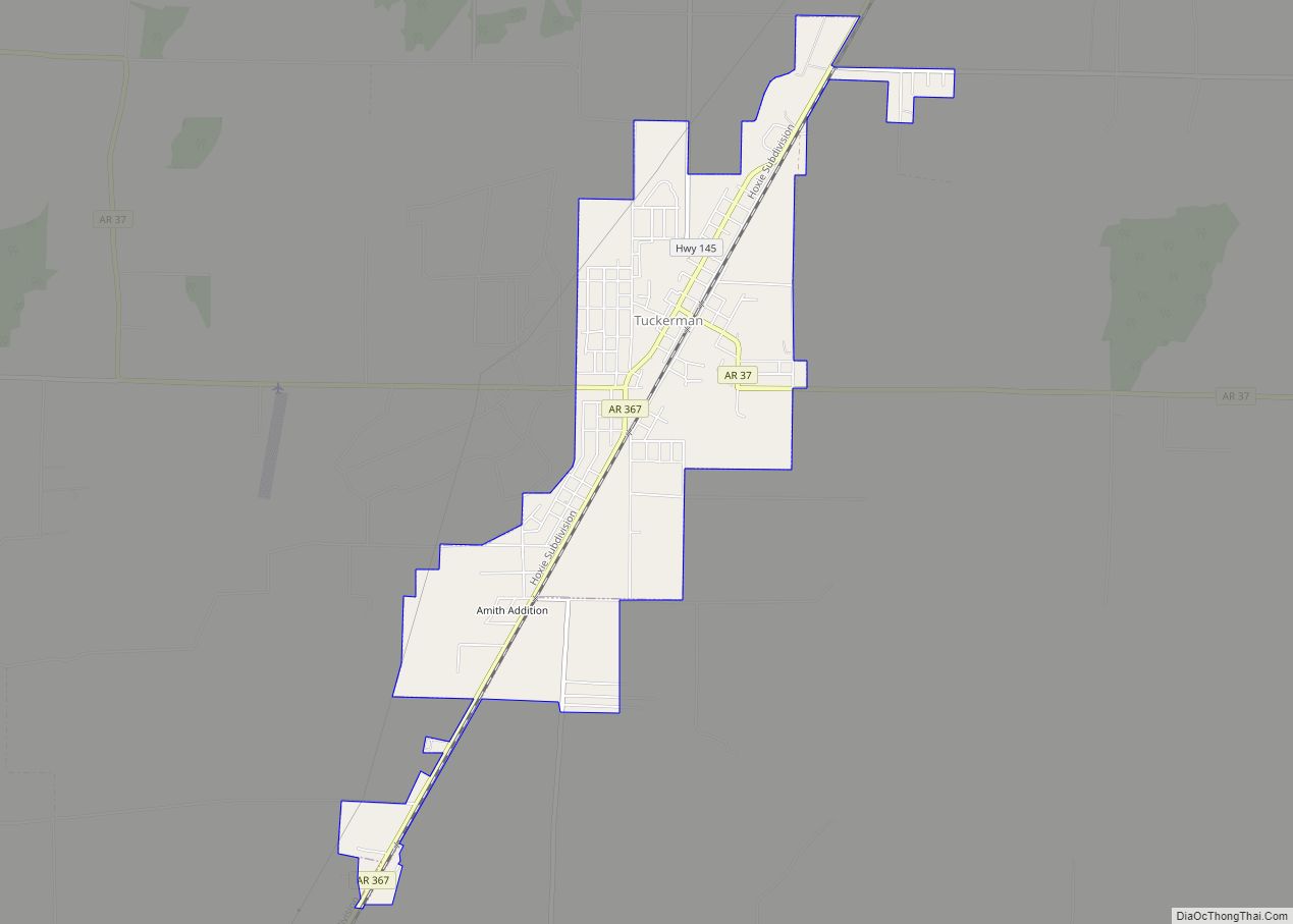
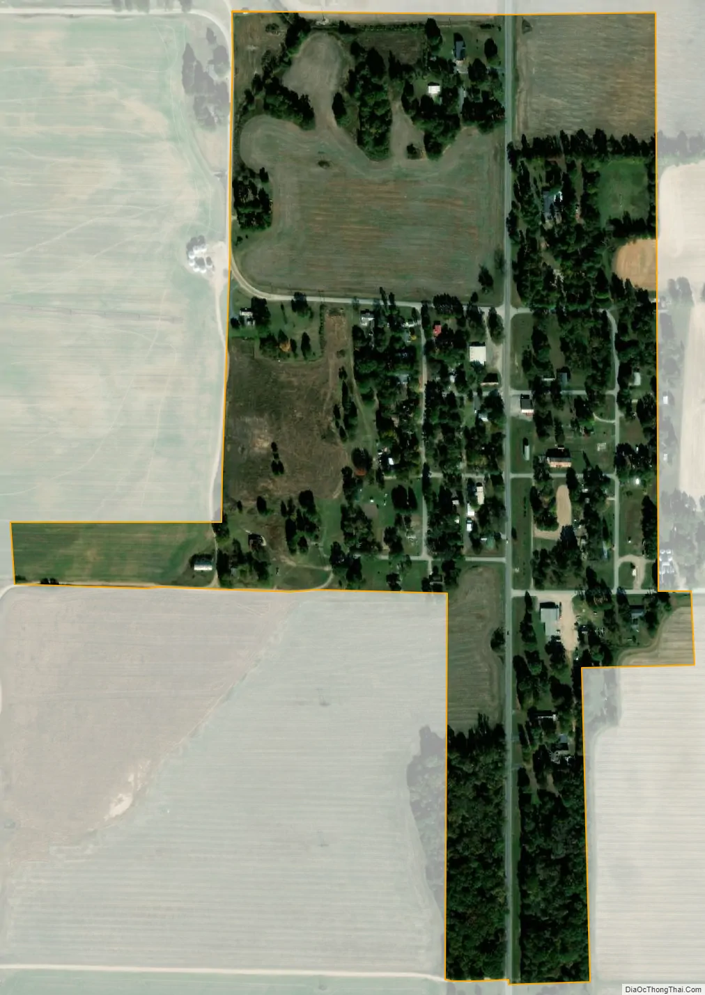
Weldon city Satellite Map
Geography
According to the United States Census Bureau, the town has a total area of 0.27 square miles (0.7 km), all land.
See also
Map of Arkansas State and its subdivision:- Arkansas
- Ashley
- Baxter
- Benton
- Boone
- Bradley
- Calhoun
- Carroll
- Chicot
- Clark
- Clay
- Cleburne
- Cleveland
- Columbia
- Conway
- Craighead
- Crawford
- Crittenden
- Cross
- Dallas
- Desha
- Drew
- Faulkner
- Franklin
- Fulton
- Garland
- Grant
- Greene
- Hempstead
- Hot Spring
- Howard
- Independence
- Izard
- Jackson
- Jefferson
- Johnson
- Lafayette
- Lawrence
- Lee
- Lincoln
- Little River
- Logan
- Lonoke
- Madison
- Marion
- Miller
- Mississippi
- Monroe
- Montgomery
- Nevada
- Newton
- Ouachita
- Perry
- Phillips
- Pike
- Poinsett
- Polk
- Pope
- Prairie
- Pulaski
- Randolph
- Saint Francis
- Saline
- Scott
- Searcy
- Sebastian
- Sevier
- Sharp
- Stone
- Union
- Van Buren
- Washington
- White
- Woodruff
- Yell
- Alabama
- Alaska
- Arizona
- Arkansas
- California
- Colorado
- Connecticut
- Delaware
- District of Columbia
- Florida
- Georgia
- Hawaii
- Idaho
- Illinois
- Indiana
- Iowa
- Kansas
- Kentucky
- Louisiana
- Maine
- Maryland
- Massachusetts
- Michigan
- Minnesota
- Mississippi
- Missouri
- Montana
- Nebraska
- Nevada
- New Hampshire
- New Jersey
- New Mexico
- New York
- North Carolina
- North Dakota
- Ohio
- Oklahoma
- Oregon
- Pennsylvania
- Rhode Island
- South Carolina
- South Dakota
- Tennessee
- Texas
- Utah
- Vermont
- Virginia
- Washington
- West Virginia
- Wisconsin
- Wyoming