Atlantis is a city in Palm Beach County, Florida, United States. As of the 2020 census, the city had a population of 2,142.
| Name: | Atlantis city |
|---|---|
| LSAD Code: | 25 |
| LSAD Description: | city (suffix) |
| State: | Florida |
| County: | Palm Beach County |
| Incorporated: | June 19, 1959 (1959-06-19) |
| Elevation: | 13 ft (4 m) |
| Total Area: | 1.40 sq mi (3.63 km²) |
| Land Area: | 1.36 sq mi (3.53 km²) |
| Water Area: | 0.04 sq mi (0.10 km²) |
| Total Population: | 2,142 |
| Population Density: | 1,572.69/sq mi (607.01/km²) |
| ZIP code: | 33462 |
| Area code: | 561 |
| FIPS code: | 1202500 |
| GNISfeature ID: | 0302714 |
| Website: | http://www.atlantisfl.gov/ |
Online Interactive Map
Click on ![]() to view map in "full screen" mode.
to view map in "full screen" mode.
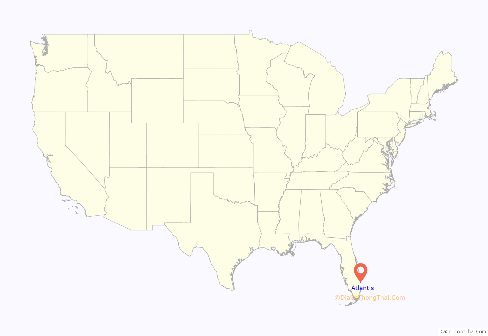
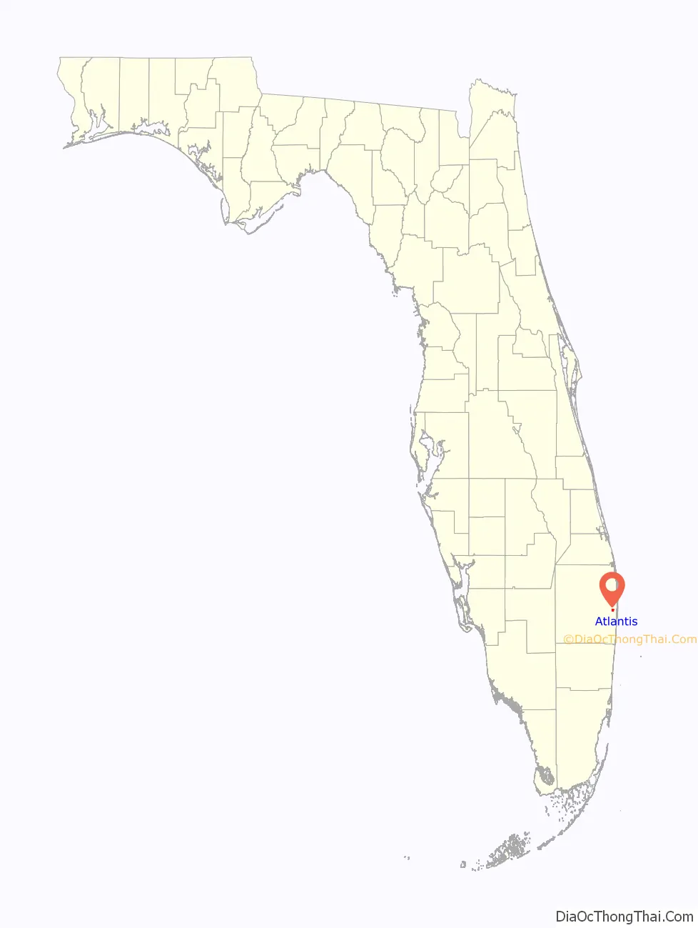
Atlantis location map. Where is Atlantis city?
History
The modern history of what became known as the city of Atlantis originates in a ranch called Mulberry Farms, owned by Philip D. Lewis, a former Florida state senator. Lewis’s Mission Company raised Brahman cattle on the land. In 1958, real estate developers Nathan Hunt and Paul Kintz purchased the land, and began the construction of what became a gated golf and country club community. The residential development, combined with a small amount of adjacent land for commercial use, was incorporated on June 19, 1959. Its first council was appointed, consisting of James Kintz as mayor, Nathan Hunt as vice mayor, and councilmen Paul Kintz, Marjorie Hunt and William Blakeslee.
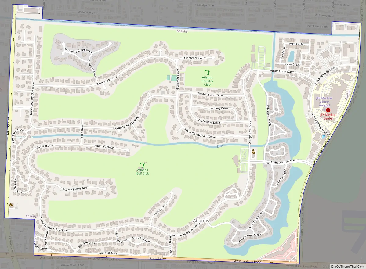
Atlantis Road Map
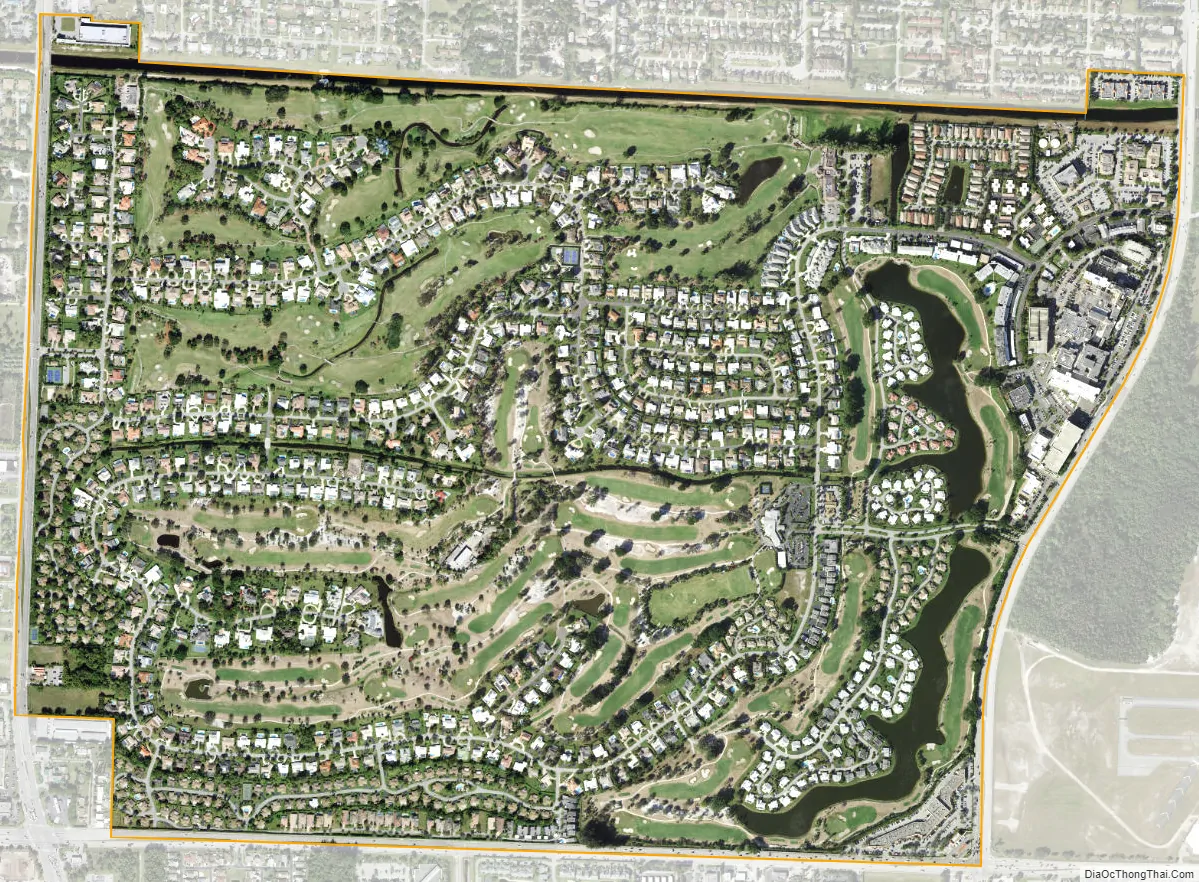
Atlantis city Satellite Map
Geography
Atlantis is located at 26°35′36″N 80°06′16″W / 26.593296°N 80.104531°W / 26.593296; -80.104531.
According to the United States Census Bureau, the city has a total area of 1.4 square miles (3.6 km), of which 1.4 square miles (3.6 km) is land and 0.04 square miles (0.10 km) (2.84%) is water. It 834 acres (338 ha) borders the Lake Worth Drainage (L-14) Canal on the north, Lantana Road to the south, Military Trail to the west and Congress Avenue to the east.
See also
Map of Florida State and its subdivision:- Alachua
- Baker
- Bay
- Bradford
- Brevard
- Broward
- Calhoun
- Charlotte
- Citrus
- Clay
- Collier
- Columbia
- Desoto
- Dixie
- Duval
- Escambia
- Flagler
- Franklin
- Gadsden
- Gilchrist
- Glades
- Gulf
- Hamilton
- Hardee
- Hendry
- Hernando
- Highlands
- Hillsborough
- Holmes
- Indian River
- Jackson
- Jefferson
- Lafayette
- Lake
- Lee
- Leon
- Levy
- Liberty
- Madison
- Manatee
- Marion
- Martin
- Miami-Dade
- Monroe
- Nassau
- Okaloosa
- Okeechobee
- Orange
- Osceola
- Palm Beach
- Pasco
- Pinellas
- Polk
- Putnam
- Saint Johns
- Saint Lucie
- Santa Rosa
- Sarasota
- Seminole
- Sumter
- Suwannee
- Taylor
- Union
- Volusia
- Wakulla
- Walton
- Washington
- Alabama
- Alaska
- Arizona
- Arkansas
- California
- Colorado
- Connecticut
- Delaware
- District of Columbia
- Florida
- Georgia
- Hawaii
- Idaho
- Illinois
- Indiana
- Iowa
- Kansas
- Kentucky
- Louisiana
- Maine
- Maryland
- Massachusetts
- Michigan
- Minnesota
- Mississippi
- Missouri
- Montana
- Nebraska
- Nevada
- New Hampshire
- New Jersey
- New Mexico
- New York
- North Carolina
- North Dakota
- Ohio
- Oklahoma
- Oregon
- Pennsylvania
- Rhode Island
- South Carolina
- South Dakota
- Tennessee
- Texas
- Utah
- Vermont
- Virginia
- Washington
- West Virginia
- Wisconsin
- Wyoming


