Canal Point is a census-designated place (CDP) and unincorporated community in Palm Beach County, Florida, United States. Canal Point is located along the eastern shore of Lake Okeechobee, to the northeast of Pahokee and to the northwest of Bryant. The unincorporated community was originally inhabited by the Calusa tribe until almost 400 years ago. Whites began occupying the area in the 1900s decade, establishing an agrarian community. The completion of the West Palm Beach Canal in 1917 allowed crops to be shipped by boat to West Palm Beach and then to other areas of the country, while construction of Conners Highway in 1924 resulted in crops being transported by motor vehicle.
Today, the community still relies heavily on agriculture, especially sugar. The town is very small with very little infrastructure. Canal Point has a small population, with 476 people counted in the 2020 census, up from 367 in the 2010 census.
| Name: | Canal Point CDP |
|---|---|
| LSAD Code: | 57 |
| LSAD Description: | CDP (suffix) |
| State: | Florida |
| County: | Palm Beach County |
| Elevation: | 13 ft (4 m) |
| Total Area: | 1.39 sq mi (3.60 km²) |
| Land Area: | 1.39 sq mi (3.60 km²) |
| Water Area: | 0.00 sq mi (0.00 km²) |
| Total Population: | 344 |
| Population Density: | 247.13/sq mi (95.42/km²) |
| ZIP code: | 33438-33439 |
| Area code: | 561 |
| FIPS code: | 1210100 |
| GNISfeature ID: | 0279964 |
Online Interactive Map
Click on ![]() to view map in "full screen" mode.
to view map in "full screen" mode.
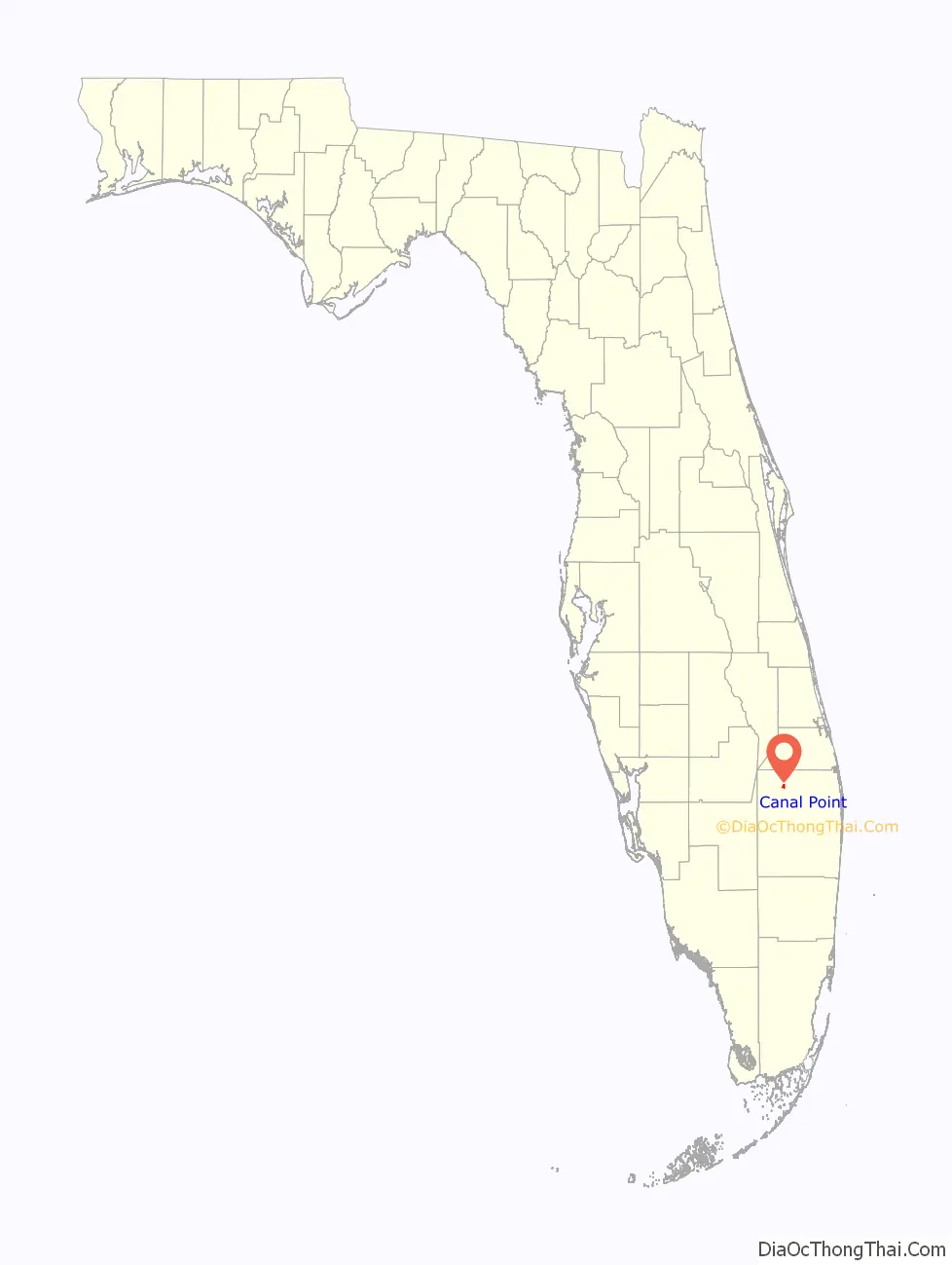
Canal Point location map. Where is Canal Point CDP?

History
Archaeological evidence from Big Mound City, located roughly 10 mi (16 km) of Canal Point, suggests that the Calusa tribe inhabited the area between about 500 BCE and 1650 CE. In 1909, Canal Point became the first White settlement on the eastern shore of Lake Okeechobee. The Southern States Land and Timber Company began planting sugarcane in the area in 1917. Around that time, the West Palm Beach Canal was completed. The canal connected Lake Okeechobee at Canal Point to West Palm Beach, allowing farms to sell crops to West Palm Beach or elsewhere in the United States via the Florida East Coast Railway. Transportation of crops by motor vehicle from the area to other destinations began in 1924 with the completion of Conners Highway, which mostly followed the path of the West Palm Beach Canal.
Unlike other communities along the southeastern and eastern shores of Lake Okeechobee, Canal Point was relatively unscathed by the 1928 hurricane. The community was likely inundated with 1.5 to 2.5 ft (0.46 to 0.76 m) of water and one death occurred. However, the local economy suffered greatly and never recovered after construction of the Herbert Hoover Dike limited boat traffic in the 1930s. Residents saved the historic Canal Point School from demolition and hoped to convert it into an agricultural museum, but the building was destroyed by a fire in 2008. About three years earlier, Hurricane Wilma wrecked several other historic buildings in the community.
Canal Point Road Map

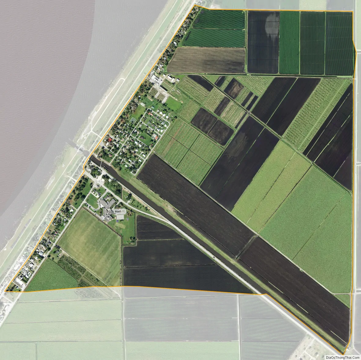
Canal Point city Satellite Map
Geography
Canal Point is located at 26°51′43″N 80°37′50″W / 26.86194°N 80.63056°W / 26.86194; -80.63056 (26.862060, -80.630543).
According to the United States Census Bureau, the CDP has a total area of 1.5 square miles (3.9 km), all land.
Climate
See also
Map of Florida State and its subdivision:- Alachua
- Baker
- Bay
- Bradford
- Brevard
- Broward
- Calhoun
- Charlotte
- Citrus
- Clay
- Collier
- Columbia
- Desoto
- Dixie
- Duval
- Escambia
- Flagler
- Franklin
- Gadsden
- Gilchrist
- Glades
- Gulf
- Hamilton
- Hardee
- Hendry
- Hernando
- Highlands
- Hillsborough
- Holmes
- Indian River
- Jackson
- Jefferson
- Lafayette
- Lake
- Lee
- Leon
- Levy
- Liberty
- Madison
- Manatee
- Marion
- Martin
- Miami-Dade
- Monroe
- Nassau
- Okaloosa
- Okeechobee
- Orange
- Osceola
- Palm Beach
- Pasco
- Pinellas
- Polk
- Putnam
- Saint Johns
- Saint Lucie
- Santa Rosa
- Sarasota
- Seminole
- Sumter
- Suwannee
- Taylor
- Union
- Volusia
- Wakulla
- Walton
- Washington
- Alabama
- Alaska
- Arizona
- Arkansas
- California
- Colorado
- Connecticut
- Delaware
- District of Columbia
- Florida
- Georgia
- Hawaii
- Idaho
- Illinois
- Indiana
- Iowa
- Kansas
- Kentucky
- Louisiana
- Maine
- Maryland
- Massachusetts
- Michigan
- Minnesota
- Mississippi
- Missouri
- Montana
- Nebraska
- Nevada
- New Hampshire
- New Jersey
- New Mexico
- New York
- North Carolina
- North Dakota
- Ohio
- Oklahoma
- Oregon
- Pennsylvania
- Rhode Island
- South Carolina
- South Dakota
- Tennessee
- Texas
- Utah
- Vermont
- Virginia
- Washington
- West Virginia
- Wisconsin
- Wyoming


