Cinco Bayou is a town in Okaloosa County, Florida, United States. The population was 383 at the 2010 census. It is part of the Fort Walton Beach–Crestview–Destin Metropolitan Statistical Area.
| Name: | Cinco Bayou town |
|---|---|
| LSAD Code: | 43 |
| LSAD Description: | town (suffix) |
| State: | Florida |
| County: | Okaloosa County |
| Elevation: | 13 ft (4 m) |
| Total Area: | 0.17 sq mi (0.45 km²) |
| Land Area: | 0.17 sq mi (0.45 km²) |
| Water Area: | 0.00 sq mi (0.00 km²) |
| Total Population: | 457 |
| Population Density: | 2,626.44/sq mi (1,013.10/km²) |
| ZIP code: | 32548 |
| Area code: | 850 |
| FIPS code: | 1212325 |
| GNISfeature ID: | 0283090 |
| Website: | www.cincobayou.com |
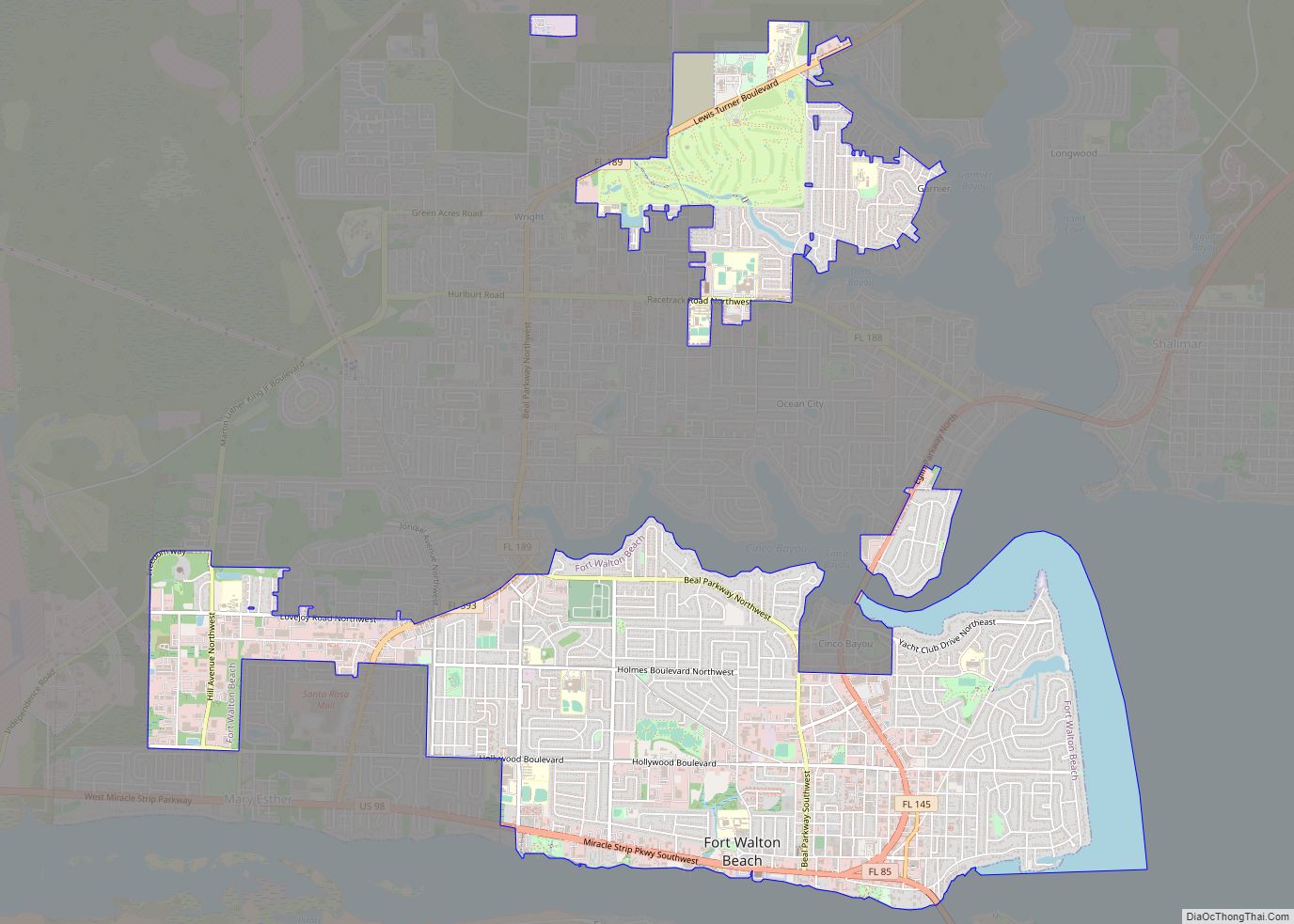
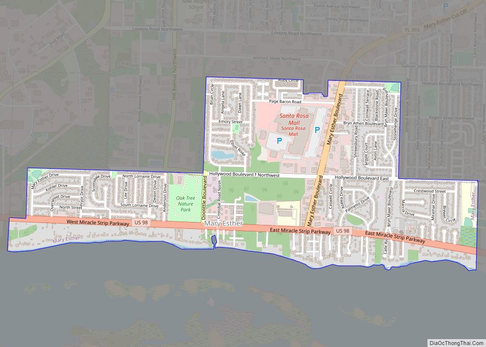
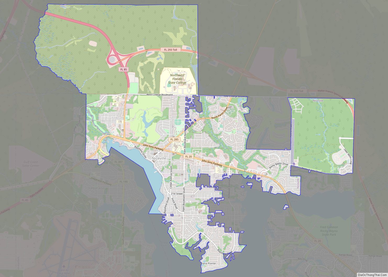
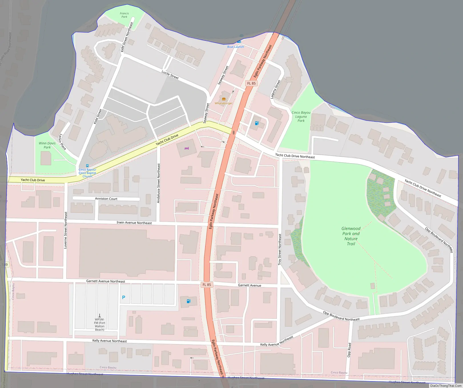
Online Interactive Map
Click on ![]() to view map in "full screen" mode.
to view map in "full screen" mode.
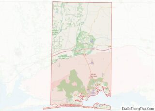
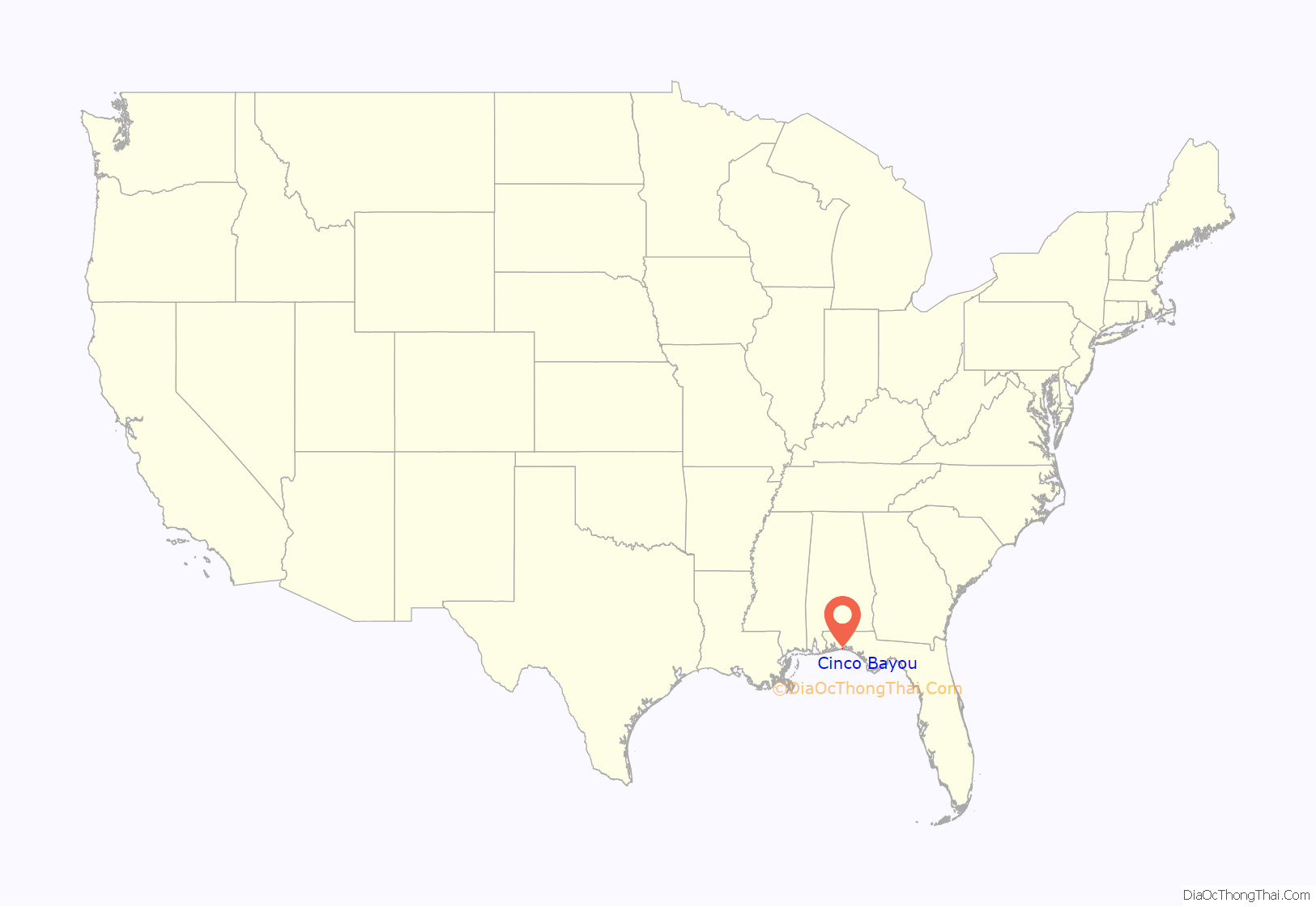
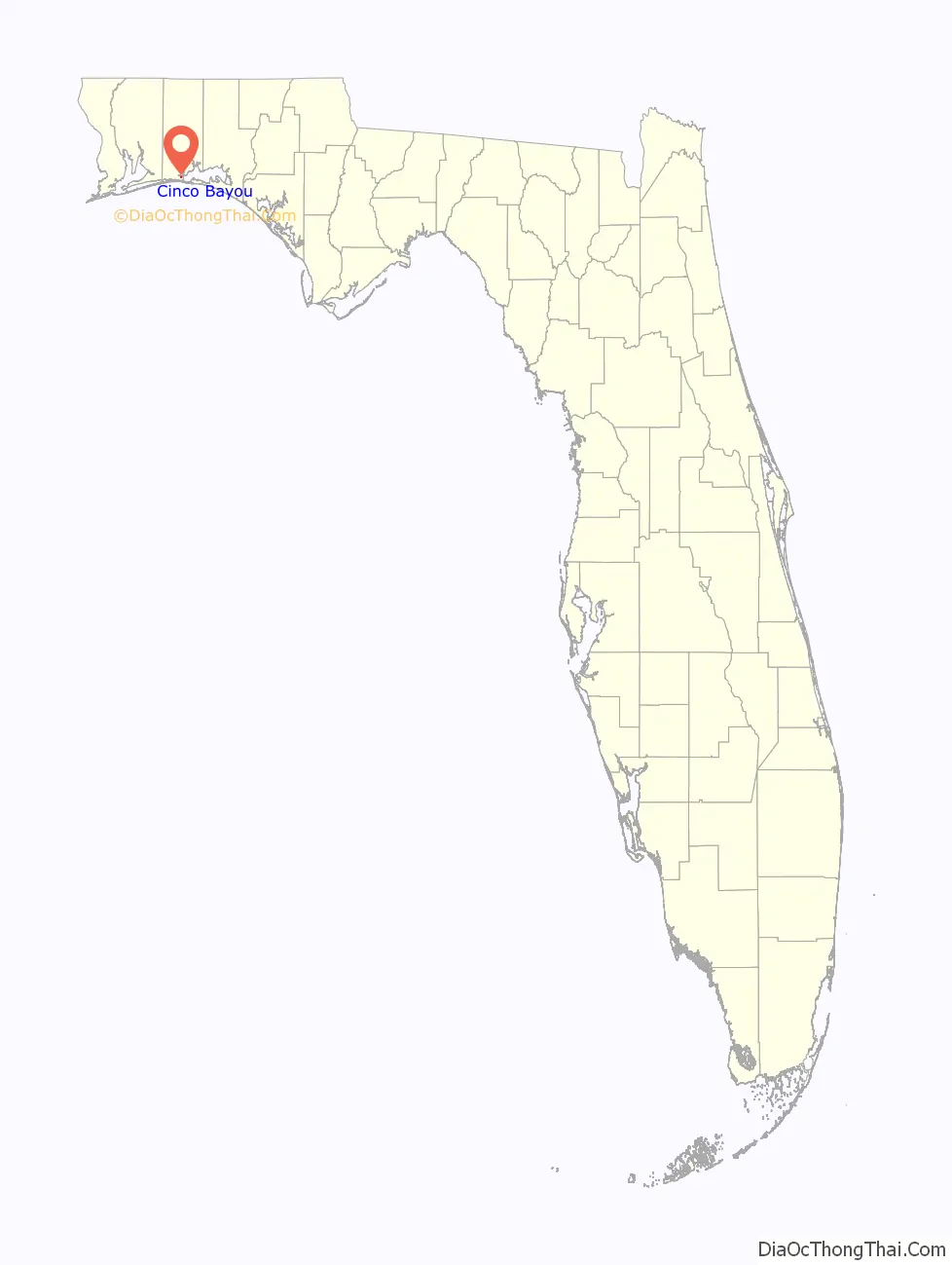
Cinco Bayou location map. Where is Cinco Bayou town?
History
Cinco Bayou was incorporated on July 3, 1950, at a meeting held at the Cinco Bayou garage, attended by about 60 people. Gordon Gibson was elected the first mayor. At this time there were about 250 residents in the area between the Fort Walton city limits and the Cinco Bayou, an east-west oriented finger of water on the west end of the Choctawhatchee Bay.
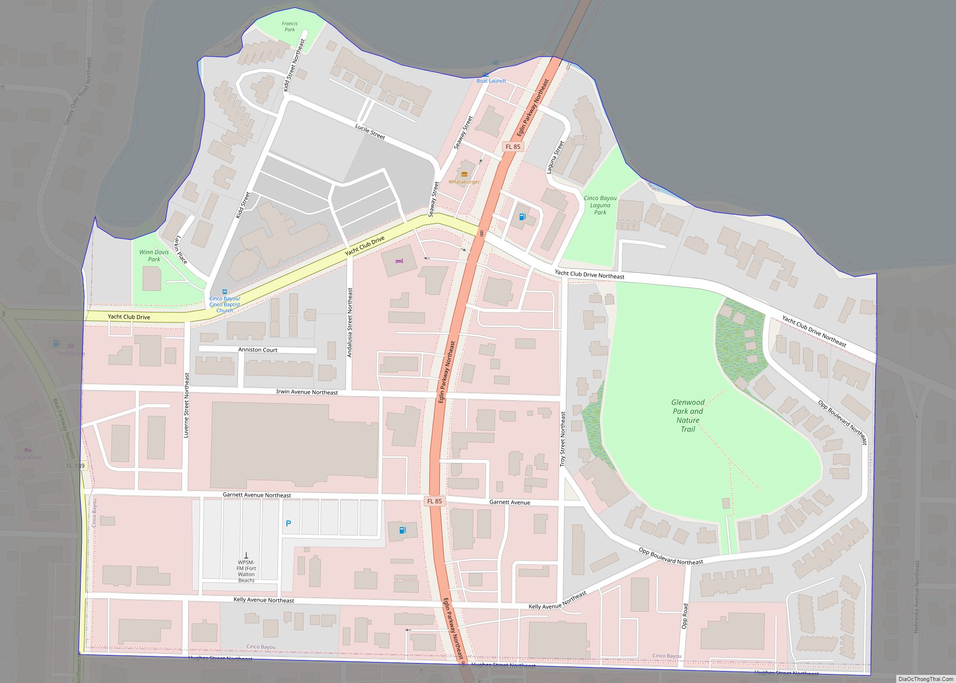
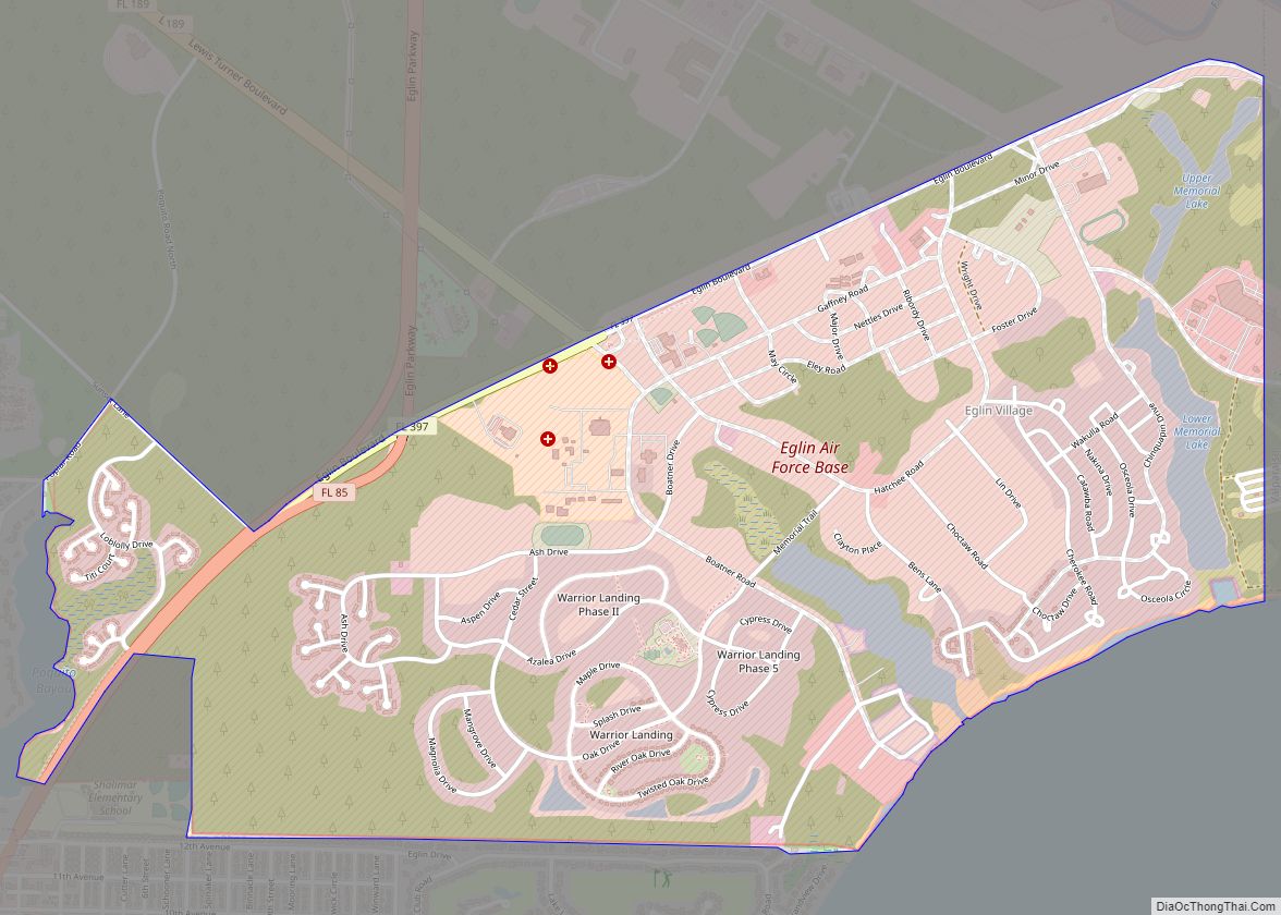
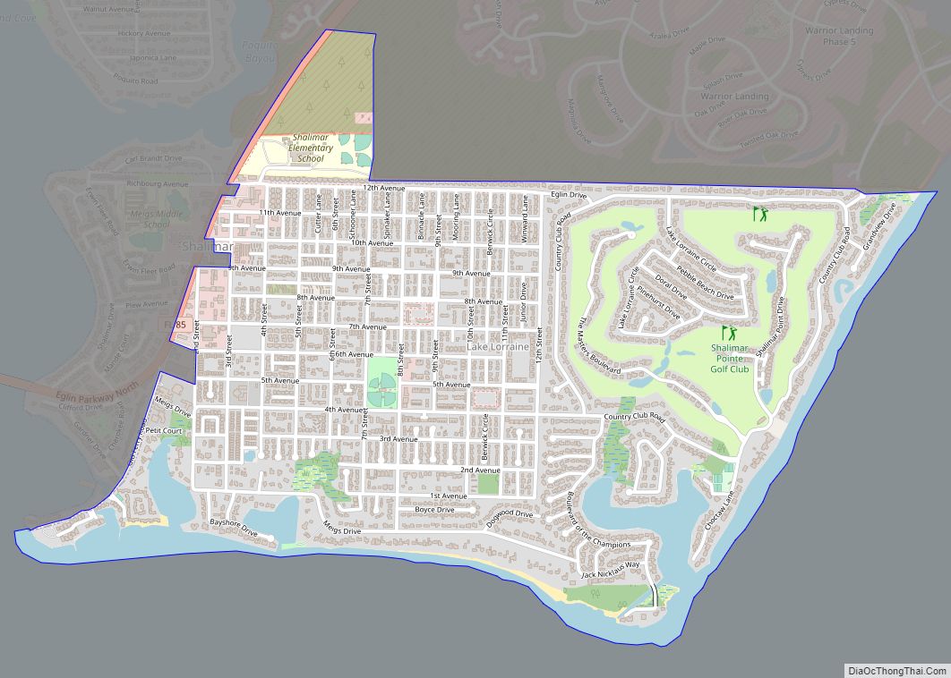
Cinco Bayou Road Map
Cinco Bayou city Satellite Map

Geography
Cinco Bayou is located at 30°25′18″N 86°36′33″W / 30.42167°N 86.60917°W / 30.42167; -86.60917 (30.421748, –86.609120).
According to the United States Census Bureau, the town has a total area of 0.2 square miles (0.52 km), all land. The town is completely surrounded by the city of Fort Walton Beach.
See also
Map of Florida State and its subdivision:- Alachua
- Baker
- Bay
- Bradford
- Brevard
- Broward
- Calhoun
- Charlotte
- Citrus
- Clay
- Collier
- Columbia
- Desoto
- Dixie
- Duval
- Escambia
- Flagler
- Franklin
- Gadsden
- Gilchrist
- Glades
- Gulf
- Hamilton
- Hardee
- Hendry
- Hernando
- Highlands
- Hillsborough
- Holmes
- Indian River
- Jackson
- Jefferson
- Lafayette
- Lake
- Lee
- Leon
- Levy
- Liberty
- Madison
- Manatee
- Marion
- Martin
- Miami-Dade
- Monroe
- Nassau
- Okaloosa
- Okeechobee
- Orange
- Osceola
- Palm Beach
- Pasco
- Pinellas
- Polk
- Putnam
- Saint Johns
- Saint Lucie
- Santa Rosa
- Sarasota
- Seminole
- Sumter
- Suwannee
- Taylor
- Union
- Volusia
- Wakulla
- Walton
- Washington
- Alabama
- Alaska
- Arizona
- Arkansas
- California
- Colorado
- Connecticut
- Delaware
- District of Columbia
- Florida
- Georgia
- Hawaii
- Idaho
- Illinois
- Indiana
- Iowa
- Kansas
- Kentucky
- Louisiana
- Maine
- Maryland
- Massachusetts
- Michigan
- Minnesota
- Mississippi
- Missouri
- Montana
- Nebraska
- Nevada
- New Hampshire
- New Jersey
- New Mexico
- New York
- North Carolina
- North Dakota
- Ohio
- Oklahoma
- Oregon
- Pennsylvania
- Rhode Island
- South Carolina
- South Dakota
- Tennessee
- Texas
- Utah
- Vermont
- Virginia
- Washington
- West Virginia
- Wisconsin
- Wyoming