Destin is a city located in Okaloosa County, Florida, United States. It is a principal city of the Crestview–Fort Walton Beach–Destin metropolitan area.
Located on Florida’s Emerald Coast, Destin is known for its white beaches and emerald green waters. Originating as a small fishing village, it is now a popular tourist destination. According to the Florida Department of Environmental Protection, over 80 percent of the Emerald Coast’s 4.5 million visitors each year visit Destin. The city styles itself “The World’s Luckiest Fishing Village”, and claims to have the largest fishing vessel fleet in the state of Florida.
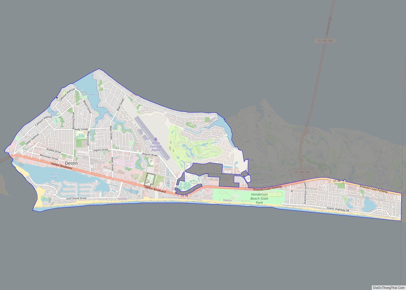
The city is located on a peninsula separating the Gulf of Mexico from Choctawhatchee Bay. The peninsula was originally a barrier island. Hurricanes and sea level changes gradually connected it to the mainland. In the 1940s, it technically became an island again with the completion of the Choctawhatchee-West Bay Canal.
| Name: | Destin city |
|---|---|
| LSAD Code: | 25 |
| LSAD Description: | city (suffix) |
| State: | Florida |
| County: | Okaloosa County |
| Elevation: | 26 ft (8 m) |
| Total Area: | 7.66 sq mi (19.83 km²) |
| Land Area: | 7.49 sq mi (19.41 km²) |
| Water Area: | 0.16 sq mi (0.42 km²) |
| Total Population: | 13,931 |
| Population Density: | 1,859.20/sq mi (717.82/km²) |
| ZIP code: | 32540-32541 |
| Area code: | 850 |
| FIPS code: | 1217325 |
| GNISfeature ID: | 0281516 |
| Website: | www.cityofdestin.com |
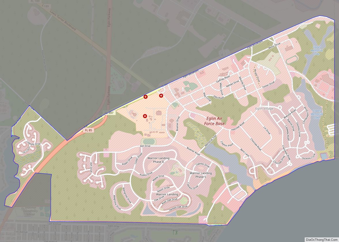
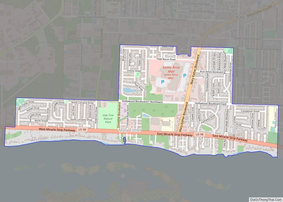
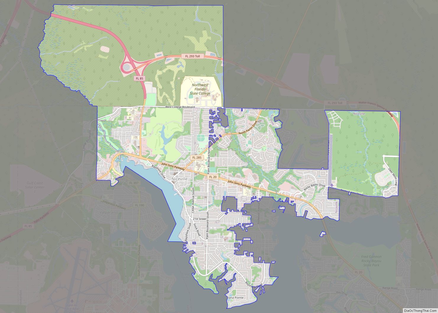
Online Interactive Map
Click on ![]() to view map in "full screen" mode.
to view map in "full screen" mode.
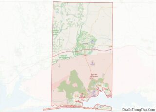
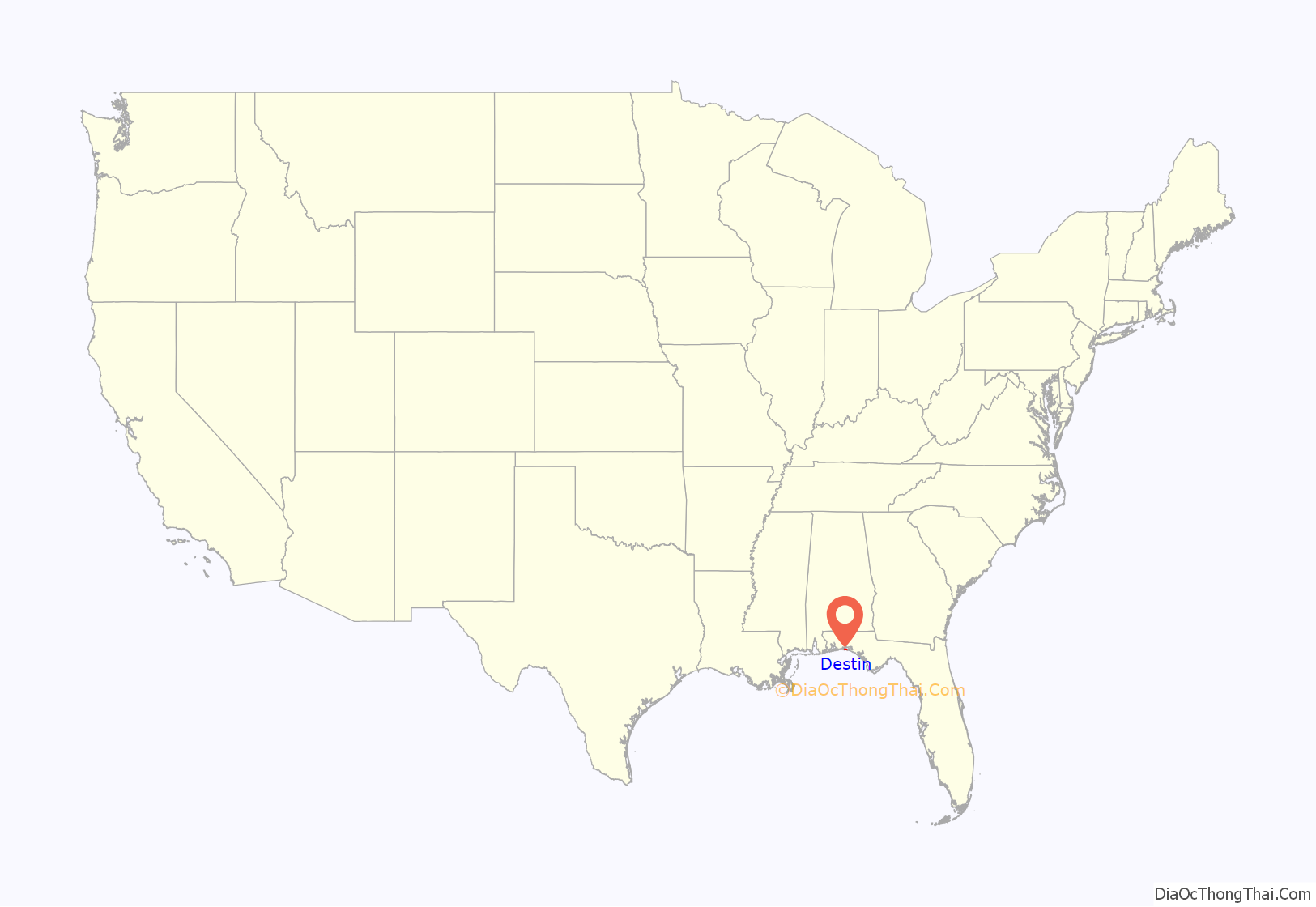
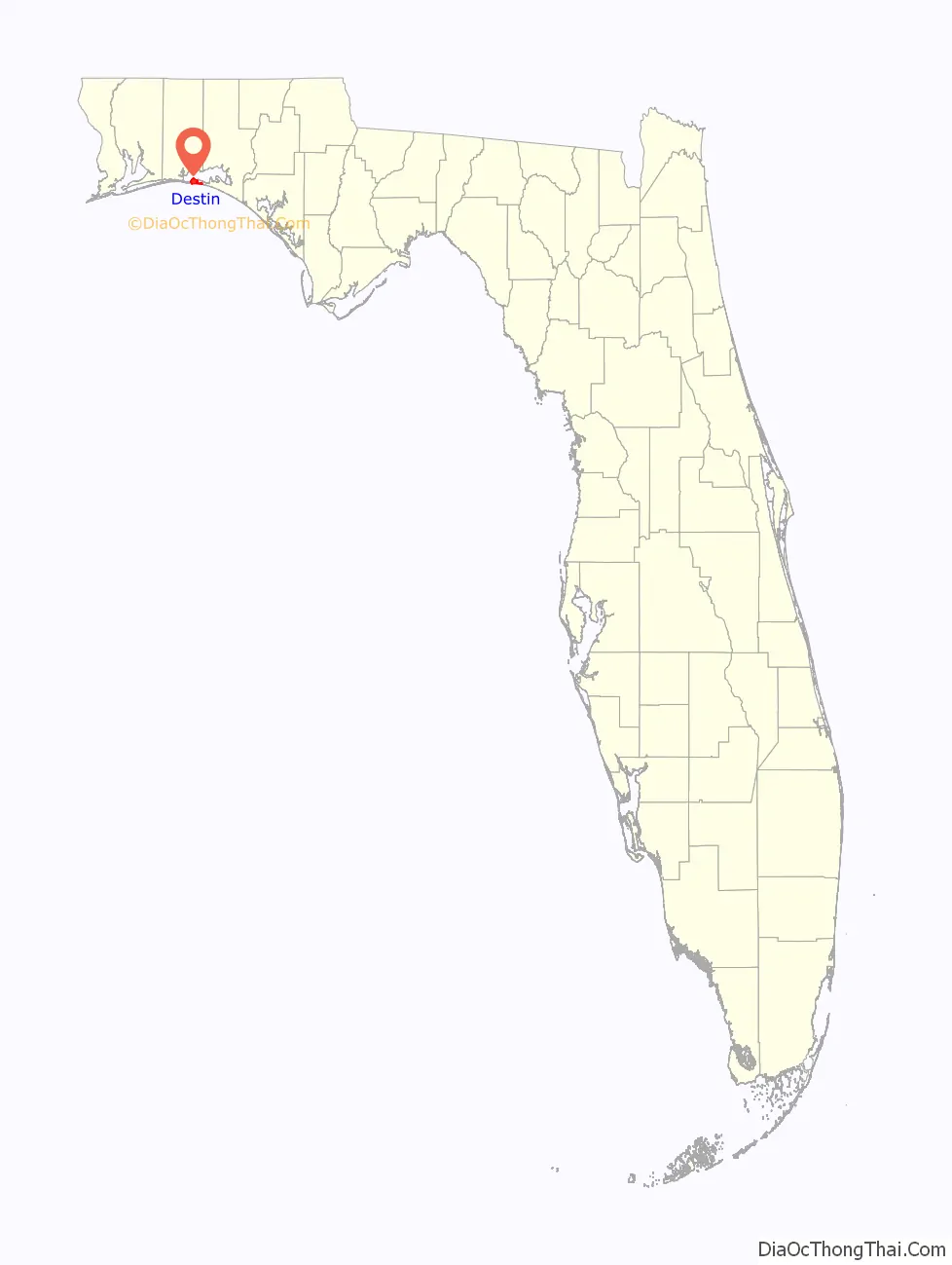
Destin location map. Where is Destin city?
History
Destin is named after Leonard Destin, a New London, Connecticut fishing captain who settled in the area between 1845 and 1850. He built a New England colonial home at the location of the Moreno Point military reservation. Captain Destin and his descendants fished the area for decades.
Condominiums were first built in Destin during the 1970s, although Destin was not incorporated as a municipality until 1984. The city has experienced rapid growth since the 1980s.
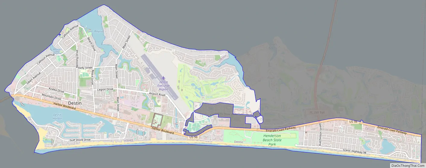
Destin Road Map
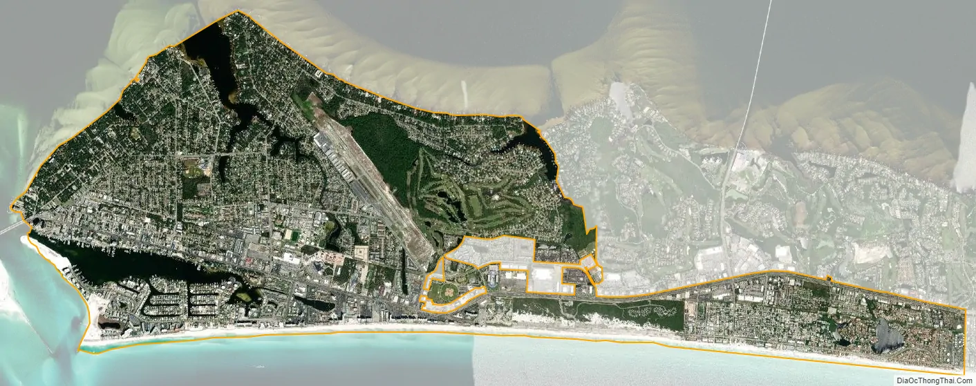
Destin city Satellite Map
Geography
The city is located on a peninsula separating the Gulf of Mexico from Choctawhatchee Bay. The peninsula was originally an island; hurricanes and sea level changes gradually connected the island to the mainland.
Destin is near several other cities in the region. The city of Fort Walton Beach is located to the west at the inlet of Santa Rosa Sound into Choctawhatchee Bay. North of Destin, across the bay is Niceville, with the Mid-Bay Bridge linking the two by road. U.S. Route 98 is the main route through the city, running from west to east. U.S. Route 98 leads east 56 mi (90 km) to Panama City and west 48 mi (77 km) to Pensacola.
At the western tip of the peninsula is East Pass (also known as Destin Pass), separating it from Santa Rosa Island to the west. East Pass is the only outlet of Choctawhatchee Bay into the Gulf of Mexico, Many sources claim that the current pass was dug by hand with an inrush of water widening it within hours. The early pass appears (at the East end of Destin Harbor) in early maps and surveys from Spanish, French, and English surveyors, such as Thomas Jefferys’s 1775 map The Coast of West Florida and Louisiana. Frequent dredging is required to keep East Pass navigable.
“Crab Island,” was actually two islands made from sand that the Army Corps of Engineers dredged up from the East Pass. These islands were large enough to inhabit sea grass, small shrubs and nesting seabirds. It has been reduced to a significant sandbar, which appears only when the tide is out. It has become a popular anchorage in the area. The entrance to Destin Harbor, a lagoon between the beaches and the main body of the western portion of the peninsula, is located just north of the East Pass jetty. The lagoon is formed by a sand spit named Holiday Isle; many condominiums have been built along the harbor since the 1970s. Norriego Point protects the harbor and was doubled in size in order to protect against coastal erosion.
According to the United States Census Bureau, the city has a total area of 8.2 square miles (21 km), of which 7.5 square miles (19 km) is land and 0.6 square miles (1.6 km) (7.95%) is water.
Climate
Environmental issues
A 2013 study identified the city as one of the cities in Florida most in risk of inundation. A 2019 report by the Florida Department of Environmental Protection listed sections of the beach as “critically eroded”.
The city received $11 million dollars from the Deepwater Horizon oil spill settlement. This was used to address coastal erosion on Norriego Point which protects the important harbor. Otherwise the city has not developed a plan to address sea level rise and coastal erosion.
See also
Map of Florida State and its subdivision:- Alachua
- Baker
- Bay
- Bradford
- Brevard
- Broward
- Calhoun
- Charlotte
- Citrus
- Clay
- Collier
- Columbia
- Desoto
- Dixie
- Duval
- Escambia
- Flagler
- Franklin
- Gadsden
- Gilchrist
- Glades
- Gulf
- Hamilton
- Hardee
- Hendry
- Hernando
- Highlands
- Hillsborough
- Holmes
- Indian River
- Jackson
- Jefferson
- Lafayette
- Lake
- Lee
- Leon
- Levy
- Liberty
- Madison
- Manatee
- Marion
- Martin
- Miami-Dade
- Monroe
- Nassau
- Okaloosa
- Okeechobee
- Orange
- Osceola
- Palm Beach
- Pasco
- Pinellas
- Polk
- Putnam
- Saint Johns
- Saint Lucie
- Santa Rosa
- Sarasota
- Seminole
- Sumter
- Suwannee
- Taylor
- Union
- Volusia
- Wakulla
- Walton
- Washington
- Alabama
- Alaska
- Arizona
- Arkansas
- California
- Colorado
- Connecticut
- Delaware
- District of Columbia
- Florida
- Georgia
- Hawaii
- Idaho
- Illinois
- Indiana
- Iowa
- Kansas
- Kentucky
- Louisiana
- Maine
- Maryland
- Massachusetts
- Michigan
- Minnesota
- Mississippi
- Missouri
- Montana
- Nebraska
- Nevada
- New Hampshire
- New Jersey
- New Mexico
- New York
- North Carolina
- North Dakota
- Ohio
- Oklahoma
- Oregon
- Pennsylvania
- Rhode Island
- South Carolina
- South Dakota
- Tennessee
- Texas
- Utah
- Vermont
- Virginia
- Washington
- West Virginia
- Wisconsin
- Wyoming