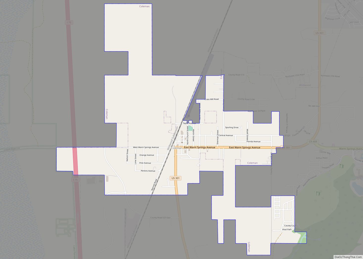
Coleman is a city in Sumter County, Florida, United States. The population was 703 at the 2010 census. According to the U.S. Census estimates of 2018, the city had a population of 877.
| Name: | Coleman city |
|---|---|
| LSAD Code: | 25 |
| LSAD Description: | city (suffix) |
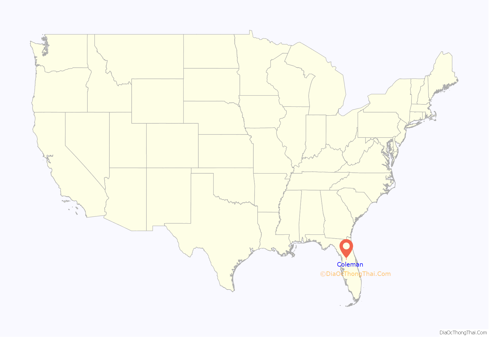
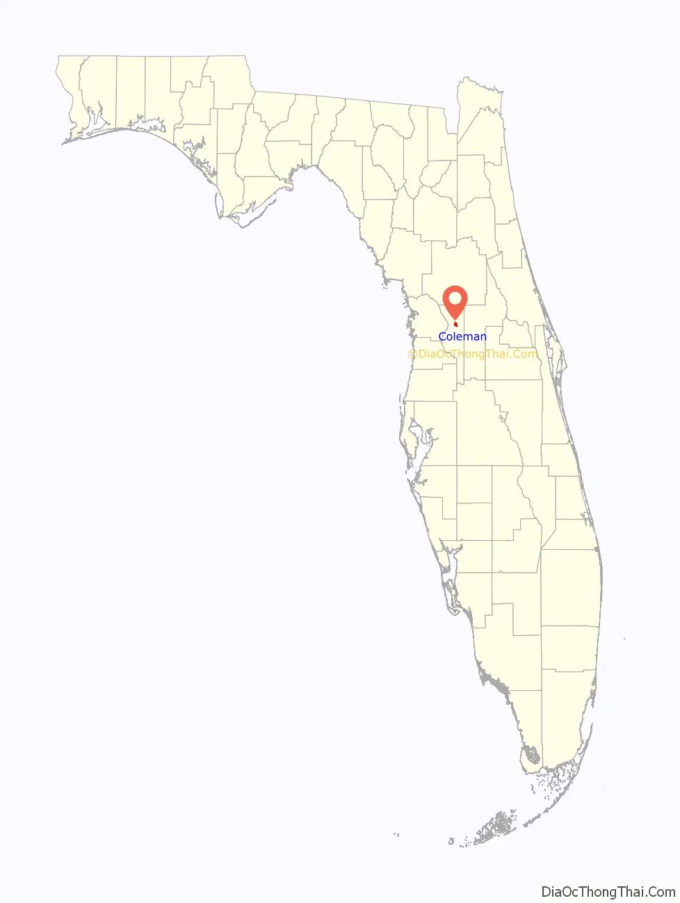
| State: | Florida |
| County: | Sumter County |
| Elevation: | 66 ft (20 m) |
| Total Area: | 2.24 sq mi (5.80 km²) |
| Land Area: | 2.24 sq mi (5.80 km²) |
| Water Area: | 0.00 sq mi (0.00 km²) |
| Total Population: | 642 |
| Population Density: | 286.86/sq mi (110.74/km²) |
| ZIP code: | 33521 |
| Area code: | 352 |
| FIPS code: | 1213400 |
| GNISfeature ID: | 0280642 |
| Website: | www.cityofcolemanfl.com |
Online Interactive Map
Click on ![]() to view map in "full screen" mode.
to view map in "full screen" mode.
Coleman location map. Where is Coleman city?
History
Second Seminole War
On June 8, 1840, Colonel W. J. Worth, Colonel Bennet Riley, and the Second and Eighth Infantry divisions transferred to Fort McClure to search the Lake Panasoffkee area for Seminole warriors. Three days later, the troops discovered an empty village.
Modern town
By 1853, Fort McClure was renamed Warm Springs.
In 1882, the town was renamed Coleman after Dr. B. F. Coleman.
The main industries were citrus, cotton, and cattle. According to Broward Mill, the past president of the Sumter County Historical Society, Coleman became known for its cabbage production in the early part of the 20th century.
In 1926, the West Palm Beach branch of the Seaboard Air Line began operations in Coleman.
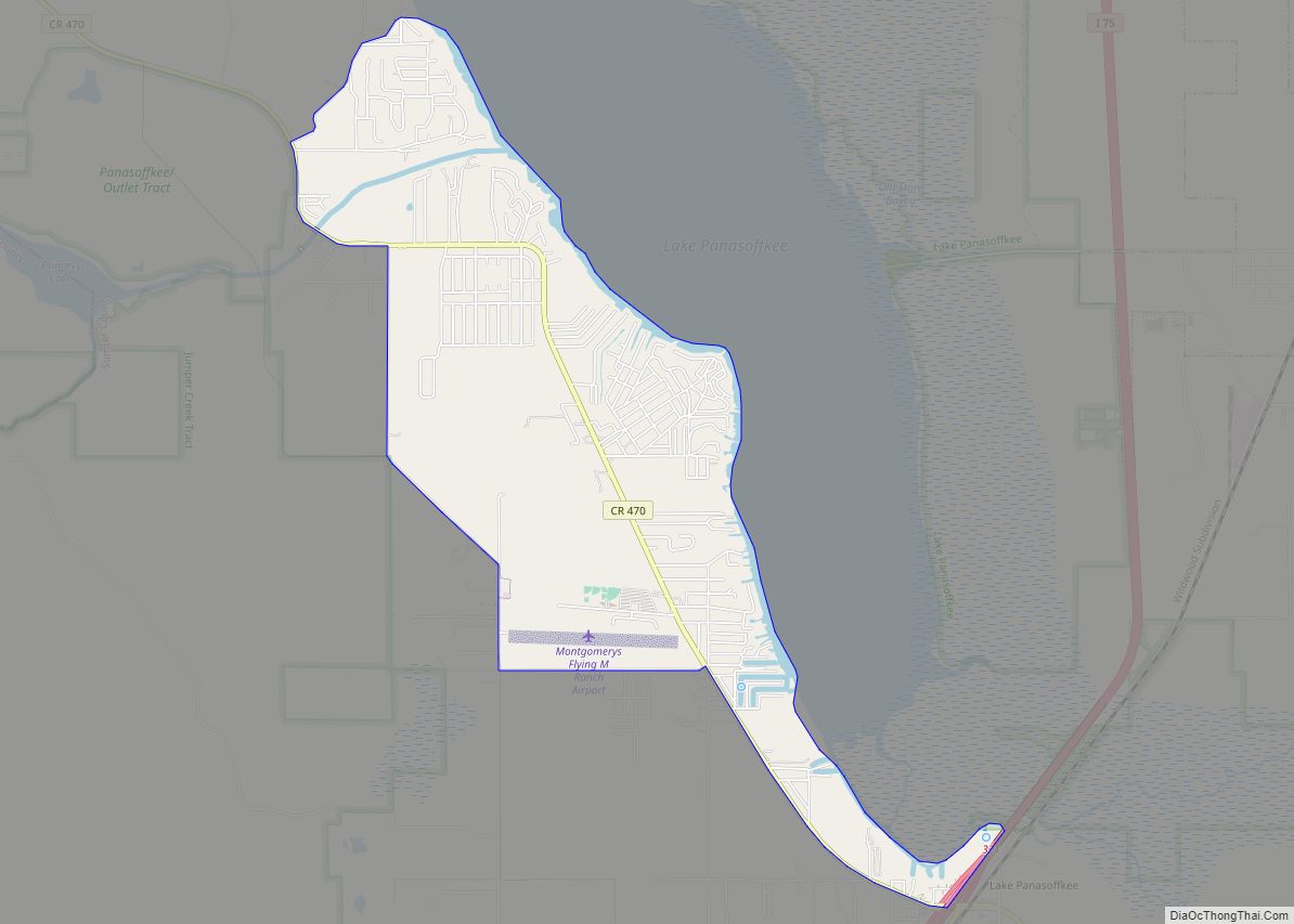
In 1992, Southwest Florida Water Management District (SWFWMD) officials approved the purchase of 8.762 acres (3.546 ha) on the northeastern shores of Lake Panasoffkee near Coleman for the purchase of environmental preservation. SWFWMD officials sought to preserve over 300 species and neighboring Lake Panasoffkee. Although some residents applauded the move, others, such as Sumter County Commissioner Jim Allen, felt that the agency would prevent public use of the land.
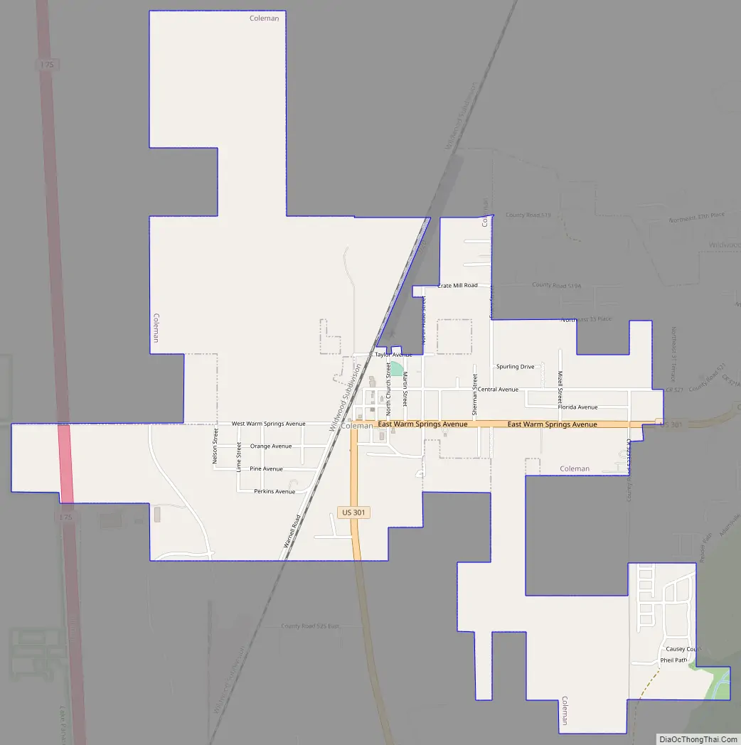
Coleman Road Map
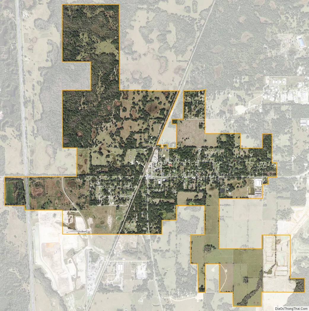
Coleman city Satellite Map
Geography
Coleman is located at 28°48′01″N 82°04′08″W / 28.800331°N 82.068766°W / 28.800331; -82.068766.
According to the United States Census Bureau, the city has a total area of 1.5 square miles (3.9 km), all land.
The city is in the South Central Florida Ridge section as defined by the United States Department of Agriculture.[1] Most of Coleman’s soils are sandy and moderately well drained or somewhat poorly drained. Topsoils are acidic, but subsoils may be alkaline with frequent presence of limestone boulders. A somewhat poorly drained, mildly alkaline sandy clay loam lies southeast of the built-up area.[2]
See also
Map of Florida State and its subdivision:- Alachua
- Baker
- Bay
- Bradford
- Brevard
- Broward
- Calhoun
- Charlotte
- Citrus
- Clay
- Collier
- Columbia
- Desoto
- Dixie
- Duval
- Escambia
- Flagler
- Franklin
- Gadsden
- Gilchrist
- Glades
- Gulf
- Hamilton
- Hardee
- Hendry
- Hernando
- Highlands
- Hillsborough
- Holmes
- Indian River
- Jackson
- Jefferson
- Lafayette
- Lake
- Lee
- Leon
- Levy
- Liberty
- Madison
- Manatee
- Marion
- Martin
- Miami-Dade
- Monroe
- Nassau
- Okaloosa
- Okeechobee
- Orange
- Osceola
- Palm Beach
- Pasco
- Pinellas
- Polk
- Putnam
- Saint Johns
- Saint Lucie
- Santa Rosa
- Sarasota
- Seminole
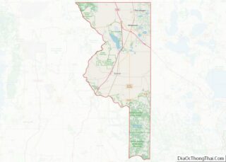
- Sumter
- Suwannee
- Taylor
- Union
- Volusia
- Wakulla
- Walton
- Washington
- Alabama
- Alaska
- Arizona
- Arkansas
- California
- Colorado
- Connecticut
- Delaware
- District of Columbia
- Florida
- Georgia
- Hawaii
- Idaho
- Illinois
- Indiana
- Iowa
- Kansas
- Kentucky
- Louisiana
- Maine
- Maryland
- Massachusetts
- Michigan
- Minnesota
- Mississippi
- Missouri
- Montana
- Nebraska
- Nevada
- New Hampshire
- New Jersey
- New Mexico
- New York
- North Carolina
- North Dakota
- Ohio
- Oklahoma
- Oregon
- Pennsylvania
- Rhode Island
- South Carolina
- South Dakota
- Tennessee
- Texas
- Utah
- Vermont
- Virginia
- Washington
- West Virginia
- Wisconsin
- Wyoming