Dunedin /dəˈniːdɪn/ is a city in Pinellas County, Florida, United States. The name comes from Dùn Èideann, the Scottish Gaelic name for Edinburgh, the capital of Scotland. Dunedin is part of the Tampa-St. Petersburg-Clearwater metropolitan area and is the fifth largest city in Pinellas County. The population was 36,068 as of the 2020 census.
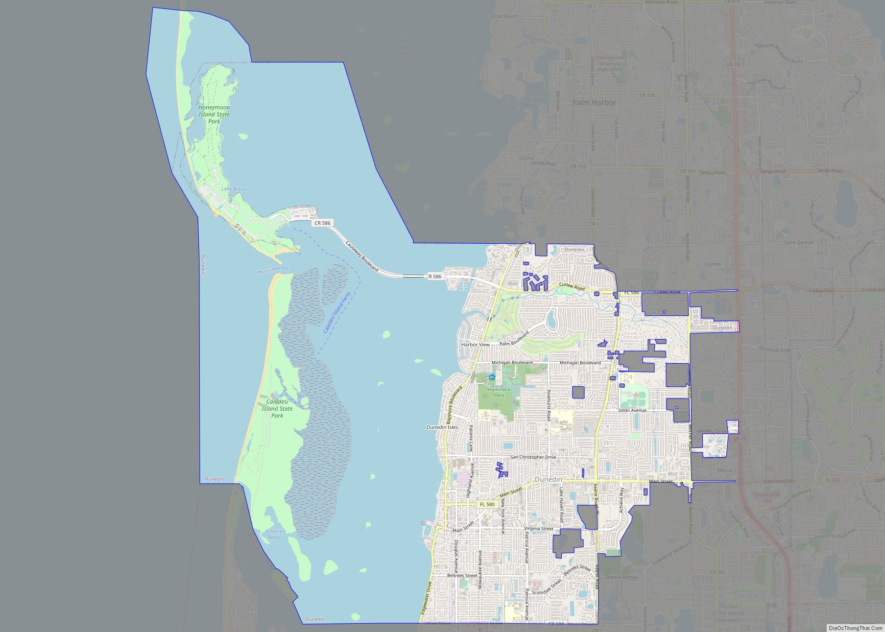
Dunedin is home to several beaches, including Dunedin Causeway, Honeymoon Island, and Caladesi Island State Park, which is consistently rated among the best beaches in the world. Dunedin is one of the few open waterfront communities from Sarasota to Cedar Key where buildings do not completely obscure the view of the Intracoastal Waterway and the Gulf of Mexico beyond; a 1-mile (1.6 km) stretch of Edgewater Drive (also known as Alternate US 19) south of downtown offers views of St. Joseph Sound, Clearwater Beach, and Caladesi Island. Downtown Clearwater and Clearwater Beach are a 6-mile (10 km) drive south on Edgewater.
| Name: | Dunedin city |
|---|---|
| LSAD Code: | 25 |
| LSAD Description: | city (suffix) |
| State: | Florida |
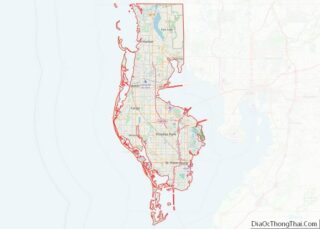
| County: | Pinellas County |
| Elevation: | 30 ft (9 m) |
| Total Area: | 22.94 sq mi (59.42 km²) |
| Land Area: | 10.41 sq mi (26.96 km²) |
| Water Area: | 12.53 sq mi (32.46 km²) |
| Total Population: | 36,068 |
| Population Density: | 3,465.08/sq mi (1,337.87/km²) |
| ZIP code: | 34697-34698 |
| Area code: | 727 |
| FIPS code: | 1218575 |
| GNISfeature ID: | 0281860 |
| Website: | www.dunedingov.com |
Online Interactive Map
Click on ![]() to view map in "full screen" mode.
to view map in "full screen" mode.
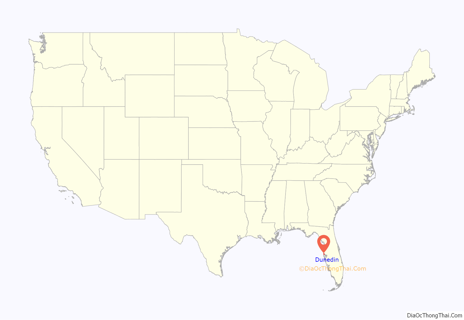
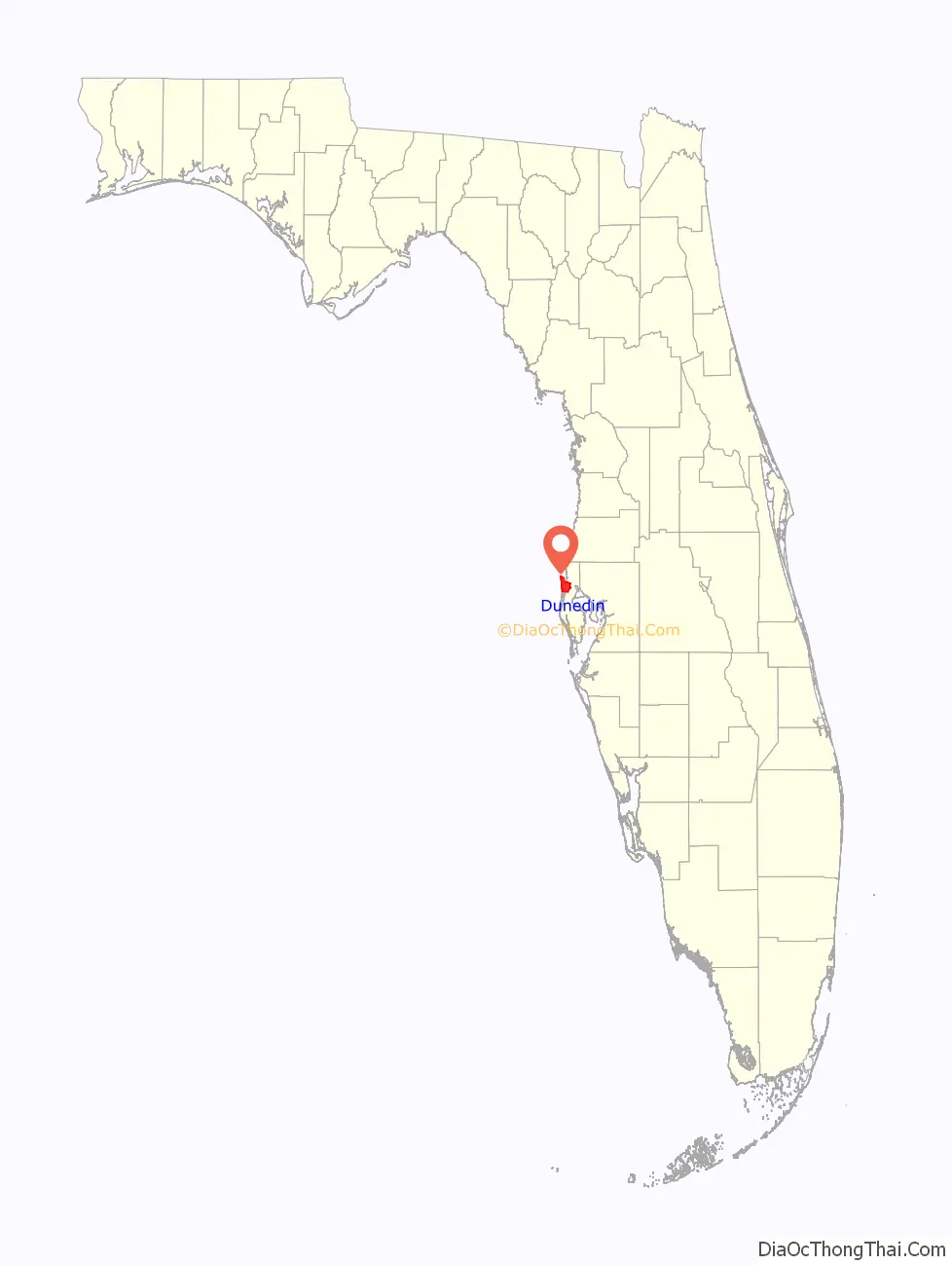
Dunedin location map. Where is Dunedin city?
History
Richard L. Garrison was the first person given a land grant in Dunedin in 1850. The settlement was originally named Jonesboro by George Jones, the owner of the area mercantile. Two Scotsmen, J.O. Douglas and James Somerville, later named the settlement Dunedin after applying for the first post office in northern Pinellas County. The name is taken from Scottish Gaelic Dùn Èideann, the Scottish Gaelic for Edinburgh. With a dock built to accommodate larger sailing vessels, Dunedin became an important trading center and at one time it had the largest fleet of sailing vessels in the state.
Dunedin became incorporated as a town in 1899 in part as a response to numerous complaints about pigs running rampant in the settlement, leading to a still-standing ban on livestock within city limits. By 1913, the town had a population of only 350. It became incorporated as the City of Dunedin in 1926.
Dunedin and the Roebling Alligator
During and shortly before World War II the Food Machinery Corporation factory in Dunedin (now demolished) was the primary site for the production of the Landing Vehicle Tracked developed by FMC Dunedin’s Engineers and Donald Roebling of Clearwater from Roebling’s own Alligator.
Initial training on the LVTs was done at the FMC factory under the auspices of the first Amphibian Tractor School, led by Major William W. Davies. Until barracks and maintenance facilities were completed, the school and its students were housed in the Hotel Dunedin. After training, the Marines from the first Amphibian Tractor School were sent to flesh out the 1st Amphibian Tractor Battalion, which has served with distinction since. In mid-1944, the Marine unit in Dunedin was transferred to Camp Pendleton, California.
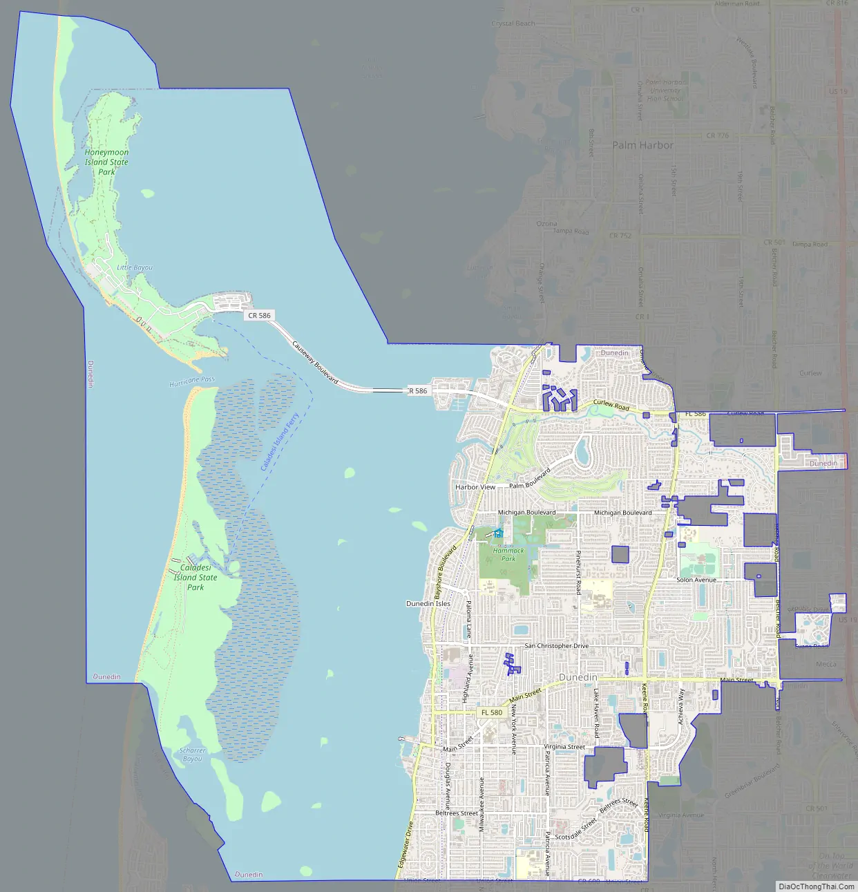
Dunedin Road Map
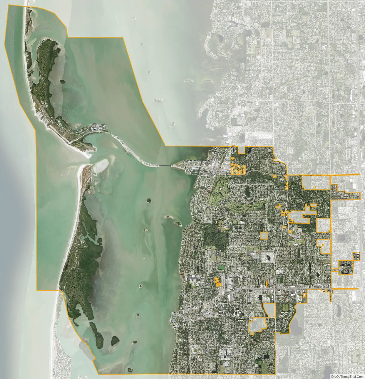
Dunedin city Satellite Map
Geography
Dunedin is located at 28°01′31″N 82°46′31″W / 28.025395°N 82.775348°W / 28.025395; -82.775348, which is the approximate geographic center of the city. The middle of downtown (intersection of Main Street and Douglas Avenue) is located at 28°00′42″N 82°47′16″W / 28.0118°N 82.7879°W / 28.0118; -82.7879.
According to the United States Census Bureau, the city has a total area of 28.2 square miles (73 km). 10.4 square miles (27 km) of it is land and 17.8 square miles (46 km) of it (63.20%) is water.
Dunedin is bordered by the city of Clearwater to the south and east, the Gulf of Mexico to the west, and by Palm Harbor (an unincorporated community of Pinellas County) to the north.
Neighborhoods
- Braemoor
- Osprey Place
- Stirling Heights
- Spanish Acres
- Spanish Place
- Lake Haven
- Virginia Crossing
- Waterford Crossing
- Fairway Estates
- Curlew Landings
- Golden Crest
- New Athens City
- Lake Highlander
- Weathersfield
- Dunedin Mobile Manor
- Spring Lakes
- Spring Lake South
- Golden Acres
- Ranchwood Estates
- Amberlea
- Spanish Trails
- Trails West
- Barrington Hills
- Piper’s Glen
See also
Map of Florida State and its subdivision:- Alachua
- Baker
- Bay
- Bradford
- Brevard
- Broward
- Calhoun
- Charlotte
- Citrus
- Clay
- Collier
- Columbia
- Desoto
- Dixie
- Duval
- Escambia
- Flagler
- Franklin
- Gadsden
- Gilchrist
- Glades
- Gulf
- Hamilton
- Hardee
- Hendry
- Hernando
- Highlands
- Hillsborough
- Holmes
- Indian River
- Jackson
- Jefferson
- Lafayette
- Lake
- Lee
- Leon
- Levy
- Liberty
- Madison
- Manatee
- Marion
- Martin
- Miami-Dade
- Monroe
- Nassau
- Okaloosa
- Okeechobee
- Orange
- Osceola
- Palm Beach
- Pasco
- Pinellas
- Polk
- Putnam
- Saint Johns
- Saint Lucie
- Santa Rosa
- Sarasota
- Seminole
- Sumter
- Suwannee
- Taylor
- Union
- Volusia
- Wakulla
- Walton
- Washington
- Alabama
- Alaska
- Arizona
- Arkansas
- California
- Colorado
- Connecticut
- Delaware
- District of Columbia
- Florida
- Georgia
- Hawaii
- Idaho
- Illinois
- Indiana
- Iowa
- Kansas
- Kentucky
- Louisiana
- Maine
- Maryland
- Massachusetts
- Michigan
- Minnesota
- Mississippi
- Missouri
- Montana
- Nebraska
- Nevada
- New Hampshire
- New Jersey
- New Mexico
- New York
- North Carolina
- North Dakota
- Ohio
- Oklahoma
- Oregon
- Pennsylvania
- Rhode Island
- South Carolina
- South Dakota
- Tennessee
- Texas
- Utah
- Vermont
- Virginia
- Washington
- West Virginia
- Wisconsin
- Wyoming