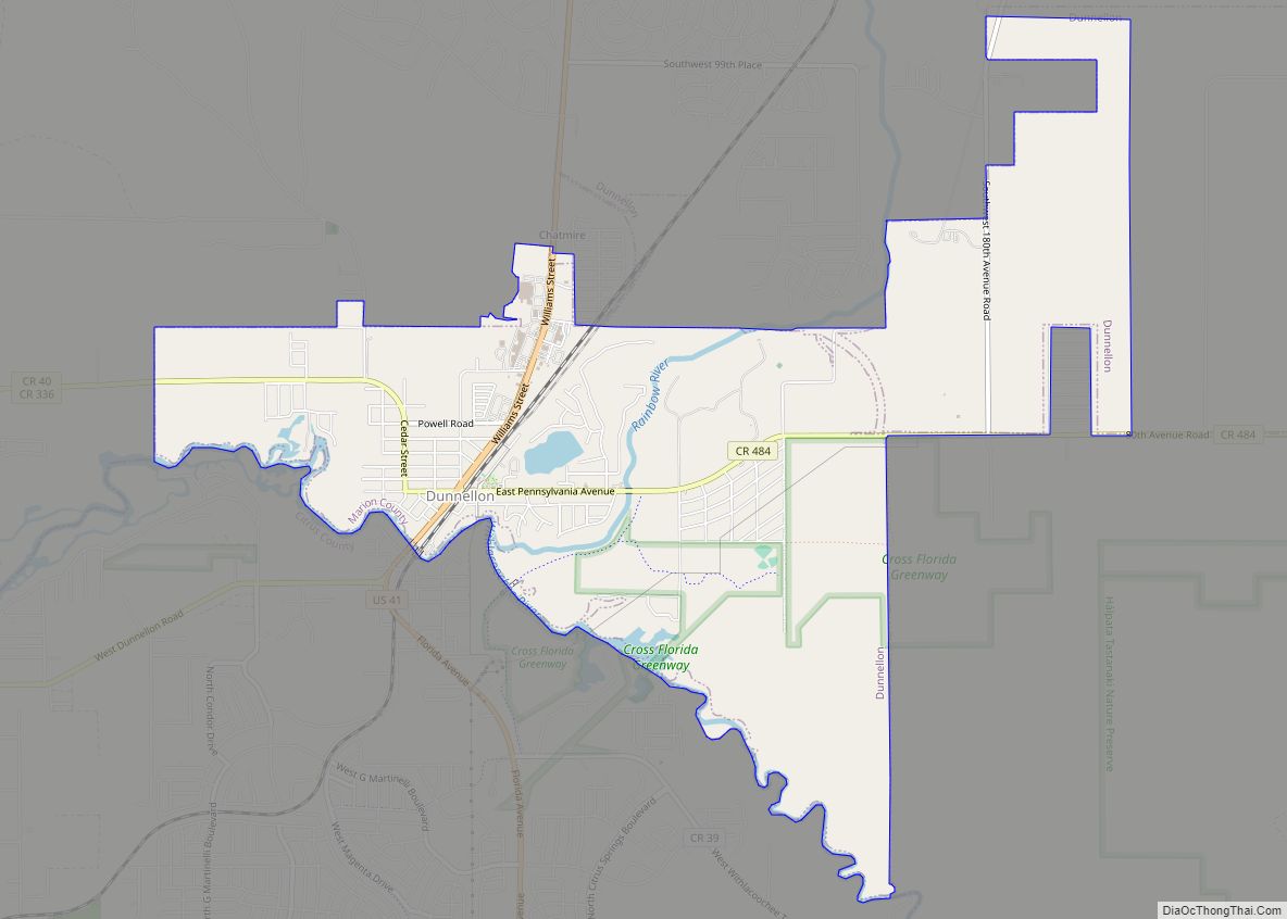
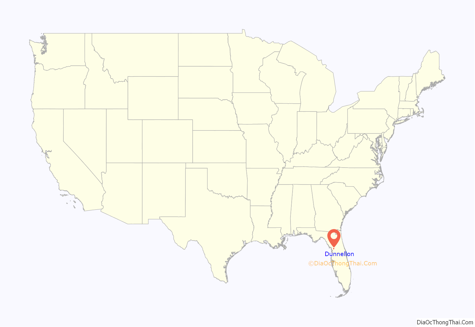
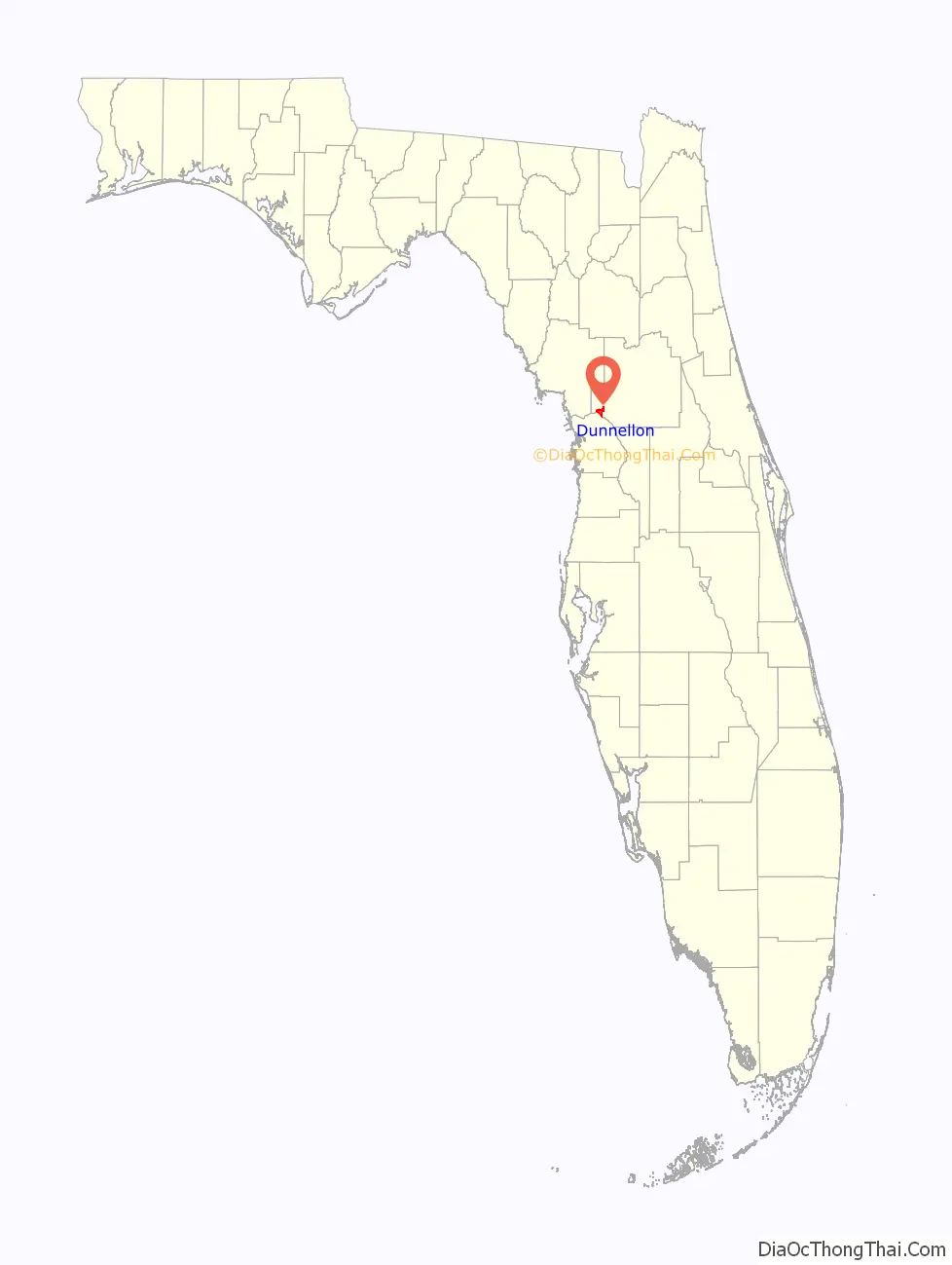
Dunnellon is a city with the unique feature of sitting in 3 counties in Marion, Levy & Citrus counties in Florida, United States. The predominant part falls in the Marion county. The population was 1,928 at the 2020 census, up from 1,733 in 2010. It is part of the Ocala Metropolitan Statistical Area.
| Name: | Dunnellon city |
|---|---|
| LSAD Code: | 25 |
| LSAD Description: | city (suffix) |
| State: | Florida |
| County: | Marion County |
| Elevation: | 49 ft (15 m) |
| Total Area: | 9.11 sq mi (23.61 km²) |
| Land Area: | 8.82 sq mi (22.83 km²) |
| Water Area: | 0.30 sq mi (0.77 km²) |
| Total Population: | 1,928 |
| Population Density: | 218.69/sq mi (84.43/km²) |
| ZIP code: | 34430-34432 |
| Area code: | 352 |
| FIPS code: | 1218675 |
| GNISfeature ID: | 0281879 |
| Website: | www.dunnellon.org |
Online Interactive Map
Click on ![]() to view map in "full screen" mode.
to view map in "full screen" mode.
Dunnellon location map. Where is Dunnellon city?
History
Dunnellon was founded in 1887, two years before the 1889 discovery of phosphate in the area. The subsequent mining boom, the first of its kind in Florida, lasted until the early 1910s. The original mining took place in and around the Rainbow River (then called Blue Run,) using the river’s natural flow to transport phosphates. One of the original mining pits is now called the ‘Blue Cove’ subdivision. Phosphate industry operations began to shift south to the Polk County area, and by the 1960s, Dunnellon’s last mine closed. Dunnellon survived the bust period, unlike other nearby phosphate towns including Romeo, LeRoy, Brewster, and Parkersburg.
Areas in and around Dunnellon served as filming locations for the 2001 horror film Jeepers Creepers, with a great deal of location work on Tiger Trail (a.k.a. High School Road), the road to Dunnellon High School, officially known as SW 180th Avenue Rd., just outside Rainbow Springs State Park.
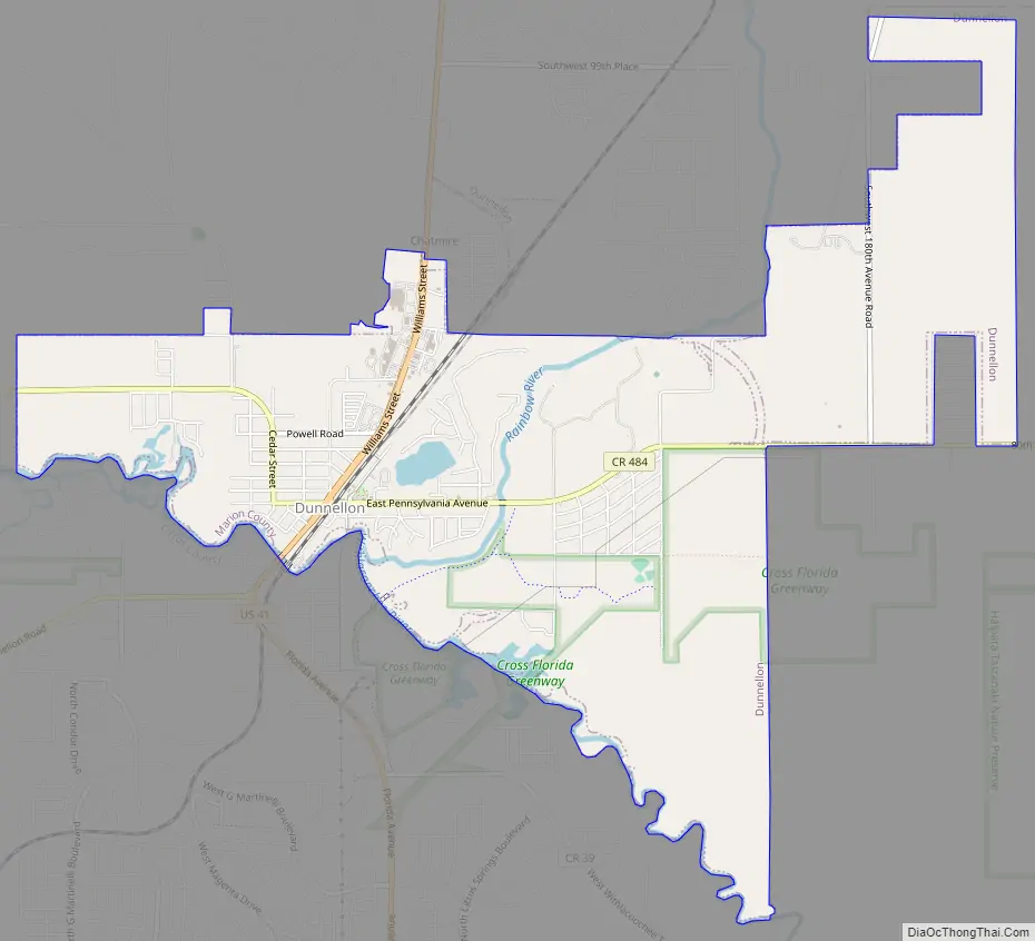
Dunnellon Road Map
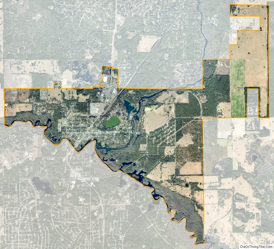
Dunnellon city Satellite Map
Geography
Dunnellon is located in southwestern Marion County at 29°3’N 82°27’W (29.0500, –82.4555), 76 miles (122 km) due north of Tampa. It is bordered to the southwest by the Withlacoochee River, which forms the border with Citrus County. Dunnellon is bordered to the north by unincorporated Rainbow Springs.
U.S. Route 41 passes through the city, leading north 24 miles (39 km) to Williston and south 18 miles (29 km) to Inverness. Ocala, the Marion county seat, is 24 miles (39 km) to the northeast.
According to the United States Census Bureau, Dunnellon has a total area of 9.1 square miles (24 km), of which 8.8 square miles (23 km) are land and 0.3 square miles (0.8 km), or 3.27%, are water. The Rainbow River joins the Withlacoochee River in Dunnellon, with the combined flow leading west toward the Gulf of Mexico.
See also
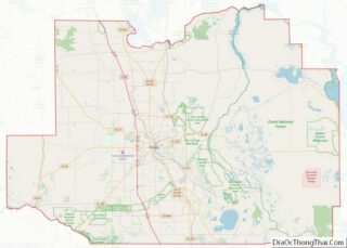
Map of Florida State and its subdivision:- Alachua
- Baker
- Bay
- Bradford
- Brevard
- Broward
- Calhoun
- Charlotte
- Citrus
- Clay
- Collier
- Columbia
- Desoto
- Dixie
- Duval
- Escambia
- Flagler
- Franklin
- Gadsden
- Gilchrist
- Glades
- Gulf
- Hamilton
- Hardee
- Hendry
- Hernando
- Highlands
- Hillsborough
- Holmes
- Indian River
- Jackson
- Jefferson
- Lafayette
- Lake
- Lee
- Leon
- Levy
- Liberty
- Madison
- Manatee
- Marion
- Martin
- Miami-Dade
- Monroe
- Nassau
- Okaloosa
- Okeechobee
- Orange
- Osceola
- Palm Beach
- Pasco
- Pinellas
- Polk
- Putnam
- Saint Johns
- Saint Lucie
- Santa Rosa
- Sarasota
- Seminole
- Sumter
- Suwannee
- Taylor
- Union
- Volusia
- Wakulla
- Walton
- Washington
- Alabama
- Alaska
- Arizona
- Arkansas
- California
- Colorado
- Connecticut
- Delaware
- District of Columbia
- Florida
- Georgia
- Hawaii
- Idaho
- Illinois
- Indiana
- Iowa
- Kansas
- Kentucky
- Louisiana
- Maine
- Maryland
- Massachusetts
- Michigan
- Minnesota
- Mississippi
- Missouri
- Montana
- Nebraska
- Nevada
- New Hampshire
- New Jersey
- New Mexico
- New York
- North Carolina
- North Dakota
- Ohio
- Oklahoma
- Oregon
- Pennsylvania
- Rhode Island
- South Carolina
- South Dakota
- Tennessee
- Texas
- Utah
- Vermont
- Virginia
- Washington
- West Virginia
- Wisconsin
- Wyoming