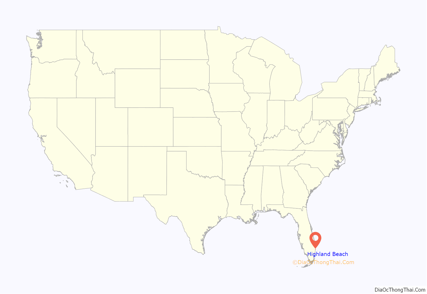
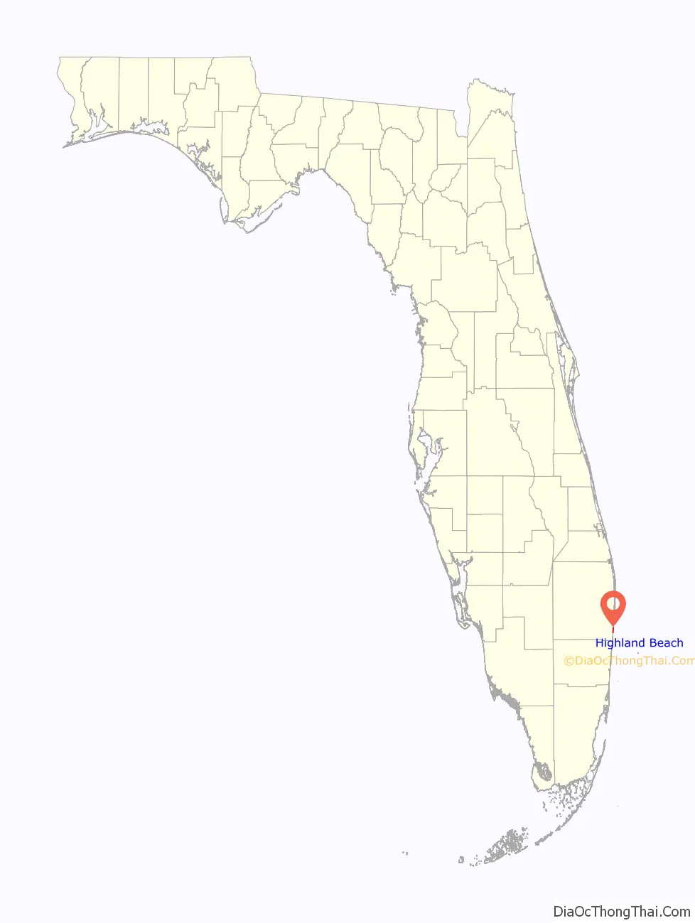
Highland Beach is a town in Palm Beach County, Florida, United States. It is situated 49 miles north of Miami and 20 miles south of Palm Beach. As of the 2010 census, the population was 3,539.
| Name: | Highland Beach town |
|---|---|
| LSAD Code: | 43 |
| LSAD Description: | town (suffix) |
| State: | Florida |
| County: | Palm Beach County |
| Elevation: | 13 ft (4 m) |
| Total Area: | 1.29 sq mi (3.34 km²) |
| Land Area: | 0.54 sq mi (1.39 km²) |
| Water Area: | 0.75 sq mi (1.95 km²) |
| Total Population: | 4,295 |
| Population Density: | 7,998.14/sq mi (3,089.80/km²) |
| ZIP code: | 33487 |
| Area code: | 561 |
| FIPS code: | 1230200 |
| GNISfeature ID: | 0283999 |
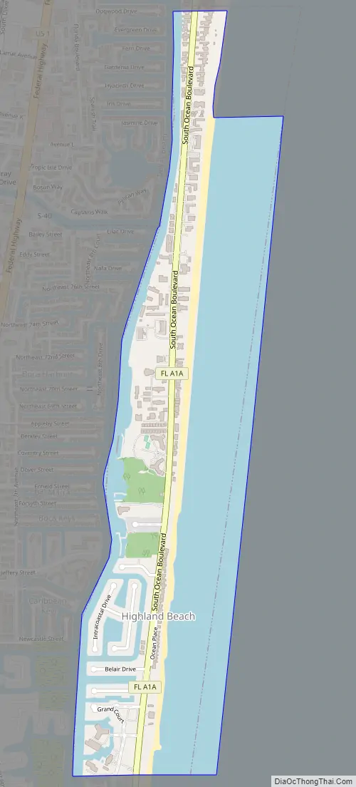
Online Interactive Map
Click on ![]() to view map in "full screen" mode.
to view map in "full screen" mode.
Highland Beach location map. Where is Highland Beach town?
History
Highland Beach was incorporated in 1949. The town was named for its relatively elevated town site.
Highland Beach Road Map
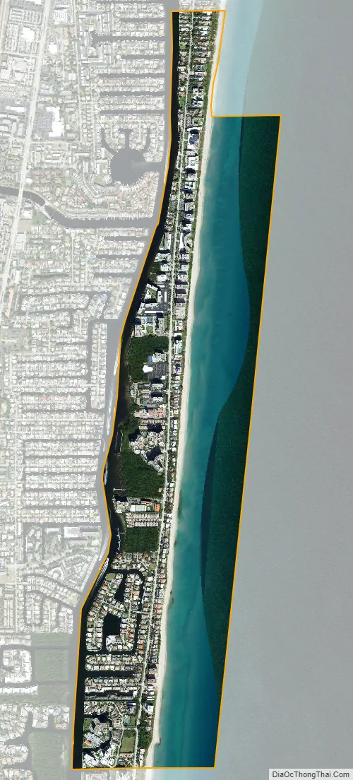
Highland Beach city Satellite Map
Geography
According to the United States Census Bureau, the town has a total area of 1.1 square miles (2.8 km), of which 0.5 square miles (1.3 km) is land and 0.6 square miles (1.6 km) (56.64%) is water.
See also
Map of Florida State and its subdivision:- Alachua
- Baker
- Bay
- Bradford
- Brevard
- Broward
- Calhoun
- Charlotte
- Citrus
- Clay
- Collier
- Columbia
- Desoto
- Dixie
- Duval
- Escambia
- Flagler
- Franklin
- Gadsden
- Gilchrist
- Glades
- Gulf
- Hamilton
- Hardee
- Hendry
- Hernando
- Highlands
- Hillsborough
- Holmes
- Indian River
- Jackson
- Jefferson
- Lafayette
- Lake
- Lee
- Leon
- Levy
- Liberty
- Madison
- Manatee
- Marion
- Martin
- Miami-Dade
- Monroe
- Nassau
- Okaloosa
- Okeechobee
- Orange
- Osceola
- Palm Beach
- Pasco
- Pinellas
- Polk
- Putnam
- Saint Johns
- Saint Lucie
- Santa Rosa
- Sarasota
- Seminole
- Sumter
- Suwannee
- Taylor
- Union
- Volusia
- Wakulla
- Walton
- Washington
- Alabama
- Alaska
- Arizona
- Arkansas
- California
- Colorado
- Connecticut
- Delaware
- District of Columbia
- Florida
- Georgia
- Hawaii
- Idaho
- Illinois
- Indiana
- Iowa
- Kansas
- Kentucky
- Louisiana
- Maine
- Maryland
- Massachusetts
- Michigan
- Minnesota
- Mississippi
- Missouri
- Montana
- Nebraska
- Nevada
- New Hampshire
- New Jersey
- New Mexico
- New York
- North Carolina
- North Dakota
- Ohio
- Oklahoma
- Oregon
- Pennsylvania
- Rhode Island
- South Carolina
- South Dakota
- Tennessee
- Texas
- Utah
- Vermont
- Virginia
- Washington
- West Virginia
- Wisconsin
- Wyoming


