Jensen Beach is an unincorporated community and census-designated place (CDP) in Martin County, Florida, United States. The population was 12,652 at the 2020 census. It is part of the Port St. Lucie, Florida Metropolitan Statistical Area.
| Name: | Jensen Beach CDP |
|---|---|
| LSAD Code: | 57 |
| LSAD Description: | CDP (suffix) |
| State: | Florida |
| County: | Martin County |
| Elevation: | 7 ft (2 m) |
| Total Area: | 8.19 sq mi (21.20 km²) |
| Land Area: | 6.97 sq mi (18.06 km²) |
| Water Area: | 1.21 sq mi (3.14 km²) |
| Total Population: | 12,652 |
| Population Density: | 1,814.43/sq mi (700.60/km²) |
| ZIP code: | 34957-34958 |
| Area code: | 772 |
| FIPS code: | 1235550 |
| GNISfeature ID: | 0284759 |
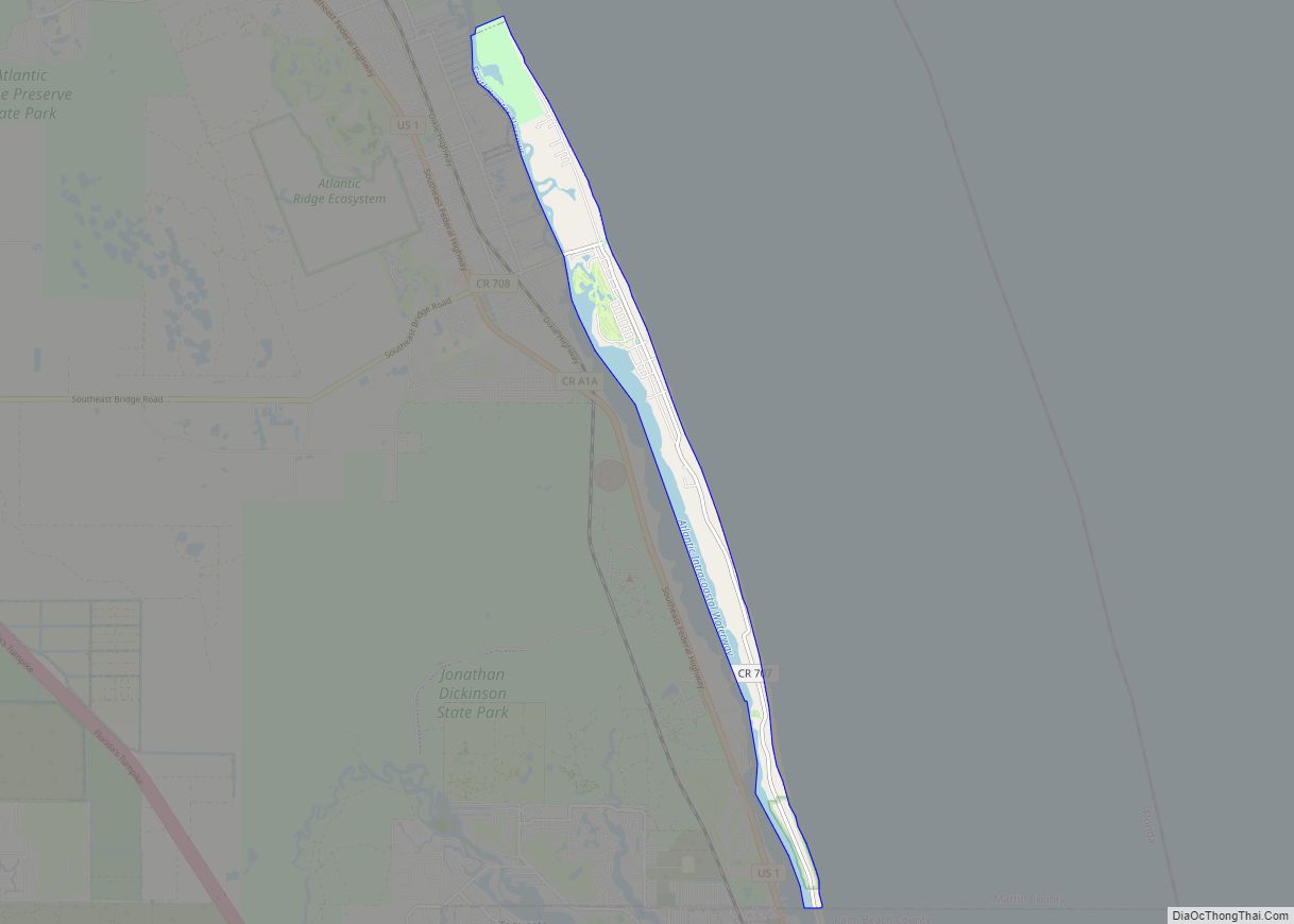
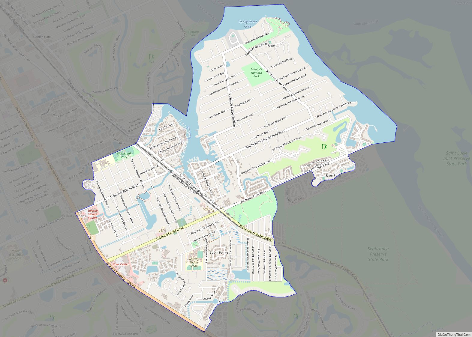
Online Interactive Map
Click on ![]() to view map in "full screen" mode.
to view map in "full screen" mode.
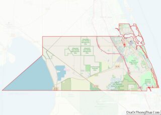
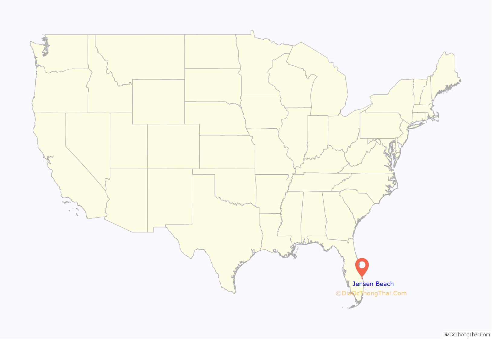
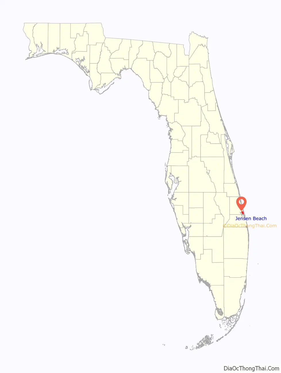
Jensen Beach location map. Where is Jensen Beach CDP?
History
The history of Jensen Beach in the 19th century revolved around pineapple farming. John Laurence Jensen, an immigrant from Denmark, arrived in 1881, and set up his pineapple plantation, which became the town of Jensen.
By 1894, the Florida East Coast Railway reached Jensen Beach, and freight shipments were loaded directly onto the freight cars.
By 1895, Jensen was called the “Pineapple Capital of the World”, shipping over one million boxes of pineapples each year during the June and July season. To help handle the increased pineapple production, a pineapple factory was built, but a hard freeze in 1895 devastated most of the small pineapple plantations. Two fires, in 1908 and 1910, destroyed most of Jensen Beach and its remaining pineapple farms. The industry finally collapsed in 1920 due to a wide variety of financial and agriculture problems. Growers decided to turn their efforts in another direction: raising citrus fruits. The pineapple has become a symbol of Jensen Beach. The fruit legacy is celebrated annually during the Jensen Beach Pineapple Festival.
Jensen Beach was incorporated as “Jensen” in 1926 during the Florida Land Boom, but was dissolved seven years later by the State of Florida in 1933 following the onset of the Great Depression. The town’s name was officially changed to “Jensen Beach” by Martin County in 1943.
In the second half of the 1900s, Saint Joseph College of Florida and later the Florida Institute of Technology both located on the Mansion at Tuckahoe premises in Jensen Beach.
In 2004 Jensen Beach was hit by two hurricanes. On September 5, 2004, Hurricane Frances made landfall at Hutchinson Island with winds of 105 miles per hour (169 km/h). On September 25, 2004, Hurricane Jeanne made landfall on Hutchinson Island with winds of 120 miles per hour (190 km/h).
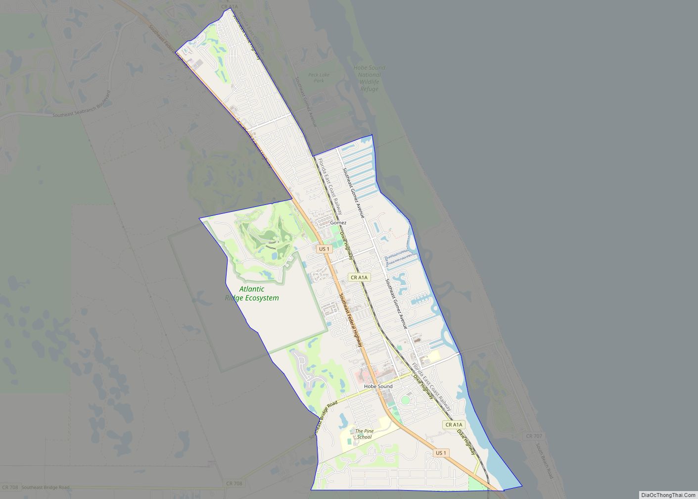
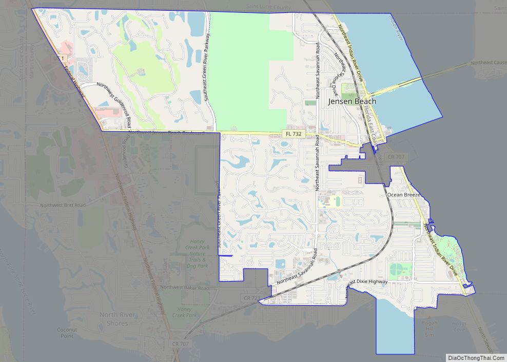
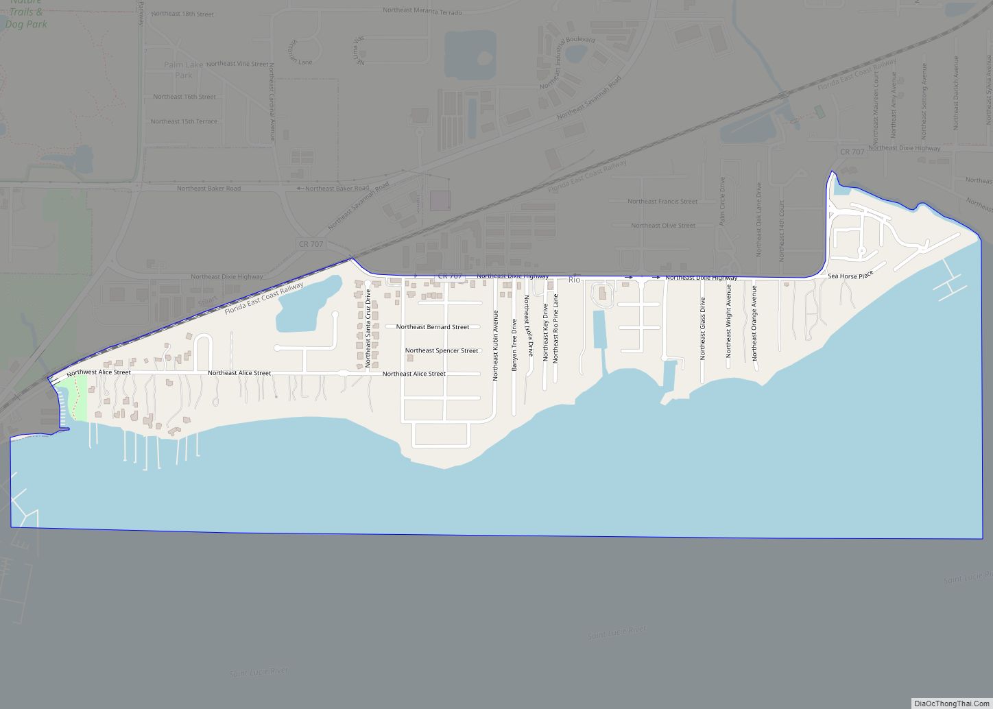
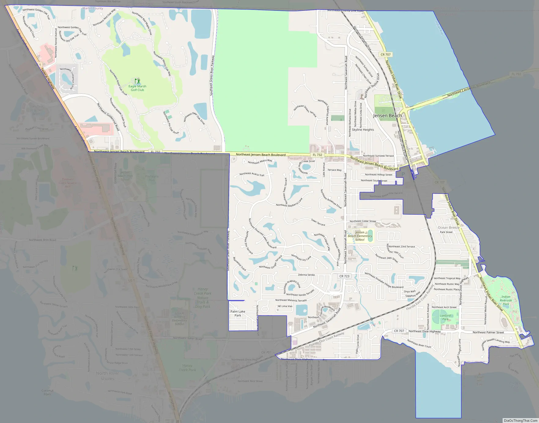
Jensen Beach Road Map
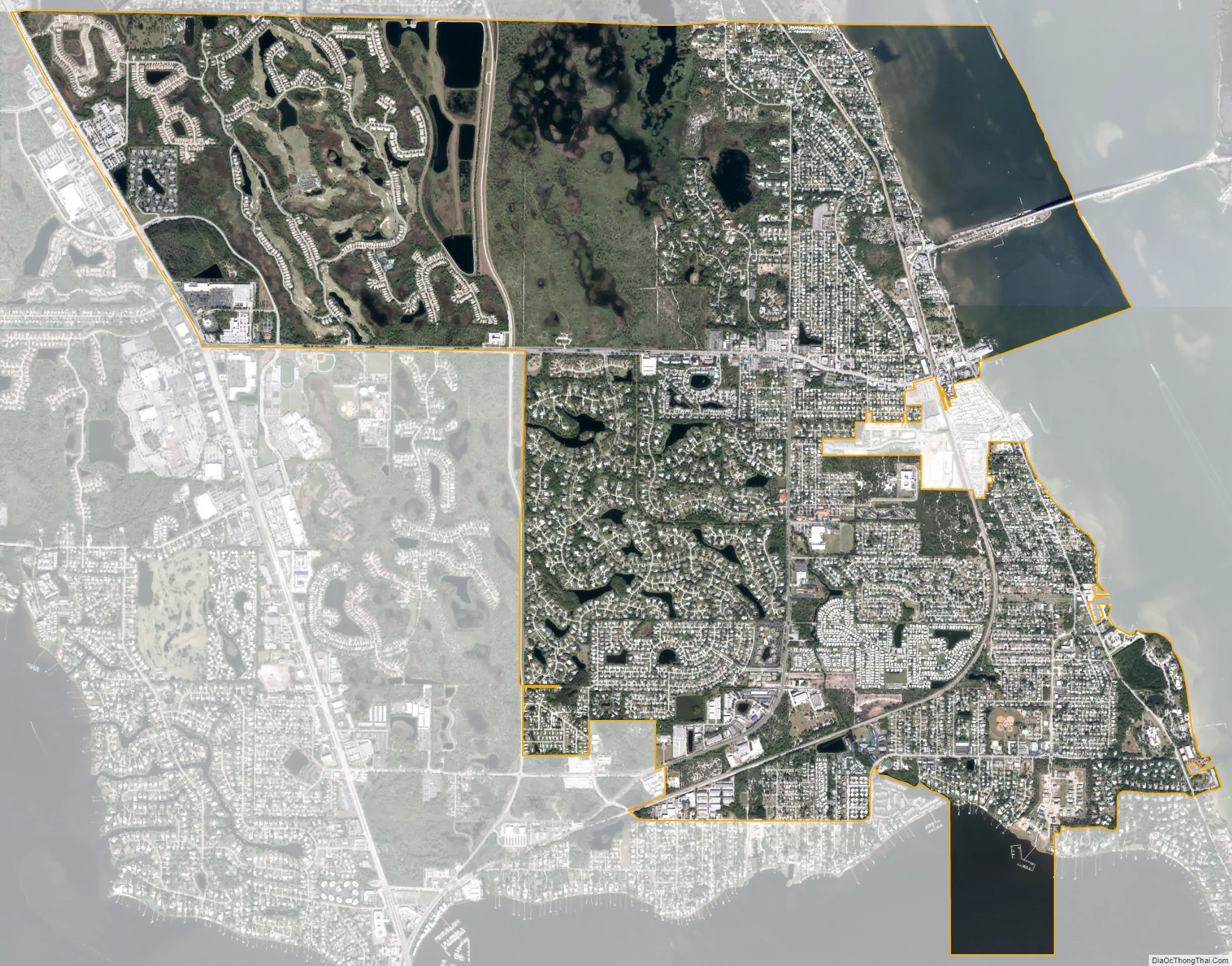
Jensen Beach city Satellite Map
Geography
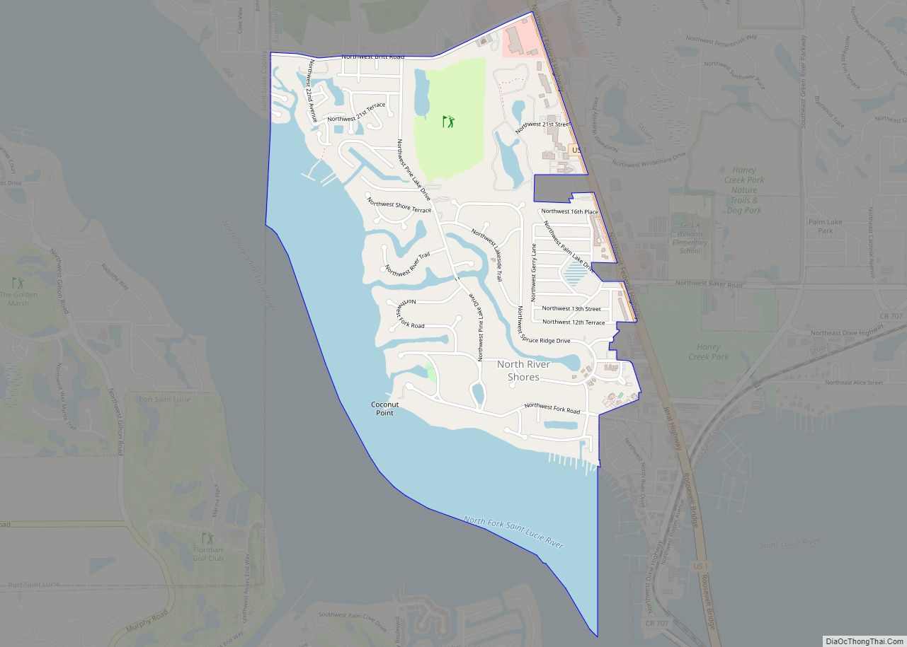
Jensen Beach occupies the northeast corner of Martin County. It is bordered to the east by the Indian River Lagoon and the town of Ocean Breeze, to the southeast by the town of Sewall’s Point, to the south by unincorporated Rio, to the southwest by the city of Stuart, the Martin county seat, to the northwest by U.S. Route 1, and to the north by the city of Port St. Lucie in St. Lucie County. Unincorporated North River Shores is to the west of Jensen Beach, on the opposite side of US 1. According to the United States Census Bureau, the CDP has a total area of 8.2 square miles (21.2 km), of which 7.0 square miles (18.1 km) are land and 1.2 square miles (3.1 km), or 14.82%, are water.
Waveland was the original name for the area from Crossroads Hill (south of N.E. Center Street) south to the tip of Sewall’s Point and west to Warner Creek.
“Jensen” originally meant the area immediately adjacent to modern-day downtown Jensen Beach.
Jensen Beach was rated the “Top Spot for Beach Volleyball” in 2008 by Prime Time Magazine, and is a part of Florida’s Treasure Coast region, which derives its name from the ships that wrecked during the 17th century because of coral reefs in the shallow waters. Artifacts and treasures from these ships of Spanish origin can still be discovered today.
The Skyline Drive area includes some of the highest points in the community, reaching an elevation of 70 feet (21 m) at one point.
The climate in the area is characterized by hot, humid summers and generally mild to cool winters. According to the Köppen Climate Classification system, Jensen Beach has a humid subtropical climate, abbreviated “Cfa” on climate maps.
See also
Map of Florida State and its subdivision:- Alachua
- Baker
- Bay
- Bradford
- Brevard
- Broward
- Calhoun
- Charlotte
- Citrus
- Clay
- Collier
- Columbia
- Desoto
- Dixie
- Duval
- Escambia
- Flagler
- Franklin
- Gadsden
- Gilchrist
- Glades
- Gulf
- Hamilton
- Hardee
- Hendry
- Hernando
- Highlands
- Hillsborough
- Holmes
- Indian River
- Jackson
- Jefferson
- Lafayette
- Lake
- Lee
- Leon
- Levy
- Liberty
- Madison
- Manatee
- Marion
- Martin
- Miami-Dade
- Monroe
- Nassau
- Okaloosa
- Okeechobee
- Orange
- Osceola
- Palm Beach
- Pasco
- Pinellas
- Polk
- Putnam
- Saint Johns
- Saint Lucie
- Santa Rosa
- Sarasota
- Seminole
- Sumter
- Suwannee
- Taylor
- Union
- Volusia
- Wakulla
- Walton
- Washington
- Alabama
- Alaska
- Arizona
- Arkansas
- California
- Colorado
- Connecticut
- Delaware
- District of Columbia
- Florida
- Georgia
- Hawaii
- Idaho
- Illinois
- Indiana
- Iowa
- Kansas
- Kentucky
- Louisiana
- Maine
- Maryland
- Massachusetts
- Michigan
- Minnesota
- Mississippi
- Missouri
- Montana
- Nebraska
- Nevada
- New Hampshire
- New Jersey
- New Mexico
- New York
- North Carolina
- North Dakota
- Ohio
- Oklahoma
- Oregon
- Pennsylvania
- Rhode Island
- South Carolina
- South Dakota
- Tennessee
- Texas
- Utah
- Vermont
- Virginia
- Washington
- West Virginia
- Wisconsin
- Wyoming