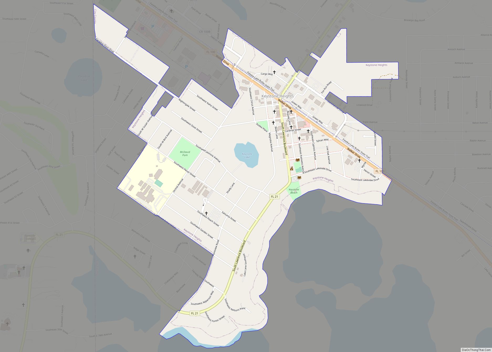
Keystone Heights is a city located in southwestern Clay County, Florida, United States. The population of the city was 1,446 at the 2020 census and increased to 1,478 in 2021. The city’s name is derived from the state of Pennsylvania‘s nickname, the “Keystone State”. Keystone Heights is the southwestern most city in the Jacksonville metropolitan area, home to 1,637,666 residents.
Keystone Heights is the principal city and primary economic driver of the Lake Region, a region in Florida consisting of southwestern Clay County and parts of Bradford, Putnam, and Alachua counties, known for its many lakes.
| Name: | Keystone Heights city |
|---|---|
| LSAD Code: | 25 |
| LSAD Description: | city (suffix) |
| State: | Florida |
| County: | Clay County |
| Elevation: | 141 ft (43 m) |
| Total Area: | 1.09 sq mi (2.82 km²) |
| Land Area: | 1.07 sq mi (2.78 km²) |
| Water Area: | 0.01 sq mi (0.04 km²) |
| Total Population: | 1,478 |
| Population Density: | 1,381.31/sq mi (531.65/km²) |
| ZIP code: | 32656 |
| Area code: | 352 |
| FIPS code: | 1236475 |
| GNISfeature ID: | 0285088 |
| Website: | www.keystoneheights.us |
Online Interactive Map
Click on ![]() to view map in "full screen" mode.
to view map in "full screen" mode.
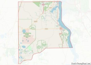
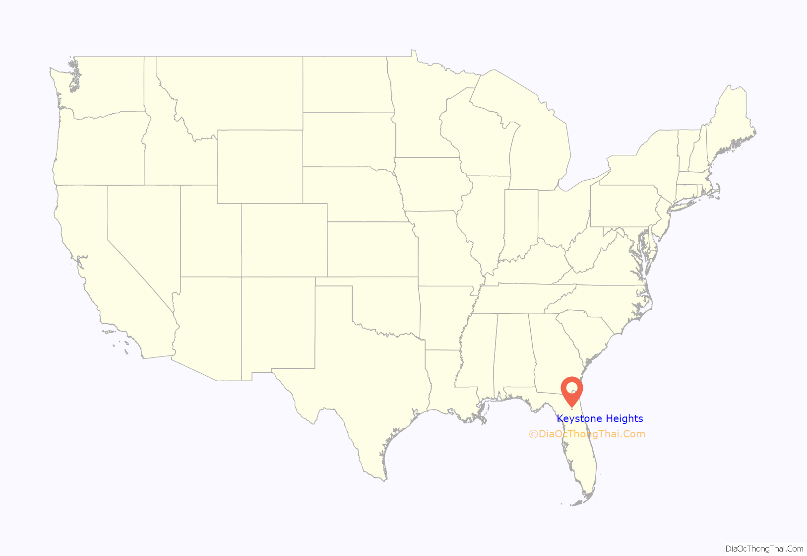
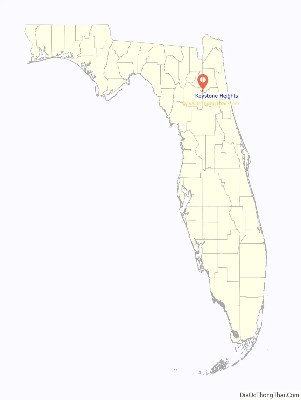
Keystone Heights location map. Where is Keystone Heights city?
History
Early years and founding
In 1917, the area that would eventually become known as the city of Keystone Heights was a small community known as Brooklyn located along present day State Road 100, about one mile north of the present location of Keystone Heights on Lake Brooklyn.
In those early days Brooklyn consisted of a large unpainted building called the Brooklyn Hotel; a combination general store and post office; and several small houses scattered about. Property Developer John J. Lawrence, who hailed from Pennsylvania, noticed the area on a visit to Lake Brooklyn, and instantly became attracted to the region.
In 1920, the Lawrence family completed their home, the first house built in Keystone Heights, which overlooked Lake Geneva, and still lies there today at the corner of Jasmine Avenue & Lawrence Blvd. (State Road 21). After hearing of natural wonders and the many different lakes of the area, other families moved to Keystone, putting a strain on those attempting to build structures within the city. Helping to address the issue, in late 1921, C. Ray Lawrence came to Keystone Heights, and began laying out the streets and lots in the city.
The town would be incorporated as Keystone Heights, named after Lawrence’s home state of Pennsylvania’s nickname, the “Keystone State”, in 1925.
20th and 21st centuries
The opening of the Keystone Inn on New Year’s Day in 1923 was one of the most significant events in the early history of the city. The inn hosted many festivals and socials, becoming an important centerpiece of the town.
Tourists visiting the inn would often also frequent the nearby Chautauqua. A large open pit that effectively served as a type of amphitheater, the Chautauqua served as a beacon for various musicians, artists, and speakers from the Chautauqua circuit in New York.
Within two years of opening, visitors traveled to the Keystone Inn and the community of Keystone Heights from across the country to experience the town for themselves. The small community boasted a public beach with a pavilion, picnic grounds and a nine-hole golf course. The University of Florida’s football team would even stay at the inn before their homecoming games.
The inn no longer exists. It burned down in October 1954, and was never rebuilt. However, it did play an important role in transforming Keystone Heights into a popular vacation destination, a status it still holds today. The former property of the inn is now a park in front of City Hall.
In 1984, an American sycamore seedling, germinated by the United States Forest Service, was planted at the Keystone Heights Library. The “Moon Tree” traveled with Stuart Roosa, a former U.S. Forest Service smokejumper, aboard the Apollo 14 mission on January 31, 1971. Roosa and his five varieties of seeds orbited the moon 34 times and the resulting seedlings were planted all around the United States and the world.
In the early 2000s, the city saw its tourism industry decline as many of its surrounding lakes, which serve as a primary inflow point for the Floridan aquifer, nearly disappeared. Increased rainfall totals in the 2010s have helped in the recovery of many area lakes including Lake Brooklyn and Lake Geneva.
The Black Creek Pipeline, a $43.3 million project to pump excess water from Black Creek in central Clay County to Alligator Creek just north of Lake Brooklyn, is expected to further restore lake levels. The project began in August 2022.
In fall of 2021, Keystone Heights served as the host of the internationally televised Nitro Rallycross North America Championship at the Florida International Rally and Motorsports Park at the Keystone Heights Airport. In April 2022, Keystone Beach hosted the Motosurf Games, a motorized surfboard racing contest on Lake Geneva that was televised on CBS Sports. The games returned to the city in April 2023 as the first race of the 2023 season.
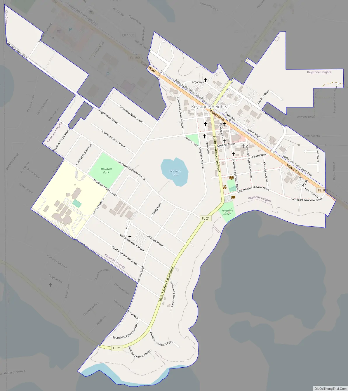
Keystone Heights Road Map
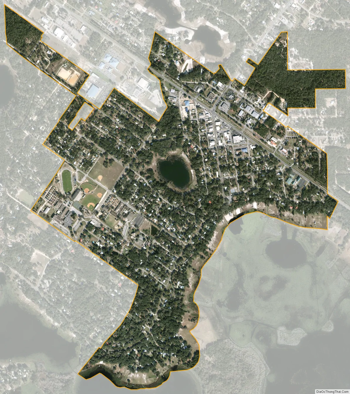
Keystone Heights city Satellite Map
Geography
Keystone Heights is located in Northeast Florida in the southwest corner of Clay County, at 29°47′14″N 82°1′59″W / 29.78722°N 82.03306°W / 29.78722; -82.03306 (29.787243, –82.033026). The city overlooks the north shore of Lake Geneva and is bordered to the west by Bradford County and to the north by Lake Brooklyn. State Road 21 leads northeast 30 miles (48 km) (via SR 16) to Green Cove Springs, the Clay County seat, and south 18 miles (29 km) to Hawthorne. SR 100 crosses SR 21 and leads northwest 12 miles (19 km) to Starke and southeast 26 miles (42 km) to Palatka. Located in the center of town, Keystone Lake is the only lake entirely within the city limits.
According to the United States Census Bureau, the city has a total area of 1.1 square miles (2.9 km), of which 0.012 square miles (0.03 km), or 1.16%, is water.
See also
Map of Florida State and its subdivision:- Alachua
- Baker
- Bay
- Bradford
- Brevard
- Broward
- Calhoun
- Charlotte
- Citrus
- Clay
- Collier
- Columbia
- Desoto
- Dixie
- Duval
- Escambia
- Flagler
- Franklin
- Gadsden
- Gilchrist
- Glades
- Gulf
- Hamilton
- Hardee
- Hendry
- Hernando
- Highlands
- Hillsborough
- Holmes
- Indian River
- Jackson
- Jefferson
- Lafayette
- Lake
- Lee
- Leon
- Levy
- Liberty
- Madison
- Manatee
- Marion
- Martin
- Miami-Dade
- Monroe
- Nassau
- Okaloosa
- Okeechobee
- Orange
- Osceola
- Palm Beach
- Pasco
- Pinellas
- Polk
- Putnam
- Saint Johns
- Saint Lucie
- Santa Rosa
- Sarasota
- Seminole
- Sumter
- Suwannee
- Taylor
- Union
- Volusia
- Wakulla
- Walton
- Washington
- Alabama
- Alaska
- Arizona
- Arkansas
- California
- Colorado
- Connecticut
- Delaware
- District of Columbia
- Florida
- Georgia
- Hawaii
- Idaho
- Illinois
- Indiana
- Iowa
- Kansas
- Kentucky
- Louisiana
- Maine
- Maryland
- Massachusetts
- Michigan
- Minnesota
- Mississippi
- Missouri
- Montana
- Nebraska
- Nevada
- New Hampshire
- New Jersey
- New Mexico
- New York
- North Carolina
- North Dakota
- Ohio
- Oklahoma
- Oregon
- Pennsylvania
- Rhode Island
- South Carolina
- South Dakota
- Tennessee
- Texas
- Utah
- Vermont
- Virginia
- Washington
- West Virginia
- Wisconsin
- Wyoming