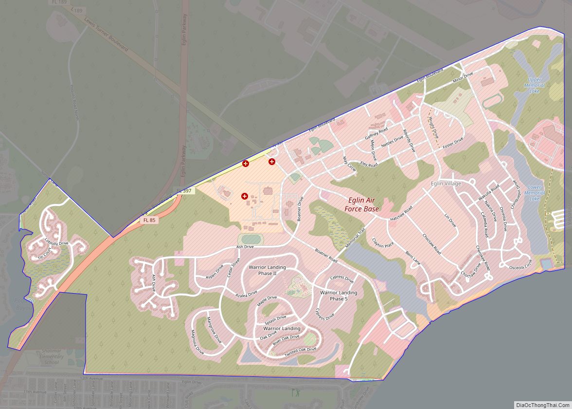
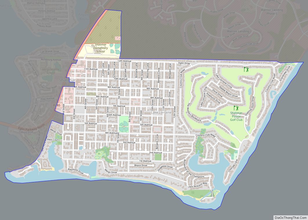
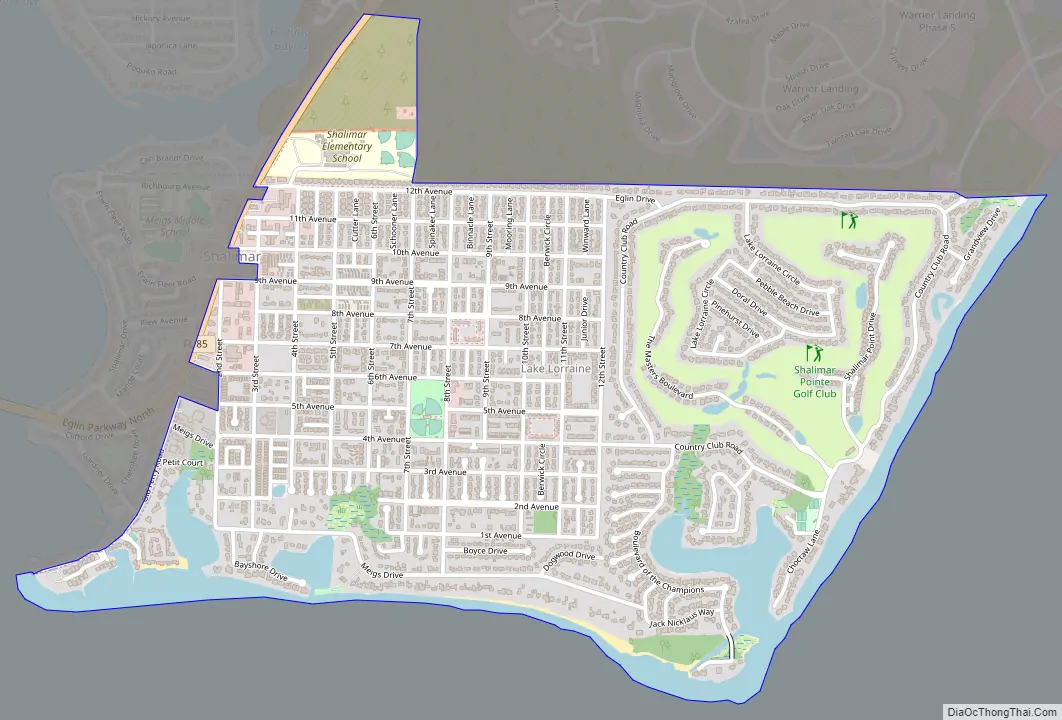
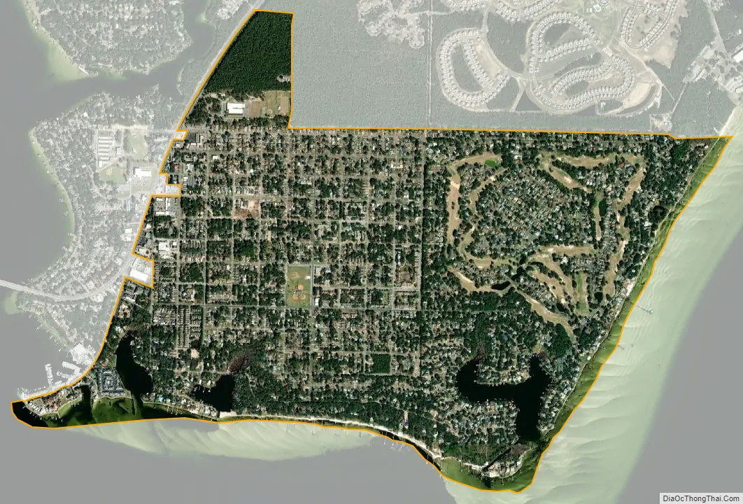
Lake Lorraine is a census-designated place (CDP) in Okaloosa County, Florida, United States. The population was 7,106 at the 2000 census. It is part of the Fort Walton Beach–Crestview–Destin Metropolitan Statistical Area. It carries a Shalimar postal address and zip code. Lake Lorraine was originally a fresh-water body, but at some point in the 1990s the narrow sandbar that separated it from the Choctawhatchee Bay was breached and the former drainage channel to the tip of Black’s Point became blocked by silt.
The residential neighborhood originally developed along circumferential Country Club Road, surrounding a golf course, in the 1970s. The recession of 1976 left a number of properties in the interior of the golf course U in an unfinished and abandoned state. These parcels were later reconstructed. Further growth took place in the 1990s and 2000s, when the formerly wooded Black’s Point area was developed with streets bearing the names of famous golfers. A “backdoor” gate onto Eglin Air Force Base, adjacent to base housing, accessed by Davis Court off of the northeast corner of Country Club Road, was closed amidst tightened base security and concerns about traffic routing through residential neighborhoods in the mid-1970s.
During World War II, adjacent Eglin Field anchored a battleship-size target float in the Choctawhatchee Bay, just south of Black’s Point, the southernmost point of the Lake Lorraine area, an area designated during the war as Eglin water range 60.
| Name: | Lake Lorraine CDP |
|---|---|
| LSAD Code: | 57 |
| LSAD Description: | CDP (suffix) |
| State: | Florida |
| County: | Okaloosa County |
| Elevation: | 26 ft (8 m) |
| Total Area: | 2.29 sq mi (5.93 km²) |
| Land Area: | 2.06 sq mi (5.33 km²) |
| Water Area: | 0.23 sq mi (0.60 km²) |
| Total Population: | 7,142 |
| Population Density: | 3,470.36/sq mi (1,339.87/km²) |
| FIPS code: | 1238287 |
| GNISfeature ID: | 1867162 |
Online Interactive Map
Click on ![]() to view map in "full screen" mode.
to view map in "full screen" mode.
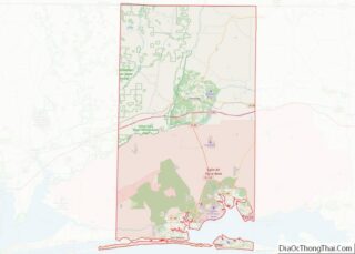
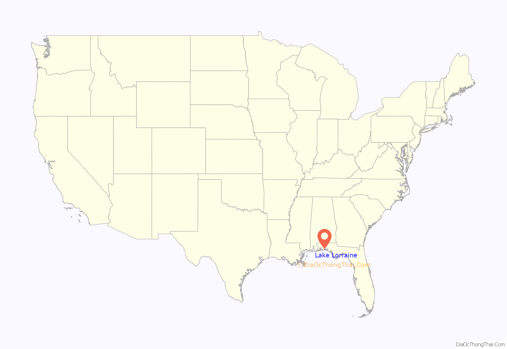
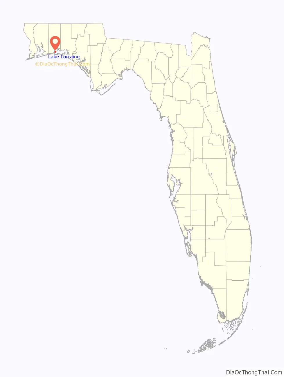
Lake Lorraine location map. Where is Lake Lorraine CDP?
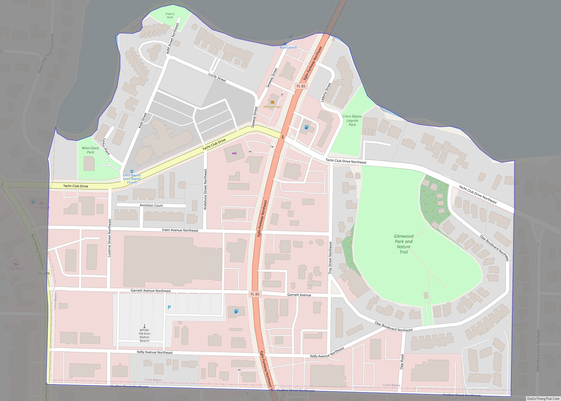
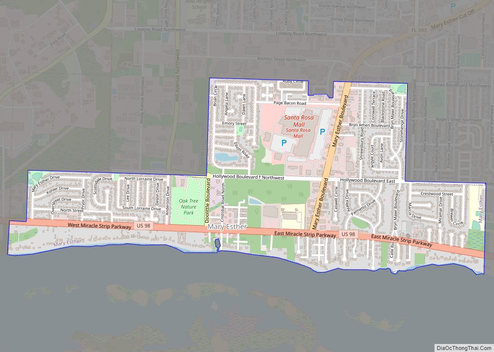
Lake Lorraine Road Map
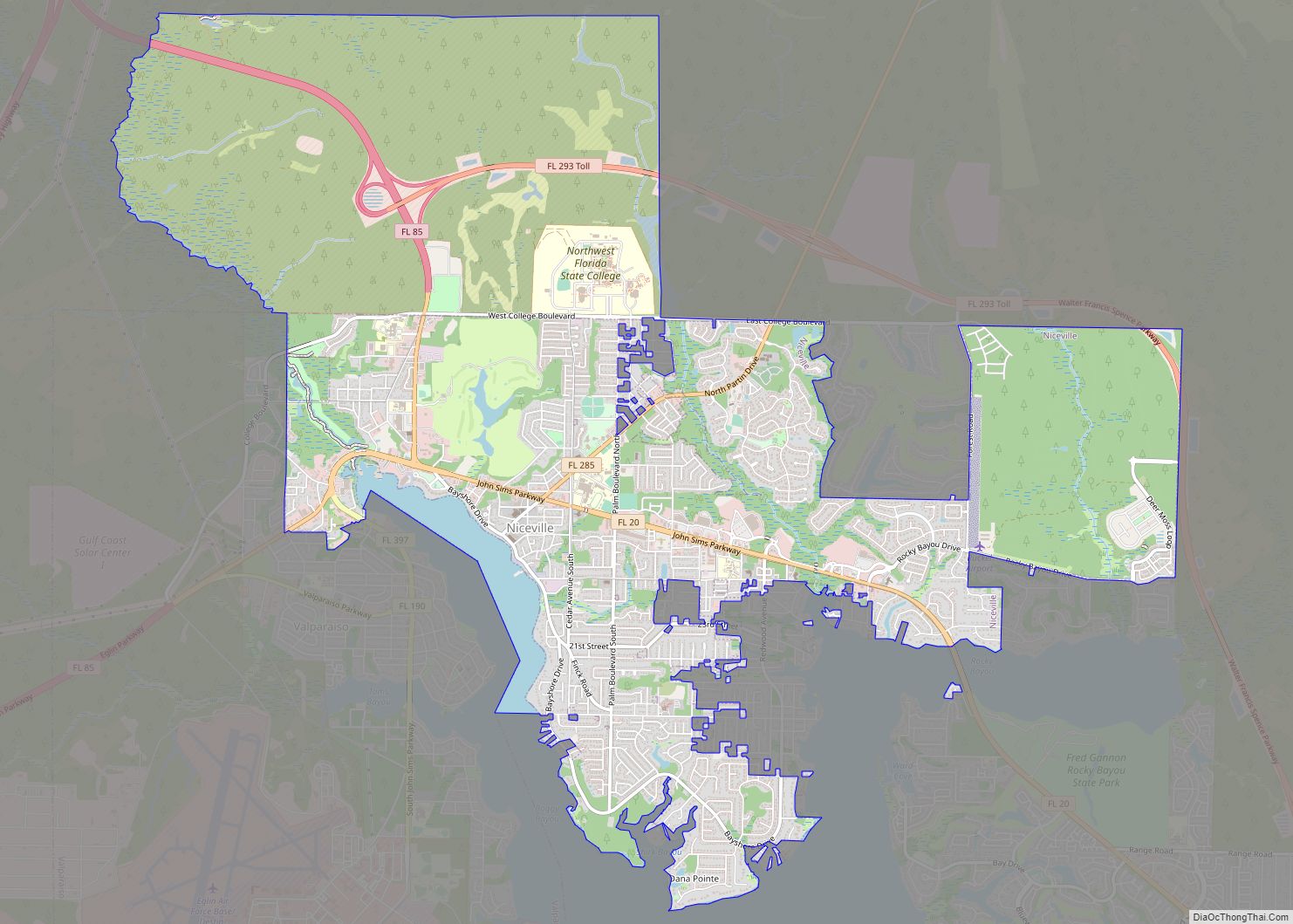
Lake Lorraine city Satellite Map
Geography
Lake Lorraine is located at 30°26′30″N 86°34′13″W / 30.44167°N 86.57028°W / 30.44167; -86.57028 (30.441648, -86.570152).
According to the United States Census Bureau, the CDP has a total area of 2.4 square miles (6.2 km), of which 2.0 square miles (5.2 km) is land and 0.3 square miles (0.78 km) (13.56%) is water.
See also
Map of Florida State and its subdivision:- Alachua
- Baker
- Bay
- Bradford
- Brevard
- Broward
- Calhoun
- Charlotte
- Citrus
- Clay
- Collier
- Columbia
- Desoto
- Dixie
- Duval
- Escambia
- Flagler
- Franklin
- Gadsden
- Gilchrist
- Glades
- Gulf
- Hamilton
- Hardee
- Hendry
- Hernando
- Highlands
- Hillsborough
- Holmes
- Indian River
- Jackson
- Jefferson
- Lafayette
- Lake
- Lee
- Leon
- Levy
- Liberty
- Madison
- Manatee
- Marion
- Martin
- Miami-Dade
- Monroe
- Nassau
- Okaloosa
- Okeechobee
- Orange
- Osceola
- Palm Beach
- Pasco
- Pinellas
- Polk
- Putnam
- Saint Johns
- Saint Lucie
- Santa Rosa
- Sarasota
- Seminole
- Sumter
- Suwannee
- Taylor
- Union
- Volusia
- Wakulla
- Walton
- Washington
- Alabama
- Alaska
- Arizona
- Arkansas
- California
- Colorado
- Connecticut
- Delaware
- District of Columbia
- Florida
- Georgia
- Hawaii
- Idaho
- Illinois
- Indiana
- Iowa
- Kansas
- Kentucky
- Louisiana
- Maine
- Maryland
- Massachusetts
- Michigan
- Minnesota
- Mississippi
- Missouri
- Montana
- Nebraska
- Nevada
- New Hampshire
- New Jersey
- New Mexico
- New York
- North Carolina
- North Dakota
- Ohio
- Oklahoma
- Oregon
- Pennsylvania
- Rhode Island
- South Carolina
- South Dakota
- Tennessee
- Texas
- Utah
- Vermont
- Virginia
- Washington
- West Virginia
- Wisconsin
- Wyoming