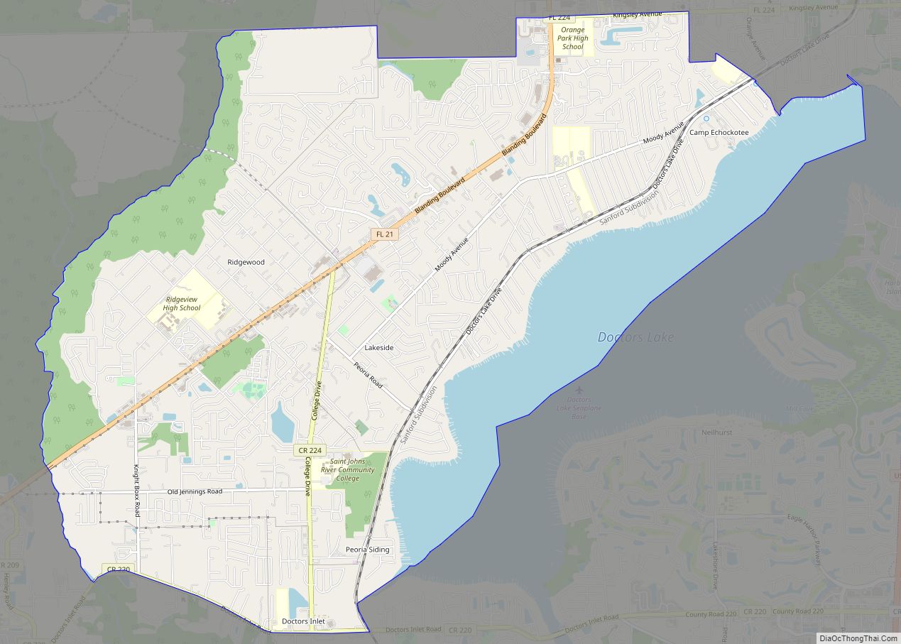
Lakeside is an unincorporated area and census-designated place in Clay County, Florida, United States. The population was 30,943 at the 2010 census. It is part of the greater Orange Park area.
| Name: | Lakeside CDP |
|---|---|
| LSAD Code: | 57 |
| LSAD Description: | CDP (suffix) |
| State: | Florida |
| County: | Clay County |
| Elevation: | 66 ft (20 m) |
| Total Area: | 15.65 sq mi (40.53 km²) |
| Land Area: | 13.45 sq mi (34.84 km²) |
| Water Area: | 2.19 sq mi (5.68 km²) |
| Total Population: | 31,275 |
| Population Density: | 2,324.76/sq mi (897.60/km²) |
| FIPS code: | 1238813 |
| GNISfeature ID: | 1867166 |
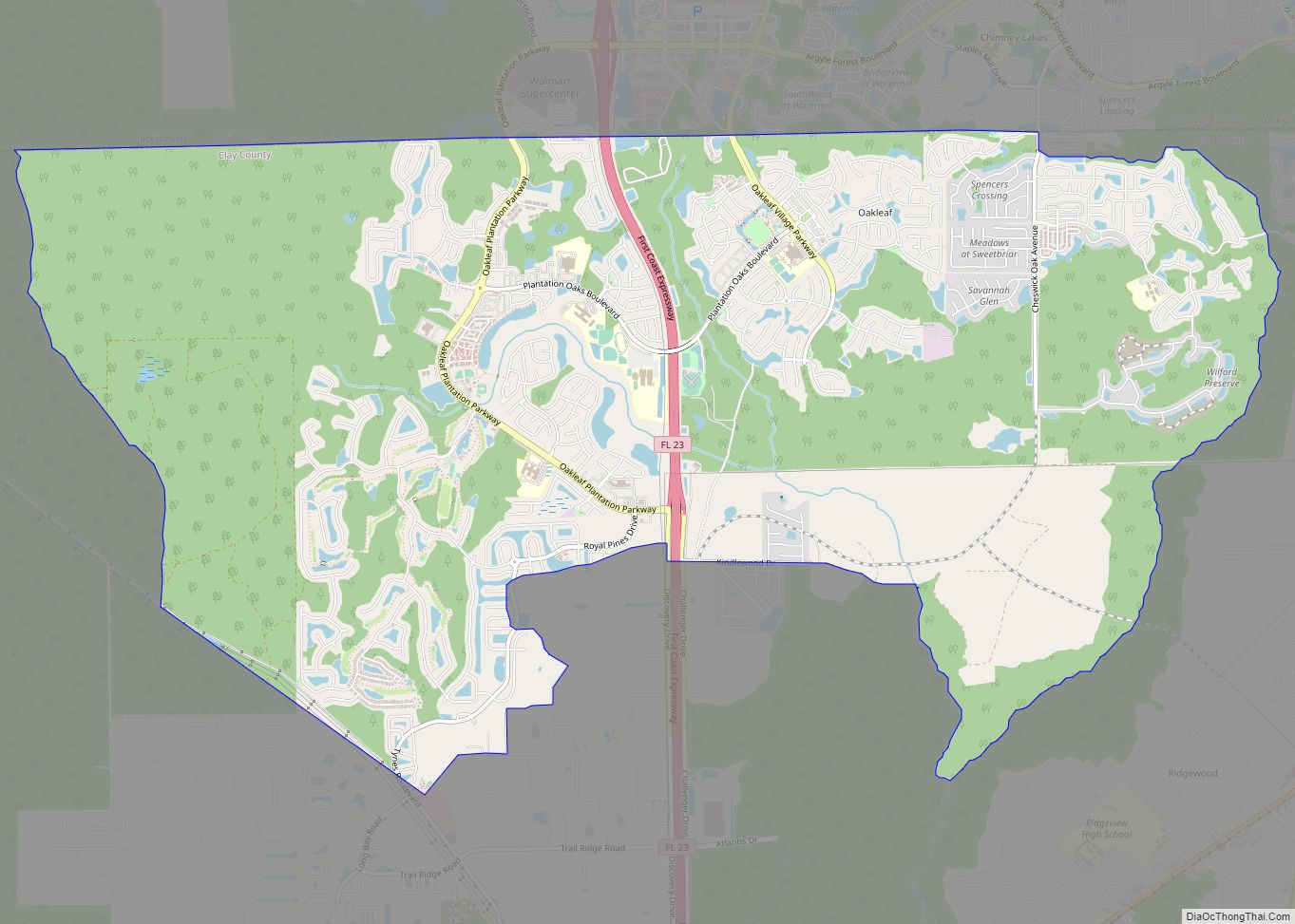
Online Interactive Map
Click on ![]() to view map in "full screen" mode.
to view map in "full screen" mode.
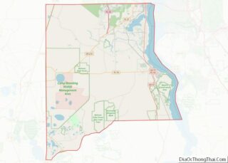
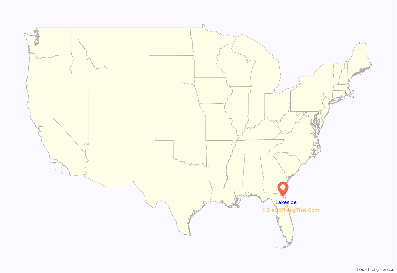
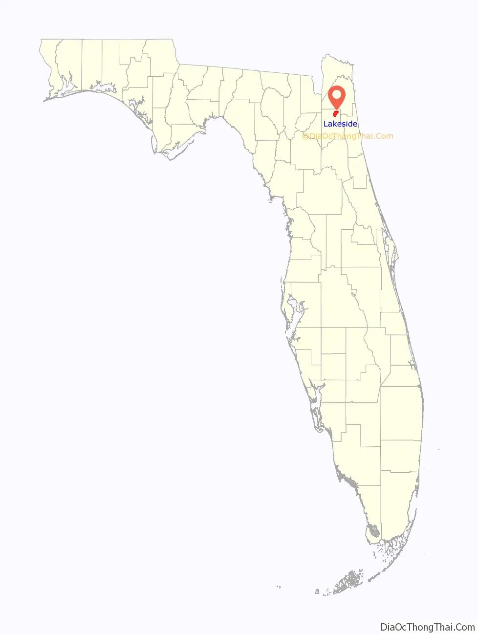
Lakeside location map. Where is Lakeside CDP?
History
The Yerkes Regional Primate Research Center, one of ten regional centers for primate research, was once located just west of Orange Park in what is now the Lakeside CDP. The center, established in 1930 by psychologist Robert Yerkes and Yale University and the Rockefeller Foundation, was the first laboratory in the United States for the study of non-human primates. Prior to the opening of the facility, Yerkes was engaged in his own research with two great apes, named “Chim” and “Panzee”. His findings convinced officials at Yale University, the Rockefeller Foundation and the Carnegie Foundation to sponsor the Florida facility. Initially designed to house about 25 chimpanzees, researchers worked with an estimated 65 chimps (and possibly more) during the lab’s 35-year history. This location was home to chimpanzees nurtured as humans such as Gua and Viki and other primates from the estate of Madame Rosalia Abreu in Havana, Cuba. It was home to some of the leading behavioral scientists of the time, some of whom either liked or hated living in the humid South. These researchers studied various aspects of primate behavior, including basic biology, sensory function, reproductive systems, behavioral patterns, physiology and anatomy. Comically, rumors about the place by some Orange Park residents included those of scientists cross-breeding humans with apes. The term “Monkey Farm” has been used by some residents, who may be aware of the location’s history, to describe the lab’s functions.
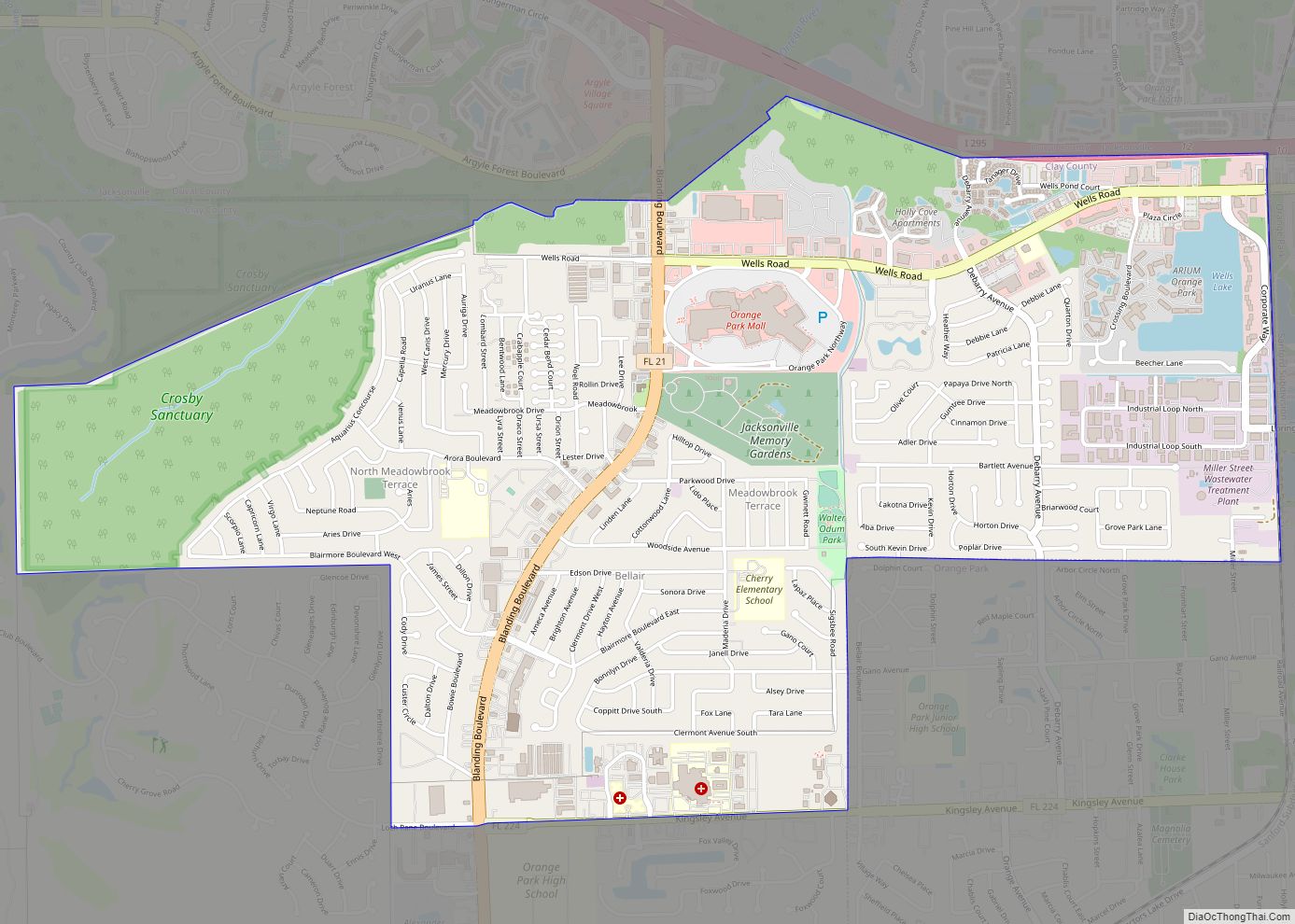
The plot of land upon which Yerkes Labs sat was 188 acres (76 ha), about a mile west of Orange Park. The actual research buildings sat on less than an acre, on what is now part of the Foxwood Center plaza (facing Orange Park Medical Center on Kingsley Avenue) in unincorporated land outside the town limits. In 1966, the abandoned buildings and adjacent land were purchased by Developer Marvin Wilhite of Ahpla, Inc., who still lives in Foxwood and built other communities such as Foxridge. He chose the name Ahpla (using a backward arrangement of the letters) after a female chimp named Alpha, who was the first chimp born at the Yerkes Labs on September 11, 1930.
Foxwood Center still has some of the original laboratory buildings that once housed the chimps, the grounds caretaker, and administrative offices. These stand alongside others that have been added, including the Orange Park Chamber of Commerce building. The old caretaker’s house is now known as The Granary, an organic food and health store.
In 1956, Emory University took over operation of the Center. In 1965, the center was relocated to the campus of Emory University in Atlanta, Georgia. In 2002, the Center was renamed the Yerkes National Primate Research Center, though officially the “Regional” name still applies.
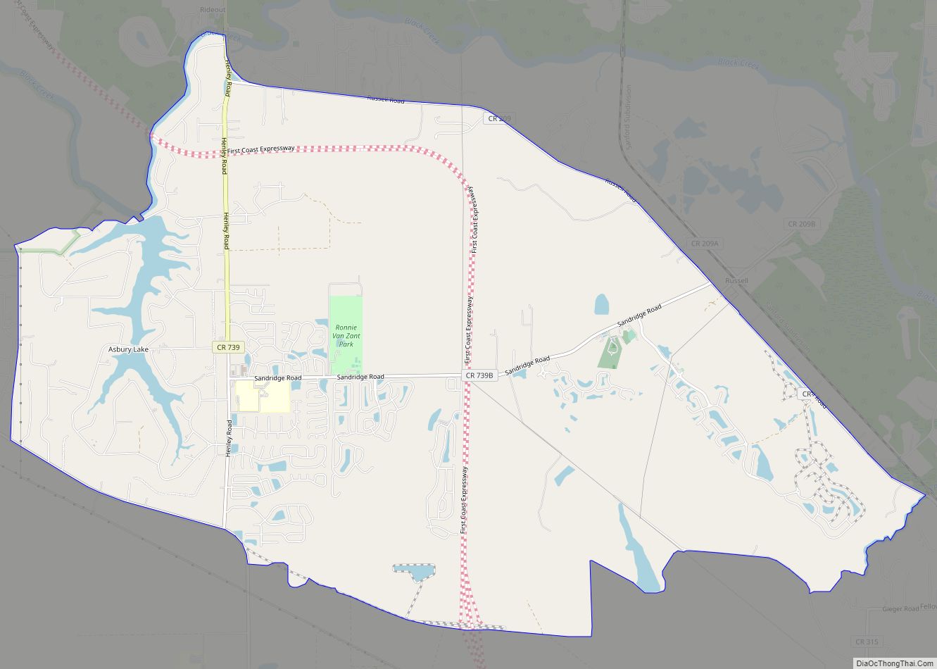
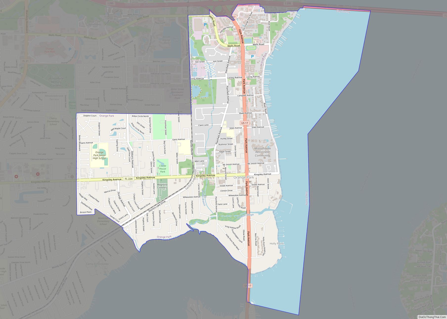
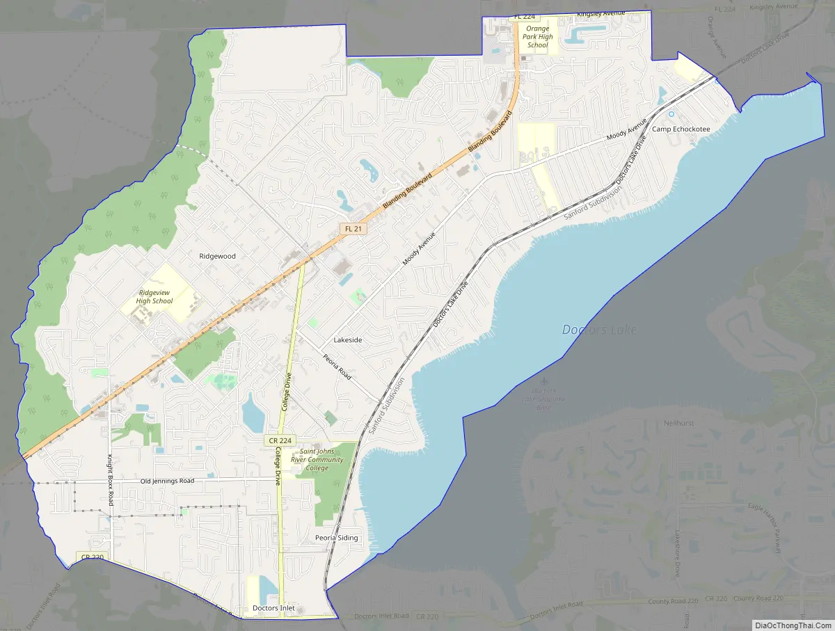
Lakeside Road Map
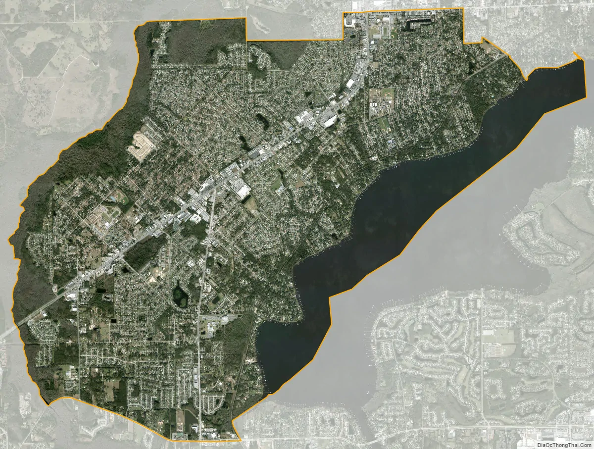
Lakeside city Satellite Map
Geography
Lakeside is located in northeastern Clay County at 30°8′5″N 81°45′57″W / 30.13472°N 81.76583°W / 30.13472; -81.76583 (30.134840, -81.765767). It is bordered on its northeastern edge by the Town of Orange Park. To the north is the Bellair-Meadowbrook Terrace CDP, and to the southeast, across Doctors Lake, an inlet of the St. Johns River, is Fleming Island. The community of Doctors Inlet is just to the south of Lakeside.
According to the United States Census Bureau, the CDP has a total area of 15.7 square miles (40.7 km), of which 13.5 square miles (35.0 km) is land and 2.2 square miles (5.7 km), or 13.96%, is water.
See also
Map of Florida State and its subdivision:- Alachua
- Baker
- Bay
- Bradford
- Brevard
- Broward
- Calhoun
- Charlotte
- Citrus
- Clay
- Collier
- Columbia
- Desoto
- Dixie
- Duval
- Escambia
- Flagler
- Franklin
- Gadsden
- Gilchrist
- Glades
- Gulf
- Hamilton
- Hardee
- Hendry
- Hernando
- Highlands
- Hillsborough
- Holmes
- Indian River
- Jackson
- Jefferson
- Lafayette
- Lake
- Lee
- Leon
- Levy
- Liberty
- Madison
- Manatee
- Marion
- Martin
- Miami-Dade
- Monroe
- Nassau
- Okaloosa
- Okeechobee
- Orange
- Osceola
- Palm Beach
- Pasco
- Pinellas
- Polk
- Putnam
- Saint Johns
- Saint Lucie
- Santa Rosa
- Sarasota
- Seminole
- Sumter
- Suwannee
- Taylor
- Union
- Volusia
- Wakulla
- Walton
- Washington
- Alabama
- Alaska
- Arizona
- Arkansas
- California
- Colorado
- Connecticut
- Delaware
- District of Columbia
- Florida
- Georgia
- Hawaii
- Idaho
- Illinois
- Indiana
- Iowa
- Kansas
- Kentucky
- Louisiana
- Maine
- Maryland
- Massachusetts
- Michigan
- Minnesota
- Mississippi
- Missouri
- Montana
- Nebraska
- Nevada
- New Hampshire
- New Jersey
- New Mexico
- New York
- North Carolina
- North Dakota
- Ohio
- Oklahoma
- Oregon
- Pennsylvania
- Rhode Island
- South Carolina
- South Dakota
- Tennessee
- Texas
- Utah
- Vermont
- Virginia
- Washington
- West Virginia
- Wisconsin
- Wyoming