Malone is a town in Jackson County, Florida, United States. The population was 2,088 at the 2010 census.
| Name: | Malone town |
|---|---|
| LSAD Code: | 43 |
| LSAD Description: | town (suffix) |
| State: | Florida |
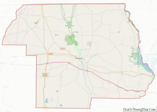
| County: | Jackson County |
| Elevation: | 141 ft (43 m) |
| Total Area: | 3.05 sq mi (7.90 km²) |
| Land Area: | 3.05 sq mi (7.90 km²) |
| Water Area: | 0.00 sq mi (0.00 km²) |
| Total Population: | 1,959 |
| Population Density: | 642.72/sq mi (248.12/km²) |
| ZIP code: | 32445 |
| Area code: | 850 |
| FIPS code: | 1242650 |
| GNISfeature ID: | 0286334 |
Online Interactive Map
Click on ![]() to view map in "full screen" mode.
to view map in "full screen" mode.
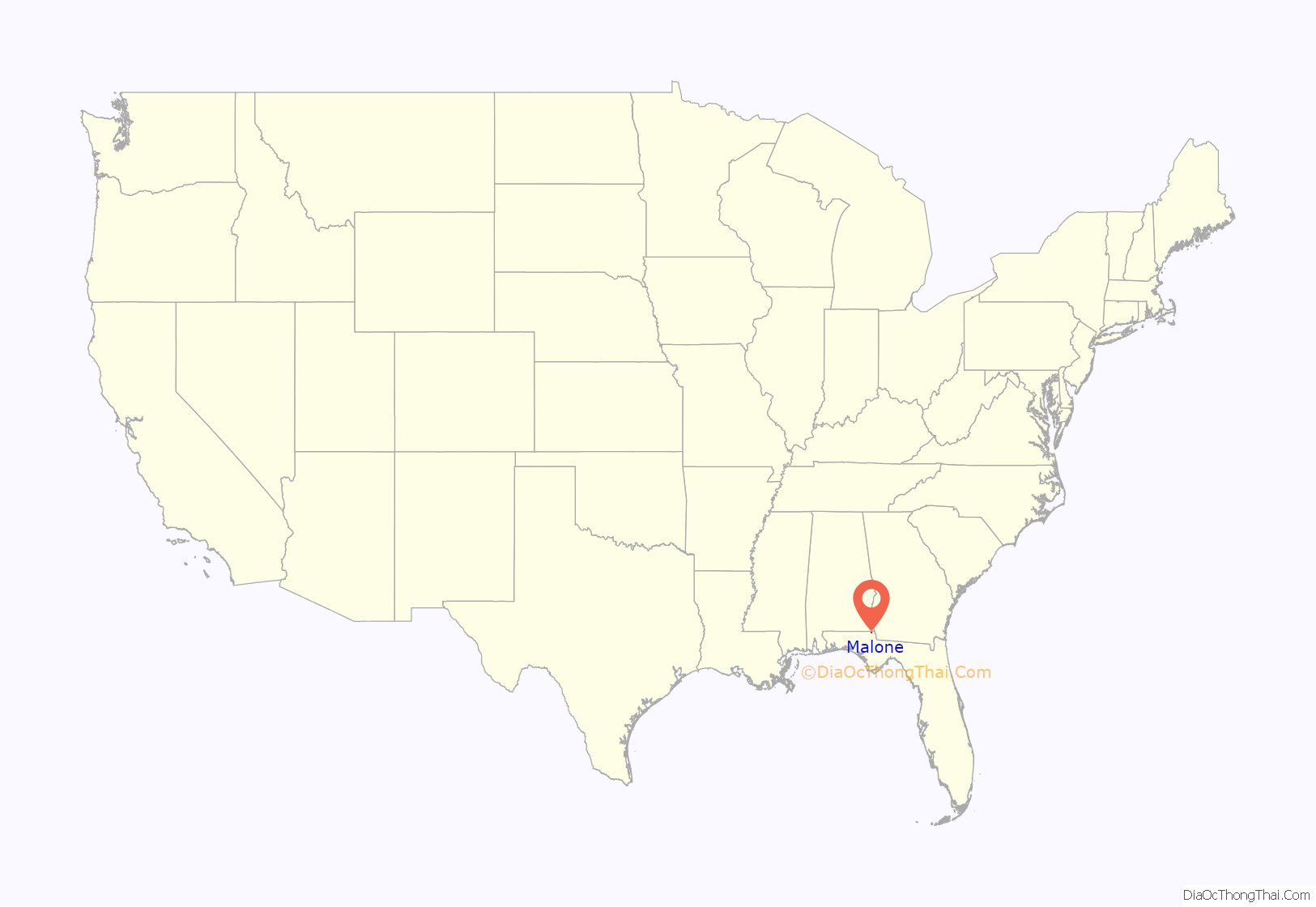
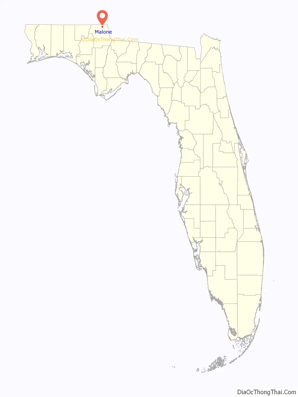
Malone location map. Where is Malone town?
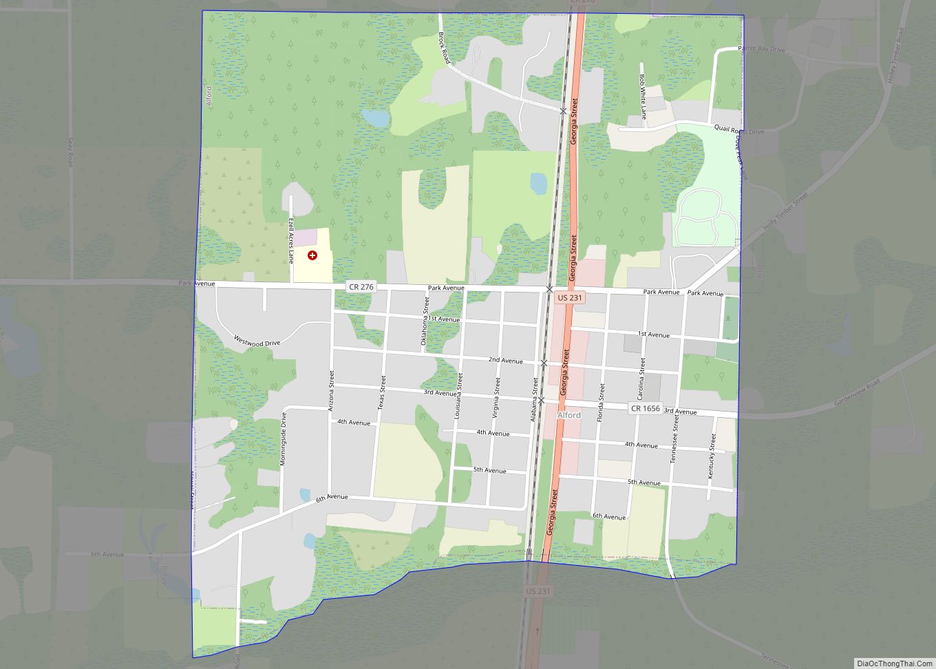
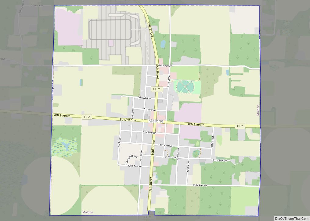
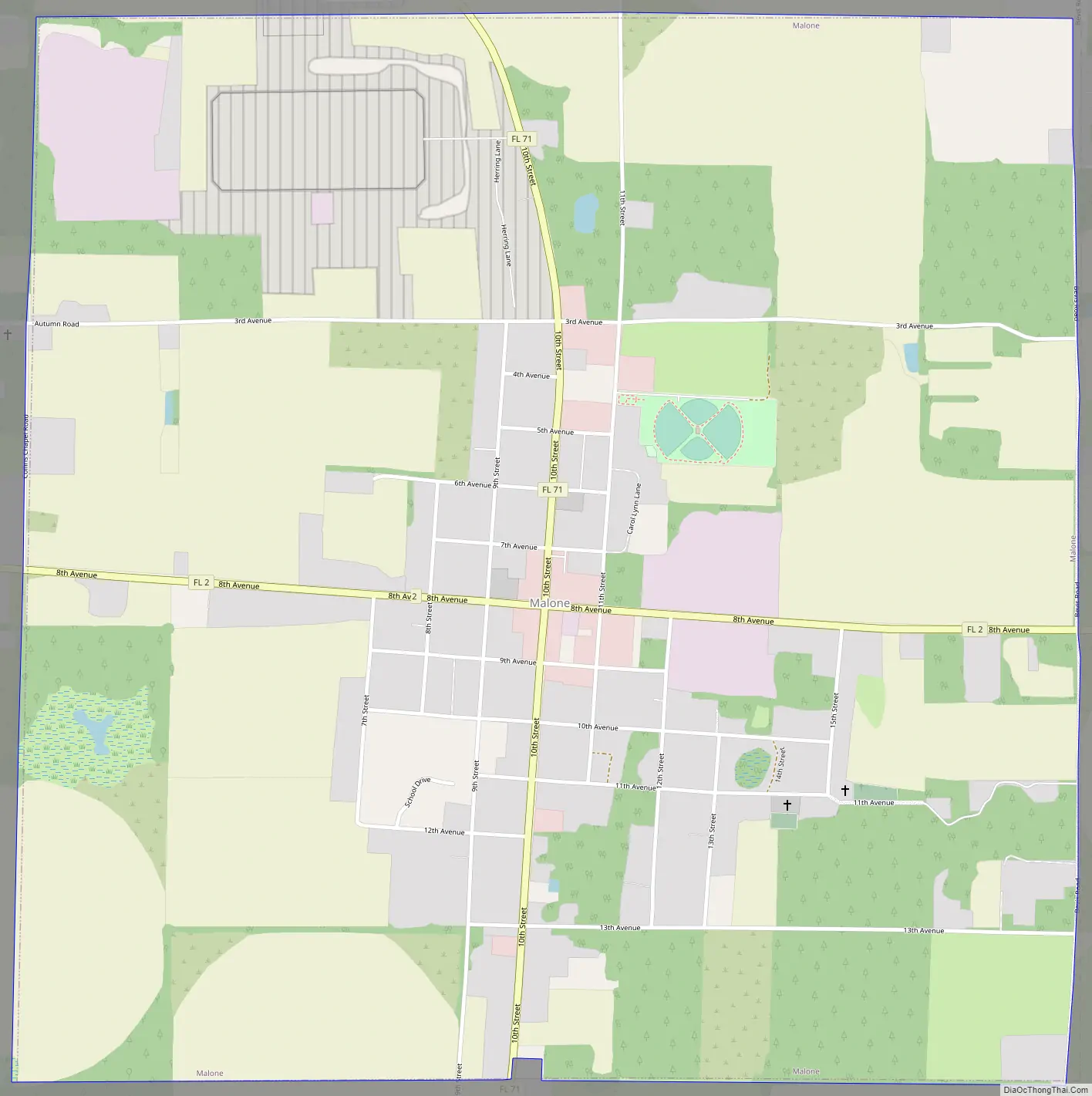
Malone Road Map
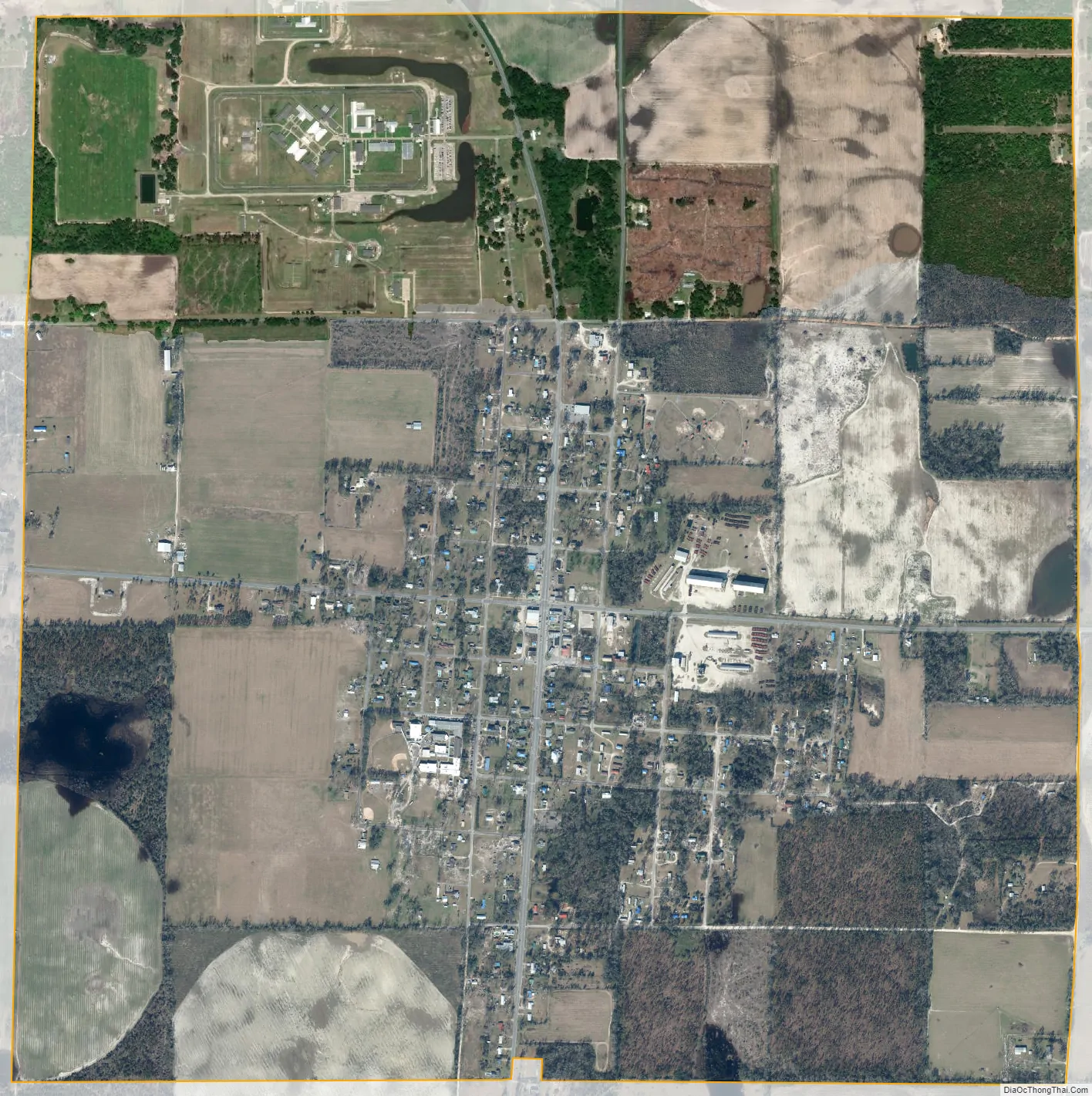
Malone city Satellite Map
Geography
Malone is located in northern Jackson County at 30°57′26″N 85°09′40″W / 30.957162°N 85.161230°W / 30.957162; -85.161230. Florida State Road 2 runs through the center of town as 8th Avenue, leading east 9 miles (14 km) to the Georgia border at the Chattahoochee River, and west 15 miles (24 km) to Campbellton. State Road 71 passes through Malone as 10th Street, crossing State Road 2 in the center of town. SR 71 leads north 4 miles (6 km) to the Alabama border and south 15 miles (24 km) to Marianna, the Jackson County seat.
According to the United States Census Bureau, Malone has a total area of 3.1 square miles (8.1 km), all land.
See also
Map of Florida State and its subdivision:- Alachua
- Baker
- Bay
- Bradford
- Brevard
- Broward
- Calhoun
- Charlotte
- Citrus
- Clay
- Collier
- Columbia
- Desoto
- Dixie
- Duval
- Escambia
- Flagler
- Franklin
- Gadsden
- Gilchrist
- Glades
- Gulf
- Hamilton
- Hardee
- Hendry
- Hernando
- Highlands
- Hillsborough
- Holmes
- Indian River
- Jackson
- Jefferson
- Lafayette
- Lake
- Lee
- Leon
- Levy
- Liberty
- Madison
- Manatee
- Marion
- Martin
- Miami-Dade
- Monroe
- Nassau
- Okaloosa
- Okeechobee
- Orange
- Osceola
- Palm Beach
- Pasco
- Pinellas
- Polk
- Putnam
- Saint Johns
- Saint Lucie
- Santa Rosa
- Sarasota
- Seminole
- Sumter
- Suwannee
- Taylor
- Union
- Volusia
- Wakulla
- Walton
- Washington
- Alabama
- Alaska
- Arizona
- Arkansas
- California
- Colorado
- Connecticut
- Delaware
- District of Columbia
- Florida
- Georgia
- Hawaii
- Idaho
- Illinois
- Indiana
- Iowa
- Kansas
- Kentucky
- Louisiana
- Maine
- Maryland
- Massachusetts
- Michigan
- Minnesota
- Mississippi
- Missouri
- Montana
- Nebraska
- Nevada
- New Hampshire
- New Jersey
- New Mexico
- New York
- North Carolina
- North Dakota
- Ohio
- Oklahoma
- Oregon
- Pennsylvania
- Rhode Island
- South Carolina
- South Dakota
- Tennessee
- Texas
- Utah
- Vermont
- Virginia
- Washington
- West Virginia
- Wisconsin
- Wyoming