Ocean Breeze, formerly Ocean Breeze Park, is a town on the Indian River in Martin County, Florida, United States. Ocean Breeze and Briny Breezes in Palm Beach County are the only two towns in Florida in which all residents live in a mobile home park bearing the name of the town. The population was 301 at the 2020 census. The population figures do not include the many part-time winter residents from other places. The town is bordered on three sides by the unincorporated community of Jensen Beach.
Ocean Breeze is part of the Port St. Lucie Metropolitan Statistical Area, which includes all of Martin and St. Lucie counties.
| Name: | Ocean Breeze town |
|---|---|
| LSAD Code: | 43 |
| LSAD Description: | town (suffix) |
| State: | Florida |
| County: | Martin County |
| Founded: | 1938 |
| Incorporated: | 1960 |
| Elevation: | 7 ft (2 m) |
| Total Area: | 0.21 sq mi (0.54 km²) |
| Land Area: | 0.17 sq mi (0.43 km²) |
| Water Area: | 0.04 sq mi (0.11 km²) |
| Total Population: | 301 |
| Population Density: | 1,824.24/sq mi (703.98/km²) |
| ZIP code: | 34957 |
| FIPS code: | 1250875 |
| GNISfeature ID: | 0288033 |
| Website: | townofoceanbreeze.org |
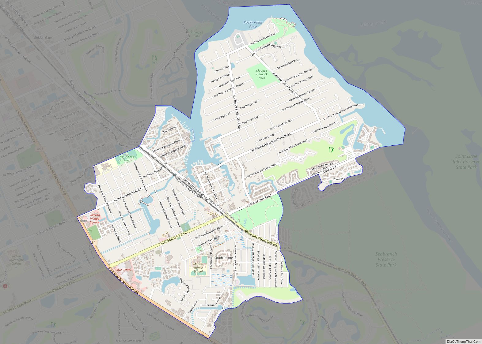
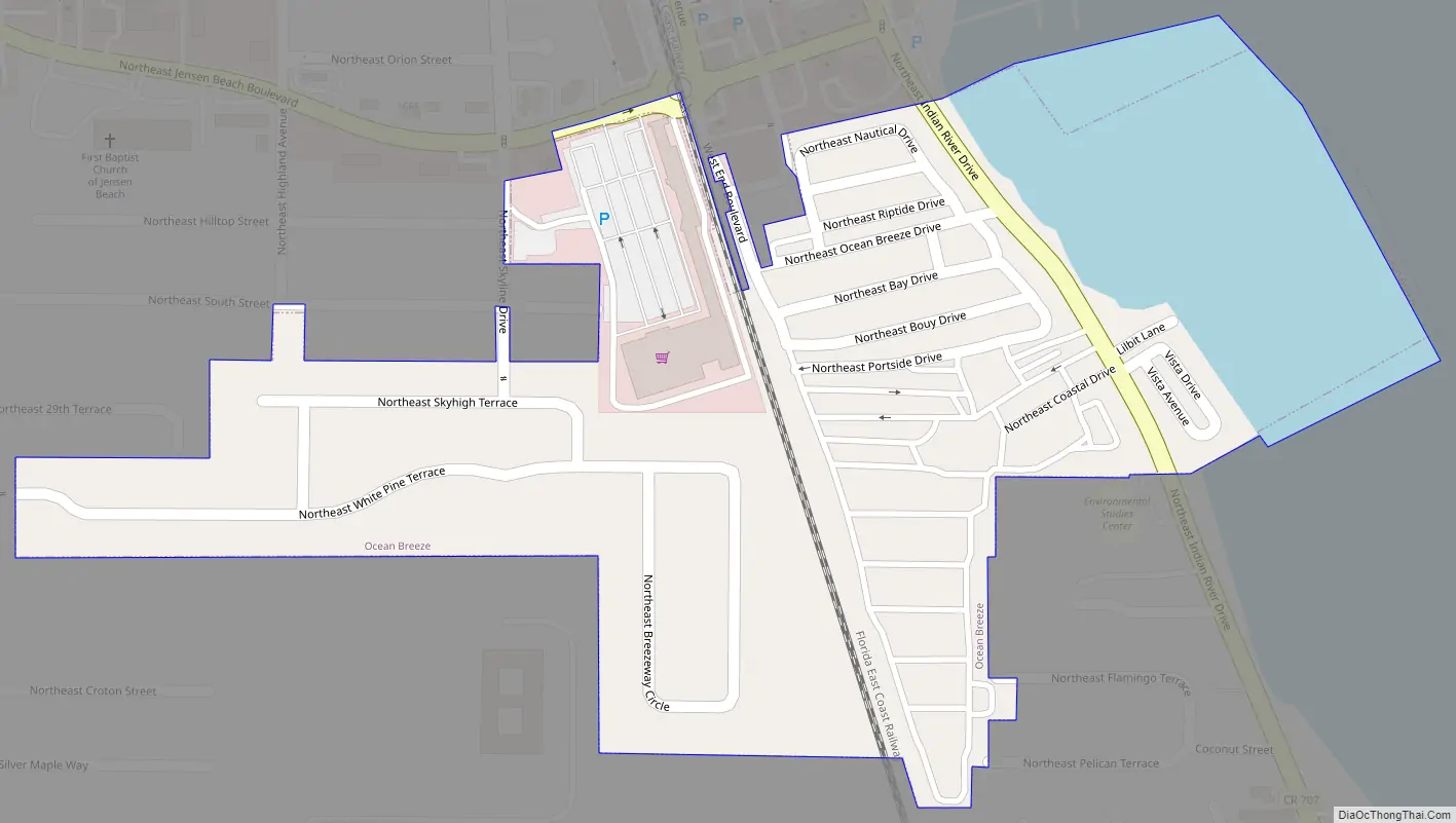
Online Interactive Map
Click on ![]() to view map in "full screen" mode.
to view map in "full screen" mode.
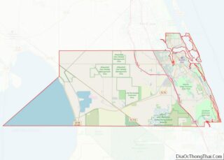
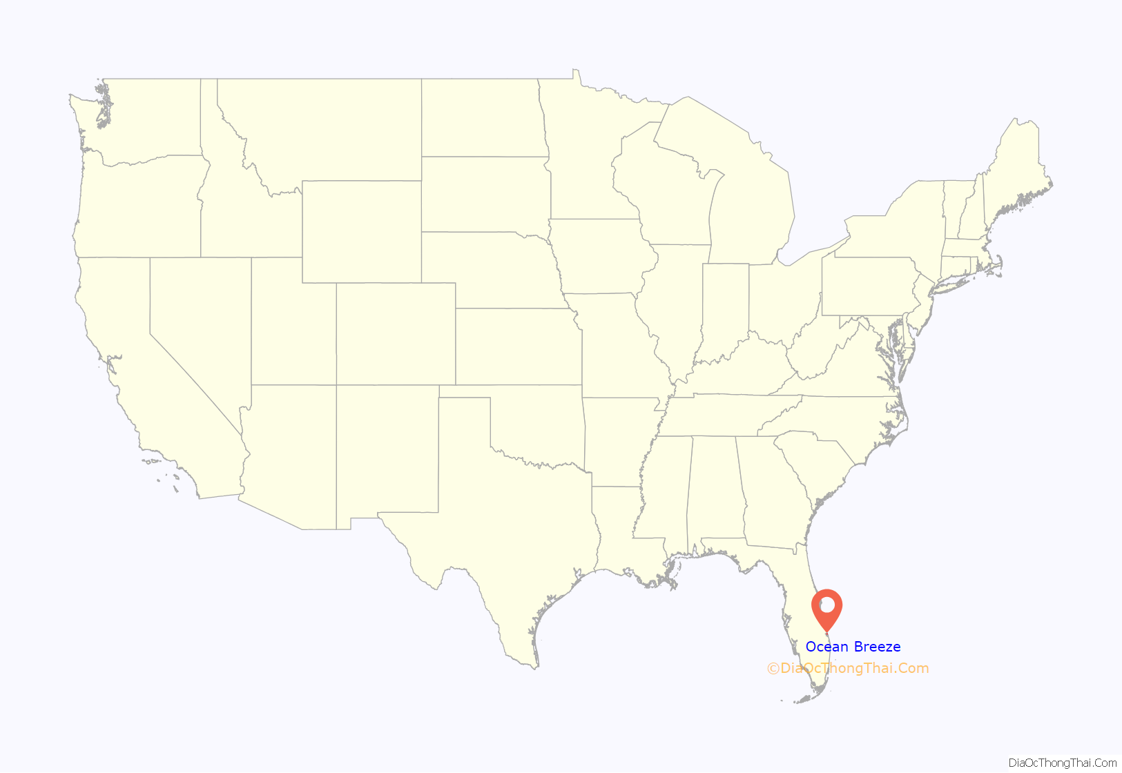
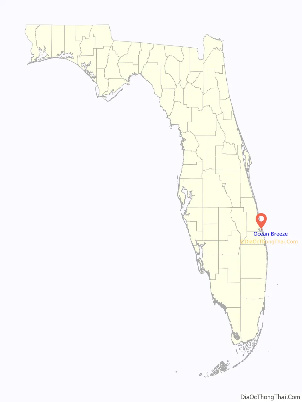
Ocean Breeze location map. Where is Ocean Breeze town?
History
Ocean Breeze Trailer Park was established in 1938 north of Stuart, Florida, by Harry Hoke.
The Ocean Breeze Park town government was formed in 1960 when 142 property owners in Ocean Breeze Trailer Park voted to incorporate. Harry Hoke was elected as the town’s first mayor. Evans Crary, Sr., who guided the town through the legal procedure of incorporation, was appointed town attorney. At the time of its incorporation, the 65-acre park was said to be the largest privately owned trailer park in the United States. By referendum held December 18, 2012, the town changed its name to “Ocean Breeze”.
Dorothy Geeben, mayor from 2001 to 2010, was re-elected in 2004 at age 96, and was identified as the United States’ oldest mayor. Mayor Geeben died on January 11, 2010, at the age of 101 just short of her 102nd birthday. The current mayor is Karen M. Ostrand (2016–present).
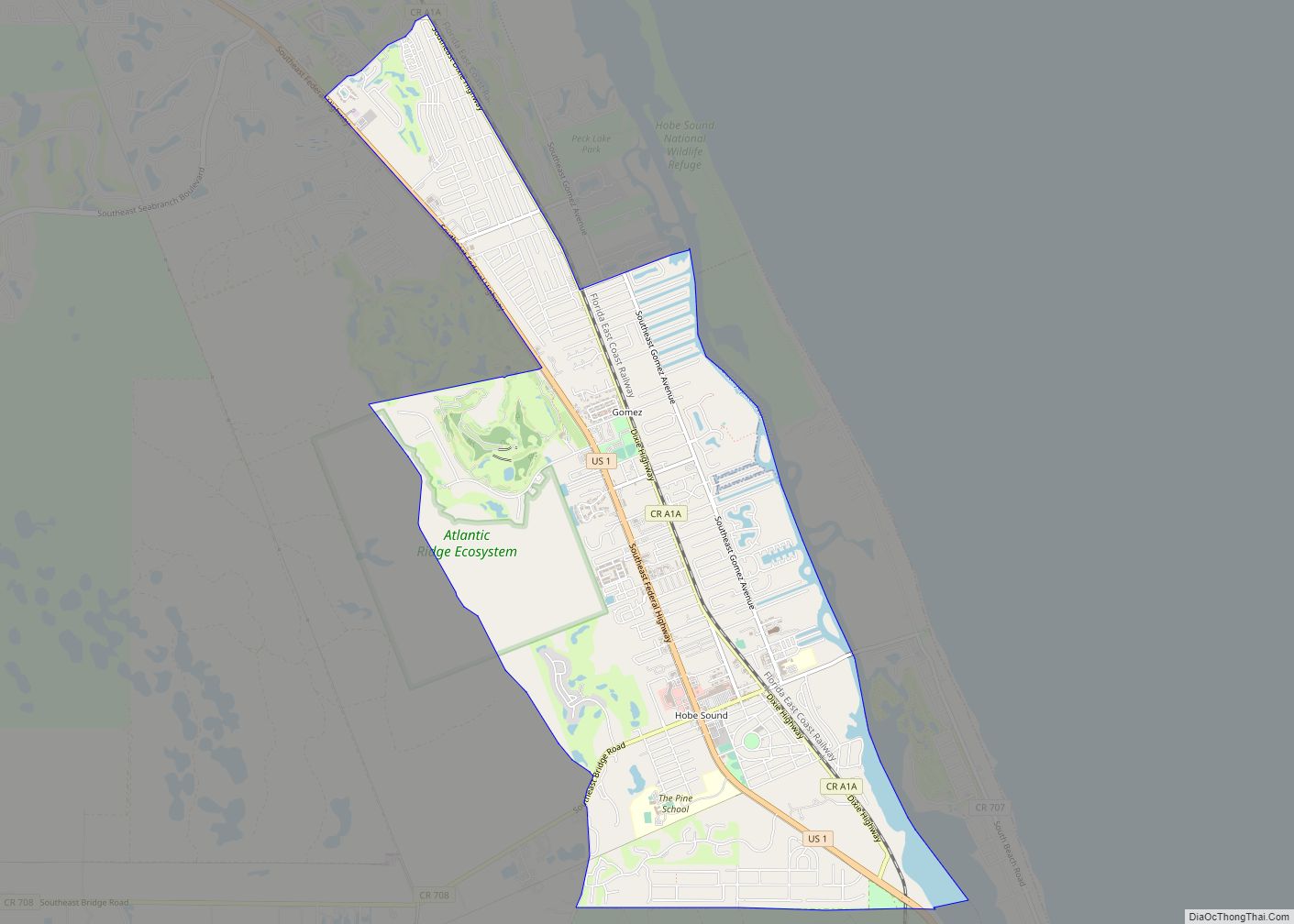
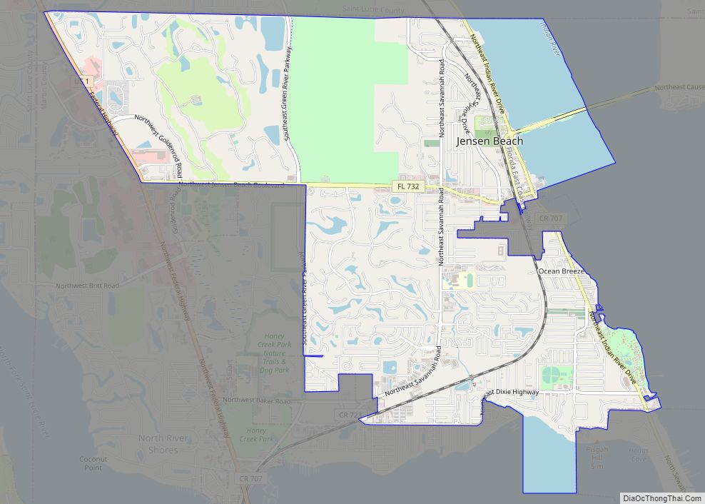
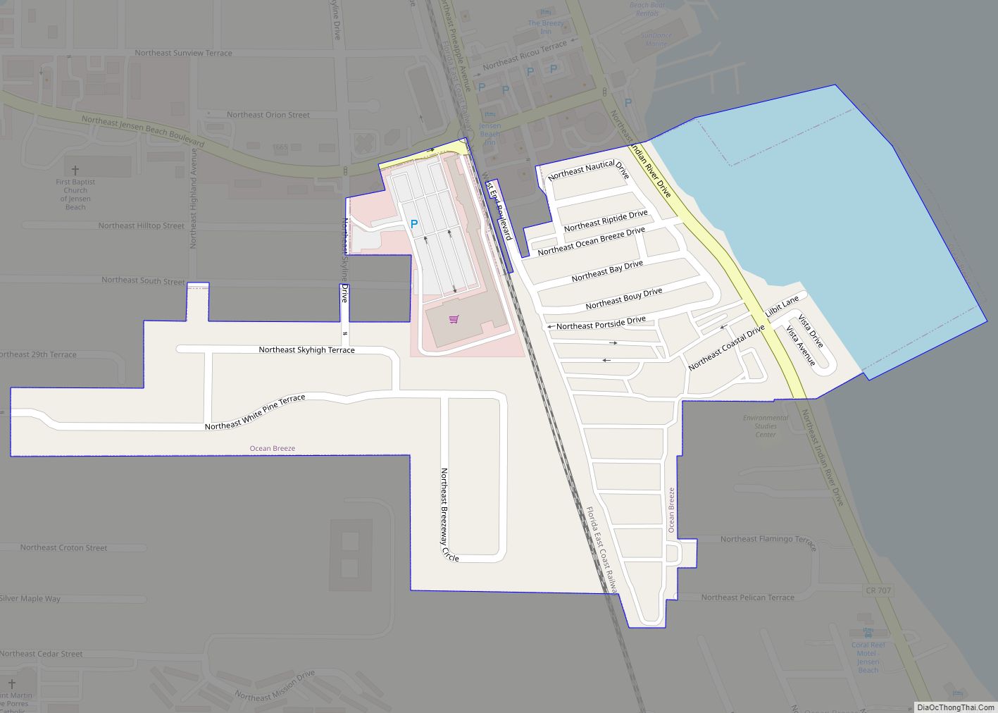
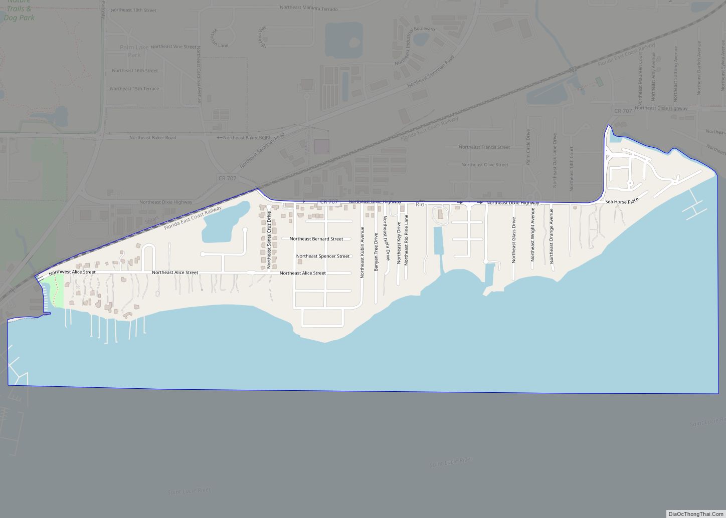
Ocean Breeze Road Map
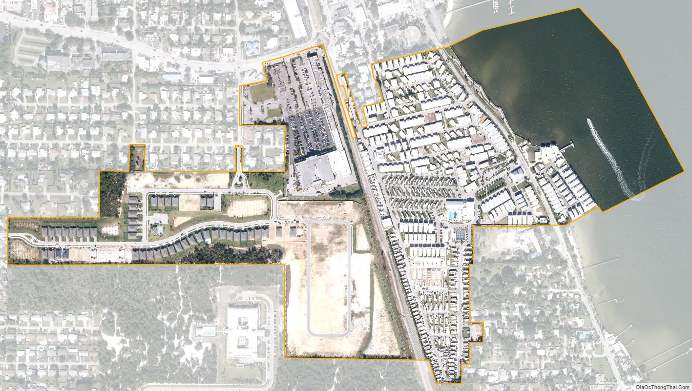
Ocean Breeze city Satellite Map
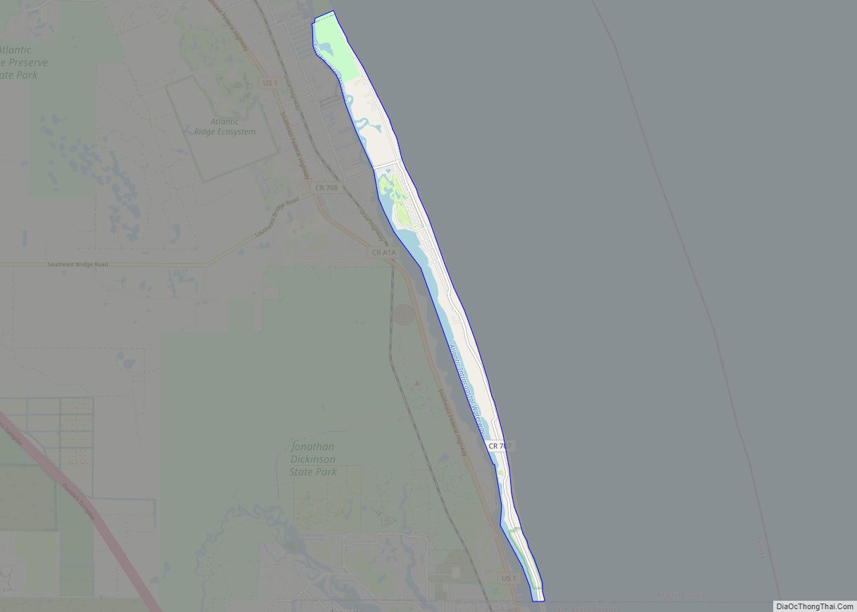
Geography
Ocean Breeze is in northeastern Martin County, 5 miles (8 km) by road northeast of Stuart, the county seat, and 15 miles (24 km) south-southeast of Fort Pierce. According to the United States Census Bureau, the town has a total area of 0.2 square miles (0.52 km), of which 0.04 square miles (0.10 km), or 21.05%, are water.
The town of Ocean Breeze is bounded on the east by the Indian River and on the south, west and north by the unincorporated community of Jensen Beach.
Layout
The town consists of three sections:
- “Ocean Breeze RV Resort”(Sun Communities), where residents live
- A shopping center, “Ocean Breeze Plaza”, anchored by a Publix super market
- An undeveloped area of high sugar sand dunes
All roads within the town are private, connecting to CR 707. The town is served by the Jensen Beach post office.
See also
Map of Florida State and its subdivision:- Alachua
- Baker
- Bay
- Bradford
- Brevard
- Broward
- Calhoun
- Charlotte
- Citrus
- Clay
- Collier
- Columbia
- Desoto
- Dixie
- Duval
- Escambia
- Flagler
- Franklin
- Gadsden
- Gilchrist
- Glades
- Gulf
- Hamilton
- Hardee
- Hendry
- Hernando
- Highlands
- Hillsborough
- Holmes
- Indian River
- Jackson
- Jefferson
- Lafayette
- Lake
- Lee
- Leon
- Levy
- Liberty
- Madison
- Manatee
- Marion
- Martin
- Miami-Dade
- Monroe
- Nassau
- Okaloosa
- Okeechobee
- Orange
- Osceola
- Palm Beach
- Pasco
- Pinellas
- Polk
- Putnam
- Saint Johns
- Saint Lucie
- Santa Rosa
- Sarasota
- Seminole
- Sumter
- Suwannee
- Taylor
- Union
- Volusia
- Wakulla
- Walton
- Washington
- Alabama
- Alaska
- Arizona
- Arkansas
- California
- Colorado
- Connecticut
- Delaware
- District of Columbia
- Florida
- Georgia
- Hawaii
- Idaho
- Illinois
- Indiana
- Iowa
- Kansas
- Kentucky
- Louisiana
- Maine
- Maryland
- Massachusetts
- Michigan
- Minnesota
- Mississippi
- Missouri
- Montana
- Nebraska
- Nevada
- New Hampshire
- New Jersey
- New Mexico
- New York
- North Carolina
- North Dakota
- Ohio
- Oklahoma
- Oregon
- Pennsylvania
- Rhode Island
- South Carolina
- South Dakota
- Tennessee
- Texas
- Utah
- Vermont
- Virginia
- Washington
- West Virginia
- Wisconsin
- Wyoming