Pinewood is an unincorporated community and census-designated place (CDP) in Miami-Dade County, Florida, United States. The population was 17,246 at the 2020 census.
Most of Pinewood was originally a neighborhood of the City of Miami, annexed into the city in 1925. With the arrival of the Great Depression, Miami gave up its jurisdiction and Pinewood became an unincorporated area of Miami-Dade County.
| Name: | Pinewood CDP |
|---|---|
| LSAD Code: | 57 |
| LSAD Description: | CDP (suffix) |
| State: | Florida |
| County: | Miami-Dade County |
| Elevation: | 7 ft (2 m) |
| Total Area: | 1.89 sq mi (4.90 km²) |
| Land Area: | 1.75 sq mi (4.54 km²) |
| Water Area: | 0.14 sq mi (0.36 km²) |
| Total Population: | 17,246 |
| Population Density: | 9,854.9/sq mi (3,805.0/km²) |
| FIPS code: | 1257250 |
| GNISfeature ID: | 1867187 |
Online Interactive Map
Click on ![]() to view map in "full screen" mode.
to view map in "full screen" mode.
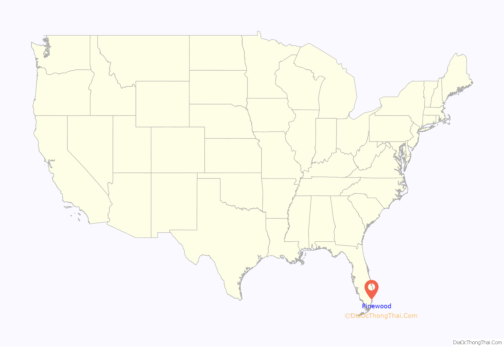
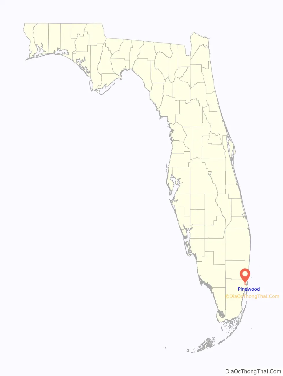
Pinewood location map. Where is Pinewood CDP?
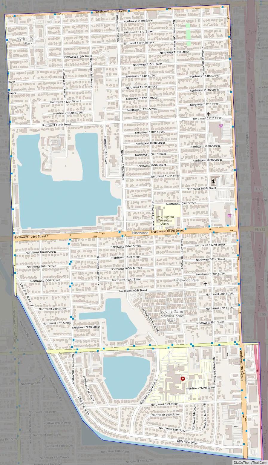
Pinewood Road Map
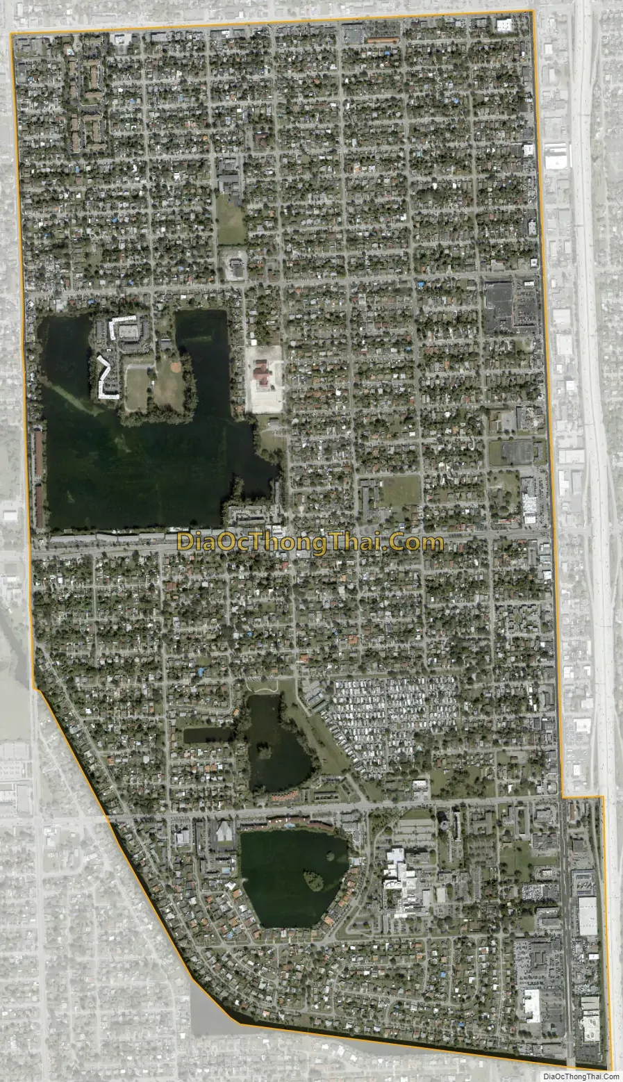
Pinewood city Satellite Map
Geography
Pinewood is located 8 miles (13 km) north of downtown Miami. It is bordered to the north by the city of North Miami, to the east by Miami Shores and unincorporated neighborhoods, to the south and southwest by unincorporated West Little River, and to the northwest by unincorporated Westview. U.S. Route 441 (NW 7th Avenue) forms most of the eastern border of Pinewood.
According to the United States Census Bureau, the CDP has a total area of 1.9 square miles (4.9 km), of which 1.8 square miles (4.7 km) are land and 0.1 square miles (0.3 km), or 7.30%, are water.
See also
Map of Florida State and its subdivision:- Alachua
- Baker
- Bay
- Bradford
- Brevard
- Broward
- Calhoun
- Charlotte
- Citrus
- Clay
- Collier
- Columbia
- Desoto
- Dixie
- Duval
- Escambia
- Flagler
- Franklin
- Gadsden
- Gilchrist
- Glades
- Gulf
- Hamilton
- Hardee
- Hendry
- Hernando
- Highlands
- Hillsborough
- Holmes
- Indian River
- Jackson
- Jefferson
- Lafayette
- Lake
- Lee
- Leon
- Levy
- Liberty
- Madison
- Manatee
- Marion
- Martin
- Miami-Dade
- Monroe
- Nassau
- Okaloosa
- Okeechobee
- Orange
- Osceola
- Palm Beach
- Pasco
- Pinellas
- Polk
- Putnam
- Saint Johns
- Saint Lucie
- Santa Rosa
- Sarasota
- Seminole
- Sumter
- Suwannee
- Taylor
- Union
- Volusia
- Wakulla
- Walton
- Washington
- Alabama
- Alaska
- Arizona
- Arkansas
- California
- Colorado
- Connecticut
- Delaware
- District of Columbia
- Florida
- Georgia
- Hawaii
- Idaho
- Illinois
- Indiana
- Iowa
- Kansas
- Kentucky
- Louisiana
- Maine
- Maryland
- Massachusetts
- Michigan
- Minnesota
- Mississippi
- Missouri
- Montana
- Nebraska
- Nevada
- New Hampshire
- New Jersey
- New Mexico
- New York
- North Carolina
- North Dakota
- Ohio
- Oklahoma
- Oregon
- Pennsylvania
- Rhode Island
- South Carolina
- South Dakota
- Tennessee
- Texas
- Utah
- Vermont
- Virginia
- Washington
- West Virginia
- Wisconsin
- Wyoming


