Bal Harbour is a village in Miami-Dade County, Florida. The population was 3,093 at the 2020 US Census.
| Name: | Bal Harbour village |
|---|---|
| LSAD Code: | 47 |
| LSAD Description: | village (suffix) |
| State: | Florida |
| County: | Miami-Dade County |
| Incorporated: | 1946 |
| Elevation: | 0 ft (0 m) |
| Total Area: | 0.64 sq mi (1.66 km²) |
| Land Area: | 0.38 sq mi (0.99 km²) |
| Water Area: | 0.26 sq mi (0.67 km²) |
| Total Population: | 3,093 |
| Population Density: | 8,075.72/sq mi (3,115.01/km²) |
| ZIP code: | 33154 |
| FIPS code: | 1203275 |
| GNISfeature ID: | 0278057 |
| Website: | balharbourfl.gov |
Online Interactive Map
Click on ![]() to view map in "full screen" mode.
to view map in "full screen" mode.
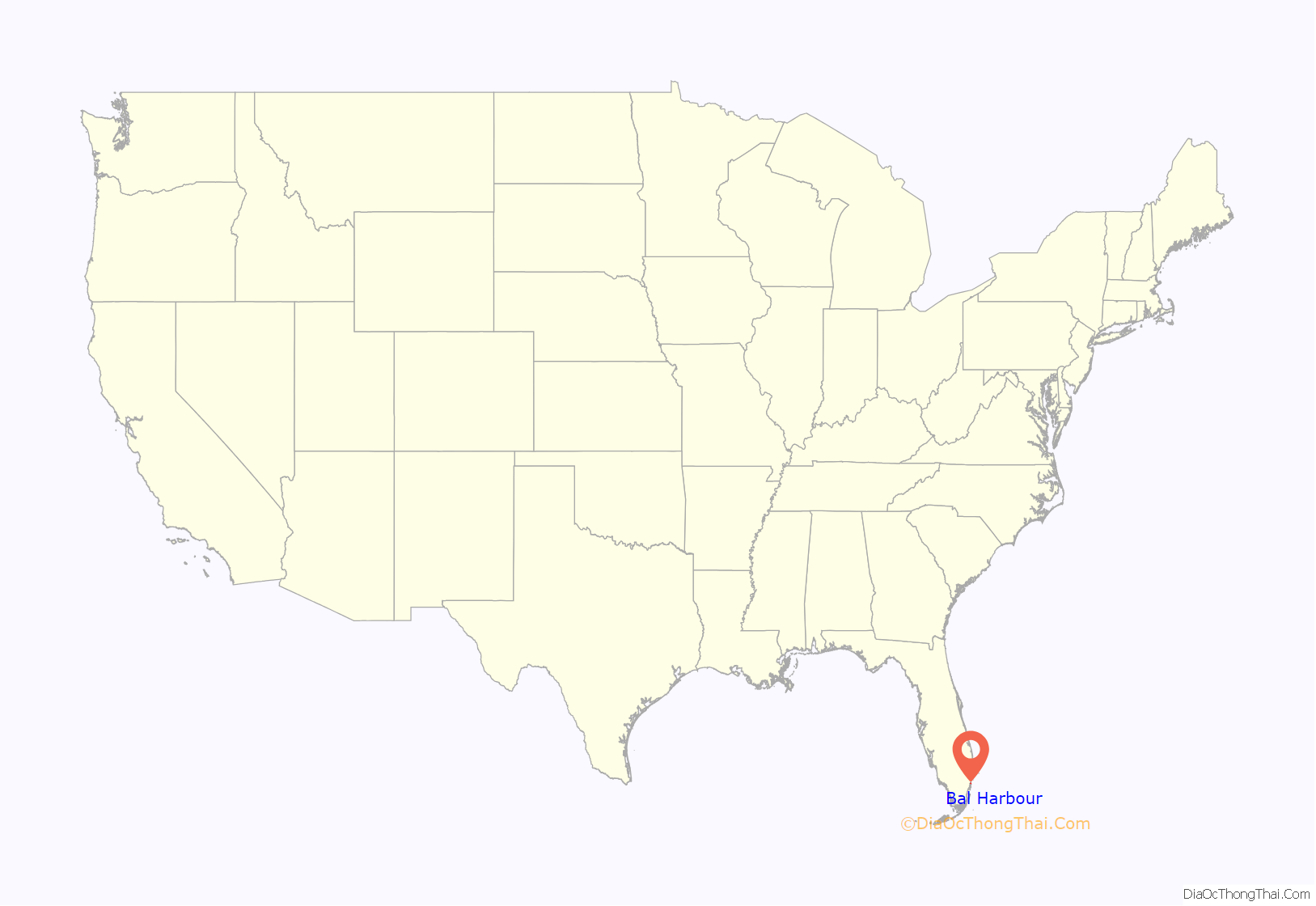
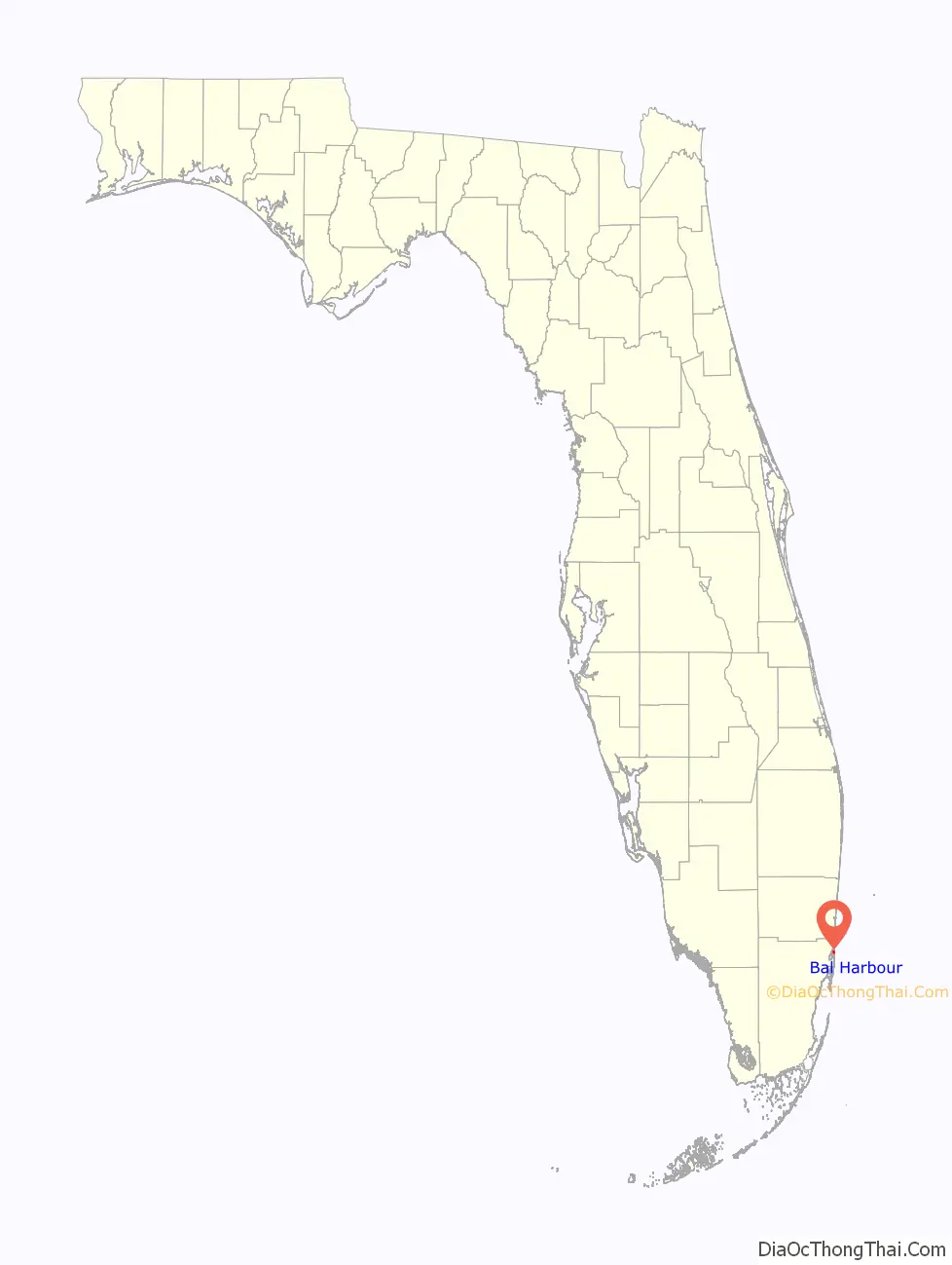
Bal Harbour location map. Where is Bal Harbour village?
History
Since the 1920s, the Detroit-based Miami Beach Heights Corporation—headed by industrialists Robert C. Graham, Walter O. Briggs, and Carl G. Fisher—owned 245 acres (0.99 km) of undeveloped, partially swampy land that stretched from the bay to the Atlantic. Mr. Graham assumed the duties as the developer for Bal Harbour. In the 1930s, city planners Harland Bartholomew & Associates were called in to design the Village. The company made several plans, and they were submitted to the Miami Beach Heights for review.
The original name chosen for Bal Harbour was Bay Harbour. However, the planning committee didn’t think that was appropriate for a city that was on the beach. A name was invented to encompass a village that ran from the bay to the Atlantic Ocean. The b was taken from the word bay and the a and l were taken from the name Atlantic. Hence the word Bal was created.
In 1940, World War II began, and the plans were put on hold. As a goodwill gesture to the government, Robert C. Graham rented the land to the United States Air Corps for $1 per year. The Air Corps used this land to train their soldiers and established a Prisoner of War camp. The ocean front area was used as a rifle range and the barracks were set up on the west side of Collins Avenue. The camp for prisoners was located where the Bal Harbour Shops are presently.
In 1945, the war was over in both Germany and Japan. The Air Corps left the barracks buildings as a thank you to the owners of the property. These barracks were converted into apartment homes by Mr. Graham in 1946.
In order to incorporate a city in 1946, there had to be at least 25 male registered voters residing in the area. Mr. Graham had twenty five families move into the apartment homes that he had converted in order to qualify the Village for incorporation. He then hired Willard Webb, a Miami Beach tax assessor, to draft a charter for the Village. After the charter was completed, the Village of Bal Harbour was incorporated on August 14, 1946, by Mr. Graham and 25 male registered voters. The Village was operated under the city manager form of government.
The council established a volunteer fire department.
Swampland was filled, sea walls were constructed and the yacht basin was created. Contracts were signed for the sewer systems, water pumping stations and utilities. Bal Harbour was the first planned community in Florida to have its utilities placed underground. Developers set guidelines for the development of the beachfront and the residential areas. Collins Avenue was paved into four lanes with a landscaped median and later widened to the present day six lanes. Village plans indicated that ocean front property was to be 200 feet (61 m) deep and lots approached $100,000. Lots in the residential area were about 1,800 square feet (170 m) and cost from $6,500 to $20,000.
The first hotel was built and was named “The Kenilworth By-the-Sea”. It was built by Tom Raffington and made famous by Arthur Godfrey. It has since been demolished and is now the Kenilworth Condominium. The first home was built at 160 Bal Cross Drive. It was built by Mr. Robert C. Graham Jr., who was the son of Bal Harbour Developer Robert C. Graham. Construction for the Sea View Hotel was started.
Bal Harbour Village was re-incorporated by a special act of the 1947 Florida Legislature and its own charter was issued June 16. This new charter supplemented the original incorporation under the General Laws of Florida. In accordance with the new charter, an election to select five to serve on the council was held June 30. The Council elected were: Edward L. Bonneau, Robert C. Graham, Jr., Glenn E. Massnick, George Whittaker, and Judge Julien Southerland. Judge Southerland was chosen as mayor. Willard Webb, who had been acting manager since the first organization, was appointed as Village Manager. Mary Wetterer was named Village Clerk and Herold Dickey was appointed Chief of Police.
In 1947, the Church by the Sea was built. In 1948, the Beach Club was built. Its restaurant was operated by Howard Johnson’s. In 1949, a new bridge was started over Baker Haulover.
In 1956, the current Village Hall was built. In 1956, the Hotel Americana was built. It became the Sheraton Hotel in 1980. It was imploded on November 18, 2007, to build a set of condos and a luxury aparthotel as the St. Regis.
In 1959, Bal Harbour’s beach was renovated due to severe erosion.
In 1965, the Bal Harbour Shops was built by the Whitman family. Stanley Whitman was one of the incorporators who lived with his family in the barrack apartments. In 1971, Bal Harbour’s beach started a major renourishment project. In 1984, the residents of an exclusive neighborhood in Bal Harbour were successfully sued to remove the clause preventing Jews and blacks from owning property there.
In 2008, The new Regent Bal Harbour opened, becoming the northern gateway to the Village. In 2012, The last oceanfront undeveloped Beach Club site was sold for $220 million in order to make way to the ultra luxury Oceana at Bal Harbour. In 2014, The Ritz-Carlton Bal Harbour, Miami opened at the former Regent Bal Harbour and ONE Bal Harbour Resort & Spa .
In 2015, it was reported in the press that “the Bal Harbour Police and the Glades County Sheriff set up a giant money laundering scheme, but it all fell apart when federal investigators and the Miami Herald found strange things going on.”
From 2015 onward, Bal Harbour has become known globally as a luxury enclave. In the words of Town & Country, Bal Harbour is the “ne plus ultra” of South Florida luxury. The Village, specifically its Resort Tax Committee, has invested in developing Bal Harbour’s reputation as a luxury destination. The committee collects a specific tax which “must be used for among other tourism related activities, for the enhancement of tourism, publicity and advertising purposes.” As the result of a concerted 5+ year international destination marketing effort from 2014-2019 by the Village, per capita resort tax revenues for the Village of Bal Harbour grew +35%.
Bal Harbour Road Map

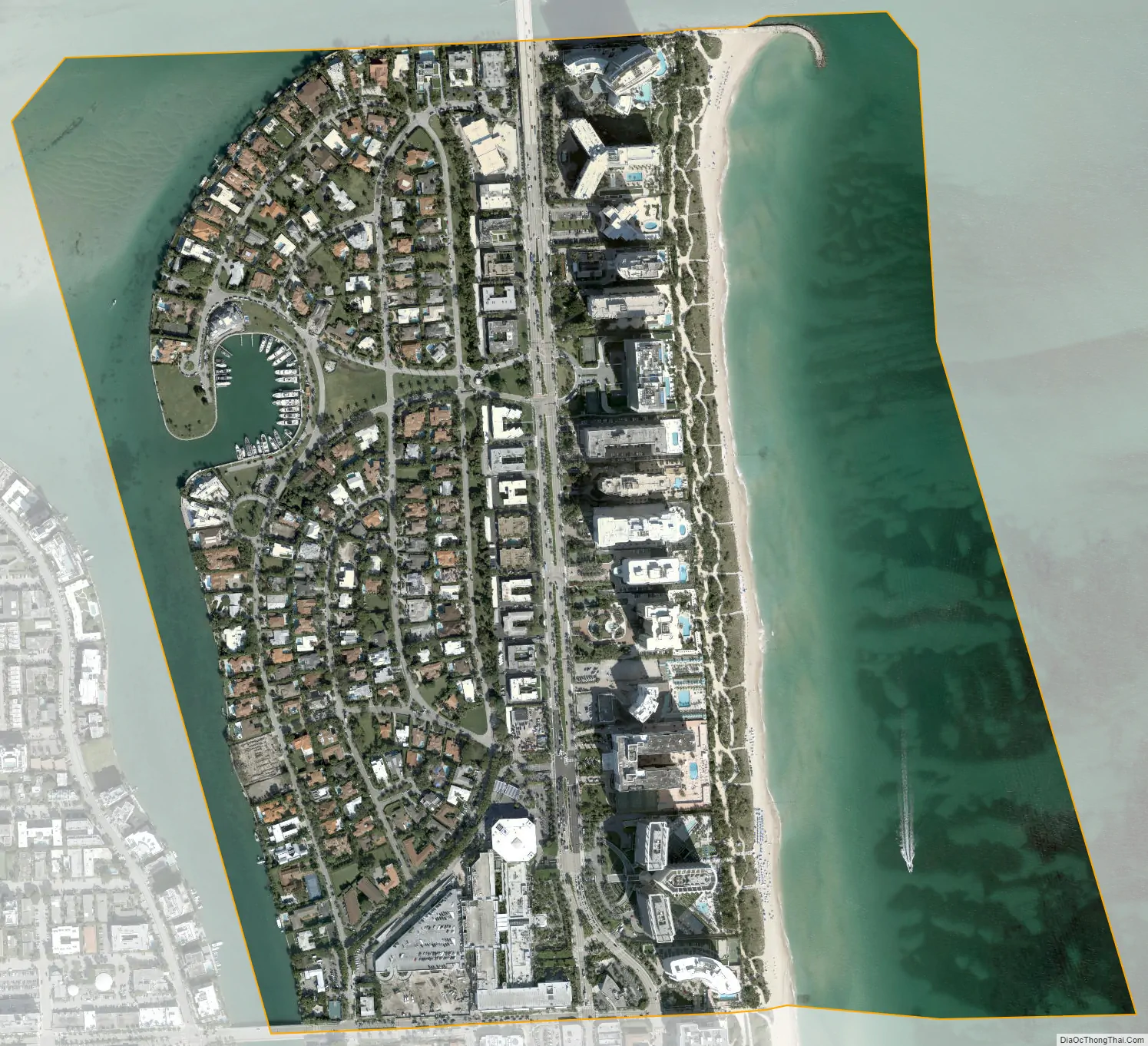
Bal Harbour city Satellite Map
Geography
According to the United States Census Bureau, the village has a total area of 0.6 square miles (1.6 km). 0.3 square miles (0.78 km) of it is land and 0.2 square miles (0.52 km) of it (42.37%) is water.
Bal Harbour, Florida is located on the northern tip of the barrier island commonly referred to as Miami Beach; it is the northernmost barrier island in a chain that extends southward up to and including Key West, Florida.
The main traffic corridor running south to north through Bal Harbour is Collins Avenue, also demarked as Florida State Highway A1A.
A channel between the north end of Biscayne Bay and the Atlantic Ocean runs across the northern end of Bal Harbour.
A bridge, maintained by the State of Florida connects Bal Harbour to Haulover Park, to the north. Haulover Park is maintained by the Miami Dade Parks Commission.
Surrounding areas
- Unincorporated Miami-Dade County (Haulover Park)
- Biscayne Bay Atlantic Ocean
- Bay Harbor Islands Atlantic Ocean
- Bay Harbor Islands Atlantic Ocean
- Surfside
See also
Map of Florida State and its subdivision:- Alachua
- Baker
- Bay
- Bradford
- Brevard
- Broward
- Calhoun
- Charlotte
- Citrus
- Clay
- Collier
- Columbia
- Desoto
- Dixie
- Duval
- Escambia
- Flagler
- Franklin
- Gadsden
- Gilchrist
- Glades
- Gulf
- Hamilton
- Hardee
- Hendry
- Hernando
- Highlands
- Hillsborough
- Holmes
- Indian River
- Jackson
- Jefferson
- Lafayette
- Lake
- Lee
- Leon
- Levy
- Liberty
- Madison
- Manatee
- Marion
- Martin
- Miami-Dade
- Monroe
- Nassau
- Okaloosa
- Okeechobee
- Orange
- Osceola
- Palm Beach
- Pasco
- Pinellas
- Polk
- Putnam
- Saint Johns
- Saint Lucie
- Santa Rosa
- Sarasota
- Seminole
- Sumter
- Suwannee
- Taylor
- Union
- Volusia
- Wakulla
- Walton
- Washington
- Alabama
- Alaska
- Arizona
- Arkansas
- California
- Colorado
- Connecticut
- Delaware
- District of Columbia
- Florida
- Georgia
- Hawaii
- Idaho
- Illinois
- Indiana
- Iowa
- Kansas
- Kentucky
- Louisiana
- Maine
- Maryland
- Massachusetts
- Michigan
- Minnesota
- Mississippi
- Missouri
- Montana
- Nebraska
- Nevada
- New Hampshire
- New Jersey
- New Mexico
- New York
- North Carolina
- North Dakota
- Ohio
- Oklahoma
- Oregon
- Pennsylvania
- Rhode Island
- South Carolina
- South Dakota
- Tennessee
- Texas
- Utah
- Vermont
- Virginia
- Washington
- West Virginia
- Wisconsin
- Wyoming


