Port Salerno is an unincorporated community and census-designated place (CDP) in Martin County, Florida, United States. The population was 10,401 at the 2020 census. It is part of the Port St. Lucie Metropolitan Statistical Area.
| Name: | Port Salerno CDP |
|---|---|
| LSAD Code: | 57 |
| LSAD Description: | CDP (suffix) |
| State: | Florida |
| County: | Martin County |
| Elevation: | 13 ft (4 m) |
| Total Area: | 4.07 sq mi (10.54 km²) |
| Land Area: | 3.57 sq mi (9.23 km²) |
| Water Area: | 0.50 sq mi (1.31 km²) |
| Total Population: | 10,401 |
| Population Density: | 2,916.71/sq mi (1,126.29/km²) |
| ZIP code: | 34992#&34997 (Stuart) |
| Area code: | 772 |
| FIPS code: | 1258727 |
| GNISfeature ID: | 0289239 |
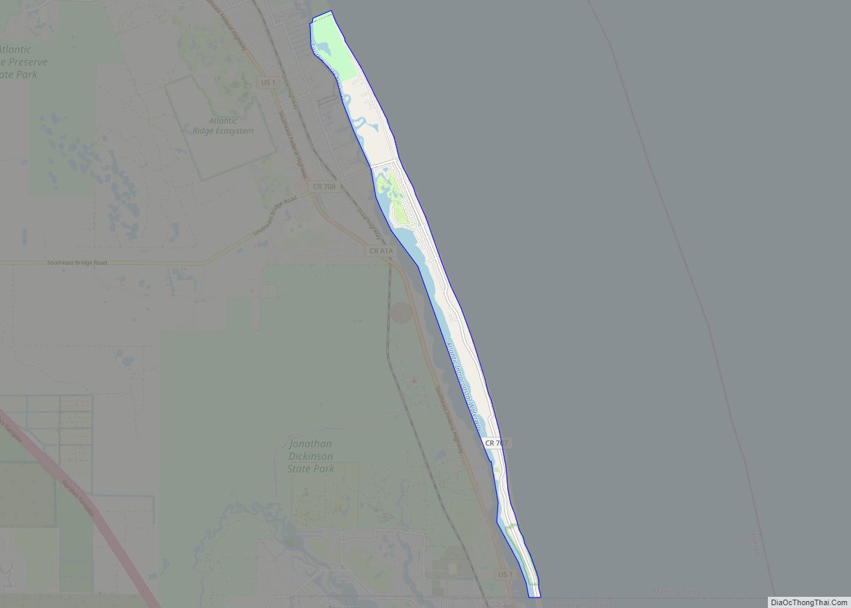
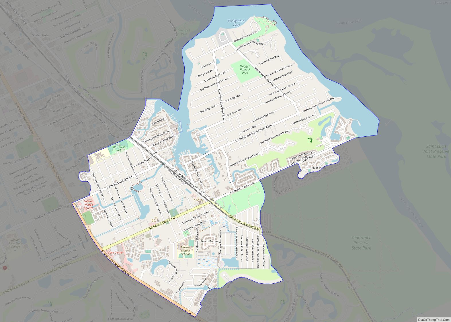
Online Interactive Map
Click on ![]() to view map in "full screen" mode.
to view map in "full screen" mode.
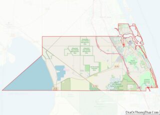
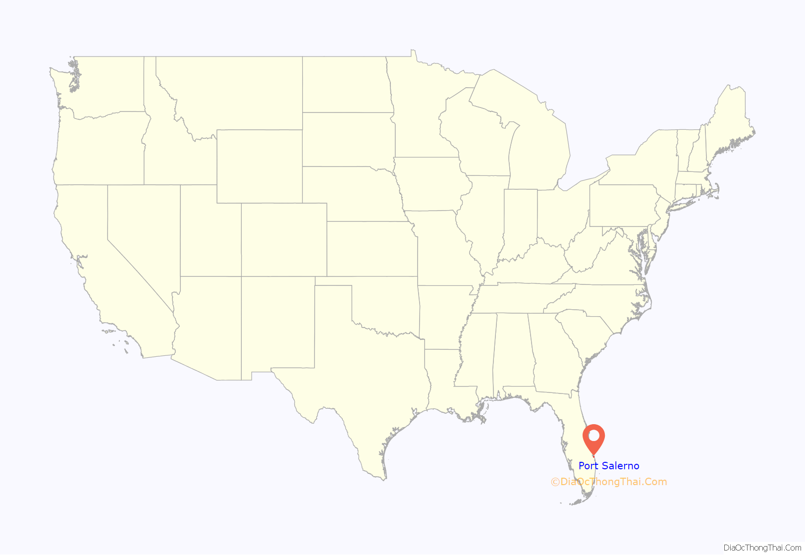
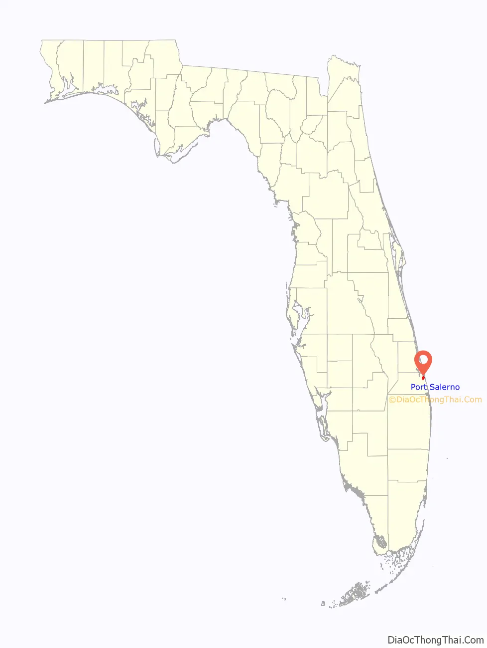
Port Salerno location map. Where is Port Salerno CDP?
History
In the 1920s, a small settlement was created in the southern shores of St. Lucie river inlet. It was named “Salerno” because of its visual resemblance to the Italian city of Salerno as observed by an early visitor. Early settlers were fisherman who lived along the banks of the Manatee Pocket, a small natural bay in the St. Lucie River. Some descendants of these original settlers remain in the area, with some families owning land for over 100 years.
The area increased in population and importance after World War II, with many people from the northeastern United States moving to Florida. In 1960, the name was changed to “Port Salerno”, in order to differentiate it from that of the Italian city.
The 1967 film Gentle Giant was partially filmed in and around Port Salerno. The only grocery store in town was P.O. Smith’s Grocery, which was housed in a small wooden building at the intersection of Snake Road (later renamed Salerno Road) and Route A1A. This grocery store was featured in the production in Palm Beach Gardens, but had been transformed into a saloon before being filmed. This was because the grocery store had swinging “saloon style” doors.
In the 1970s, the Manatee Hotel was transformed into the Manatee Resort upon purchase by Michael Reynolds, heir to the R. J. Reynolds tobacco fortune. Sally Field mentioned the town and resort in an interview with Johnny Carson on The Tonight Show.
In the 1980s, the Chastain Campus of Indian River State College was established. Port Salerno is known for their “World Fishing Tournaments”, based on the yacht port.
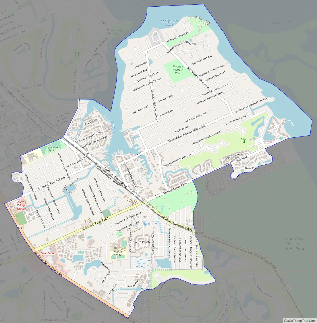
Port Salerno Road Map
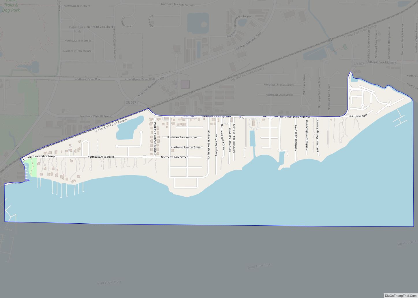
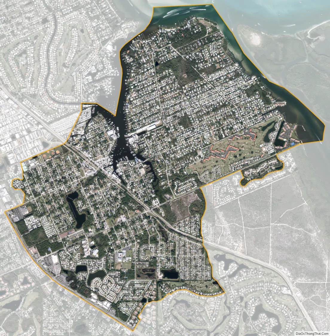
Port Salerno city Satellite Map
Geography
Port Salerno is located in eastern Martin County at 27°8′39″N 80°11′30″W / 27.14417°N 80.19167°W / 27.14417; -80.19167 (27.144090, -80.191765). It is bordered to the north by the St. Lucie River and Indian River Lagoon, to the east by one of its branches, known as Great Pocket, to the northwest by Manatee Pocket, and to the southwest by U.S. Route 1. It is 5 miles (8 km) southeast of Stuart, the county seat, and 8 miles (13 km) northwest of Hobe Sound.
According to the United States Census Bureau, the Port Salerno CDP has a total area of 4.1 square miles (11 km), of which 3.6 square miles (9.3 km) are land and 0.5 square miles (1.3 km), or 12.38%, are water.
See also
Map of Florida State and its subdivision:- Alachua
- Baker
- Bay
- Bradford
- Brevard
- Broward
- Calhoun
- Charlotte
- Citrus
- Clay
- Collier
- Columbia
- Desoto
- Dixie
- Duval
- Escambia
- Flagler
- Franklin
- Gadsden
- Gilchrist
- Glades
- Gulf
- Hamilton
- Hardee
- Hendry
- Hernando
- Highlands
- Hillsborough
- Holmes
- Indian River
- Jackson
- Jefferson
- Lafayette
- Lake
- Lee
- Leon
- Levy
- Liberty
- Madison
- Manatee
- Marion
- Martin
- Miami-Dade
- Monroe
- Nassau
- Okaloosa
- Okeechobee
- Orange
- Osceola
- Palm Beach
- Pasco
- Pinellas
- Polk
- Putnam
- Saint Johns
- Saint Lucie
- Santa Rosa
- Sarasota
- Seminole
- Sumter
- Suwannee
- Taylor
- Union
- Volusia
- Wakulla
- Walton
- Washington
- Alabama
- Alaska
- Arizona
- Arkansas
- California
- Colorado
- Connecticut
- Delaware
- District of Columbia
- Florida
- Georgia
- Hawaii
- Idaho
- Illinois
- Indiana
- Iowa
- Kansas
- Kentucky
- Louisiana
- Maine
- Maryland
- Massachusetts
- Michigan
- Minnesota
- Mississippi
- Missouri
- Montana
- Nebraska
- Nevada
- New Hampshire
- New Jersey
- New Mexico
- New York
- North Carolina
- North Dakota
- Ohio
- Oklahoma
- Oregon
- Pennsylvania
- Rhode Island
- South Carolina
- South Dakota
- Tennessee
- Texas
- Utah
- Vermont
- Virginia
- Washington
- West Virginia
- Wisconsin
- Wyoming