Ridge Manor is a census-designated place (CDP) in Hernando County, Florida, United States. The population was 4,513 at the 2010 census.
| Name: | Ridge Manor CDP |
|---|---|
| LSAD Code: | 57 |
| LSAD Description: | CDP (suffix) |
| State: | Florida |
| County: | Hernando County |
| Elevation: | 69 ft (21 m) |
| Total Area: | 9.04 sq mi (23.41 km²) |
| Land Area: | 8.63 sq mi (22.35 km²) |
| Water Area: | 0.41 sq mi (1.07 km²) |
| Total Population: | 4,743 |
| Population Density: | 549.72/sq mi (212.24/km²) |
| ZIP code: | 33523, 33597, 34602 |
| FIPS code: | 1260325 |
| GNISfeature ID: | 0289687 |
Online Interactive Map
Click on ![]() to view map in "full screen" mode.
to view map in "full screen" mode.
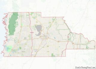
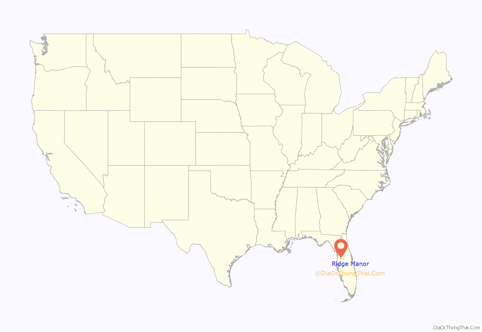
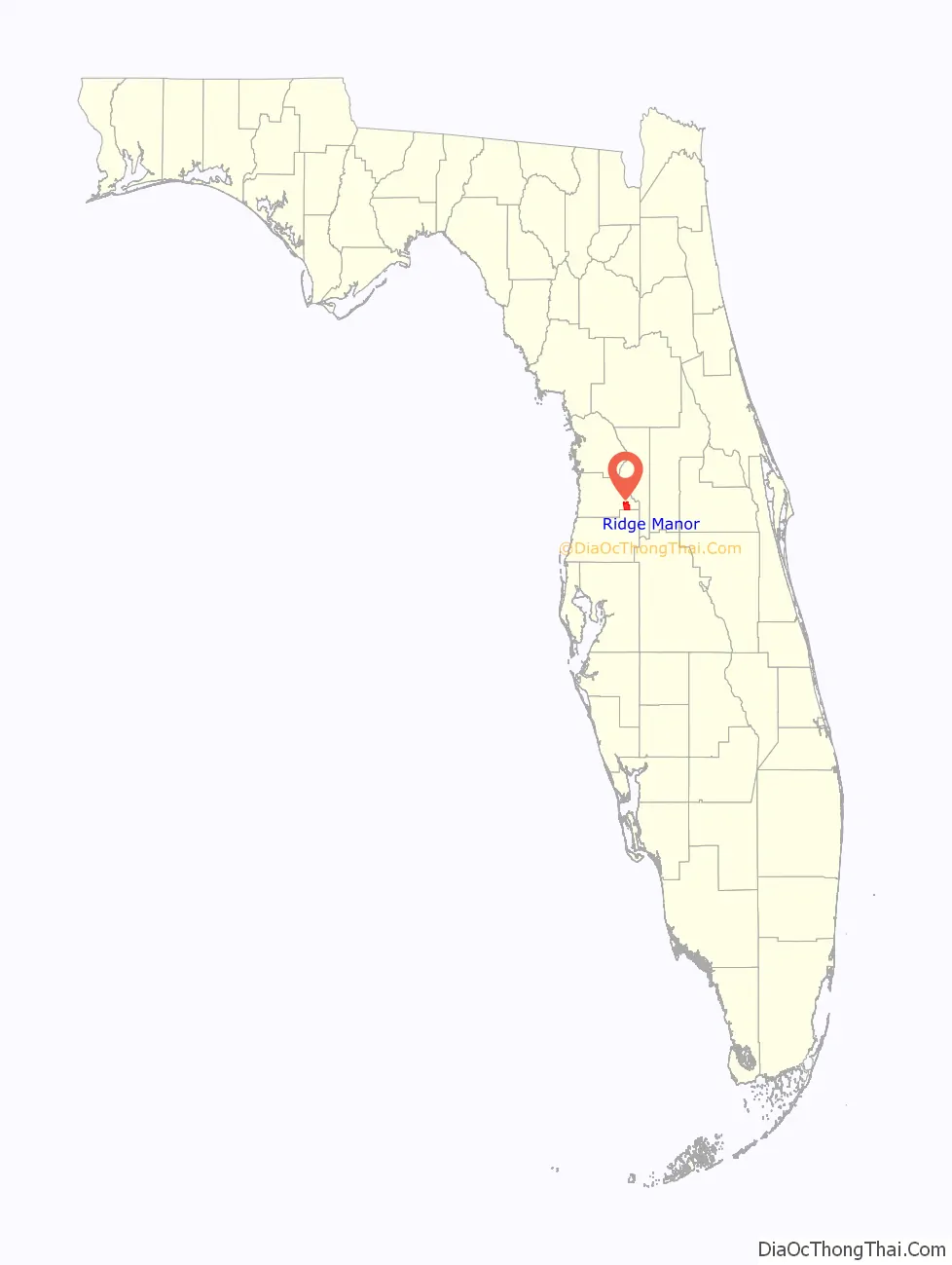
Ridge Manor location map. Where is Ridge Manor CDP?
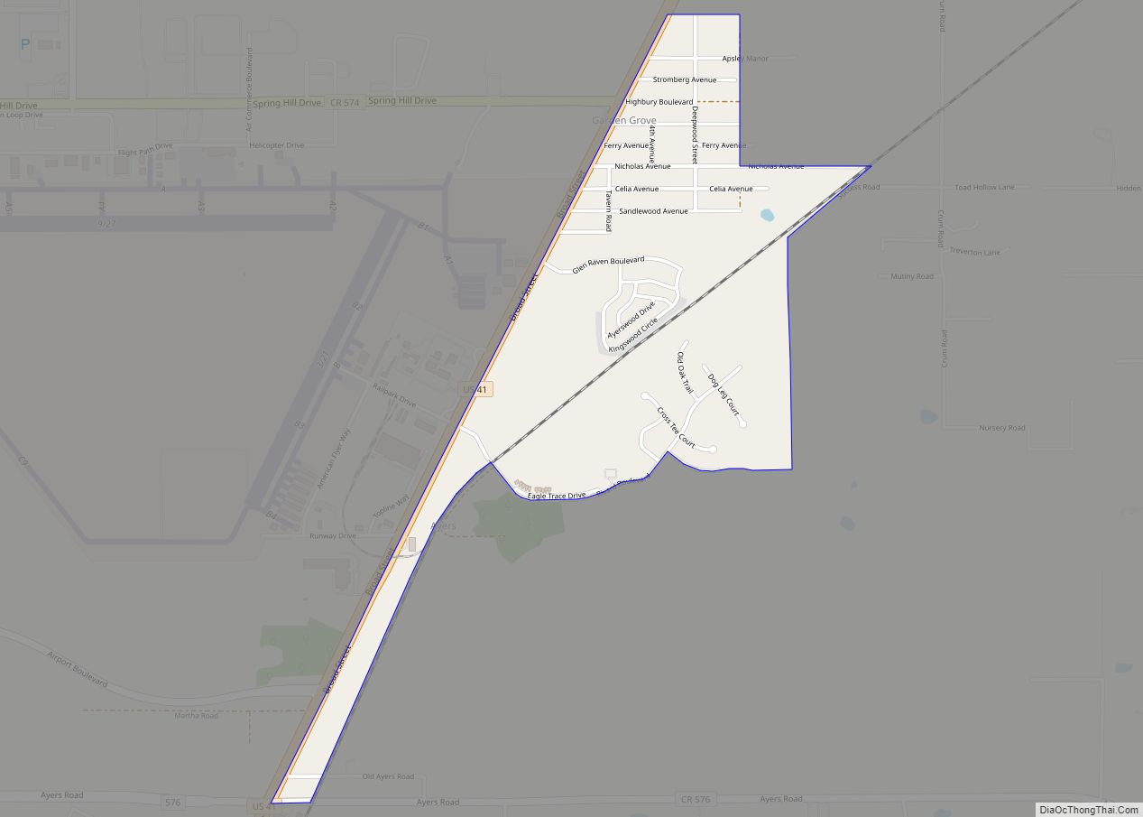
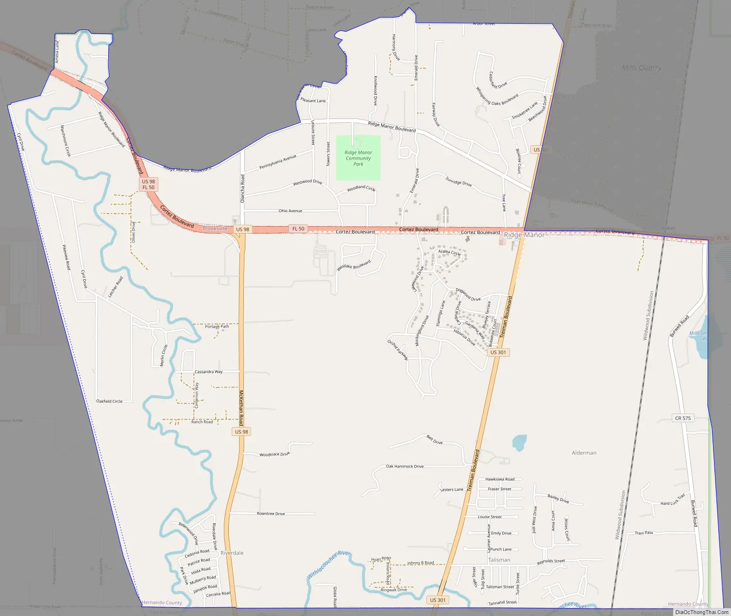
Ridge Manor Road Map
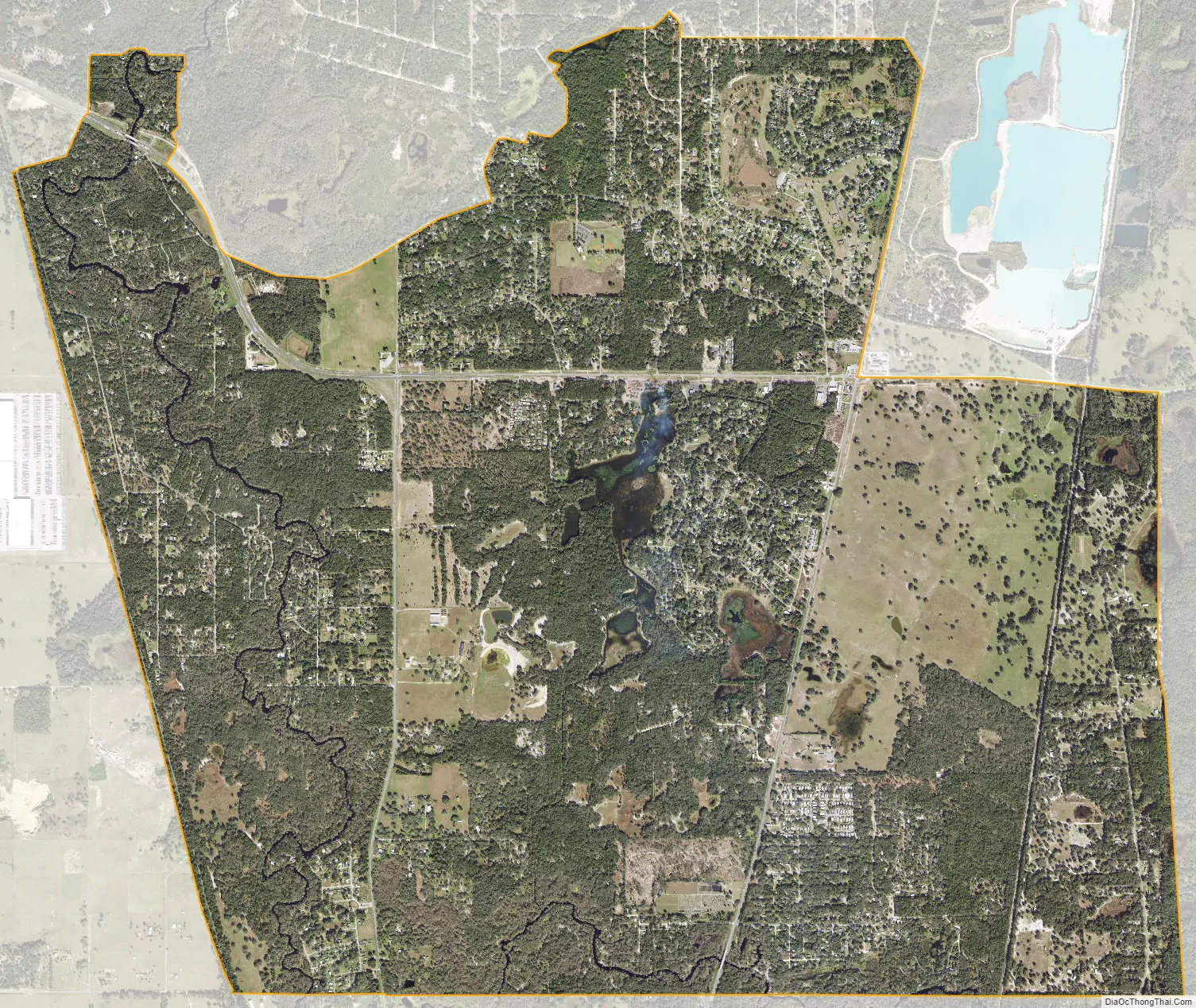
Ridge Manor city Satellite Map
Geography
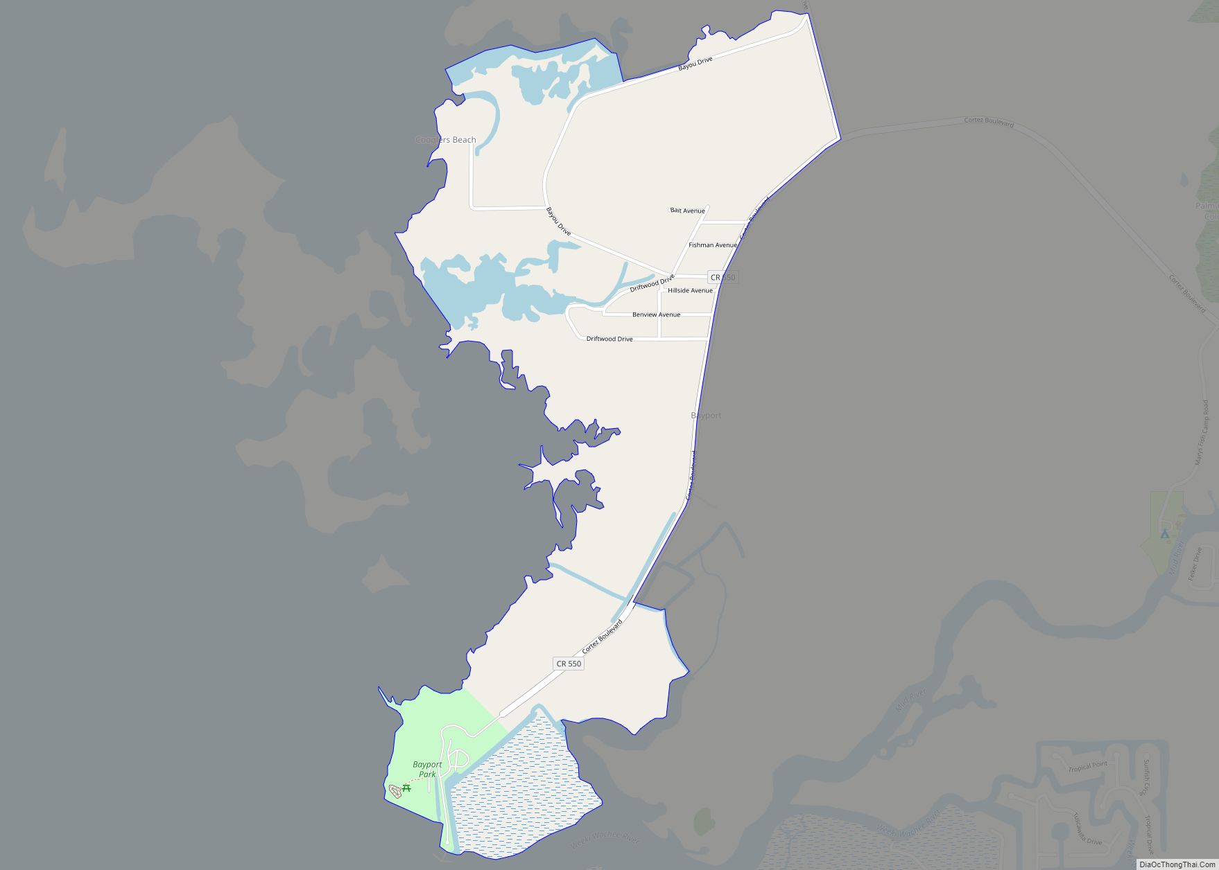
Ridge Manor is located in eastern Hernando County at 28°29′57″N 82°10′53″W / 28.49917°N 82.18139°W / 28.49917; -82.18139 (28.499108, -82.181305). It is bordered to the south by Lacoochee in Pasco County. The north-flowing Withlacoochee River winds through the southern and western parts of Ridge Manor.
U.S. Route 301 runs through the east side of Ridge Manor, leading north 12 miles (19 km) to Bushnell and south 10 miles (16 km) to Dade City. U.S. Route 98 crosses the western side of Ridge Manor, leading west 13 miles (21 km) to Brooksville, the Hernando County seat, and south 10 miles to Dade City. Florida State Road 50 runs across the northern part of Ridge Manor, connecting US 98 and 301. SR 50 leads east 20 miles (32 km) to Mascotte and west with US 98 to Brooksville. Interstate 75 is 3 miles (5 km) west of Ridge Manor, with access via US 98 / SR 50. A portion of Ridge Manor along US 98 / SR 50 in the vicinity the Withlacoochee State Trail (originally the South Florida Railroad Pemberton Ferry Branch) was the location of the ghost town of Rital.
According to the United States Census Bureau, the CDP has a total area of 9.0 square miles (23.4 km), of which 8.6 square miles (22.4 km) are land and 0.42 square miles (1.1 km), or 4.55%, are water.
Ridge Manor Community Park, located off Ridge Manor Boulevard, has baseball fields used for Little League.
See also
Map of Florida State and its subdivision:- Alachua
- Baker
- Bay
- Bradford
- Brevard
- Broward
- Calhoun
- Charlotte
- Citrus
- Clay
- Collier
- Columbia
- Desoto
- Dixie
- Duval
- Escambia
- Flagler
- Franklin
- Gadsden
- Gilchrist
- Glades
- Gulf
- Hamilton
- Hardee
- Hendry
- Hernando
- Highlands
- Hillsborough
- Holmes
- Indian River
- Jackson
- Jefferson
- Lafayette
- Lake
- Lee
- Leon
- Levy
- Liberty
- Madison
- Manatee
- Marion
- Martin
- Miami-Dade
- Monroe
- Nassau
- Okaloosa
- Okeechobee
- Orange
- Osceola
- Palm Beach
- Pasco
- Pinellas
- Polk
- Putnam
- Saint Johns
- Saint Lucie
- Santa Rosa
- Sarasota
- Seminole
- Sumter
- Suwannee
- Taylor
- Union
- Volusia
- Wakulla
- Walton
- Washington
- Alabama
- Alaska
- Arizona
- Arkansas
- California
- Colorado
- Connecticut
- Delaware
- District of Columbia
- Florida
- Georgia
- Hawaii
- Idaho
- Illinois
- Indiana
- Iowa
- Kansas
- Kentucky
- Louisiana
- Maine
- Maryland
- Massachusetts
- Michigan
- Minnesota
- Mississippi
- Missouri
- Montana
- Nebraska
- Nevada
- New Hampshire
- New Jersey
- New Mexico
- New York
- North Carolina
- North Dakota
- Ohio
- Oklahoma
- Oregon
- Pennsylvania
- Rhode Island
- South Carolina
- South Dakota
- Tennessee
- Texas
- Utah
- Vermont
- Virginia
- Washington
- West Virginia
- Wisconsin
- Wyoming