Samoset is an unincorporated community and census-designated place (CDP) in Manatee County, Florida, United States. The population was 4,146 at the 2020 census, up from 3,854 in 2010. It is part of the Bradenton–Sarasota–Venice Metropolitan Statistical Area.
| Name: | Samoset CDP |
|---|---|
| LSAD Code: | 57 |
| LSAD Description: | CDP (suffix) |
| State: | Florida |
| County: | Manatee County |
| Elevation: | 30 ft (9 m) |
| Total Area: | 1.47 sq mi (3.81 km²) |
| Land Area: | 1.47 sq mi (3.81 km²) |
| Water Area: | 0.00 sq mi (0.00 km²) |
| Total Population: | 4,146 |
| Population Density: | 2,816.58/sq mi (1,087.43/km²) |
| ZIP code: | 34208 (Bradenton) |
| Area code: | 941 |
| FIPS code: | 1263225 |
| GNISfeature ID: | 0290451 |
Online Interactive Map
Click on ![]() to view map in "full screen" mode.
to view map in "full screen" mode.
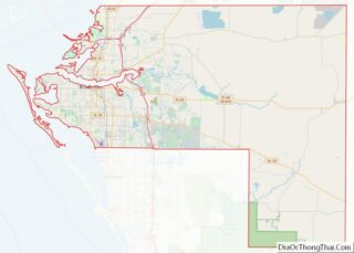
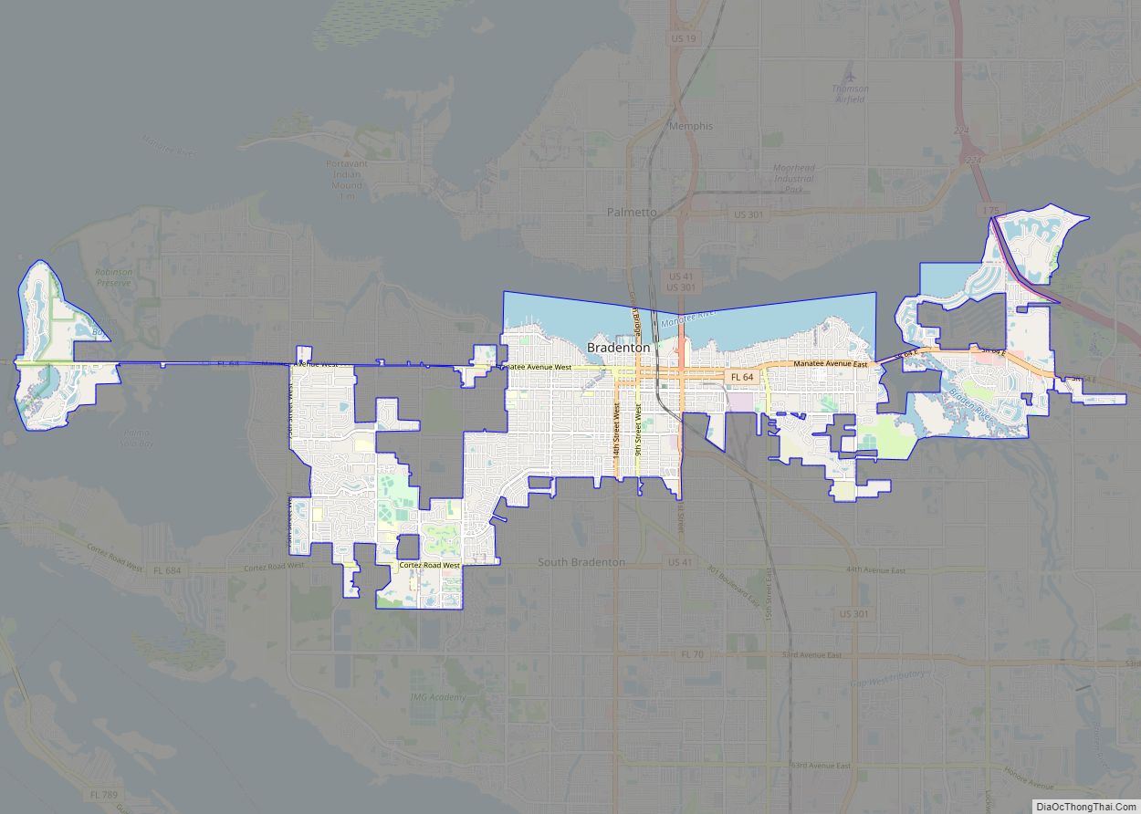
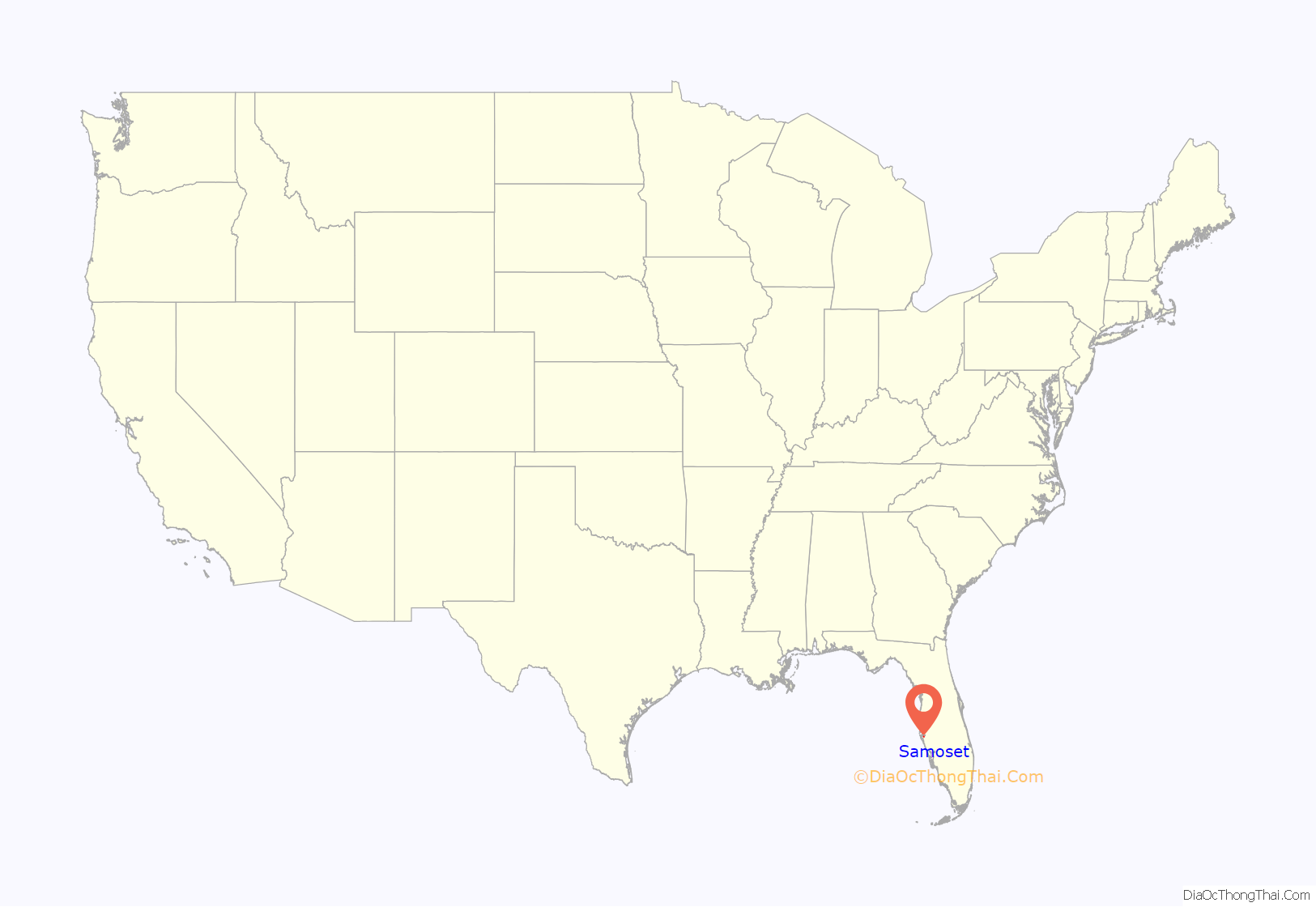
Samoset location map. Where is Samoset CDP?

History
Samoset was incorporated as a city in September 1926, and had a reported population of 1,034. The name of Samoset may have come from an Algonquin Indian, but a newspaper article at the time reported that the township was named for a flag station of the Atlantic Coast Line Railroad. The new city’s seal consisted of an Indian head, a palm tree, and the year 1926, all surrounded by the name “Samoset” and Florida at the bottom. There were a few subdivisions that were developed before the incorporation, consisting of Listville, Hill Park, and Pinecrest, all of which were consolidated into the new city of Samoset.
William A. Thomas built the new community’s first general store, a two-story brick building, in 1925. The original boundaries of the township ran south from the Bradenton city limits to present-day Cortez Road along 1st Street and a mile east of old Bradenton-Sarasota Road. The city of Manatee bordered it on the north, but it merged with Bradenton in 1944 and is now known as East Bradenton. Manatee’s original borders ran from 1st Street to Braden River.
Early pioneers Thomas, George, and Luke Wyatt, and Eva Felts secured the installation of power lines from Southern Power Company. Upon incorporation, R.R. Rodeman, a developer, was elected the town’s first mayor. G.L. Bryant was made city clerk, W.W. Fry town marshal, and Claud Schafer, George Wyatt, W.D. Thomas, C.A. Bingham, and E.F. Staples made up the city council. New mayor Rodeman was the developer of the above-mentioned subdivisions as well as that of Sunshine Ridge. Within days of the town’s incorporation, a group of 20 residents organized in a bid to dissolve the new incorporation, but the move failed.
Meanwhile, a new school opened in October 1926, and had an enrollment of 30 children and was housed in the community hall. A teacher, Mrs. Charles Bingham, taught second and third grades. Another teacher, Mrs. Gladys La Croix, instructed 55 more children in the primary room (probably kindergarten and first grades). In March 1927, a post office opened and city clerk Joseph E. Bryant was made postmaster, and a stand-alone building was subsequently constructed. A new church, Missionary Baptist, was founded in May of that year and consisted of 20 parishioners.
In August 1927, Samoset residents’ election was held, and S. Ed Curry succeeded outgoing mayor R.R. Rodeman, while J.P. Haynes and W.D. Thomas were elected to city council. In addition, E.B. Johnson was elected city clerk and F.A. Schmacher was marshal. In June 1928, another move to abolish the new town failed and the town continued on, until December when the move to abolish the town finally went through by a vote of 115 to 31. After the dissolution, the area returned to unincorporated, rural status.
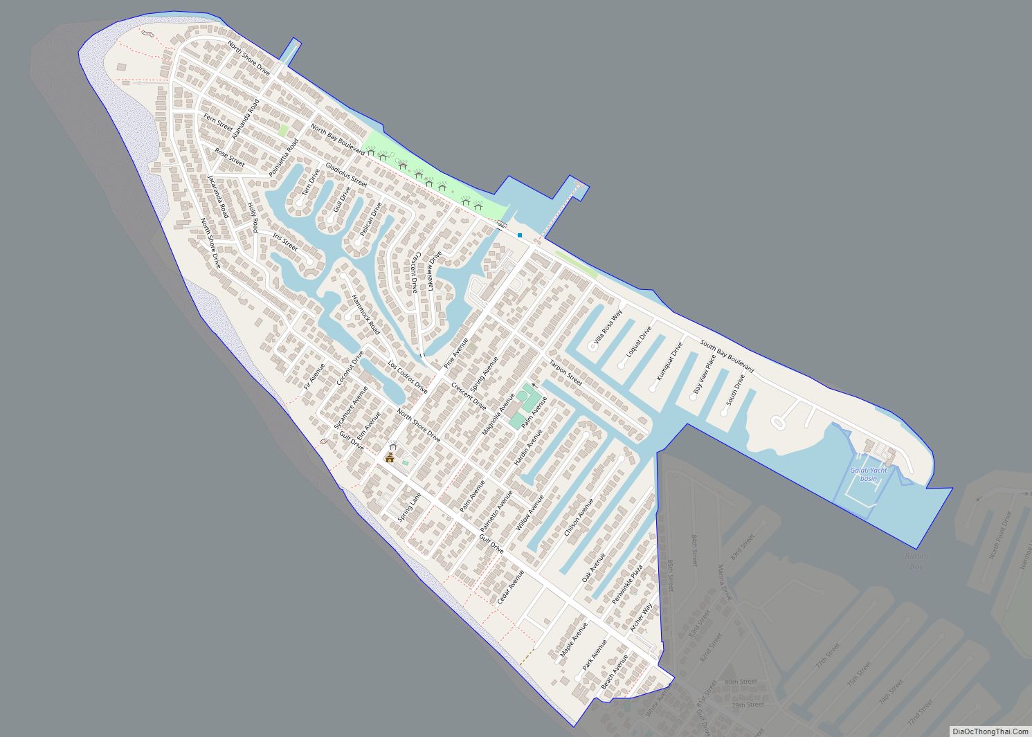
Samoset Road Map
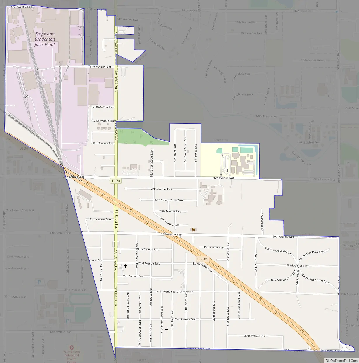
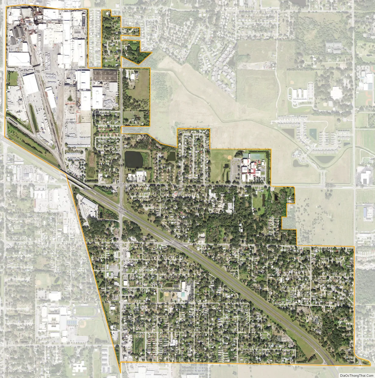
Samoset city Satellite Map
Geography
Samoset is located at 27°28′28″N 82°32′34″W / 27.47444°N 82.54278°W / 27.47444; -82.54278 (27.474567, -82.542817). It is bordered to the north by the city of Bradenton and to the west by unincorporated West Samoset.
U.S. Route 301 passes through the center of the community, leading northwest into Bradenton and south 10 miles (16 km) to Sarasota.
According to the United States Census Bureau, the Samoset CDP has a total area of 1.5 square miles (3.9 km), all land.
See also
Map of Florida State and its subdivision:- Alachua
- Baker
- Bay
- Bradford
- Brevard
- Broward
- Calhoun
- Charlotte
- Citrus
- Clay
- Collier
- Columbia
- Desoto
- Dixie
- Duval
- Escambia
- Flagler
- Franklin
- Gadsden
- Gilchrist
- Glades
- Gulf
- Hamilton
- Hardee
- Hendry
- Hernando
- Highlands
- Hillsborough
- Holmes
- Indian River
- Jackson
- Jefferson
- Lafayette
- Lake
- Lee
- Leon
- Levy
- Liberty
- Madison
- Manatee
- Marion
- Martin
- Miami-Dade
- Monroe
- Nassau
- Okaloosa
- Okeechobee
- Orange
- Osceola
- Palm Beach
- Pasco
- Pinellas
- Polk
- Putnam
- Saint Johns
- Saint Lucie
- Santa Rosa
- Sarasota
- Seminole
- Sumter
- Suwannee
- Taylor
- Union
- Volusia
- Wakulla
- Walton
- Washington
- Alabama
- Alaska
- Arizona
- Arkansas
- California
- Colorado
- Connecticut
- Delaware
- District of Columbia
- Florida
- Georgia
- Hawaii
- Idaho
- Illinois
- Indiana
- Iowa
- Kansas
- Kentucky
- Louisiana
- Maine
- Maryland
- Massachusetts
- Michigan
- Minnesota
- Mississippi
- Missouri
- Montana
- Nebraska
- Nevada
- New Hampshire
- New Jersey
- New Mexico
- New York
- North Carolina
- North Dakota
- Ohio
- Oklahoma
- Oregon
- Pennsylvania
- Rhode Island
- South Carolina
- South Dakota
- Tennessee
- Texas
- Utah
- Vermont
- Virginia
- Washington
- West Virginia
- Wisconsin
- Wyoming