Longboat Key is a town in Manatee and Sarasota counties along the central west coast of the U.S. state of Florida, located on and coterminous with the barrier island of the same name. Longboat Key is south of Anna Maria Island, between Sarasota Bay and the Gulf of Mexico. It is almost equally divided between Manatee and Sarasota counties. The town of Longboat Key was incorporated in 1955 and is part of the Bradenton-Sarasota-Venice, Florida Metropolitan Statistical Area. The town’s population was 6,888 at the 2010 census, down from 7,603 at the 2000 census. It was back up to 7,505 in the 2020 census.
| Name: | Longboat Key town |
|---|---|
| LSAD Code: | 43 |
| LSAD Description: | town (suffix) |
| State: | Florida |
| County: | Manatee County, Sarasota County |
| Elevation: | 3 ft (1 m) |
| Total Area: | 16.00 sq mi (41.44 km²) |
| Land Area: | 4.08 sq mi (10.56 km²) |
| Water Area: | 11.92 sq mi (30.88 km²) |
| Total Population: | 7,505 |
| Population Density: | 1,840.36/sq mi (710.54/km²) |
| ZIP code: | 34228 |
| Area code: | 941 |
| FIPS code: | 1241150 |
| GNISfeature ID: | 0286084 |
| Website: | www.longboatkey.org |
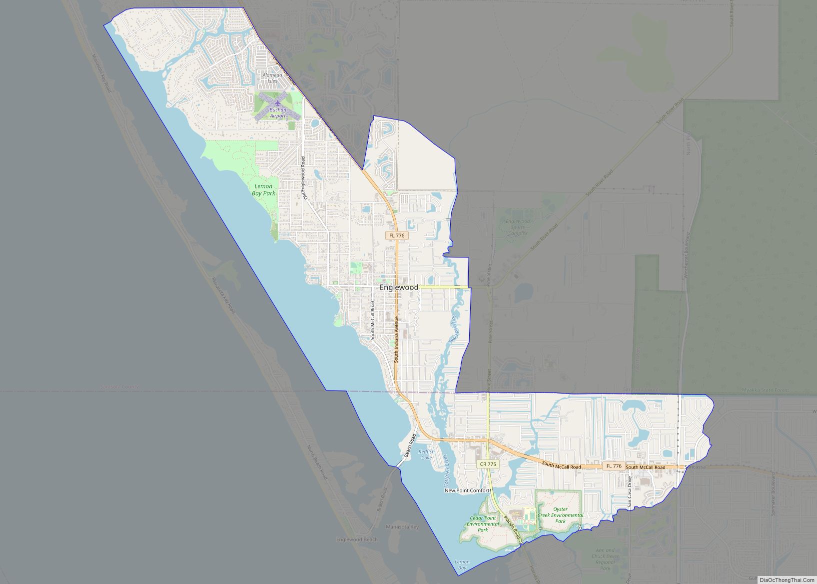
Online Interactive Map
Click on ![]() to view map in "full screen" mode.
to view map in "full screen" mode.
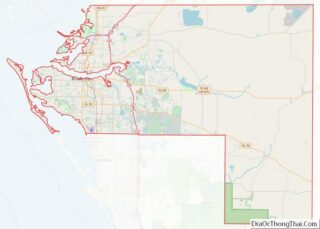
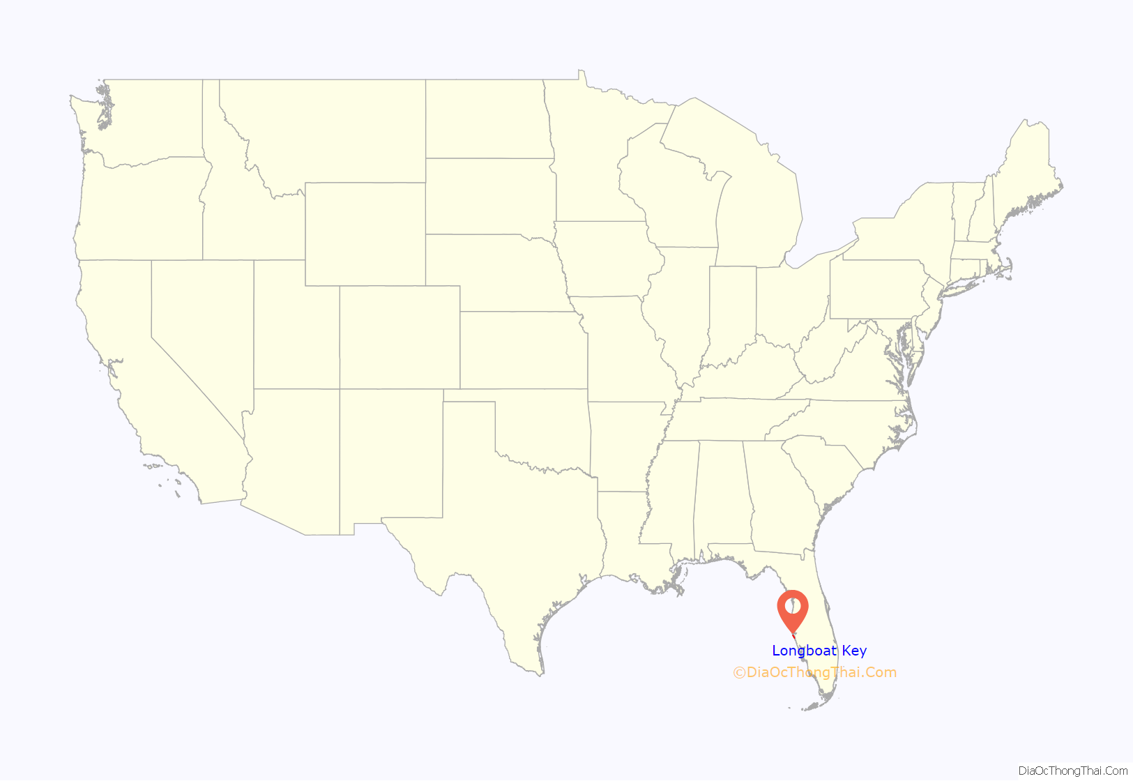
Longboat Key location map. Where is Longboat Key town?

History
Early history
Longboat Key was originally inhabited by Native Americans. The area of what is now Longboat Key was scouted by Juan de Añasco who was the first known European to explore the key and Hernando De Soto’s scout. He spent about two months attempting to find a landing site, and he was also most likely the first European man to see and explore Sarasota Bay, Boca Ceiga Bay and the Manatee River. According to local legend, he believed the Indians were hostile. When the party reached land on the island, the Indians fled leaving their Longboat in a bayou. Pirate Jean Lafitte was said to have been shipwrecked near or on Longboat Key.
Prior to 1842, Cuban and Spanish fishermen along with some squatters would reside on the island. A fishing camp and a trading post for Native Americans would exist in the northern part of the key located in what is presently the Longboat Village. At the time, the area was referred to on maps as “Saraxola” and “Zarazote”.
There is little known about the island after 1848 and until the 1880s, because a hurricane hit the area and destroyed most of Longboat Key. The only thing that is known is that Charles Abbe had a plantation at an unknown location on the island where citrus and pineapples were grown.
Late 1800s & early 1900s
The first people of European descent to claim land on the island were Colin and Rowlin W. Witt, claiming 7.15 acres (2.89 ha) on the north end of the island in 1882. Several others would claim land on the island during the late 1800s, but none of them are known to have lived on the island permanently.
In 1884, Thomas Mann claimed 144.5 acres (58 ha) on the key. He and his family would move there in 1888, becoming the first known permanent residents on the key. His home was located somewhere on the north end of the key.
Mann was a carpenter by trade who was originally from Indiana and later moved to Minnesota. During the American Civil War he served for the Union under the 7th Minnesota Infantry Regiment. Mann and his family moved to what is today Bradenton in 1872. He left because of either a local yellow fever epidemic or prejudice against him from being from the Northern United States. Mann died in 1908 in nearby Cortez. His son, James, claimed 143.5 acres (58 ha) south of his father’s land in 1891.
With a passage being dug in 1895 from Sarasota Bay to Tampa Bay, steamships and paddle boats could access the island. Soon, a mail service was established that brought residents mail from Cortez. Thomas Mann sold his land in 1898 to May and June Pointevesant of Ocean Springs, Mississippi.
Longboat Key’s first post office was established in 1907 at Byron Corey’s pier at the southern end of the island, where he owned 153.5 acres (62 ha) of land beginning in 1903. Corey also served as Longboat Key’s first postmaster. The post office on the sound end lasted until 1921, when it was destroyed by a hurricane.
During the 1910s, the key saw a surge in development and changes to it. The Pointevesants sold their land to Rufus Perry Jordan and Annie Jordan in May 1911. Rufus laid out a community named Longbeach, filling the plat in November 1911. During 1913, another subdivision named Shore Acres that covered 170 acres of land would began to be developed at the “narrowest” part of the island, and would be finished by the next year. Another community was also started at about the same time, named Island Beach, located south of it. Longbeach gained its own post office in 1914. During the early 1900s and prior to the 1921 hurricane, Longboat Key had a significant farming presence, with local residents growing a variety of products. A 1912 Sarasota Times headline read: “From a lonely Key, it is now a center of trucking and fruit growing.”
1920s
In 1921, the key lost most of its agricultural land and buildings during a hurricane. That same year, the island was split between two counties, Sarasota and Manatee.
Starting in 1923, John Ringling purchased a large amount of land on Longboat Key. In February 1926, Ringling entered a contract to develop a luxury hotel named the Ritz-Carlton on the south side of the island. The hotel would have had 200+ rooms, docking facilities and a railroad leading to it to bring guests there. The hotel began construction in March 1926, with a completion date of before December 15, 1926 specified in the contract. An 18-hole golf course would be built next to the hotel as well. Ringling found himself preoccupied with other financial interests, and during that year the Florida land boom began to slow down as well. In November he ordered construction to be stopped on the hotel, and later claimed he would resume construction, but never did.
There were no roads that led to the key until 1929, when a bridge was built to St. Armands. A bridge across Longboat Pass was built in April 1929 and would exist until March 1932.
1930s & 1940s
Starting in 1935, a former Chicago insurance agent named Gordon Whitney started buying up property to construct a series of cottages on the northern end of the island. The area was given the name of Whitney Beach. Whitney intended to have the cottages serve as part of a resort.
In 1936, for the first time, telephone service was brought to the southern part of the island.
In 1937, John Ringling North, the head of the estate of John Ringling, who had died in 1936, announced that Martin Sweeney had an interest in finishing the Ritz-Carlton Hotel. Sweeney said the hotel would have two 18 hole golf courses, an airport, a club and facilities for fishing, along with 235 rooms when completed. However, these plans would never transpire and the hotel remained in its then-current state.
By 1939 or 1940, telephone service was brought to the North End. Longboat Key got its first newspaper, Gulf Gale, in 1941; it would run until 1944.
In World War II, Longboat Key had a bombing range. In 1942, it was used by B-26 planes, and from 1943 to 1945 by P-40 and P-51 planes. The range was used between 8am and 5pm, which meant that residents on the northern side of the island could not go south of it until after its training sessions.
1950s to the present
On November 13, 1955, the town was incorporated by a 186–13 vote at a meeting in a fire station. The meeting itself lasted for 3 hours and 10 minutes in total. Reasons for supporting incorporation included that Longboat Key could have more say in its governmental affairs. It is also believed that the placement of a segregated beach for African-Americans on the island was a motivator behind incorporating. By incorporating the entire key, they could somehow avoid the placement of the beach altogether. Residents also held meetings protesting the beach’s placement. Significant arguments against incorporation were that property taxes would go up. After doing the incorporation vote, Will LePage was elected as the first mayor, along with the first eight members of the Board of Aldermen. At the time, only about a third of Longboat Key was developed, and roughly 215 people lived on the key. When the town was incorporated, it changed its name from Longbeach to Longboat Key.
In 1959 the Arvida Corporation created by Arthur Vining Davis purchased 2,000 acres, which included the southern half of Longboat Key, a majority of Lido Key, along with Bird, Otter and Coon Keys, at a price of $13.5 million. It was expected that the population would be increased by 12,000 extra residents. Some of the land purchased would come from John Ringling North, and on his Longboat Key land included the unfinished Ritz-Carlton Hotel. There was a proposal in 1962 by a Sarasota realtor to finish its construction and make it into a convention site for Sarasota. However, Arvida had no interest in either selling or attempting to finish the hotel. The hotel was torn down between December 1963 and January 1964. Debris from the demolished hotel would be used as fill for the city’s civic center and City Island.
President George W. Bush arrived on Longboat Key on September 10, 2001, the day before the September 11 attacks, to read to second graders in a campaign at the Emma E. Booker School in Sarasota.
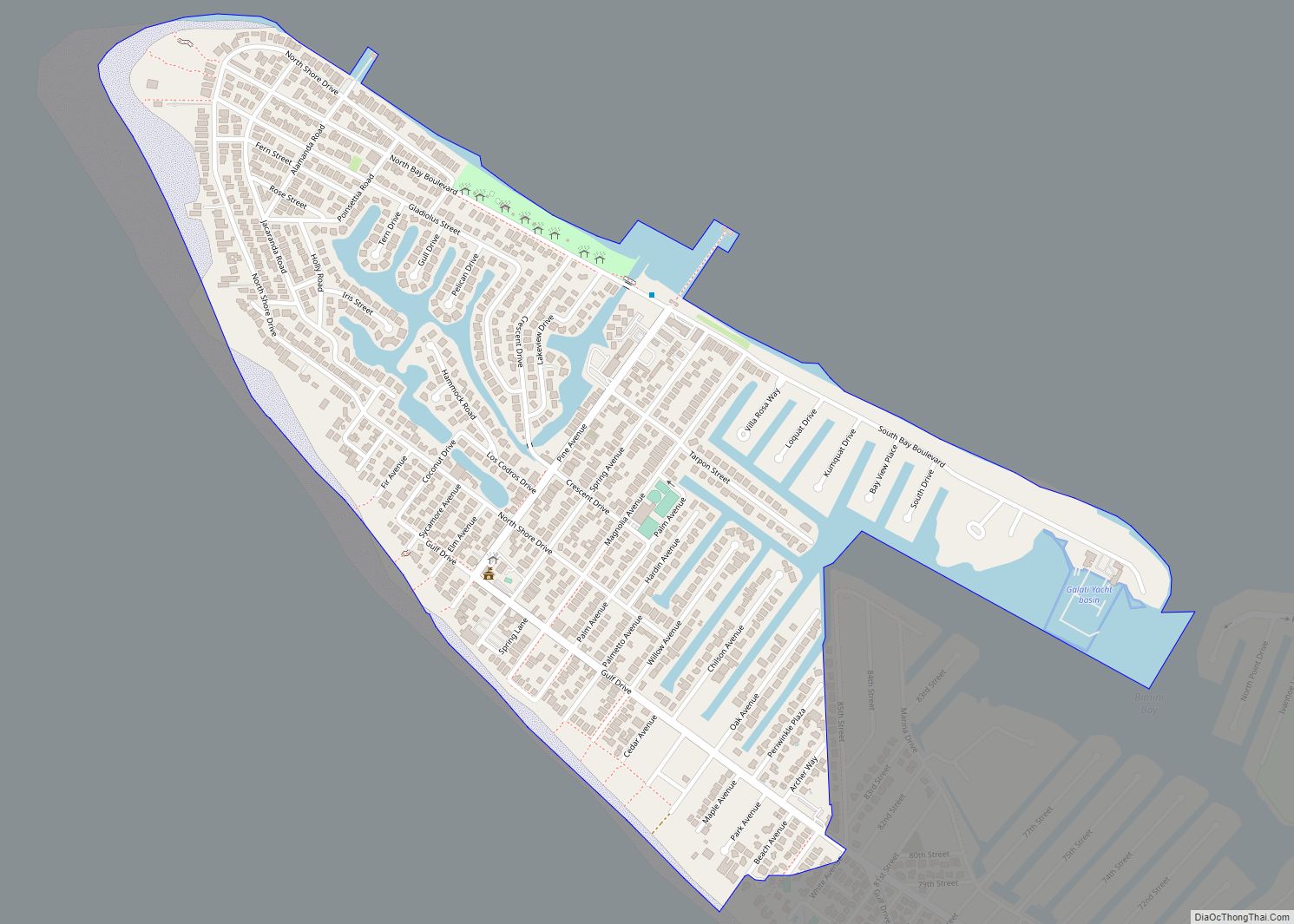
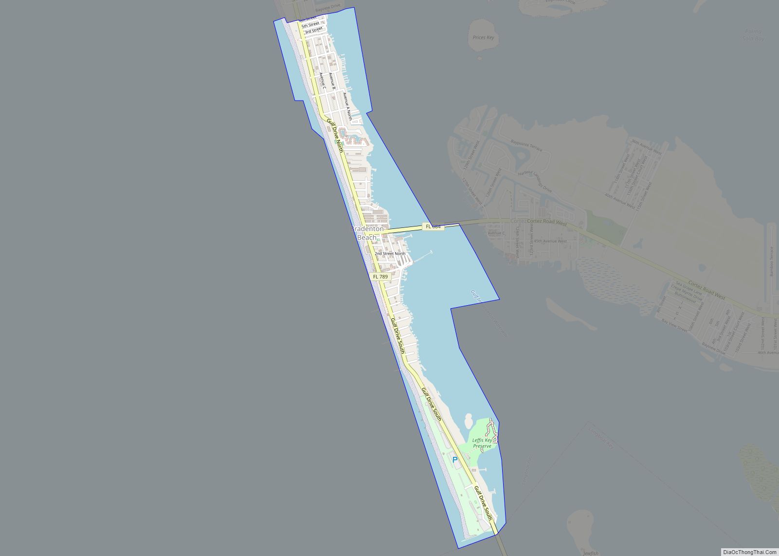
Longboat Key Road Map

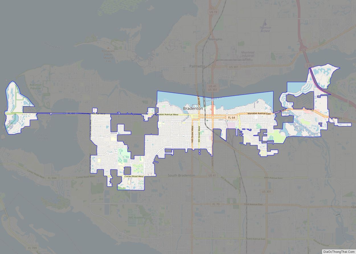
Longboat Key city Satellite Map
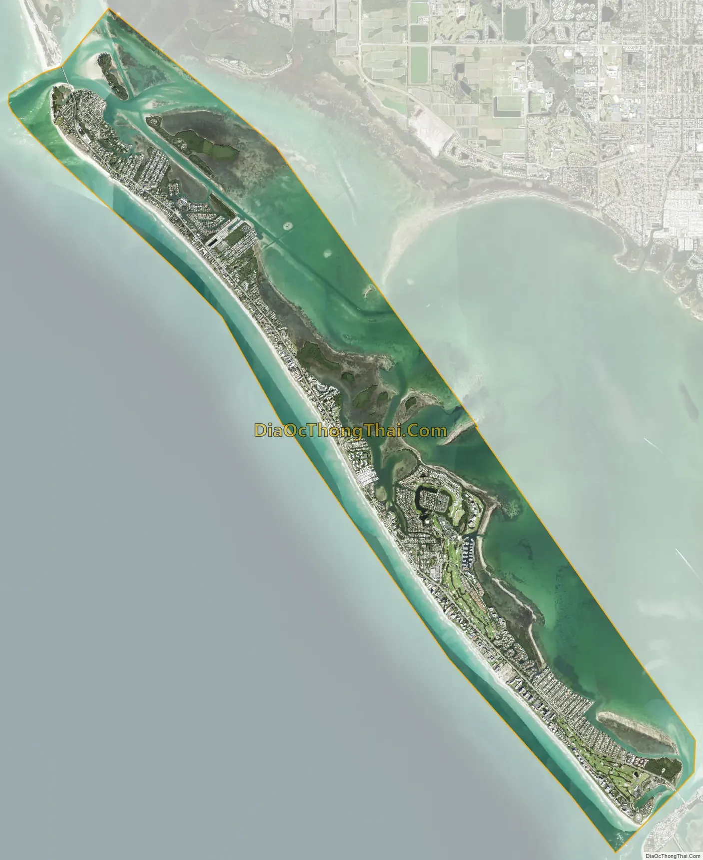
Geography
According to the United States Census Bureau, the town has a total area of 16.0 square miles (41.4 km), of which 4.1 square miles (10.7 km) is land and 11.9 square miles (30.7 km), or 74.19%, is water.
Longboat Key is located north of St. Armands Key, with its circle of shopping and dining, and Lido Key, and south of Bradenton Beach, Holmes Beach, and Anna Maria, which are located on adjacent Anna Maria Island. The nearby cities of Sarasota and Bradenton and the Sarasota–Bradenton International Airport round out Longboat Key’s varied list of geographic amenities. State Road 789 (Gulf of Mexico Drive) runs the length of the island, with ancillary boulevards branching off to residential neighborhoods. From some locations one can see both Sarasota Bay and the Gulf of Mexico.
At other points the island widens and accommodates various homes owned both singly and in condominiums, hotels, and sports clubs. Some Longboat Key residents are “snowbirds”, who vacation on or own second homes on Longboat Key, and are present only during the winter months.
Others are homesteaders, utilizing the various homestead exemptions provided to Florida citizens who own and occupy their principal residences within the state, as set forth under the Florida Constitution. There are numerous restaurants on Longboat Key, including Mar Vista, The Lazy Lobster, The Dry Dock, Pattigeorge’s Restaurant, Chart House, the Longboat Key Club Restaurant, Euphemia Haye, Maison Blanche, Bayou Tavern, and Harry’s. There are also full-service grocery stores, including Publix, and pharmacies, located centrally. Most of the Gulf side of Longboat Key comprises beaches. The southernmost area of the key is mostly part of the Longboat Key Club.
Boardwalk to beach
Beach on Gulf side of key
Beach expanse
Jewfish Key
Jewfish Key is an island that covers 38 acres (150,000 m) located within city limits. The island is only accessible via boat and the eastern part of the key is a nature preserve. Electricity is provided via underwater cables and there is no landline phone lines to the key. Residents of the island get water from wells and use septic tanks.
Until the 1930s, Jewfish Key was two islands: Pickett Key to the north and Fisherman’s Key located to the south. When the US Army Corps of Engineers dredged the Intracoastal Waterway they needed a place to deposit the spoil; and the two owners (whose last names were Jordan and Zeisse) allowed for the spoil to be placed to make a single island in exchange for a deed to this now one island and “a case of whisky”. The island’s name comes from when local fisherman started calling the island Jewfish Key because they caught large amounts of Goliath groupers or Jewfish there.
See also
Map of Florida State and its subdivision:- Alachua
- Baker
- Bay
- Bradford
- Brevard
- Broward
- Calhoun
- Charlotte
- Citrus
- Clay
- Collier
- Columbia
- Desoto
- Dixie
- Duval
- Escambia
- Flagler
- Franklin
- Gadsden
- Gilchrist
- Glades
- Gulf
- Hamilton
- Hardee
- Hendry
- Hernando
- Highlands
- Hillsborough
- Holmes
- Indian River
- Jackson
- Jefferson
- Lafayette
- Lake
- Lee
- Leon
- Levy
- Liberty
- Madison
- Manatee
- Marion
- Martin
- Miami-Dade
- Monroe
- Nassau
- Okaloosa
- Okeechobee
- Orange
- Osceola
- Palm Beach
- Pasco
- Pinellas
- Polk
- Putnam
- Saint Johns
- Saint Lucie
- Santa Rosa
- Sarasota
- Seminole
- Sumter
- Suwannee
- Taylor
- Union
- Volusia
- Wakulla
- Walton
- Washington
- Alabama
- Alaska
- Arizona
- Arkansas
- California
- Colorado
- Connecticut
- Delaware
- District of Columbia
- Florida
- Georgia
- Hawaii
- Idaho
- Illinois
- Indiana
- Iowa
- Kansas
- Kentucky
- Louisiana
- Maine
- Maryland
- Massachusetts
- Michigan
- Minnesota
- Mississippi
- Missouri
- Montana
- Nebraska
- Nevada
- New Hampshire
- New Jersey
- New Mexico
- New York
- North Carolina
- North Dakota
- Ohio
- Oklahoma
- Oregon
- Pennsylvania
- Rhode Island
- South Carolina
- South Dakota
- Tennessee
- Texas
- Utah
- Vermont
- Virginia
- Washington
- West Virginia
- Wisconsin
- Wyoming