Tarpon Springs is a city in Pinellas County, Florida, United States. The population was 23,484 at the 2010 census. Downtown Tarpon Springs has long been a focal point and is undergoing beautification.
Tarpon Springs has the highest percentage of Greek Americans of any city in the US.
| Name: | Tarpon Springs city |
|---|---|
| LSAD Code: | 25 |
| LSAD Description: | city (suffix) |
| State: | Florida |
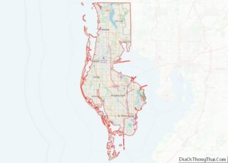
| County: | Pinellas County |
| Elevation: | 23 ft (7 m) |
| Total Area: | 17.93 sq mi (46.44 km²) |
| Land Area: | 9.26 sq mi (23.98 km²) |
| Water Area: | 8.67 sq mi (22.46 km²) |
| Total Population: | 25,117 |
| Population Density: | 2,712.42/sq mi (1,047.31/km²) |
| ZIP code: | 34688, 34689 |
| Area code: | 727 |
| FIPS code: | 1271150 |
| GNISfeature ID: | 0292048 |
| Website: | www.ctsfl.us |
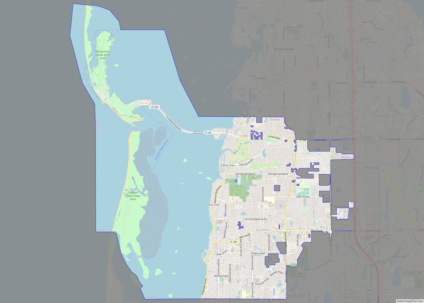
Online Interactive Map
Click on ![]() to view map in "full screen" mode.
to view map in "full screen" mode.
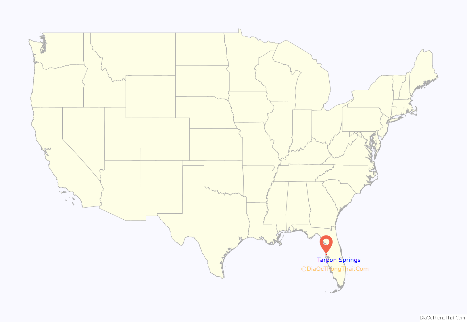
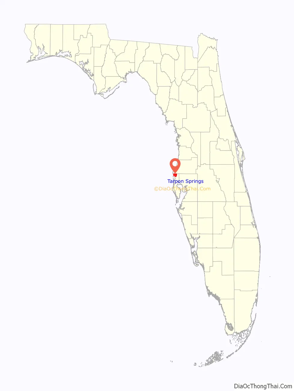
Tarpon Springs location map. Where is Tarpon Springs city?
History
The region, with a series of bayous feeding into the Gulf of Mexico, was first settled by farmers and fishermen around 1876. Some of the newly arrived visitors spotted tarpon jumping out of the waters and so named the location Tarpon Springs. The name is said to have originated with a remark of Mrs. Ormond Boyer, an early settler from South Carolina, and who, while standing on the shore of the Bayou and seeing fish leaping, exclaimed, “See the tarpon spring!’ However, for the most part, the fish seen splashing here were mullet rather than tarpon. In 1882, Hamilton Disston, who in the previous year had purchased the land where the city of Tarpon Springs now stands, ordered the creation of a town plan for the future city. On February 12, 1887, Tarpon Springs became the first incorporated city in what is now Pinellas County. Less than a year later on January 13, 1888, the Orange Belt Railway, the first railroad line to be built in what is now Pinellas County, arrived in the city. During this time the area was developed as a wintering spot for wealthy northerners.
Sponge industry
In the 1880s, John K. Cheyney founded the first local sponge business. The industry continued to grow in the 1890s. Many people from Key West and the Bahamas settled in Tarpon Springs to hook sponges and then process them. A few Greek immigrants also arrived in this city during the 1890s to work in the sponge industry.
In 1905, John Cocoris introduced the technique of sponge diving to Tarpon Springs by recruiting divers and crew members from Greece. The first divers came from the Saronic Gulf islands of Aegina and Hydra, but they were soon outnumbered by those from the Dodecanese islands of Kalymnos, Symi and Halki. The sponge industry soon became one of the leading maritime industries in Florida and the most important business in Tarpon Springs, generating millions of dollars a year. The 1953 film Beneath the 12-Mile Reef, depicting the sponge industry, takes place and was filmed in Tarpon Springs.
In 1947, a red tide algae bloom wiped out the sponge fields in the Gulf of Mexico, causing many of the sponge boats and divers to switch to shrimping for their livelihood, while others left the business. Eventually, the sponges recovered, allowing for a smaller but consistent sponge industry today. In the 1980s, the sponge business experienced a boom due to a sponge disease that killed the Mediterranean sponges. Today there is still a small active sponge industry.
In 2007 and 2008, the City of Tarpon Springs established Sister City relationships with Kalymnos, Halki, Symi, Hydra, and Larnaca, Cyprus, honoring the close historical link with these Greek-speaking islands.
Historic sites
There are several districts or properties in Tarpon Springs that have been listed on the National Register of Historic Places:
- Tarpon Springs Greektown Historic District
- Tarpon Springs Historic District
- Arcade Hotel
- Old Tarpon Springs City Hall
- Old Tarpon Springs High School
- Safford House
- Rose Hill Cemetery
- Tarpon Springs Depot
Many sites related to the sponge industry within the Greektown District also have been recognized. They include but are not limited to two sponge packing houses:
- E.R. Meres Sponge Packing House
- N.G. Arfaras Sponge Packing House
And several boats:
- N.K. Symi (Sponge Diving Boat)
- St. Nicholas III (Sponge Diving Boat)
- St. Nicholas VI (Sponge Diving Boat)
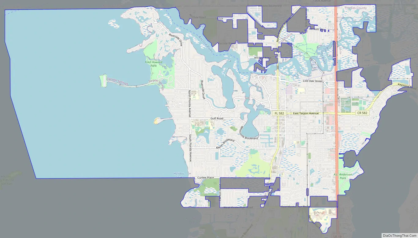
Tarpon Springs Road Map
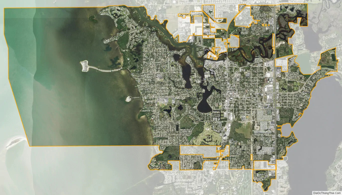
Tarpon Springs city Satellite Map
Geography
According to the United States Census Bureau, the city of Tarpon Springs has a total area of 16.9 square miles (44 km), of which 9.1 square miles (24 km) is land and 7.7 square miles (20 km) (45.83%) is water.
Climate
Tarpon Springs’ climate borders on humid subtropical and tropical savanna, with warm temperatures year-round, although winter nights are cool. Annual precipitation is around 50 inches (1,300 mm). Winters are warm, with daytime highs of 69 °F (21 °C) to 72 °F (22 °C), and nightly lows of 50 °F (10 °C) to 54 °F (12 °C). Freezing temperatures (32 °F (0 °C) or lower) occur infrequently, while snowfall is extremely rare; there was accumulation in 1977 and 1989, while the years 1899, 1954, 1958, 1973, 2001, 2006, 2010, and 2014 either saw light snow mixed with rain, or flurries. The record low temperature of 19 °F (−7 °C) was observed on four different dates: December 1, 1962, December 13, 1962, December 14, 1962, and January 13, 1985. Summers are hot and very humid, causing frequent afternoon thunderstorms that can occasionally produce hail, and, even tornadoes or waterspouts off the Gulf of Mexico. Daytime temperatures usually range from 89 °F (32 °C) to 91 °F (33 °C), with temperatures over 100 °F (38 °C) very rare. The record high temperature of 102 °F (39 °C) was observed on July 10, 1997. Spring and fall are generally warm.
See also
Map of Florida State and its subdivision:- Alachua
- Baker
- Bay
- Bradford
- Brevard
- Broward
- Calhoun
- Charlotte
- Citrus
- Clay
- Collier
- Columbia
- Desoto
- Dixie
- Duval
- Escambia
- Flagler
- Franklin
- Gadsden
- Gilchrist
- Glades
- Gulf
- Hamilton
- Hardee
- Hendry
- Hernando
- Highlands
- Hillsborough
- Holmes
- Indian River
- Jackson
- Jefferson
- Lafayette
- Lake
- Lee
- Leon
- Levy
- Liberty
- Madison
- Manatee
- Marion
- Martin
- Miami-Dade
- Monroe
- Nassau
- Okaloosa
- Okeechobee
- Orange
- Osceola
- Palm Beach
- Pasco
- Pinellas
- Polk
- Putnam
- Saint Johns
- Saint Lucie
- Santa Rosa
- Sarasota
- Seminole
- Sumter
- Suwannee
- Taylor
- Union
- Volusia
- Wakulla
- Walton
- Washington
- Alabama
- Alaska
- Arizona
- Arkansas
- California
- Colorado
- Connecticut
- Delaware
- District of Columbia
- Florida
- Georgia
- Hawaii
- Idaho
- Illinois
- Indiana
- Iowa
- Kansas
- Kentucky
- Louisiana
- Maine
- Maryland
- Massachusetts
- Michigan
- Minnesota
- Mississippi
- Missouri
- Montana
- Nebraska
- Nevada
- New Hampshire
- New Jersey
- New Mexico
- New York
- North Carolina
- North Dakota
- Ohio
- Oklahoma
- Oregon
- Pennsylvania
- Rhode Island
- South Carolina
- South Dakota
- Tennessee
- Texas
- Utah
- Vermont
- Virginia
- Washington
- West Virginia
- Wisconsin
- Wyoming