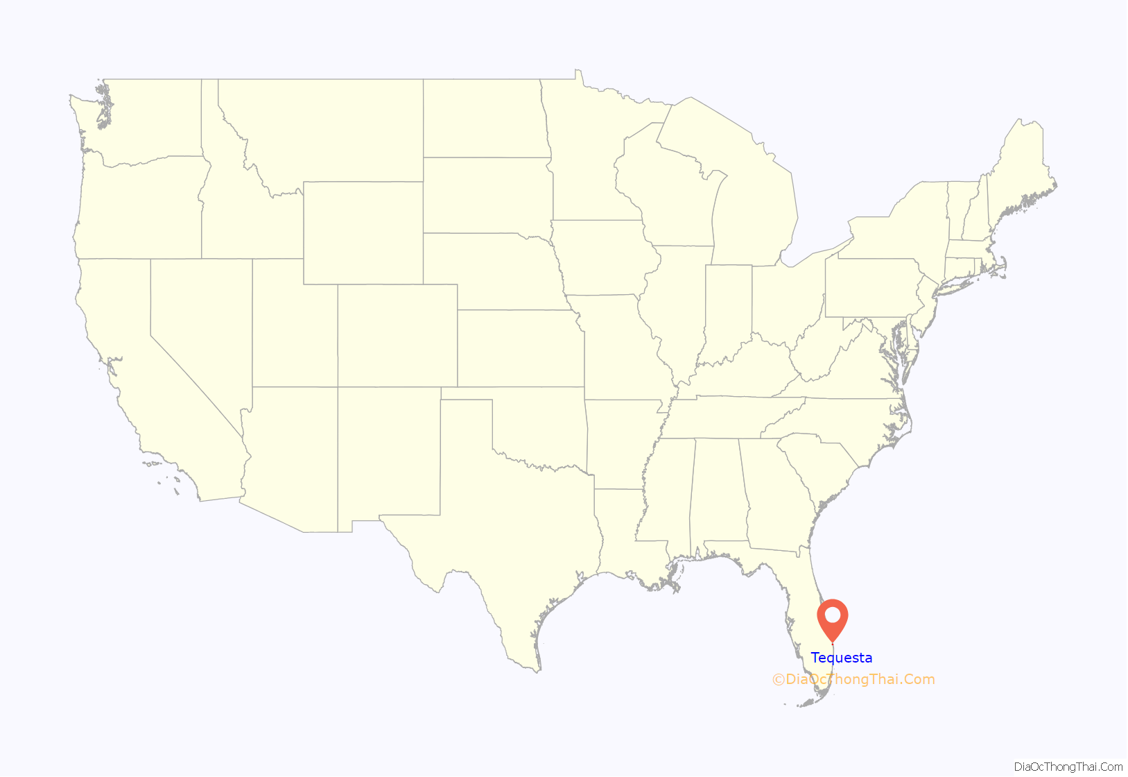
Tequesta is an incorporated village in Palm Beach County, Florida, United States. The population was 6,158 at the 2020 Census. It is the northernmost municipality in the Miami metropolitan area, which in 2010 had a total population of 5,564,635 according to the U.S. Census.
| Name: | Tequesta village |
|---|---|
| LSAD Code: | 47 |
| LSAD Description: | village (suffix) |
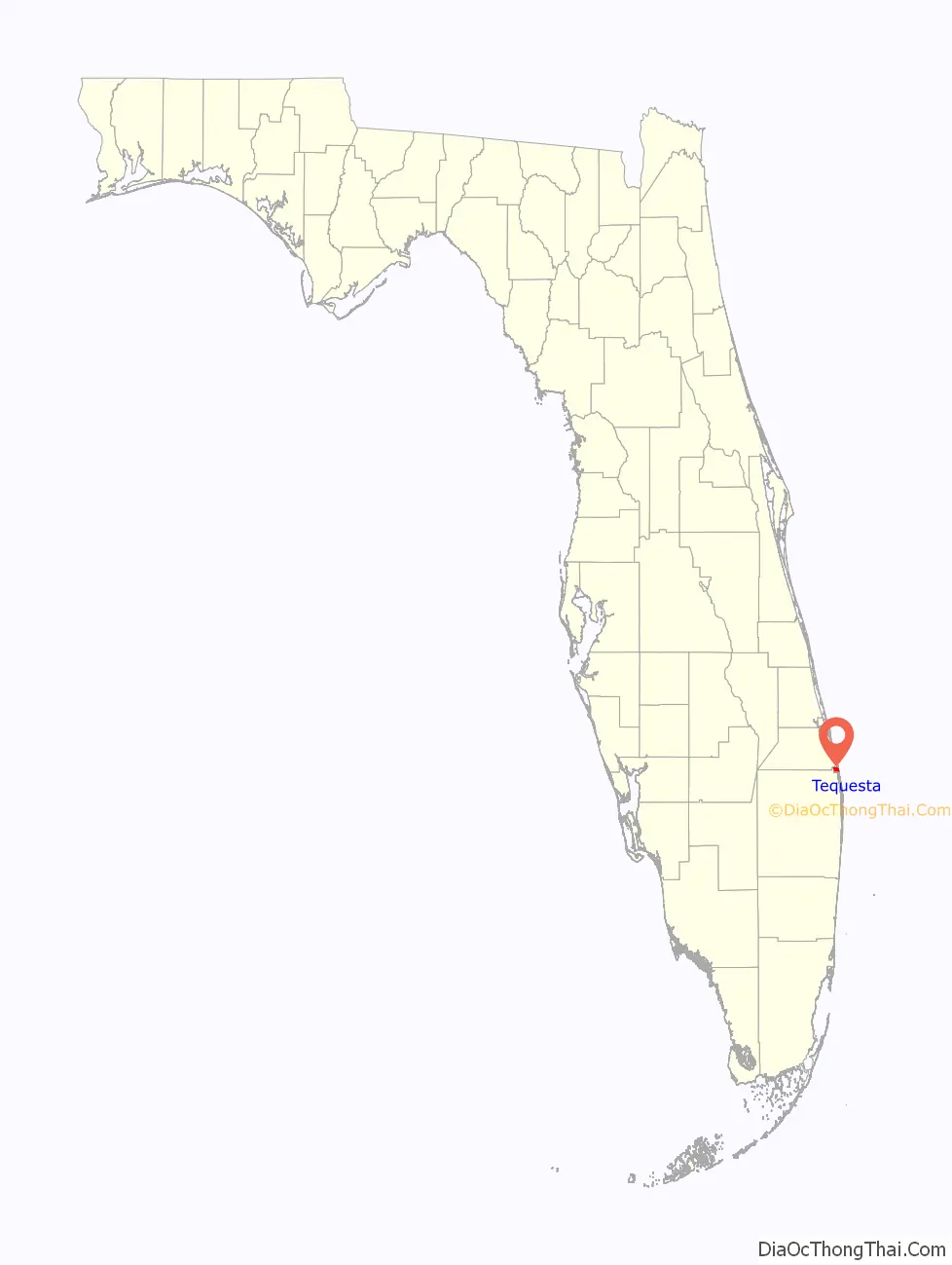
| State: | Florida |
| County: | Palm Beach County |
| Elevation: | 10 ft (3 m) |
| Total Area: | 2.26 sq mi (5.84 km²) |
| Land Area: | 1.83 sq mi (4.74 km²) |
| Water Area: | 0.42 sq mi (1.10 km²) |
| Total Population: | 6,158 |
| Population Density: | 3,361.35/sq mi (1,298.05/km²) |
| ZIP code: | 33469 |
| Area code: | 561 |
| FIPS code: | 1271525 |
| GNISfeature ID: | 0302676 |
| Website: | www.tequesta.org |
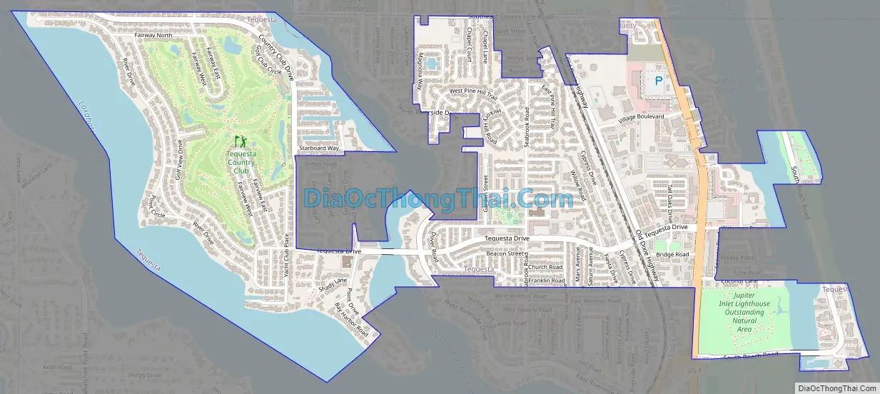
Online Interactive Map
Click on ![]() to view map in "full screen" mode.
to view map in "full screen" mode.
Tequesta location map. Where is Tequesta village?
History
Tequesta was founded in the 1950s as a planned community centered on the Tequesta Country Club. Tequesta was named after the Tequesta people. The village was incorporated in 1957.
Tequesta Road Map
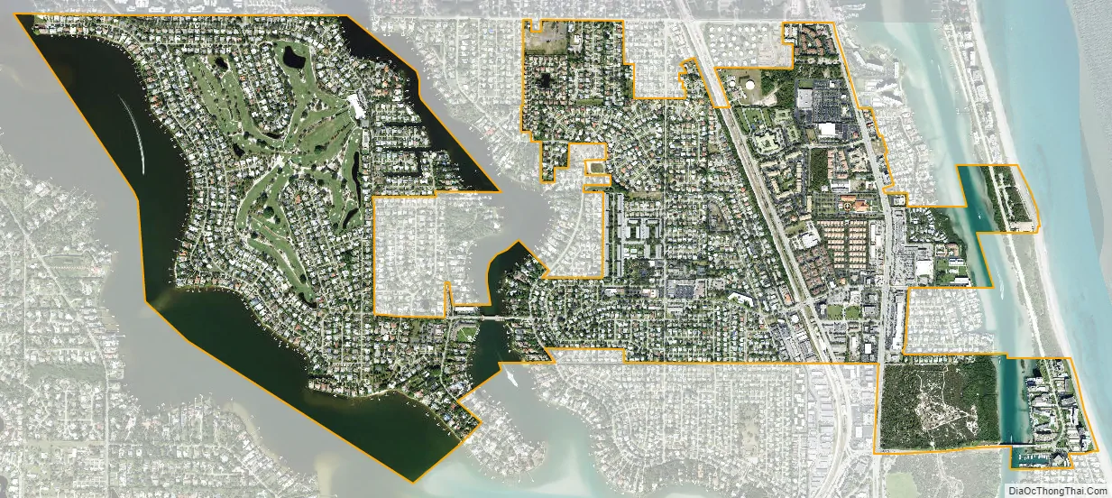
Tequesta city Satellite Map
Geography
The Village of Tequesta is located at 26°57′39″N 80°5′48″W / 26.96083°N 80.09667°W / 26.96083; -80.09667 (26.960867, –80.096620).
According to the United States Census Bureau, the village has a total area of 2.2 square miles (5.7 km), of which 1.8 square miles (4.5 km) is land and 0.5 square mile (1.2 km) (20.81%) is water.
Most of the village is located on the mainland but parts of the village are on Jupiter Island in Martin County, with small sections both north and south of the unincorporated, county-owned Coral Cove Park.
Going to and from Tequesta from the South or East requires going over a bridge. Starting March 13, 2023, the Jupiter Federal Bridge will be closed for roughly 20 months to construct two 11-foot travel lanes, 7-foot bicycle lanes and 8-foot sidewalks in each direction. The new bridge will have up to 42 feet of vertical clearance, and the navigable-channel width will be increased to 125 feet as well.
See also
Map of Florida State and its subdivision:- Alachua
- Baker
- Bay
- Bradford
- Brevard
- Broward
- Calhoun
- Charlotte
- Citrus
- Clay
- Collier
- Columbia
- Desoto
- Dixie
- Duval
- Escambia
- Flagler
- Franklin
- Gadsden
- Gilchrist
- Glades
- Gulf
- Hamilton
- Hardee
- Hendry
- Hernando
- Highlands
- Hillsborough
- Holmes
- Indian River
- Jackson
- Jefferson
- Lafayette
- Lake
- Lee
- Leon
- Levy
- Liberty
- Madison
- Manatee
- Marion
- Martin
- Miami-Dade
- Monroe
- Nassau
- Okaloosa
- Okeechobee
- Orange
- Osceola
- Palm Beach
- Pasco
- Pinellas
- Polk
- Putnam
- Saint Johns
- Saint Lucie
- Santa Rosa
- Sarasota
- Seminole
- Sumter
- Suwannee
- Taylor
- Union
- Volusia
- Wakulla
- Walton
- Washington
- Alabama
- Alaska
- Arizona
- Arkansas
- California
- Colorado
- Connecticut
- Delaware
- District of Columbia
- Florida
- Georgia
- Hawaii
- Idaho
- Illinois
- Indiana
- Iowa
- Kansas
- Kentucky
- Louisiana
- Maine
- Maryland
- Massachusetts
- Michigan
- Minnesota
- Mississippi
- Missouri
- Montana
- Nebraska
- Nevada
- New Hampshire
- New Jersey
- New Mexico
- New York
- North Carolina
- North Dakota
- Ohio
- Oklahoma
- Oregon
- Pennsylvania
- Rhode Island
- South Carolina
- South Dakota
- Tennessee
- Texas
- Utah
- Vermont
- Virginia
- Washington
- West Virginia
- Wisconsin
- Wyoming


