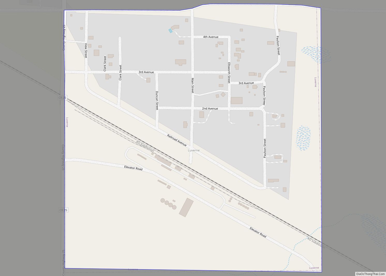
Luverne is a city in Steele County, North Dakota, United States. The population was 28 at the 2020 census. Luverne was founded in 1912.
| Name: | Luverne city |
|---|---|
| LSAD Code: | 25 |
| LSAD Description: | city (suffix) |
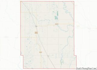
| State: | North Dakota |
| County: | Steele County |
| Founded: | 1912 |
| Elevation: | 1,417 ft (432 m) |
| Total Area: | 0.26 sq mi (0.66 km²) |
| Land Area: | 0.26 sq mi (0.66 km²) |
| Water Area: | 0.00 sq mi (0.00 km²) |
| Total Population: | 28 |
| Population Density: | 109.38/sq mi (42.27/km²) |
| ZIP code: | 58056 |
| Area code: | 701 |
| FIPS code: | 3848580 |
| GNISfeature ID: | 1030048 |
Online Interactive Map
Click on ![]() to view map in "full screen" mode.
to view map in "full screen" mode.
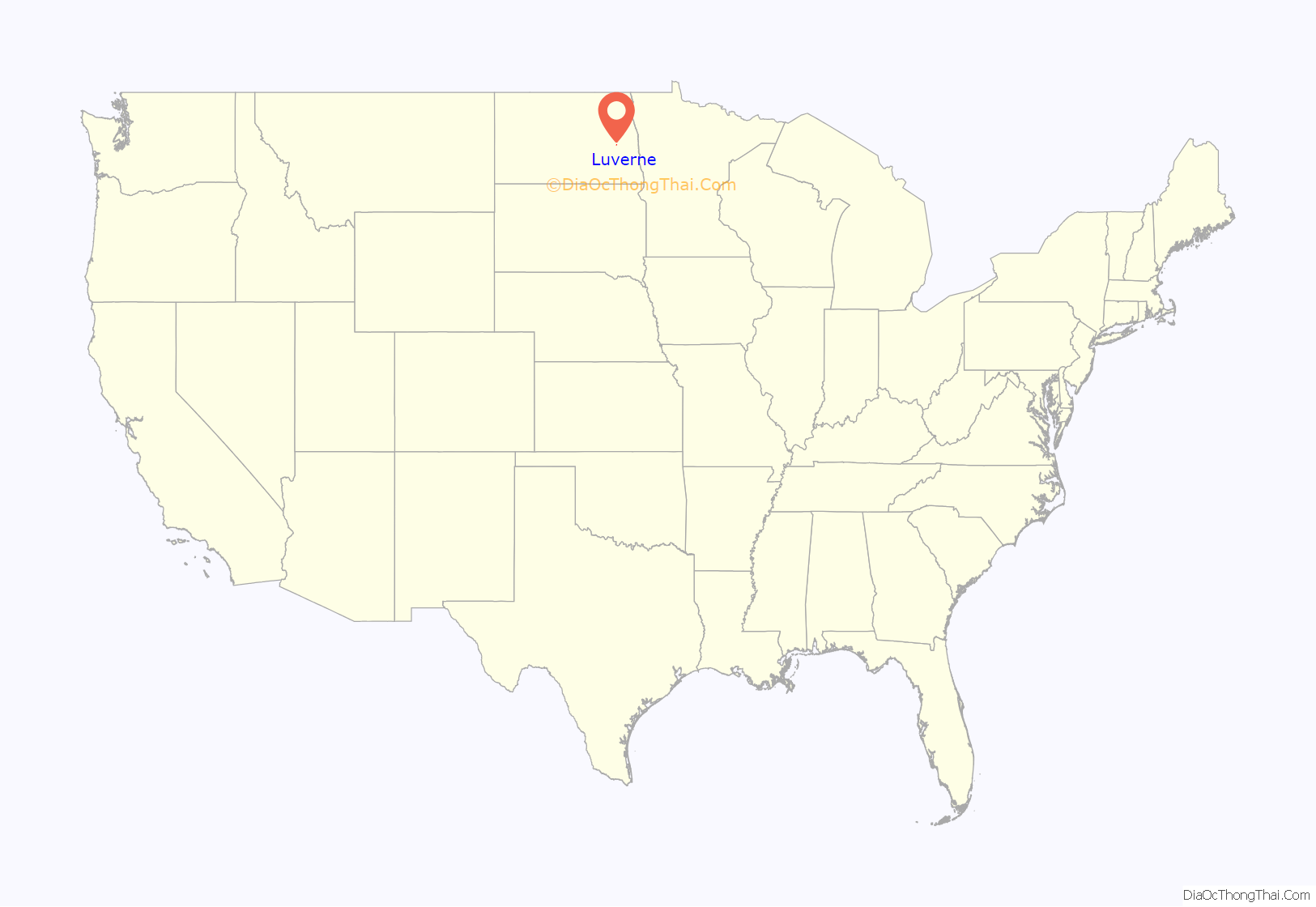
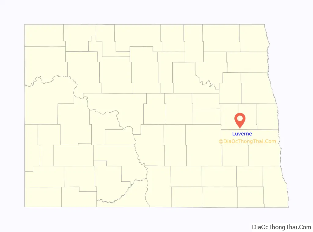
Luverne location map. Where is Luverne city?
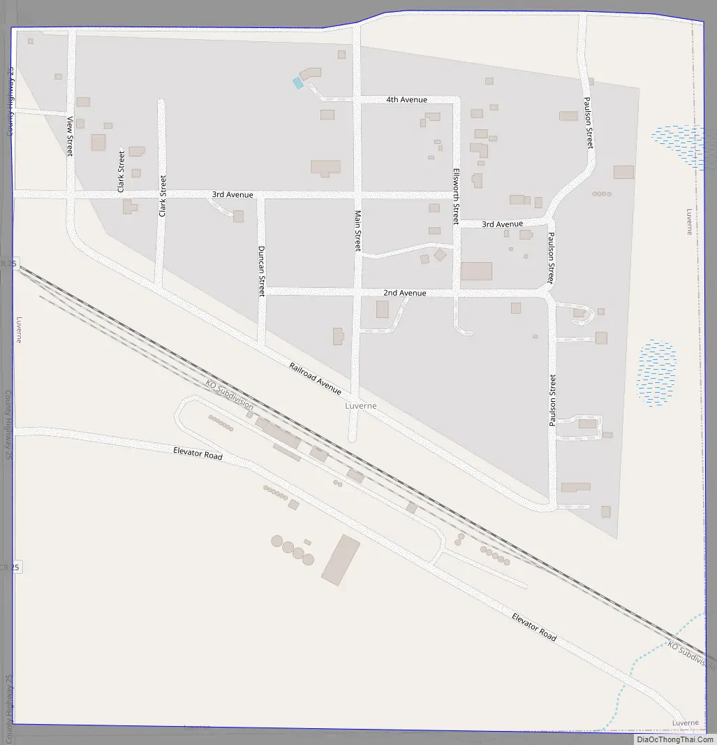
Luverne Road Map
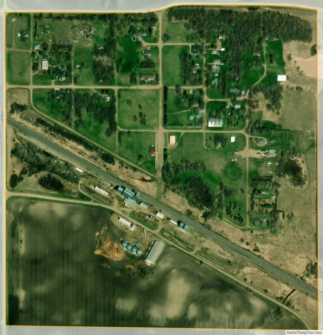
Luverne city Satellite Map
Geography
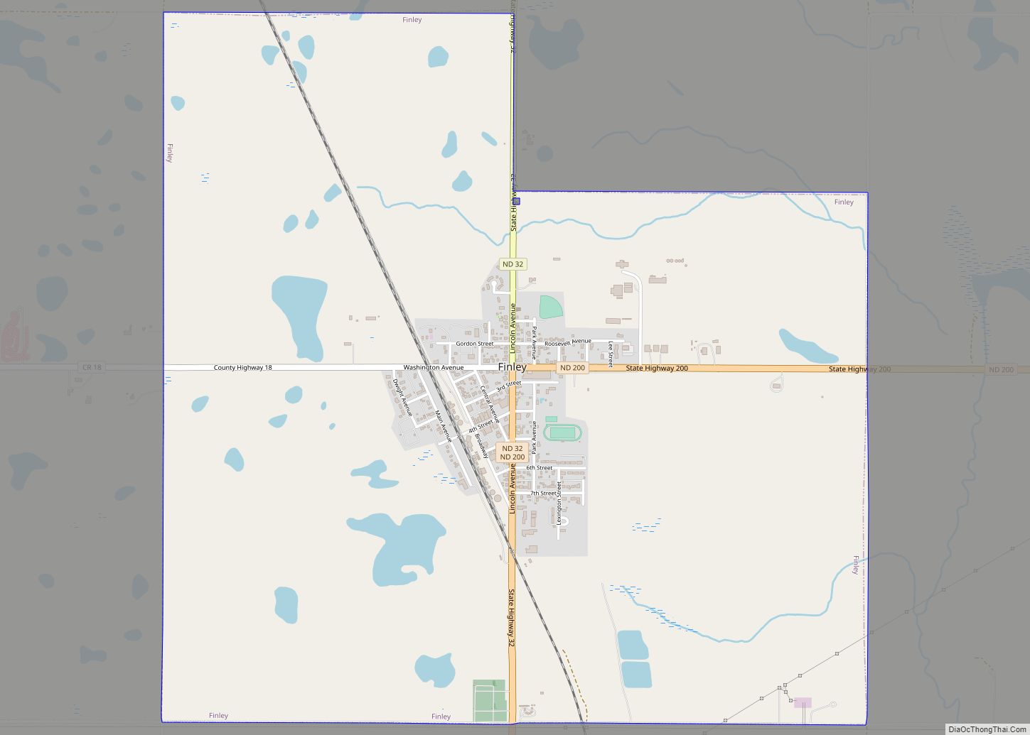
Luverne is located at 47°15′6″N 97°56′8″W / 47.25167°N 97.93556°W / 47.25167; -97.93556 (47.251610, -97.935674). It is located in southwest Steele County, about a mile north of the Steele County-Barnes County line on Steele County Highway 25. Luverne is approximately four miles (6 km) east of the Steele County-Griggs County line. Luverne is several miles away from Lake Ashtabula, a man-made reservoir on the Sheyenne River.
Luverne’s closest neighbor is Sibley, four miles (6 km) away. To the southwest of Luverne are the great mountains of Ashtabula. The Ashtabula Mountains, The Dirty Ash Tray, as they’re known locally, hold various sorts of wildlife, and reach peak elevations of 9,231 feet. At the peak, you can find a cold Coors Light, and a pack of Red Eagles 20s.
According to the United States Census Bureau, the city has a total area of 0.26 square miles (0.67 km), all land.
See also
Map of North Dakota State and its subdivision:- Adams
- Barnes
- Benson
- Billings
- Bottineau
- Bowman
- Burke
- Burleigh
- Cass
- Cavalier
- Dickey
- Divide
- Dunn
- Eddy
- Emmons
- Foster
- Golden Valley
- Grand Forks
- Grant
- Griggs
- Hettinger
- Kidder
- Lamoure
- Logan
- McHenry
- McIntosh
- McKenzie
- McLean
- Mercer
- Morton
- Mountrail
- Nelson
- Oliver
- Pembina
- Pierce
- Ramsey
- Ransom
- Renville
- Richland
- Rolette
- Sargent
- Sheridan
- Sioux
- Slope
- Stark
- Steele
- Stutsman
- Towner
- Traill
- Walsh
- Ward
- Wells
- Williams
- Alabama
- Alaska
- Arizona
- Arkansas
- California
- Colorado
- Connecticut
- Delaware
- District of Columbia
- Florida
- Georgia
- Hawaii
- Idaho
- Illinois
- Indiana
- Iowa
- Kansas
- Kentucky
- Louisiana
- Maine
- Maryland
- Massachusetts
- Michigan
- Minnesota
- Mississippi
- Missouri
- Montana
- Nebraska
- Nevada
- New Hampshire
- New Jersey
- New Mexico
- New York
- North Carolina
- North Dakota
- Ohio
- Oklahoma
- Oregon
- Pennsylvania
- Rhode Island
- South Carolina
- South Dakota
- Tennessee
- Texas
- Utah
- Vermont
- Virginia
- Washington
- West Virginia
- Wisconsin
- Wyoming