Mercer is a city in McLean County, North Dakota, United States. The population was 88 at the 2020 census.
Mercer was founded in 1905 along a now-abandoned branch line of the Northern Pacific Railway extending from Carrington to Turtle Lake. The name comes from William Henry Harrison Mercer, a well known rancher in the Missouri River Valley for many years and for whom Mercer County is also named.
The city of Mercer lies on North Dakota Highway 200 between Underwood and McClusky.
| Name: | Mercer city |
|---|---|
| LSAD Code: | 25 |
| LSAD Description: | city (suffix) |
| State: | North Dakota |
| County: | McLean County |
| Founded: | 1905 |
| Elevation: | 1,929 ft (588 m) |
| Total Area: | 0.23 sq mi (0.59 km²) |
| Land Area: | 0.22 sq mi (0.58 km²) |
| Water Area: | 0.01 sq mi (0.02 km²) |
| Total Population: | 88 |
| Population Density: | 396.40/sq mi (152.78/km²) |
| ZIP code: | 58559 |
| Area code: | 701 |
| FIPS code: | 3852340 |
| GNISfeature ID: | 1030203 |
| Website: | mercernd.org |
Online Interactive Map
Click on ![]() to view map in "full screen" mode.
to view map in "full screen" mode.
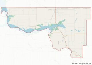
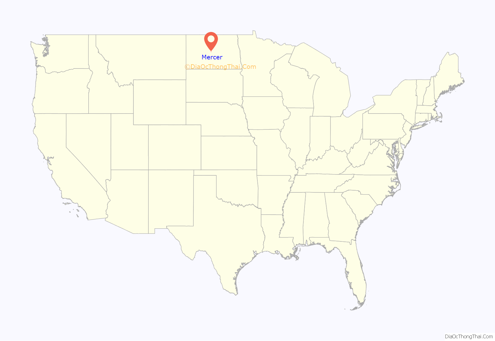
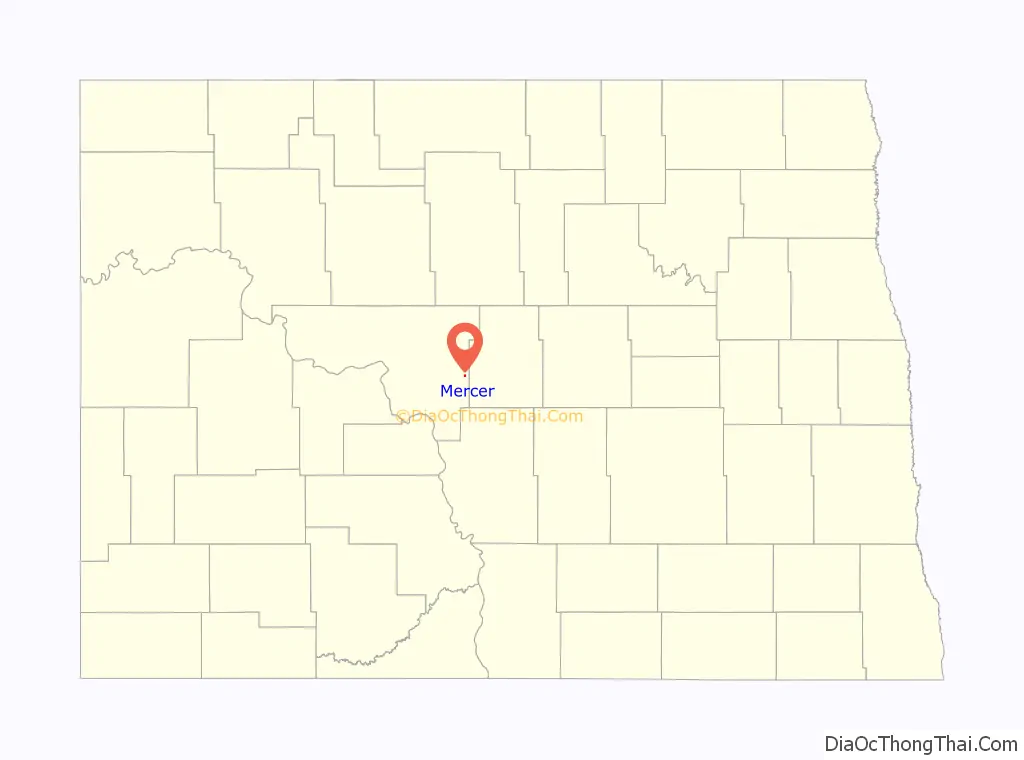
Mercer location map. Where is Mercer city?
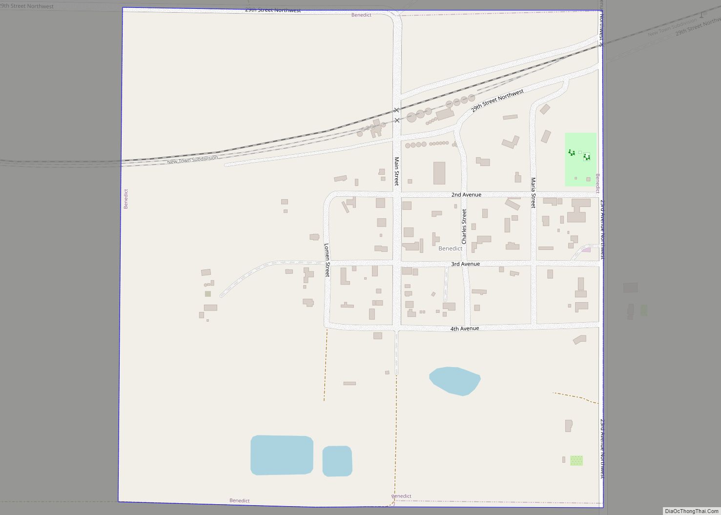
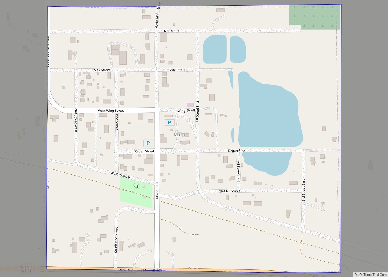
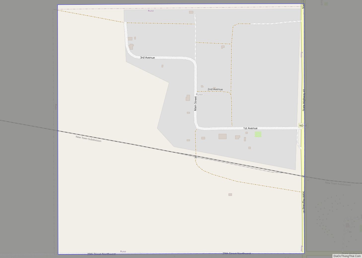
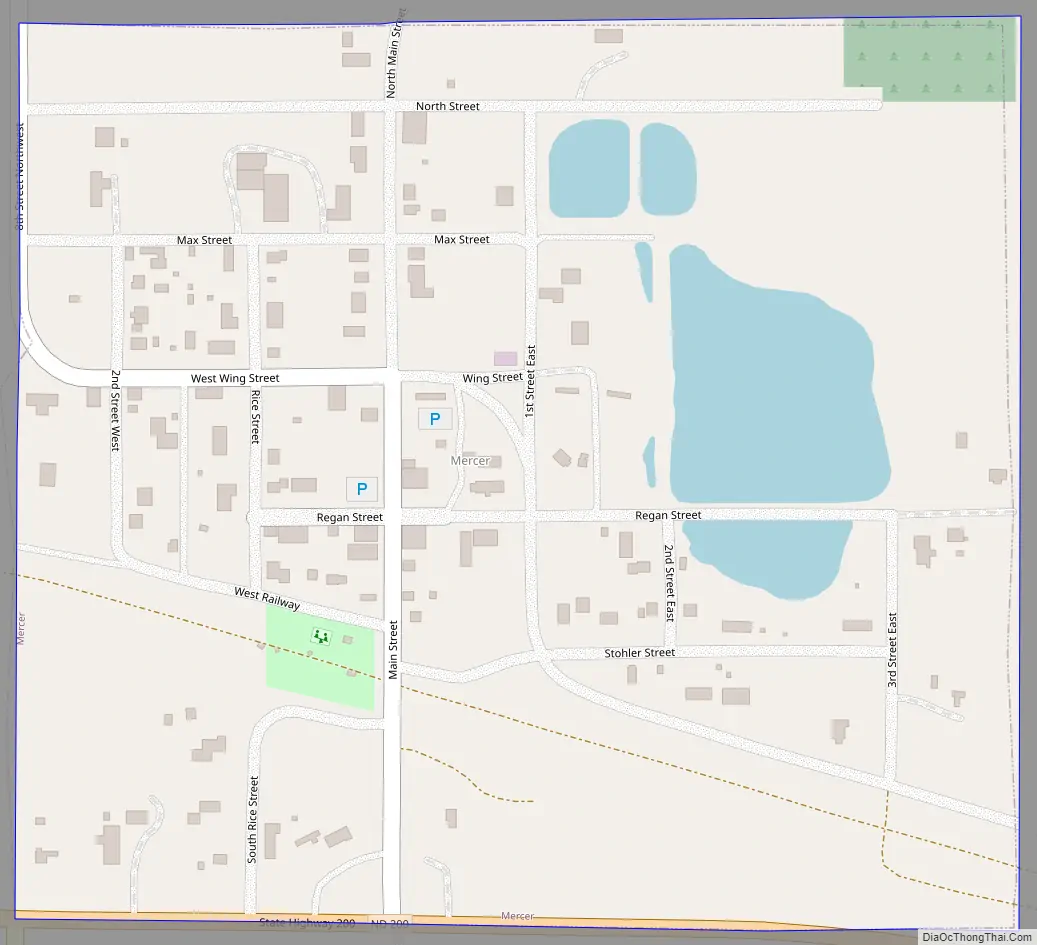
Mercer Road Map
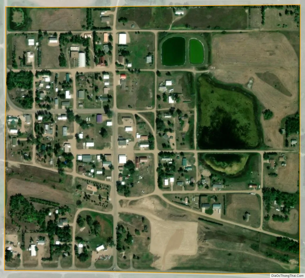
Mercer city Satellite Map
Geography
Mercer is located at 47°29′26″N 100°42′41″W / 47.49056°N 100.71139°W / 47.49056; -100.71139 (47.490594, -100.711254).
According to the United States Census Bureau, the city has a total area of 0.23 square miles (0.60 km), of which 0.22 square miles (0.57 km) is land and 0.01 square miles (0.03 km) is water.
See also
Map of North Dakota State and its subdivision:- Adams
- Barnes
- Benson
- Billings
- Bottineau
- Bowman
- Burke
- Burleigh
- Cass
- Cavalier
- Dickey
- Divide
- Dunn
- Eddy
- Emmons
- Foster
- Golden Valley
- Grand Forks
- Grant
- Griggs
- Hettinger
- Kidder
- Lamoure
- Logan
- McHenry
- McIntosh
- McKenzie
- McLean
- Mercer
- Morton
- Mountrail
- Nelson
- Oliver
- Pembina
- Pierce
- Ramsey
- Ransom
- Renville
- Richland
- Rolette
- Sargent
- Sheridan
- Sioux
- Slope
- Stark
- Steele
- Stutsman
- Towner
- Traill
- Walsh
- Ward
- Wells
- Williams
- Alabama
- Alaska
- Arizona
- Arkansas
- California
- Colorado
- Connecticut
- Delaware
- District of Columbia
- Florida
- Georgia
- Hawaii
- Idaho
- Illinois
- Indiana
- Iowa
- Kansas
- Kentucky
- Louisiana
- Maine
- Maryland
- Massachusetts
- Michigan
- Minnesota
- Mississippi
- Missouri
- Montana
- Nebraska
- Nevada
- New Hampshire
- New Jersey
- New Mexico
- New York
- North Carolina
- North Dakota
- Ohio
- Oklahoma
- Oregon
- Pennsylvania
- Rhode Island
- South Carolina
- South Dakota
- Tennessee
- Texas
- Utah
- Vermont
- Virginia
- Washington
- West Virginia
- Wisconsin
- Wyoming